Weather quieting down until Memorial Day


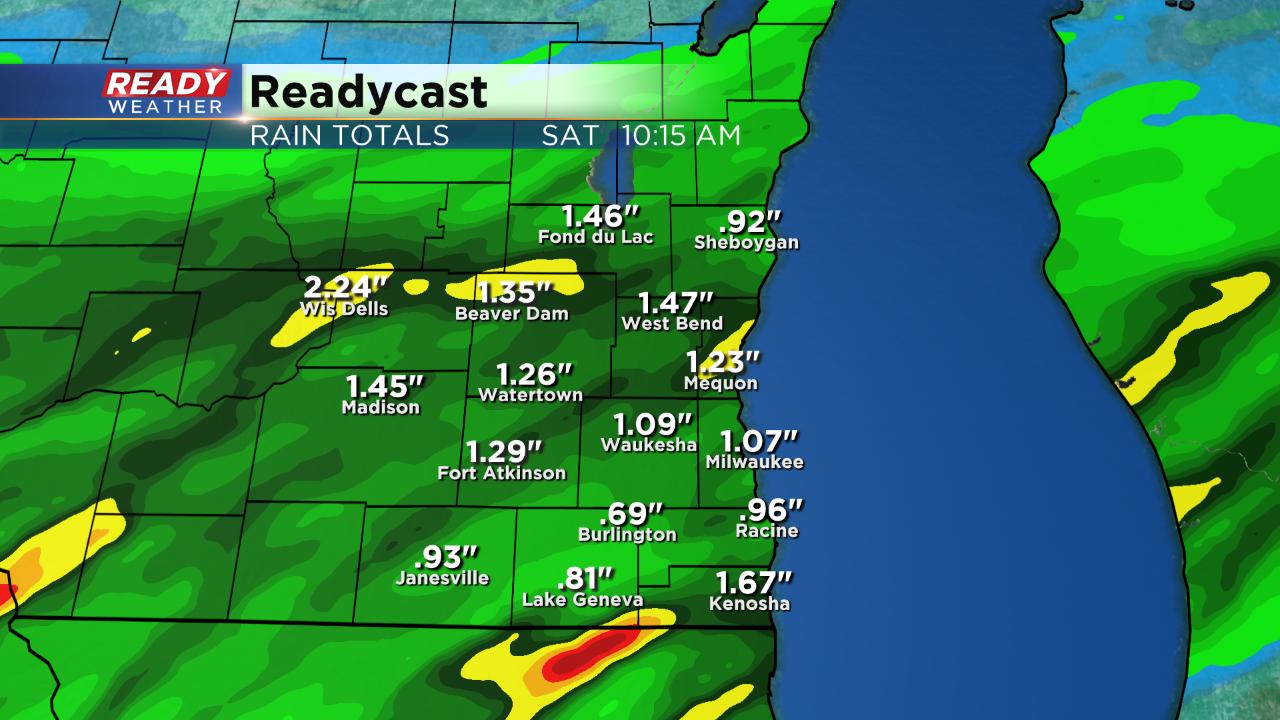
Saturday Update:
After a stormy night for some us, the atmosphere has quieted down considerably, for now. Expect the storms to stay away, for the most part, until the Memorial Day holiday itself on Monday when a cold front will help to generate some stronger storms potentially. In the meantime count on the warmest day of the holiday weekend to be on Saturday with highs in the 80s! It’ll be cooler, in the 60s and 70s, Sunday and Monday.
————————————————————————————————————————————————————————————
Evening Update:
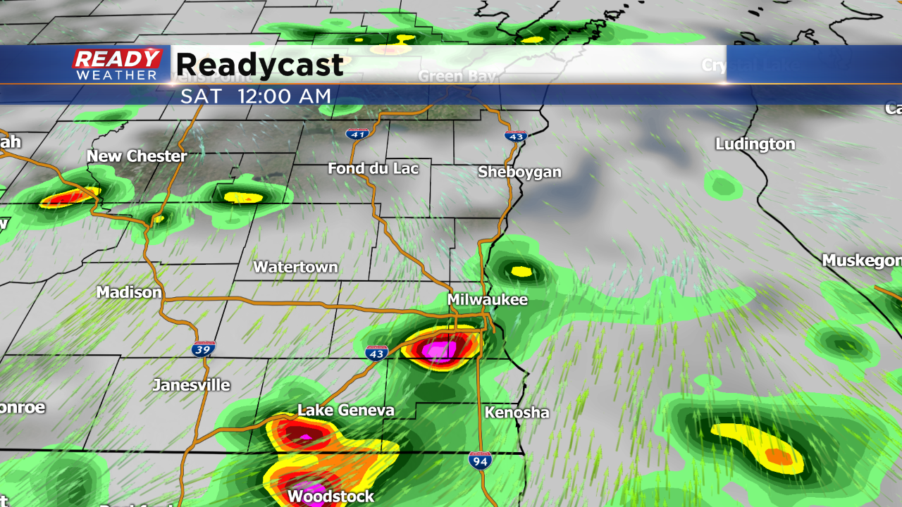
Scattered showers and storms are likely after midnight.
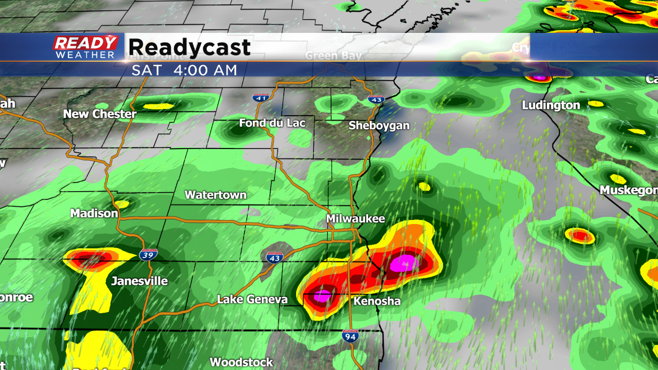
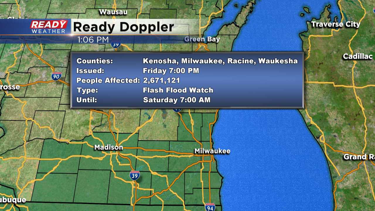
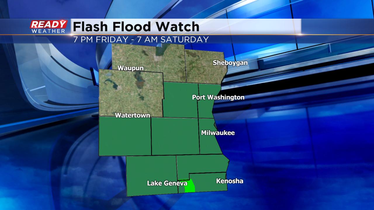
Overnight the storms should increase in coverage and intensity. Hail and gusty winds look to be the main threats. A flash flood watch remains in effect until Saturday morning. Another 1" to 2" of rain is possible. A few lingering showers are possible for Saturday morning; otherwise, expect warmer highs in the 80s!
______________________________________________________________________________________________________________
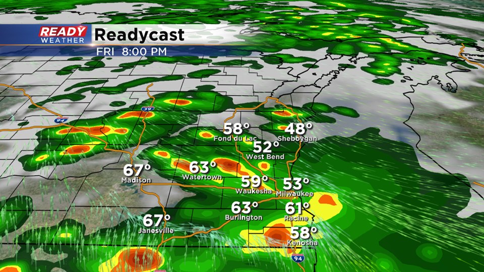
We are in a lull right now until more showers and storms develop later this evening. As of now the best ingredients remain well south across Illinois. The models develop more scattered showers and storms this evening. While southeastern Wisconsin remains in the slight risk, it's very possible the severe storms stay south.
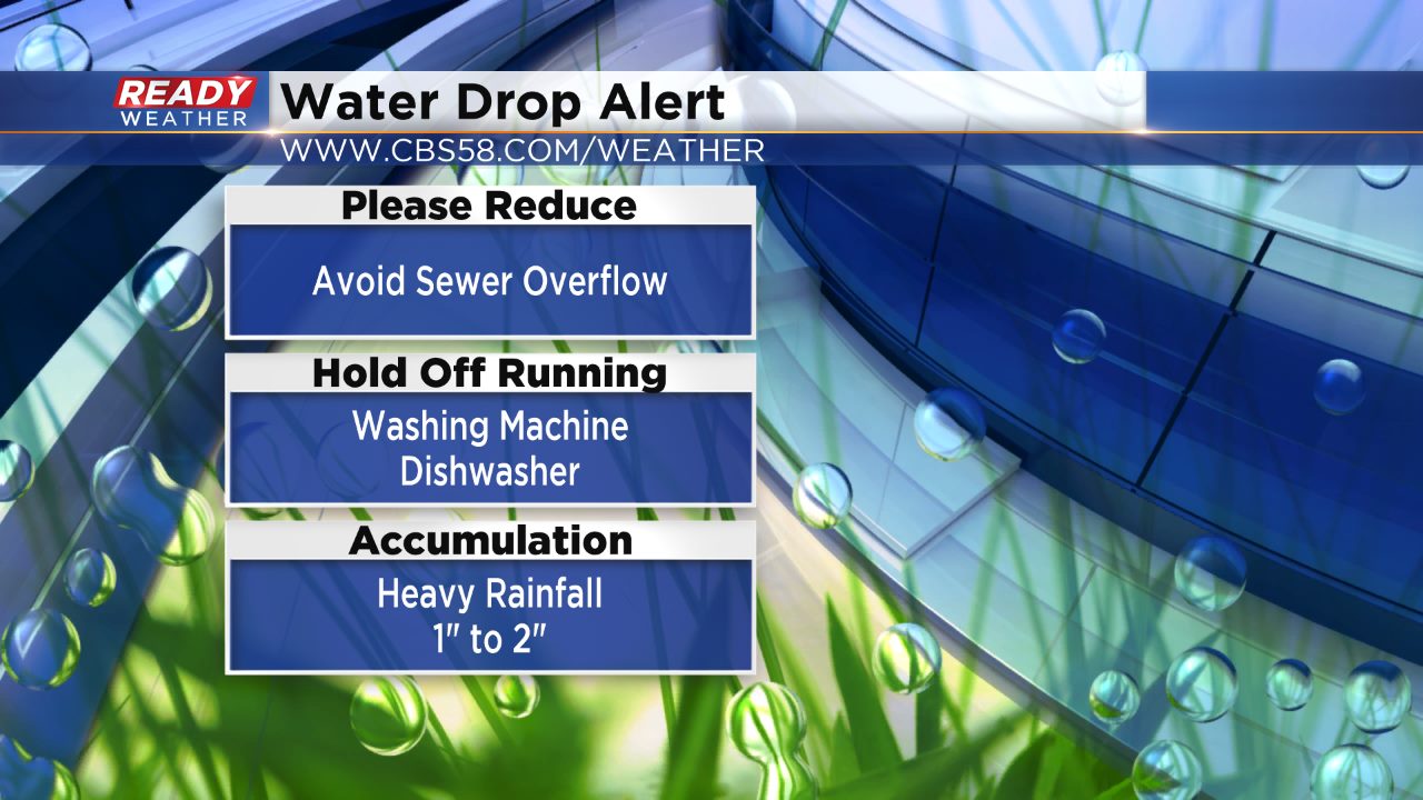
A water drop alert has been issued for the area. To reduce sewer overflows please hold off on washing dishes or doing laundry.
______________________________________________________________________________________________________________
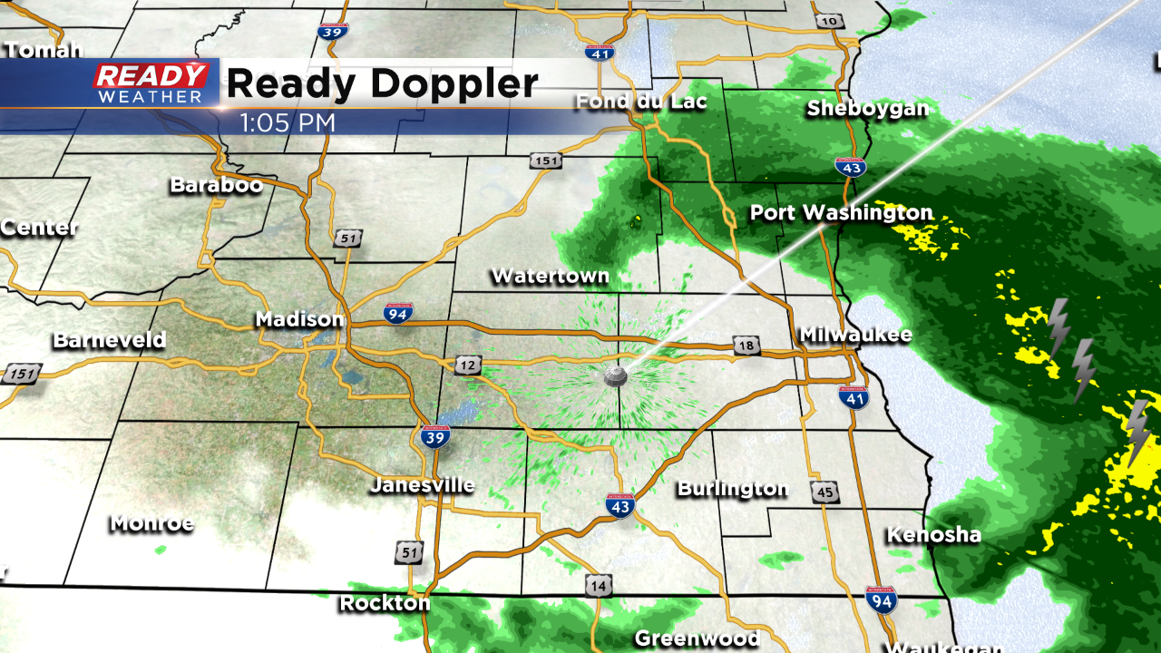
1pm Update: We are seeing the most recent batch of non severe storms push out of the area.
Updated: 9:25 a.m. May 24, 2019
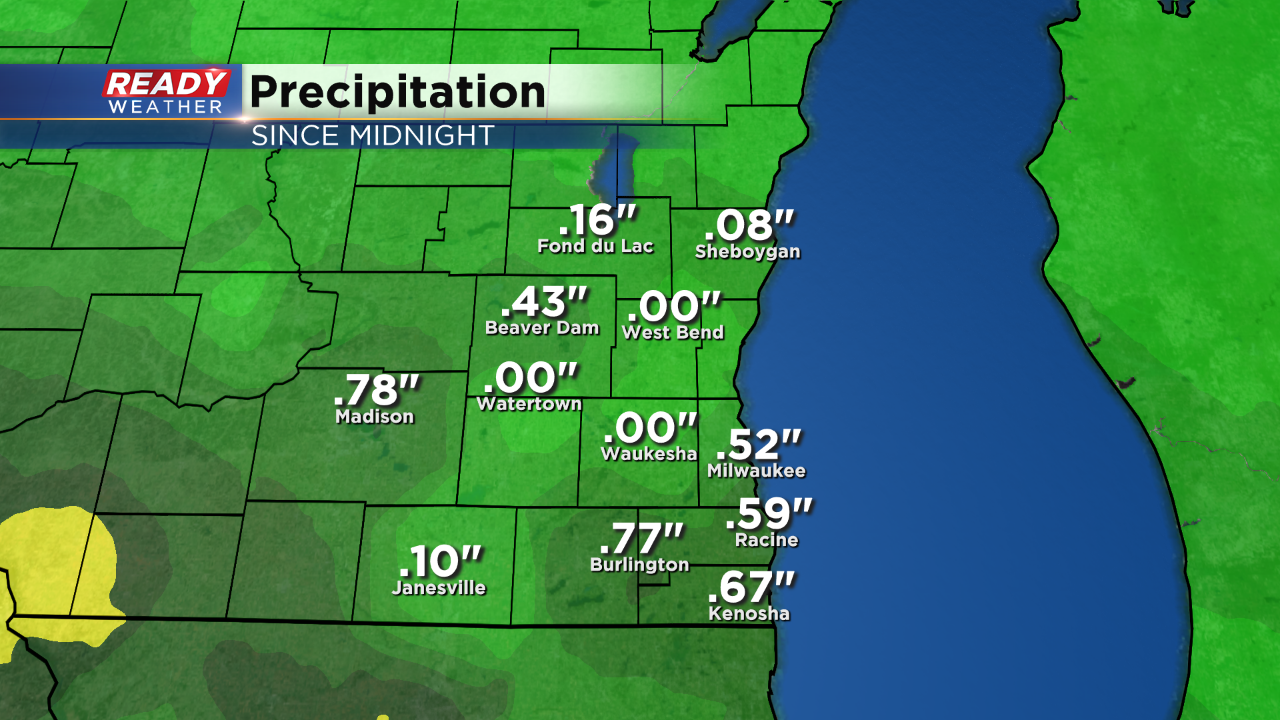
Friday morning's steady rain is done, but another round is moving our way before the chance for severe weather this evening. The morning rain dropped a quarter of an inch in some spots as it came down light but steady for a few hours.
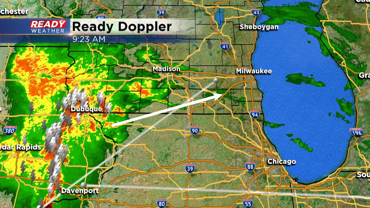
Rain and storms currently in Iowa and western Wisconsin are moving eastward. A few showers may be possible the rest of the morning but the heaviest rain and the chance at an isolated strong storm are mainly between 11 a.m. and 1 p.m.
The threat for severe weather still remains Friday evening but is heavily dependent on how this next round of rain impacts the atmosphere and where the warm front ends up. Any sunshine we get Friday afternoon will increase the chance for severe weather. Better chances still remain across northern Illinois and western Wisconsin.
------
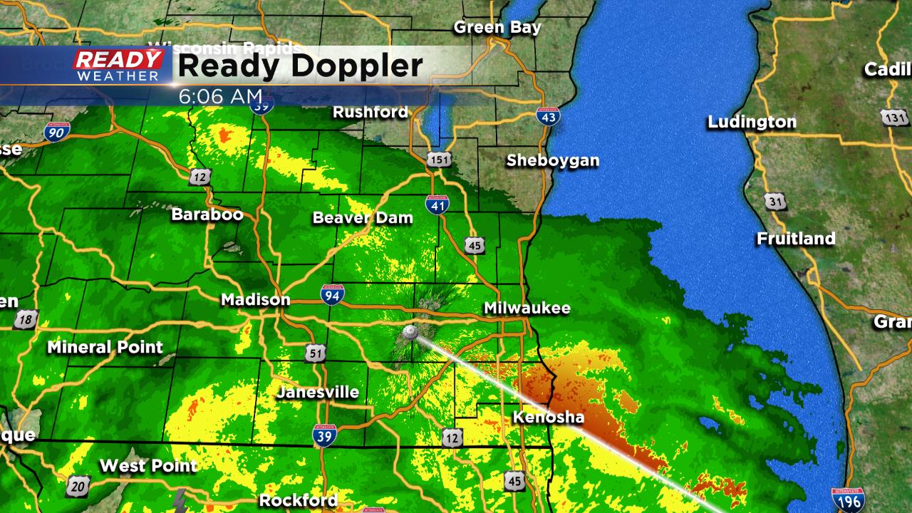
Posted: 5:49 a.m. May 24, 2019
Rain is back. After a brief break on Thursday a round of steady rain is currently pushing through all of southeast Wisconsin. The morning rain is expected to continue through 1 p.m. in eastern spots with a few thunderstorms possible. Here's a look at the radar as of 6 a.m.
After a dry break during the afternoon we have storms returning in the evening.
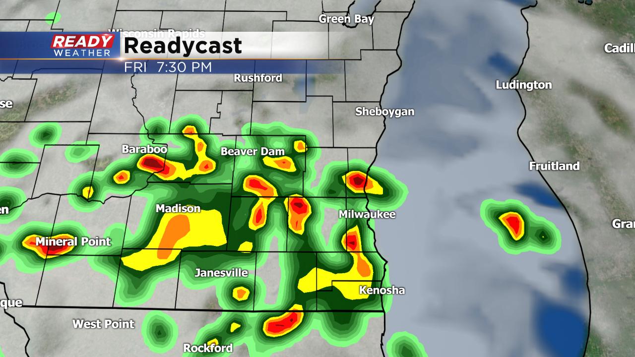
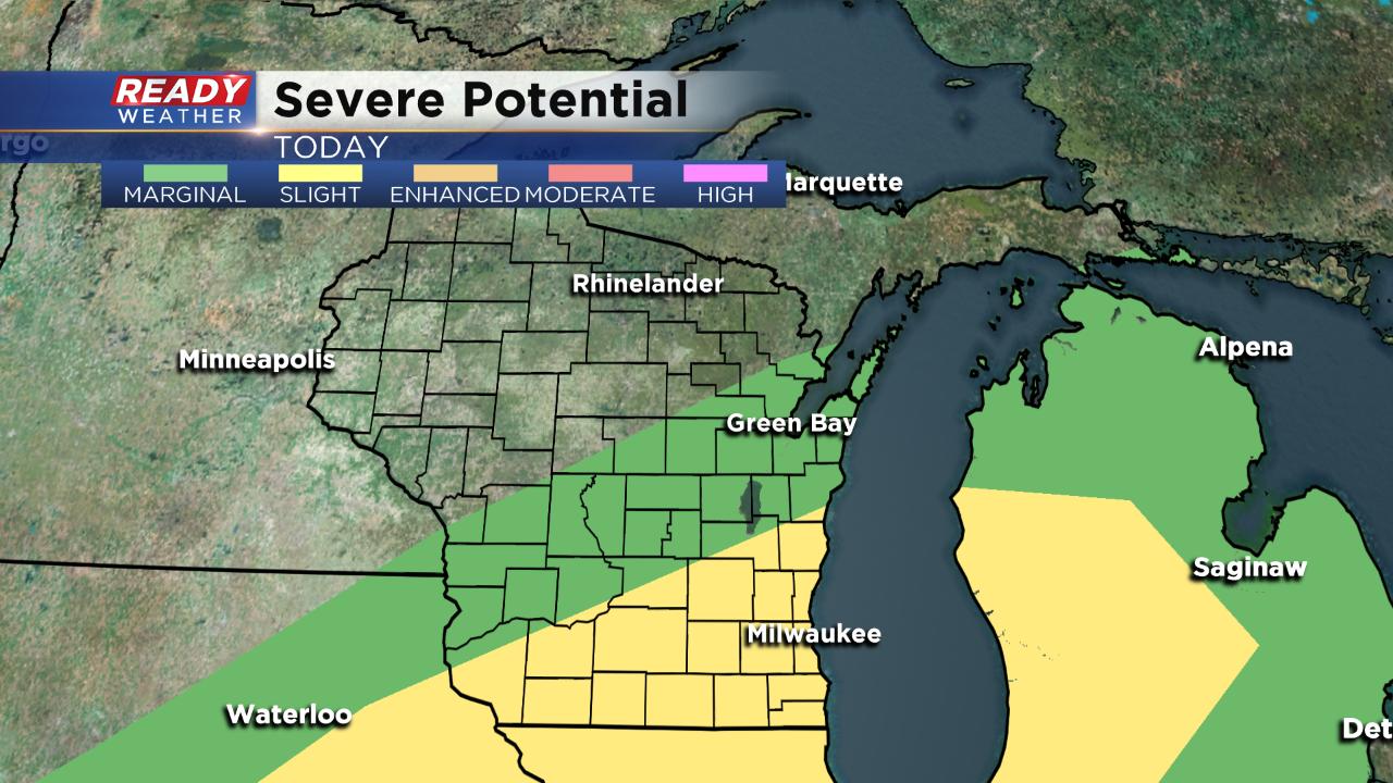
A few storms this evening could be strong to severe. The location of a warm front to our south will be key to determining where severe weather sets up. Northern Illinois has a better chance to see some severe storms but they may drift north into southern Wisconsin. Almost all of southeast Wisconsin is in the slight risk for severe weather Friday.
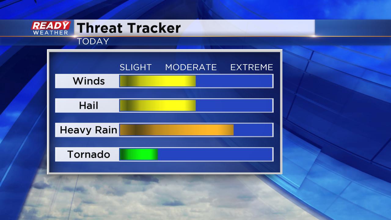
Heavy rain will be the biggest threats with any storms that develop with damaging wind and hail also possible. The tornado risk is a little higher than it usually is this far north in the Plains but is still relatively low.
After a morning of heavy rain and strong storms possible Friday evening up to 2" of rain will be possible by Saturday morning.
All of that heavy rain has resulted in the issuance of a flash flood watch for most of southeast Wisconsin from 7 p.m. Friday through 7 a.m. Saturday. Rain could come down at a heavy rate of an inch or more per hour during the evening and overnight.
Download the CBS 58 Ready Weather app to track the storms as the develop. The app will also notify you if severe warnings are issued.