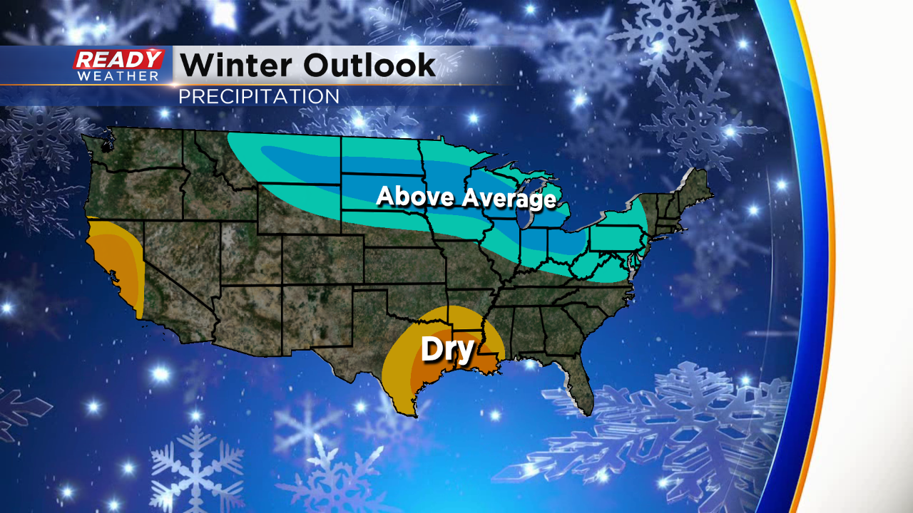
NOAA Winter Outlook: Better chances for snow across the Midwest
Courtesy of NOAA:
Warmer-than-average temperatures are forecast for much of the U.S. this winter according to NOAA’s Climate Prediction Center. Although below-average temperatures are not favored, cold weather is anticipated and some areas could still experience a colder-than-average winter. Wetter-than-average weather is most likely across the Northern Tier of the U.S. during winter, which extends from December through February.
While the El Nino Southern Oscillation (ENSO) climate pattern often influences the winter, neutral conditions are in place this year and expected to persist into the spring. In the absence of El Nino or La Nina, long-term trends become a key predictor for the outlook, while other climate patterns, such as the Madden-Julian Oscillation and Arctic Oscillation (AO), will likely play a larger role in determining winter weather. For example, the AO influences the number of arctic air masses that intrude into the U.S., but its predictability is limited to a couple weeks.
Precipitation
-
Wetter-than-average conditions are most likely in Alaska and Hawaii this winter, along with portions of the Northern Plains, Upper Mississippi Valley, the Great Lakes and parts of the Mid-Atlantic and Northeast.
-
Drier-than-average conditions are most likely for Louisiana, parts of Texas, Mississippi, Arkansas and Oklahoma as well areas of northern and central California.
-
The remainder of the U.S. falls into the category of equal chances for below-, near-, or above-average precipitation.
NOAA’s Climate Prediction Center updates the three-month outlook each month. The next update will be available November 21.


