October ends dry and warm as we look ahead to when snow typically arrives in November
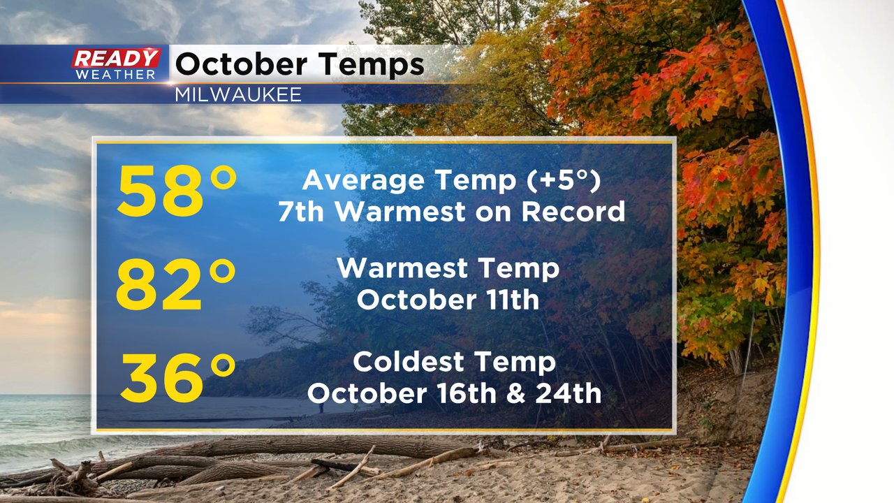
Halloween has come and gone and with it, the end of October! This October was a warm one with multiple days reaching the 80s! When all was said it done the average temperature of 58 degrees during the month was five full degrees above average and goes down as the 7th warmest on record. The warmest temp of the month of 82 happened on the 11th and we had a few frosty mornings when we dropped into the 30s and even 20s inland.
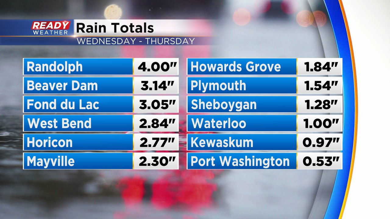
What we gained in warmth during October we lacked in rainfall. Northern counties ended the month with a good soaking rain Wednesday into Thursday with up to 4" in some spots, but the Milwaukee metro didn't get much of that rain.
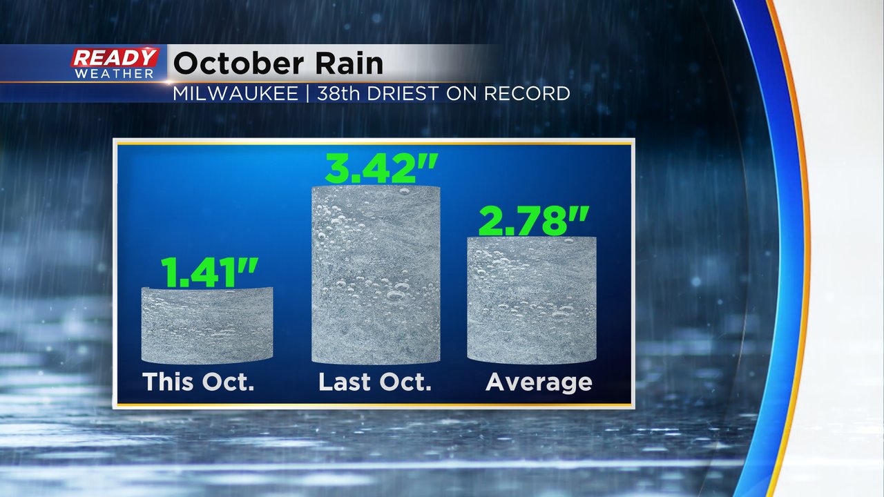
October ends almost exactly two inches behind last year's rainfall and over an inch behind average with 1.41" of rain and goes down as the 38th driest on record.
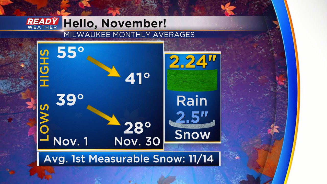
Now we look ahead to November which is another month when the temperatures cool quite a bit. The average high goes from the mid 50s today to around 40 by the end of the month and the average lows go from the upper 30s to the upper 20s. November also averages 2.5" of snow! Most of that snow falls in the second half of the month with the average first measurable snow falling on November 14th.
Download the CBS 58 Ready Weather to track a soaking rain for the first week of the month!


