Evening Update: Light snow will develop this evening.


8:30 PM Update:
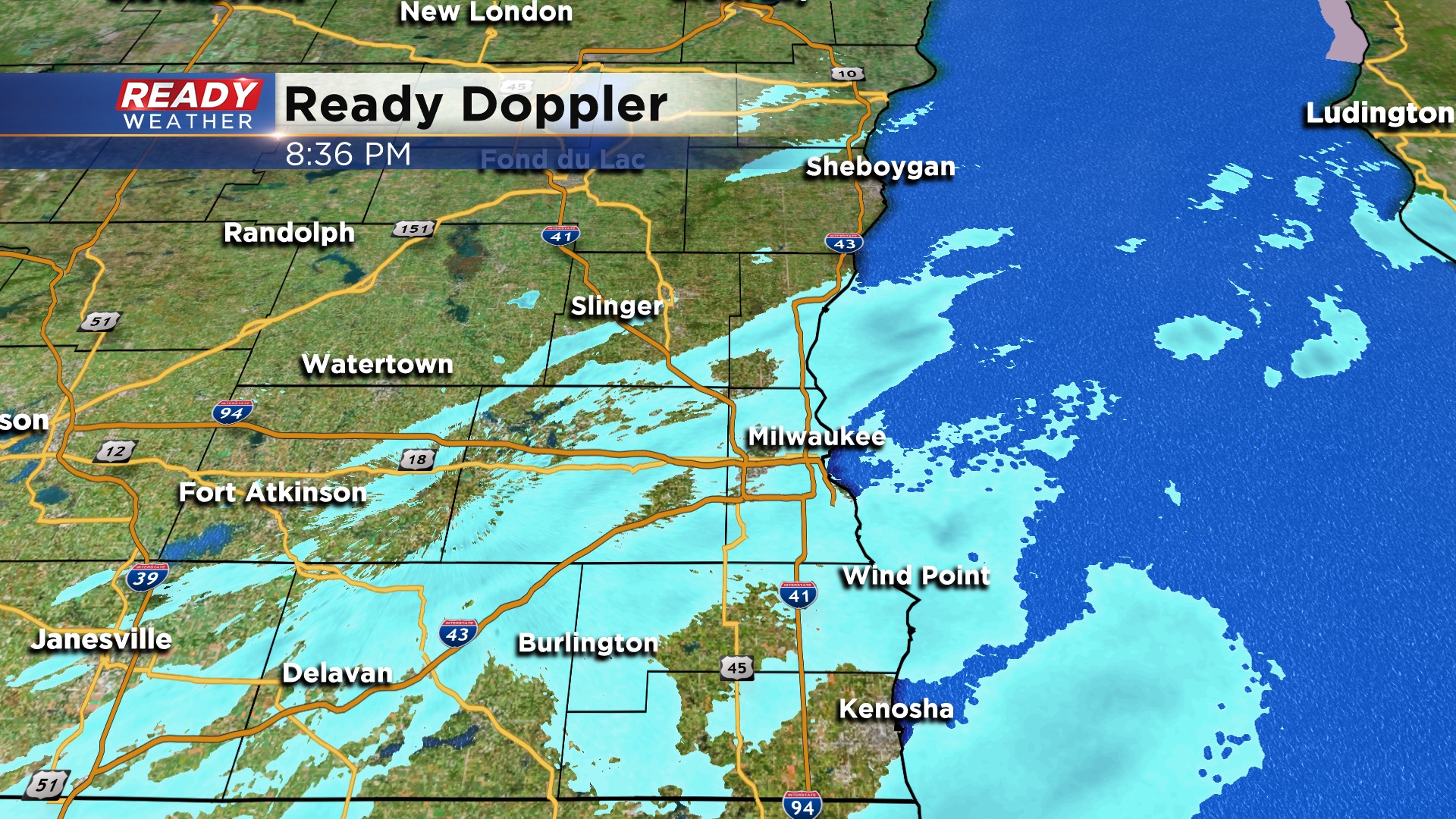
Light snow continues to develop across the area. Some side roads will have a light coating; otherwise, main roads are just going to remain wet. Temperatures overnight should hold in the low to middle 30s, so significant accumulation isn't expected.
More of a mix is expected on Friday as winds off the water help to keep the precipitation a mix of rain and snow. late Friday night another round of snow is expected into Saturday morning. Another couple of inches will be possible.
______________________________________________________________________________________________________________
Updated 5:00 PM January 23, 2020
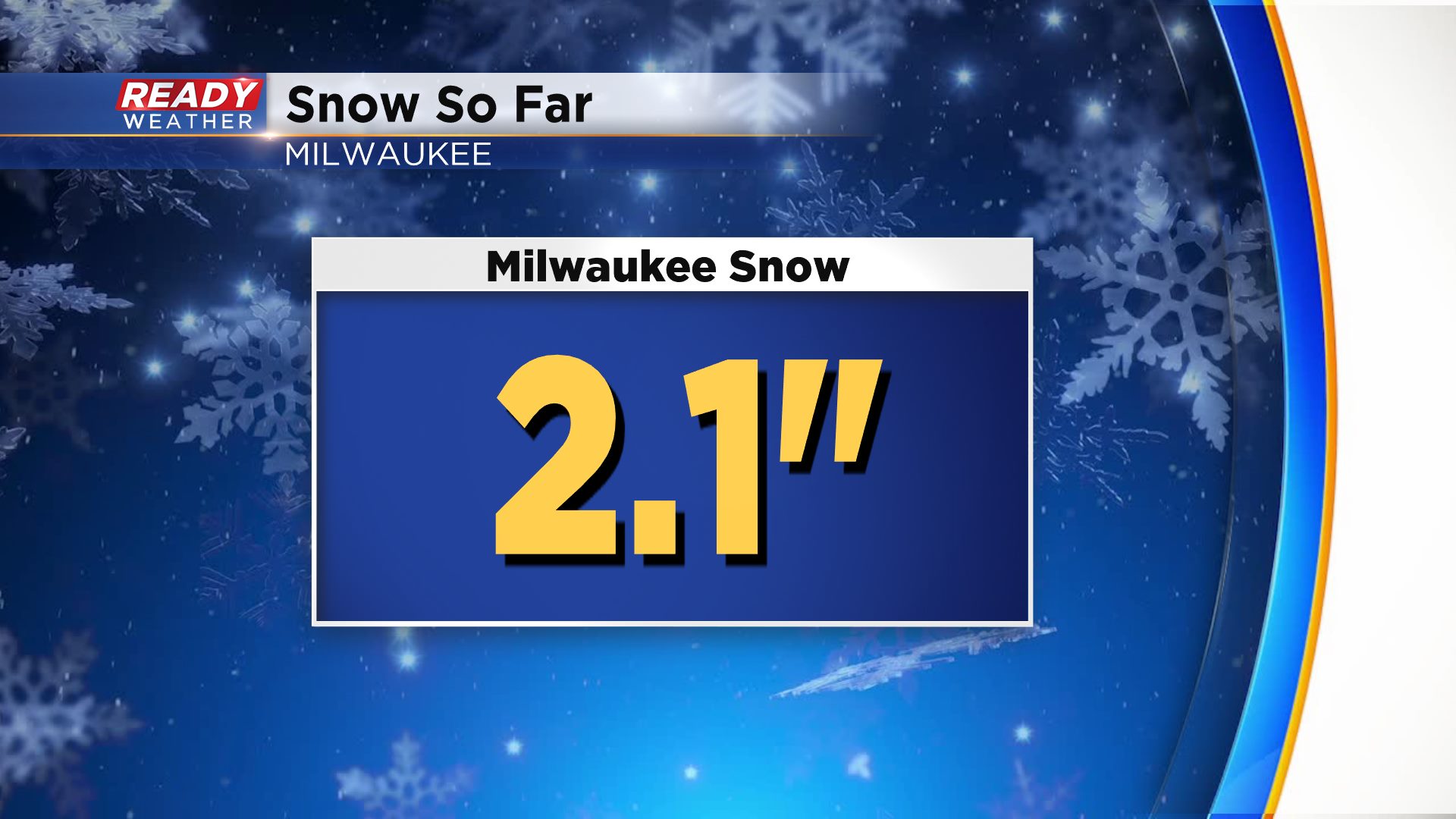
Milwaukee is now up to 2" of snow out of this event. Snow will be very hit or miss this evening with little to no accumulation from now until 10 pm.
Overnight we are expecting an additional 1" possible for Friday morning. Friday is tricky right along the lakefront with a mix of rain or snow. Additional snow for Friday will be between 1" to 2" going into Saturday morning.
Snow is expected to continue into Saturday morning with some flurries by the afternoon.
_____________________________________________________________________________________________________________
Updated: 3:00 p.m. January 23, 2020
Spotty light snow showers will continue to push through the area during the rest of the afternoon and through the evening. Less than an inch of accumulation is expected. Roads will remain wet, but overall are in good condition.
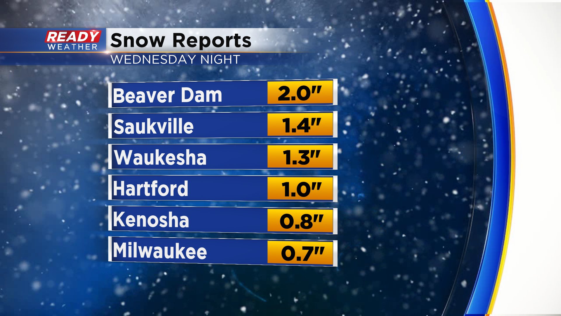
Here are a few updated snow totals. Most of the area has picked up between 1-2" of snow.
Snow will start to mix with rain overnight tonight.
-------
Updated: 1:05 p.m. January 23, 2020
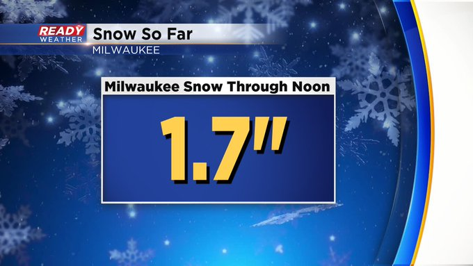
Milwaukee has picked up an additional inch of snow since 6 a.m., bringing our snow total to 1.7" so far. The only additional report since 9 a.m. is Brookfield with 2.1".
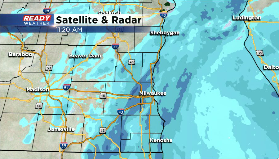
Light snow is still pushing through our eastern counties, but western spots have seen a break or just some light flurries. Snow will taper off to scattered light flurries for a period of time this afternoon, but more light snow in Illinois will move in later this afternoon into the evening.
-------
Updated: 11:30 a.m. January 23, 2020
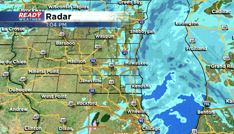
Light snow continues to push through southeast Wisconsin here at midday, with a few more moderate bands of snow mixing in at times from Waukesha and Milwaukee counties southward.
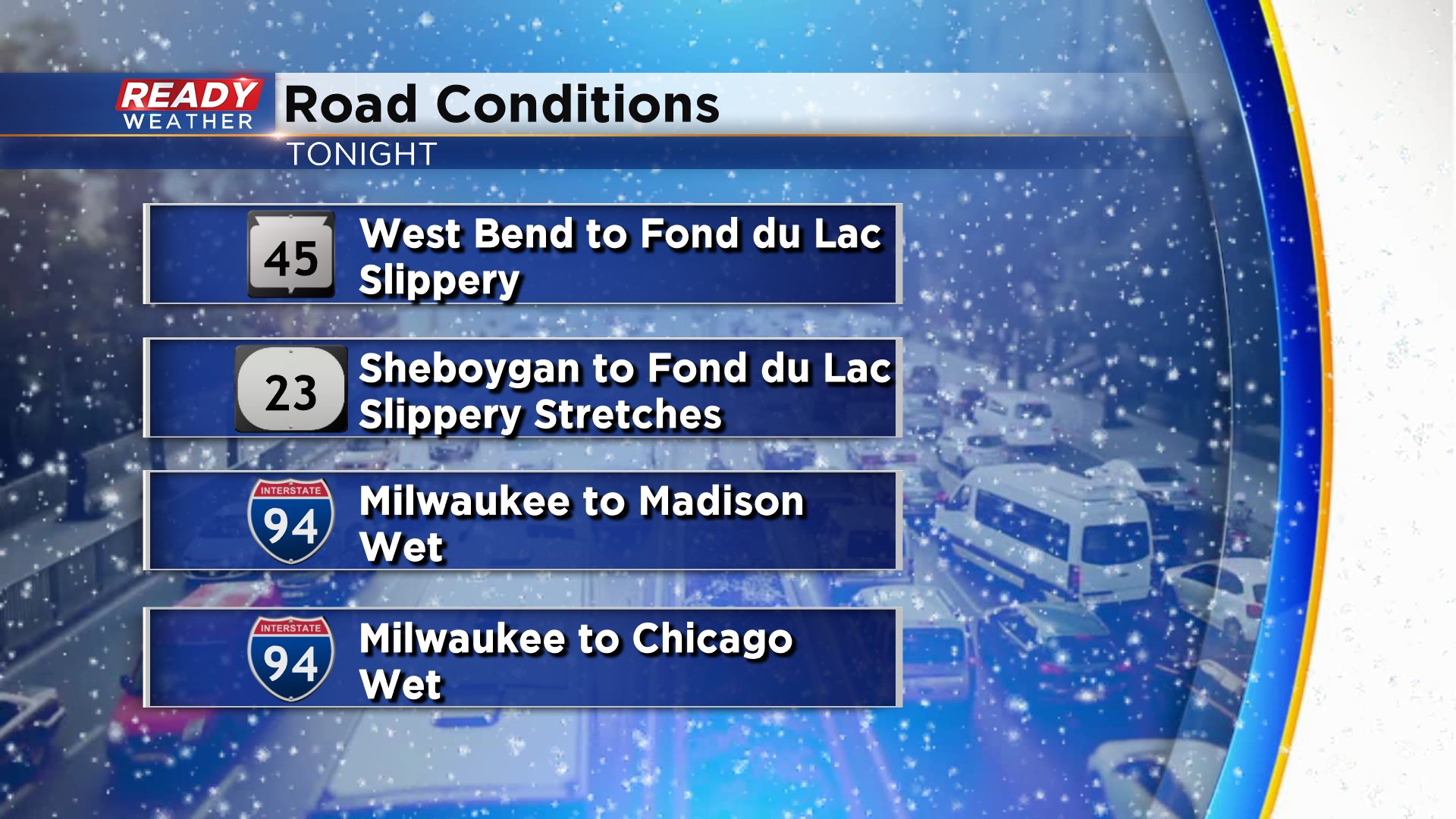
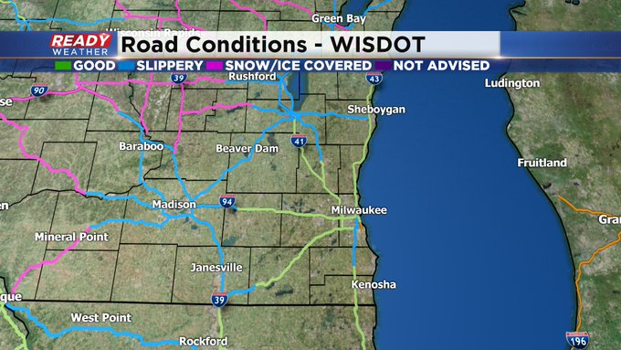
A majority of highways in SE Wisconsin continue to report good driving conditions with primarily wet roads. There are a few slippery stretches out there, but the salt is doing its job.
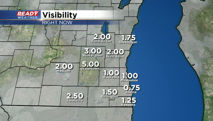
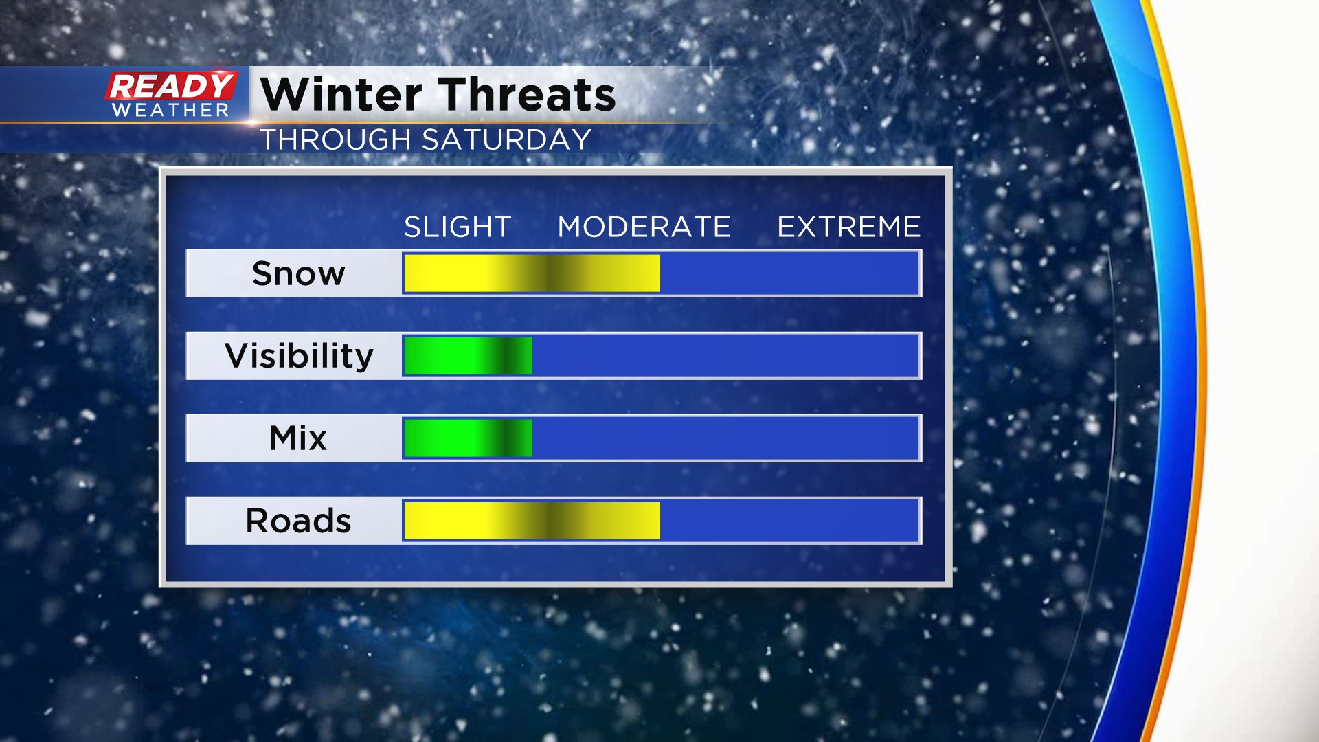
The biggest impact we're seeing with this snow is reduced visibilities. Visibilities under the more moderate snow bands are at a mile or less, so remember you need to have your headlights on if you're driving!
Snow will continue off and on throughout the day with an additional 1-2" of accumulation expected through tonight. Areas farther inland may see more of a break in the snow than lakeside communities.
------
Updated: 9:00 a.m. January 23, 2020
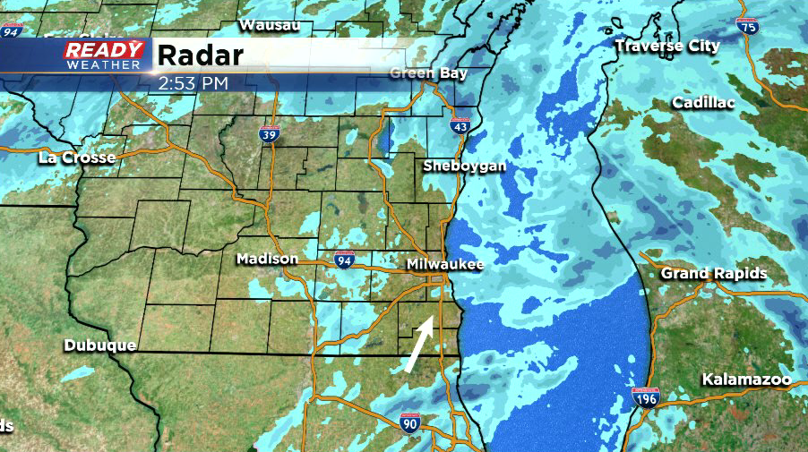
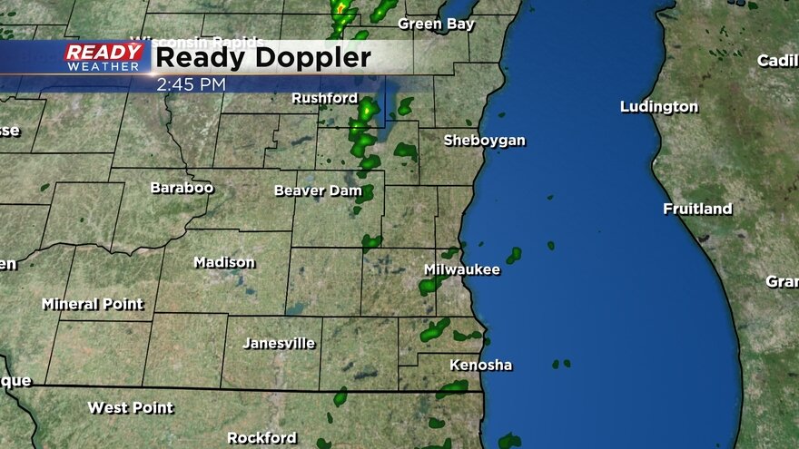
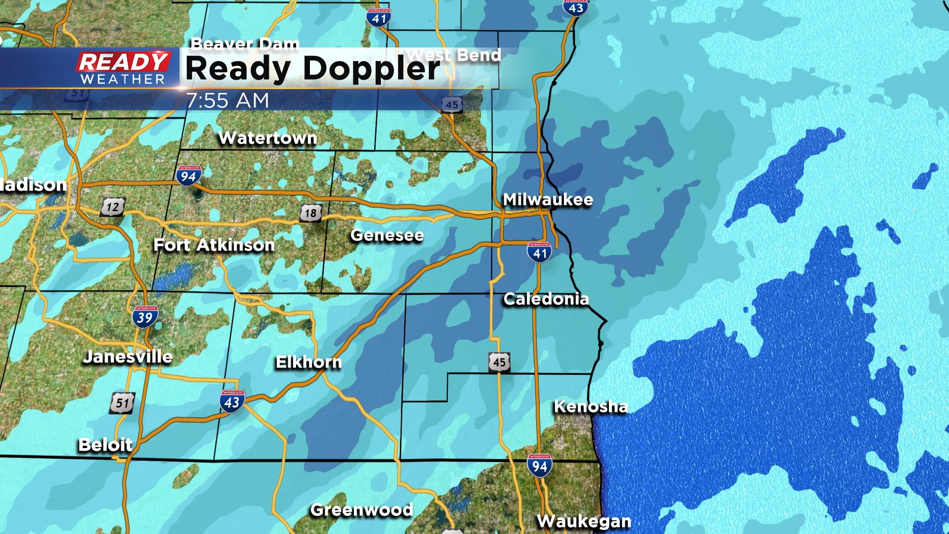
Light to moderate snow showers continue across southeast Wisconsin and don't look to quit until Saturday morning. An additional 1-2" of snow is possible Thursday with more coming Friday into Saturday morning. Here's the latest radar map that will update with time:
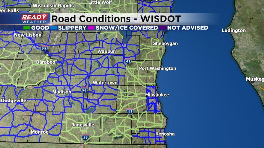
Side roads and untreated surfaces have been reported as snow covered Thursday morning but treated roads like freeways are mainly wet or slushy. No major accidents have been reported but a few spin outs have been spotted by people not driving well for the conditions. Here are the current road conditions:
------
Updated: 8:00 a.m. January 23, 2020
A moderate area of snow is currently moving through Milwaukee and stretching southwest towards Lake Geneva. Expect low visibility and quick accumulation as this moves through. The rest of Thursday should feature light off and on snow showers with the best chance for a few hours break later this evening.
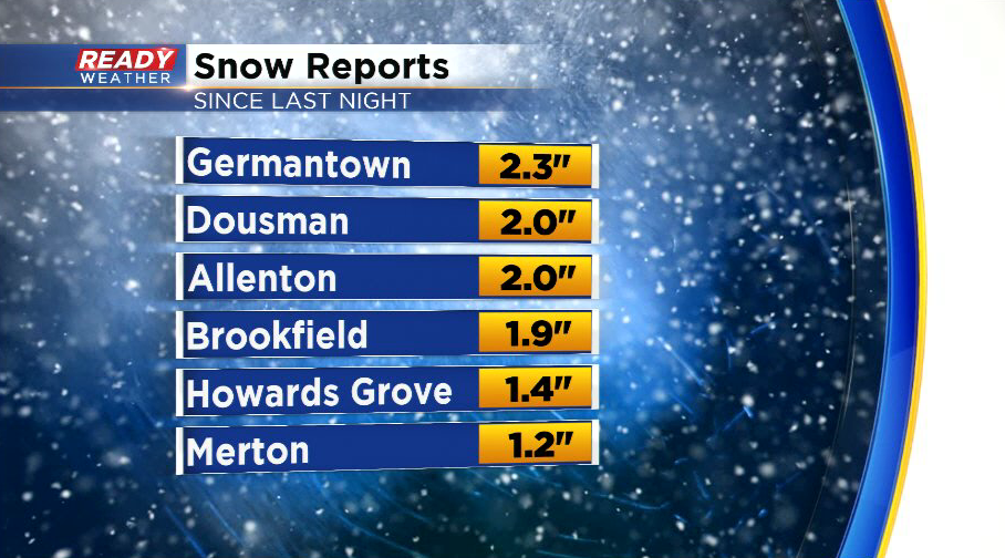
Snow reports are starting to come in with most spots getting up to 2" of snow since last night. Totals by the end of Thursday are expected to reach 1-3" with another 1-3" possible Friday and storm totals between 3-6".
------
Posted: 5:33 a.m. January 23, 2020
Light snow had to overcome some dry air before it started falling in southeast Wisconsin but around or just after midnight Thursday morning we saw the light snow start to come down and accumulate. Expect off and on light snow showers to continue throughout much of the day. There will be some dry breaks during the day but the best chance for a couple dry hours will be Thursday evening. By nighttime Thursday most spots in southeast Wisconsin will have picked up 1-3" of snow.

The light snow may start to mix with some light rain after midnight Thursday night and throughout Friday. The best chance to see some rain/snow mix will be in lakeside and southern communities with best chances Friday evening.

The off and on snow and rain/snow mix will continue for most of Friday into Saturday morning with another 1-3" possible. By the time the precipitation is all done by noon on Saturday many spots will pick up 3-6" of snow.

Breezy wind from Wednesday has ended and the wind will remain light for much of Thursday and Friday so blowing snow is not going to be a big issue. The snow also won't come down at a heavy rate so visibility won't be a big concern. Any mix that develops Friday will remain just rain and snow with no icing threat. The main threats for this storm will be the steady snow and the impact on the roads that could become slushy and snow covered at times.
Download the CBS 58 Ready Weather app to track the snow the next 48 hours.