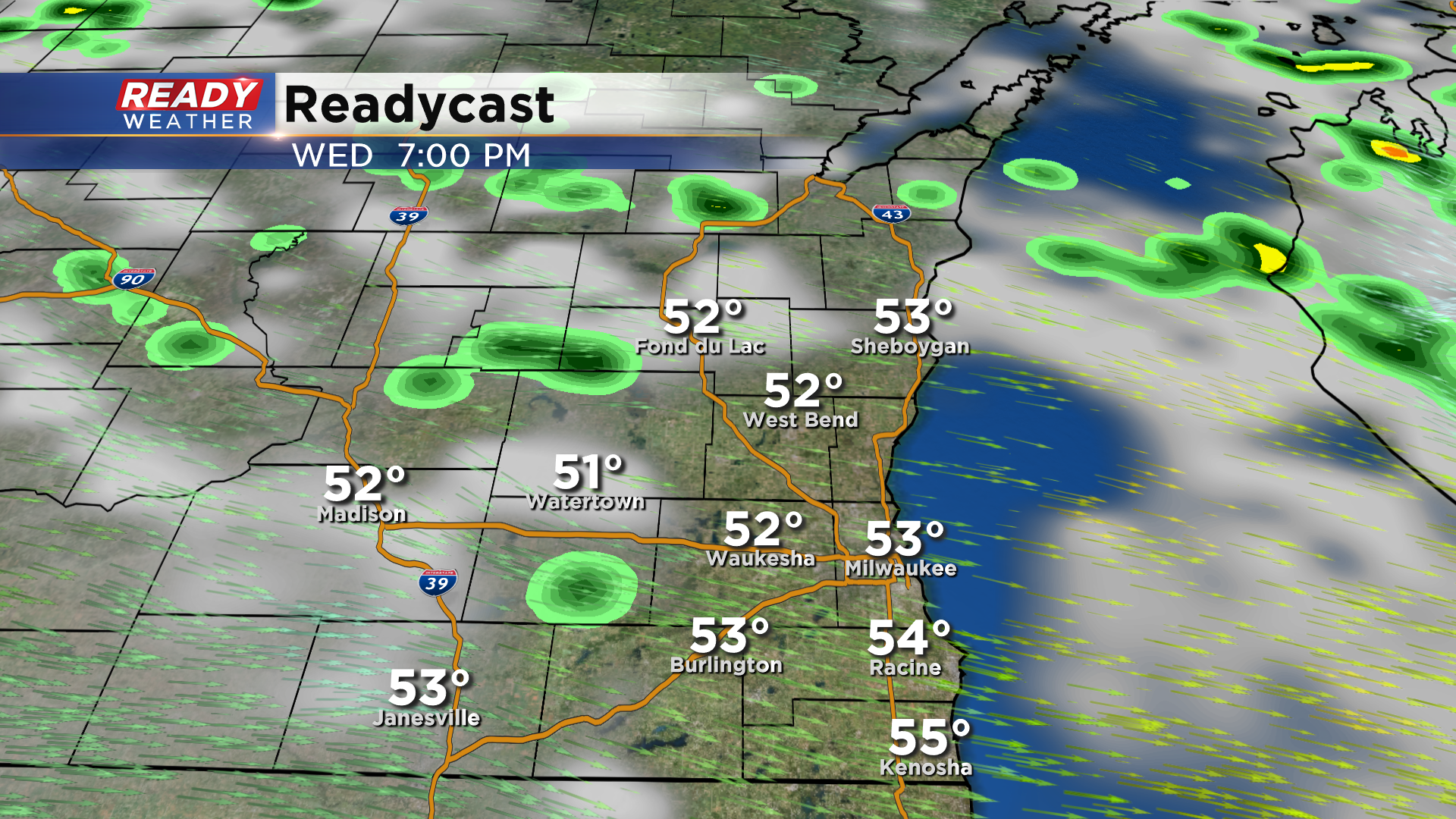
After a pleasant, sunny start to the day, another round of rain is pushing through southeast Wisconsin.
Behind this batch of rain, scattered wrap around showers will rotate into southeast Wisconsin through the afternoon. Some may linger into the evening with the best chance being in far northern and western spots.
You’ll want to keep that umbrella handy for one more day as scattered showers will be around throughout the day on Thursday. We’ll finally dry out on Friday, but it will be our coldest day of the week with highs struggling to reach 50°.
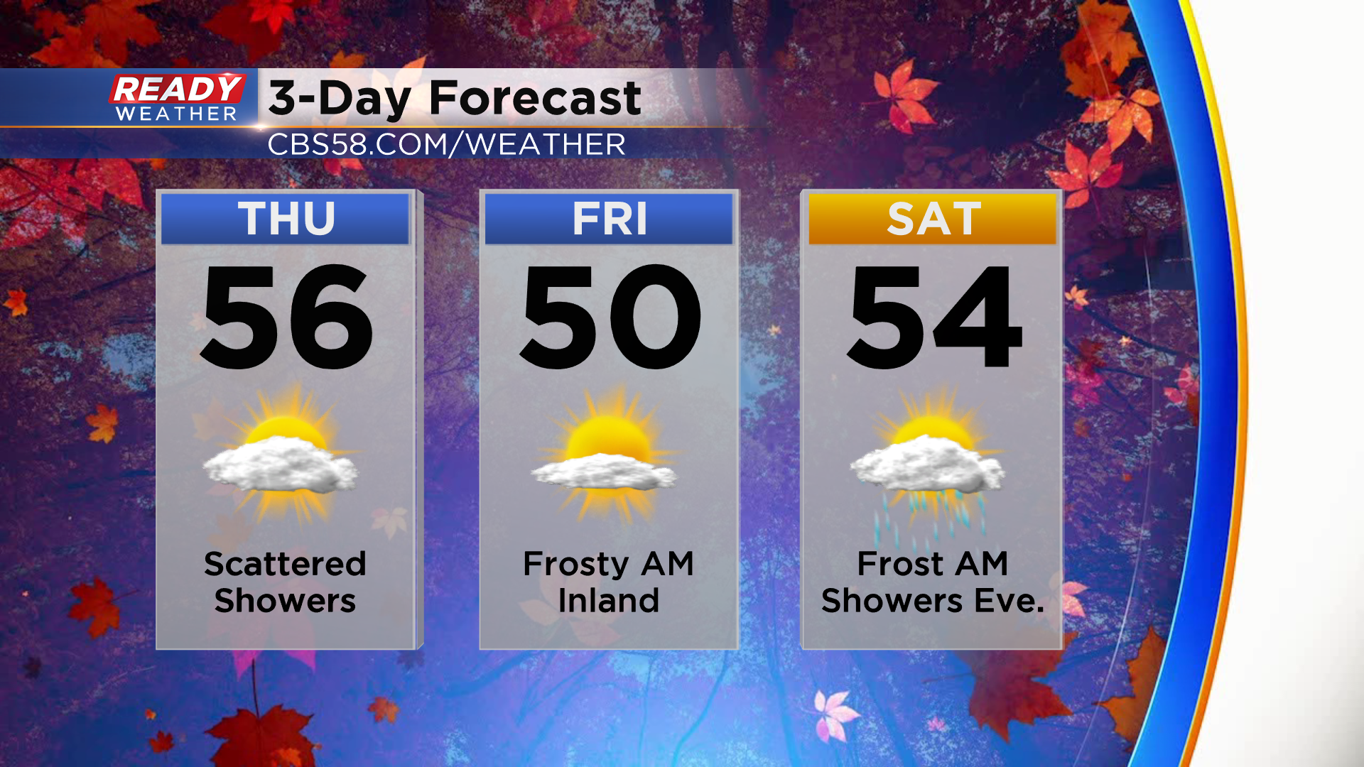
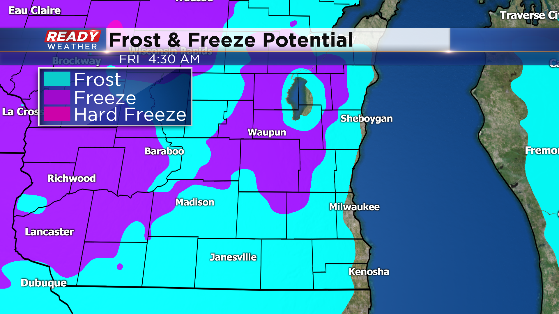
There is a chance for frost in inland locations Thursday night if clouds are able to clear. If the clouds clear quickly Thursday night, there could even been a freeze well away from the lake. Another chance for frost will come Friday night.
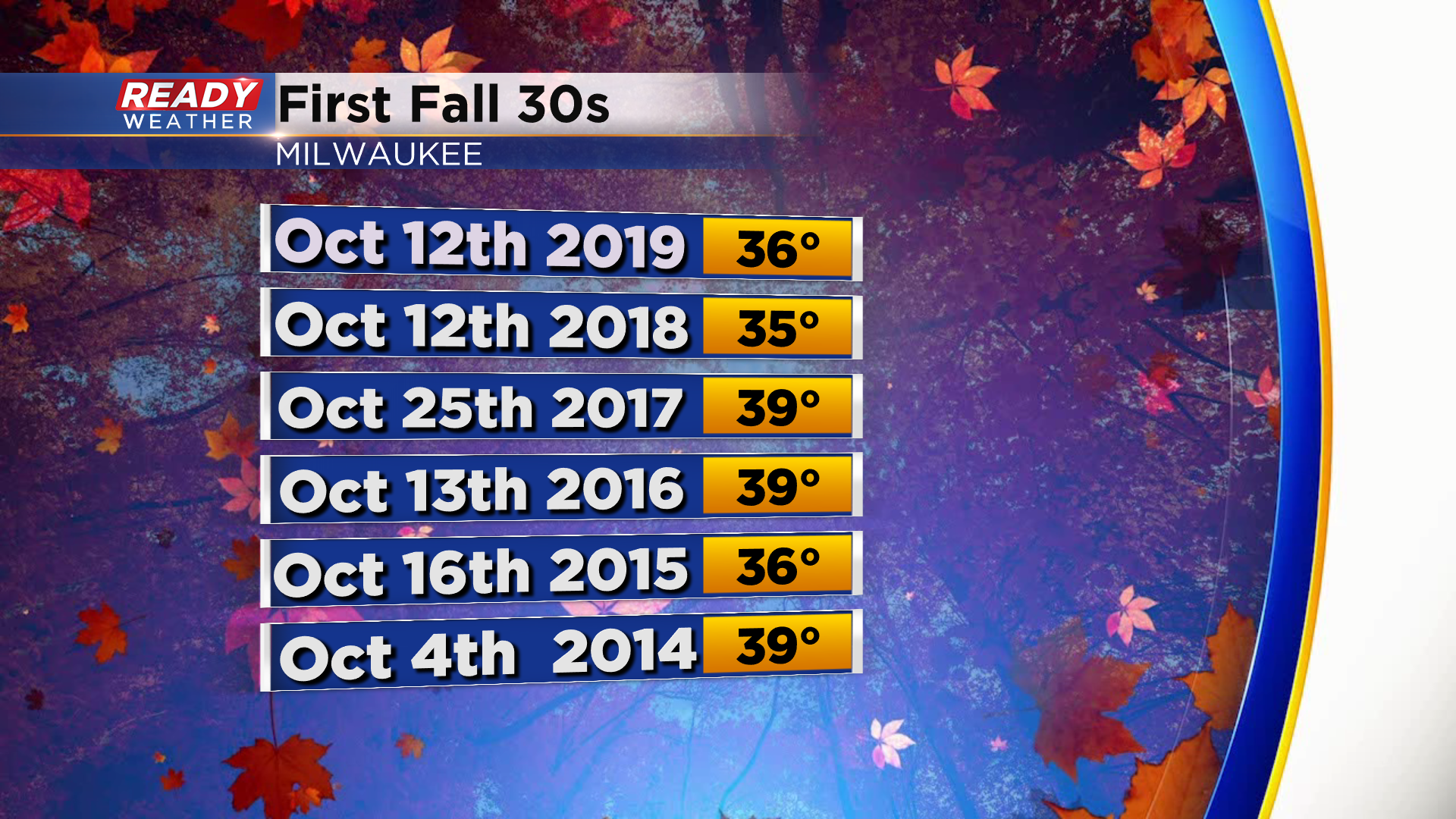
Most inland spots had their first frost of the season two weekends ago, but Milwaukee hasn't fallen into the 30s yet this fall. However, that's not too unusual. On average, Milwaukee's first night in the 30s occurs on October 2nd. The last few years our first night in the 30s occurred a bit later into October.
Download the CBS 58 Ready weather app to track the scattered showers and frost potential.
