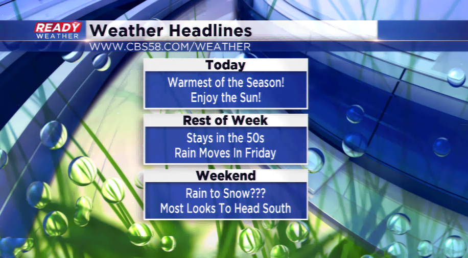
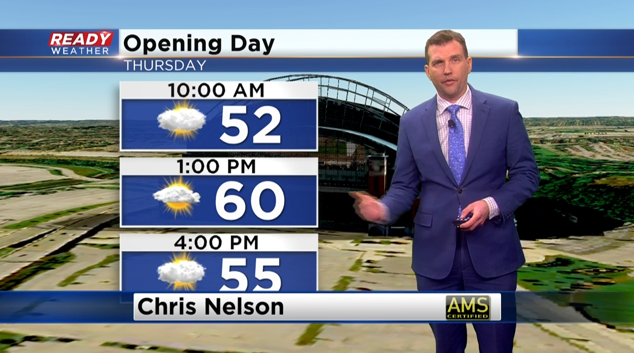
Opening Day should stay dry; rest of week different story
High pressure is cruising to the east coast for the rest of the week and that will lead to waves of disturbances brushing the region. The first could bring a shower to the northern part of the state today, and then an isolated shower tomorrow along a cold front. Today and tomorrow will be mild ahead of the front, and since we’ll stay very mild tonight, we have a good chance to make a run at 60 for Opening Day.
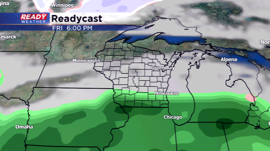
After this time period our attention will be turned to Friday and Saturday with the next storm system. Rain moves in by Friday, and then with cooler air heading into Wisconsin, the rain will transition to a wintry mix or snowfall Friday night and Saturday. Minor slushy accumulation will be possible around southeastern Wisconsin. The temperatures fall with highs in the lower 40s for the weekend and Monday. Computer models are hinting at another brief warmup for next week with temperatures returning into the 50s.