Temps have climbed into the mid to upper 80s this afternoon with just a few showers popping up along the lake breeze.

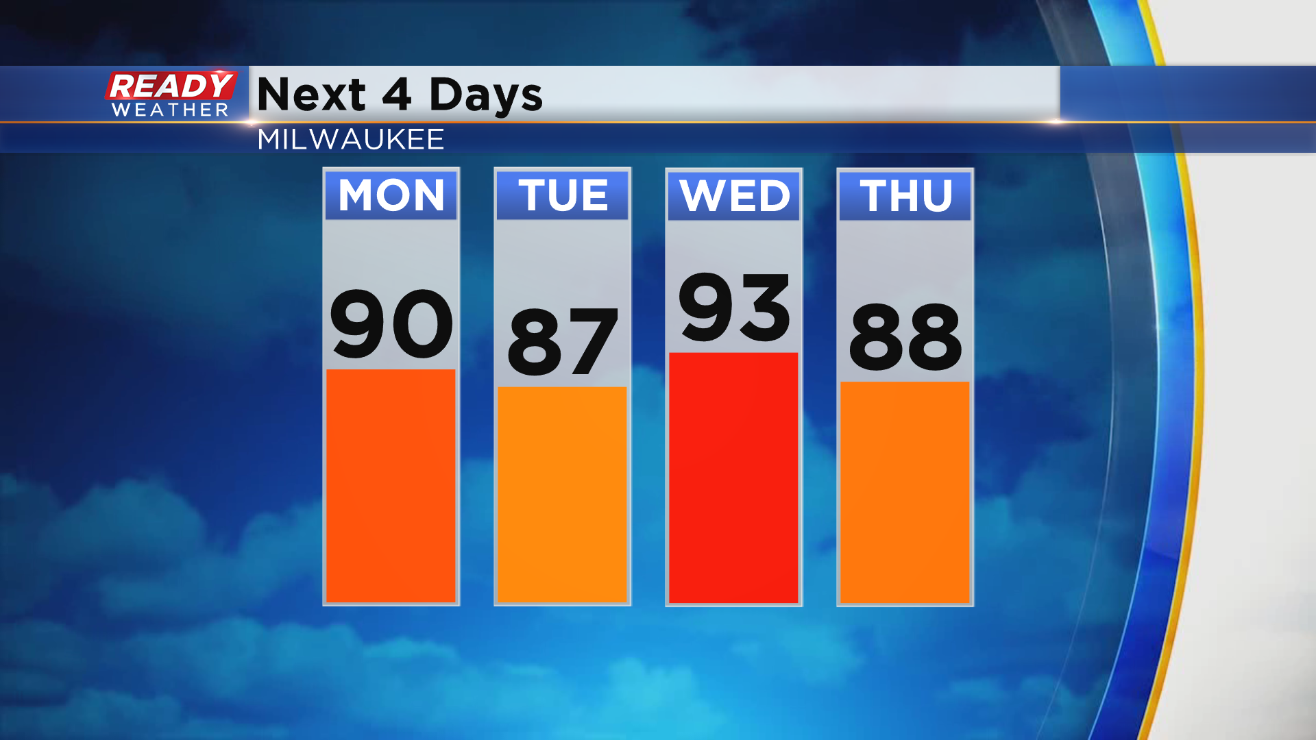
Any shower activity will come to an end around sunset with mostly clear skies expected overnight. The mostly clear skies will continue into Monday, but the sun may be filtered a bit as smoke from the California wildfires moves overhead. Regardless, it's going to be hot and humid with temps making a run at 90 degrees. Upper 80s to low 90s will stick around through Thursday, along with dew points in the upper 60s to low 70s.
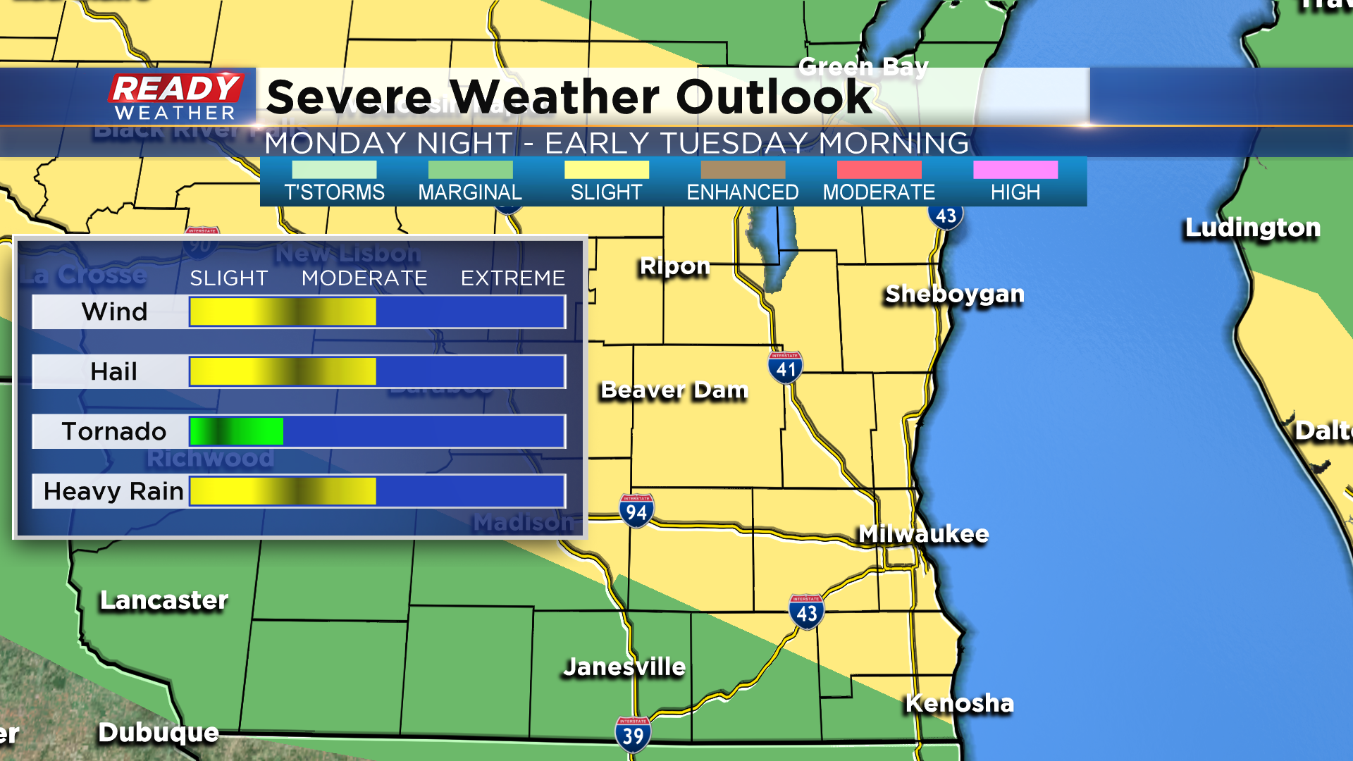
While we'll have a good deal of sun during the day on Monday, a complex of thunderstorms may work through the area Monday night into early Tuesday morning.
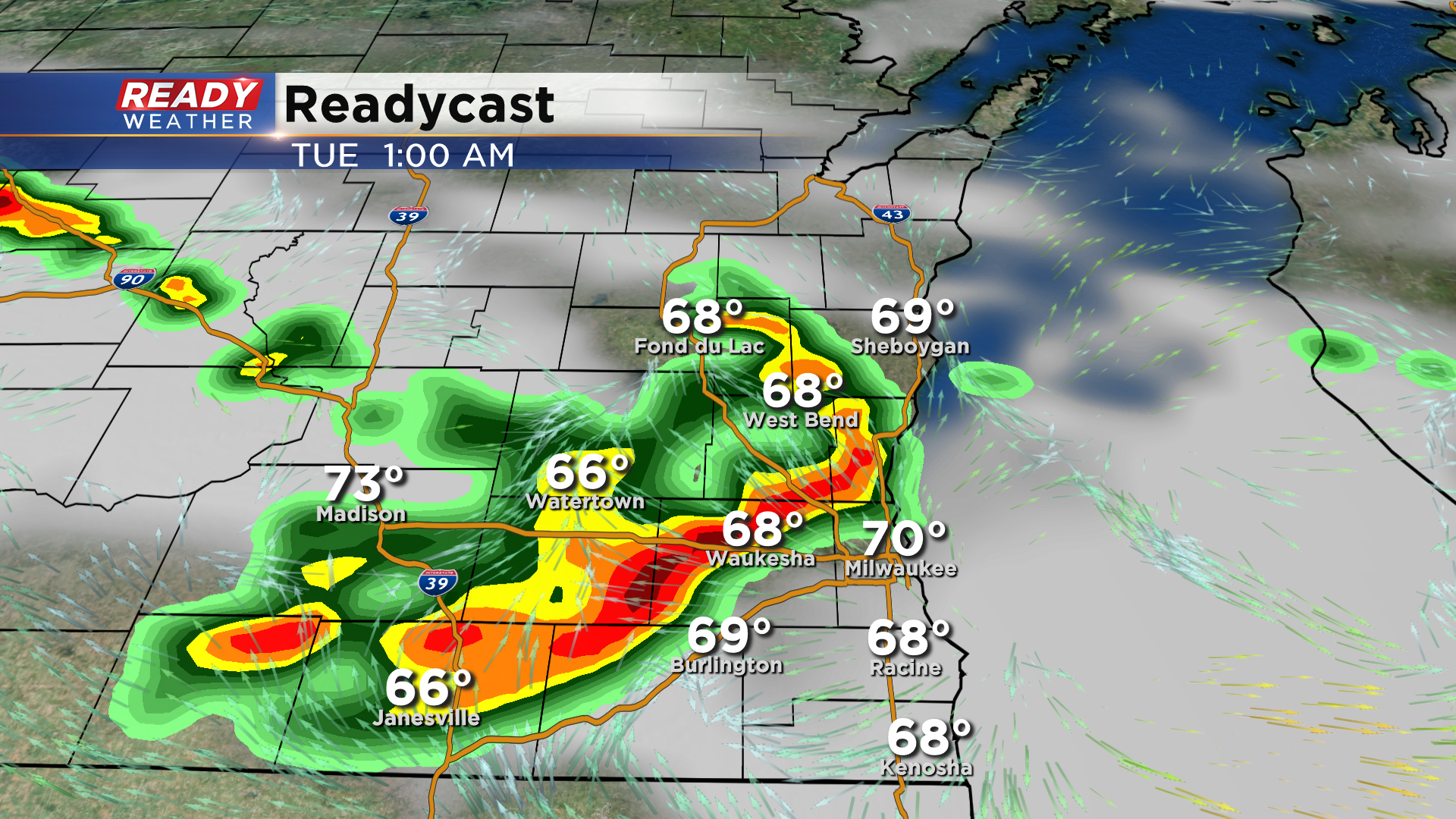
There's still some uncertainty with how far south this complex of storms may track, but it'll be our best chance of rain until a cold front moves through on Friday. With plenty of heat and humidity in place, these storms could be strong to severe with damaging wind, hail, and heavy rain being the primary threats. The tornado threat is low, but not zero. Nearly all of southeast Wisconsin is under a Level 2 of 5, Slight Risk for severe storms Monday night into Tuesday morning.
The hot and humid weather won't last all week. Find out when we'll cool back into the mid 70s by downloading the CBS 58 Ready Weather App.
