


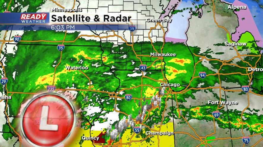
Rain has started to move into southeast Wisconsin this afternoon and will continue to overspread the area tonight as a low pressure system moves into central Illinois.
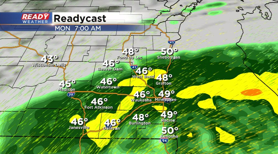
Steady rain will continue for most during the morning commute before tapering off around lunch time.
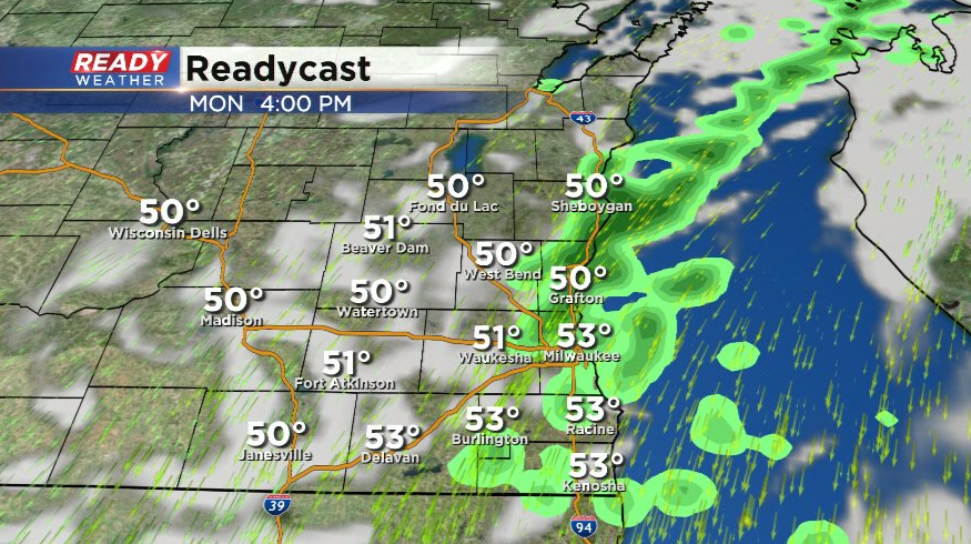
While inland spots look to dry out Monday afternoon, a few lake effect rain showers will be possible lakeside and could even linger into Monday evening.
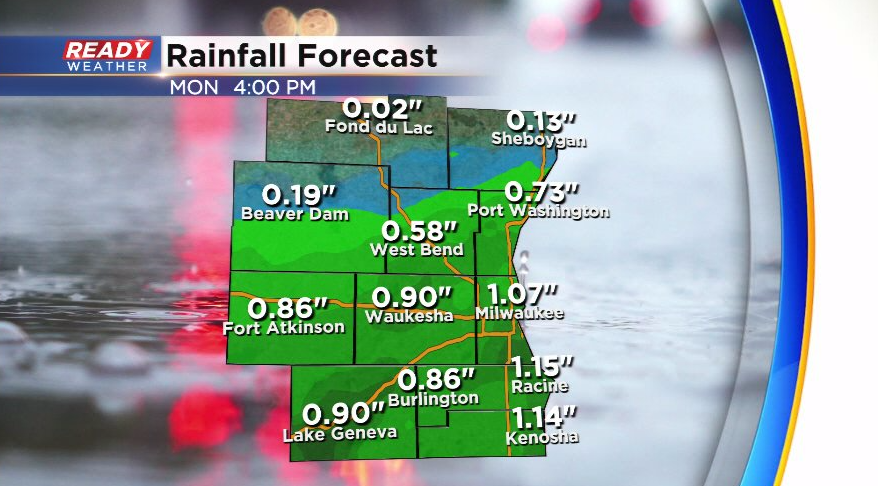
Folks along and south of I-94 have the best shot at picking up an inch or more of rain with this system, but there will be a sharp cutoff in rain totals in our northern counties where rain won't be as steady.
Not only will we be dealing with the steady rain tonight into Monday morning, we'll also have to experience 35-45 mph wind gusts.
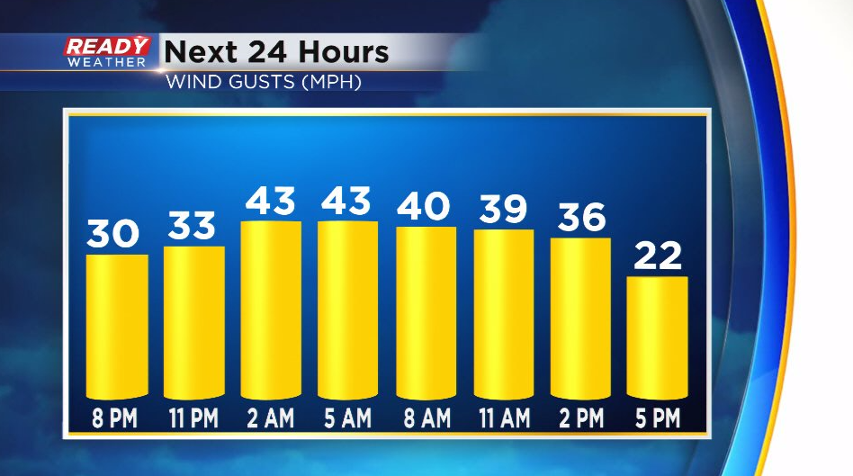
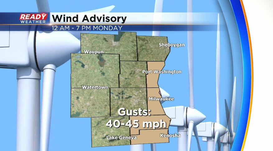
Folks near the lake and along the WI/IL border have the best shot at 40-45 mph wind gusts. A Wind Advisory remains in place for Ozaukee, Milwaukee, Racine, and Kenosha counties until 7 pm Monday.
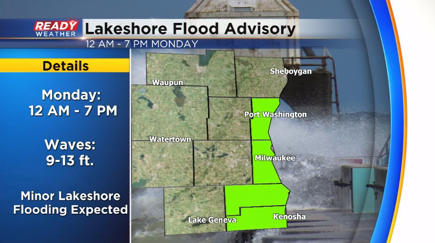
That strong onshore wind will also create 9-13 ft waves throughout most of Monday, which could lead to minor lakeshore flooding and erosion. A Lakeshore Flood Advisory is also in place for a few lakeside counties through 7pm Monday.
Drier and less breezy weather will return for the middle of the week. Download the CBS 58 Ready Weather App to track the rain.