We've had just a splash of rain so far this month. To date .16" accumulated on the second. But there's plenty more rain on the way that could impact outdoor holiday plans.
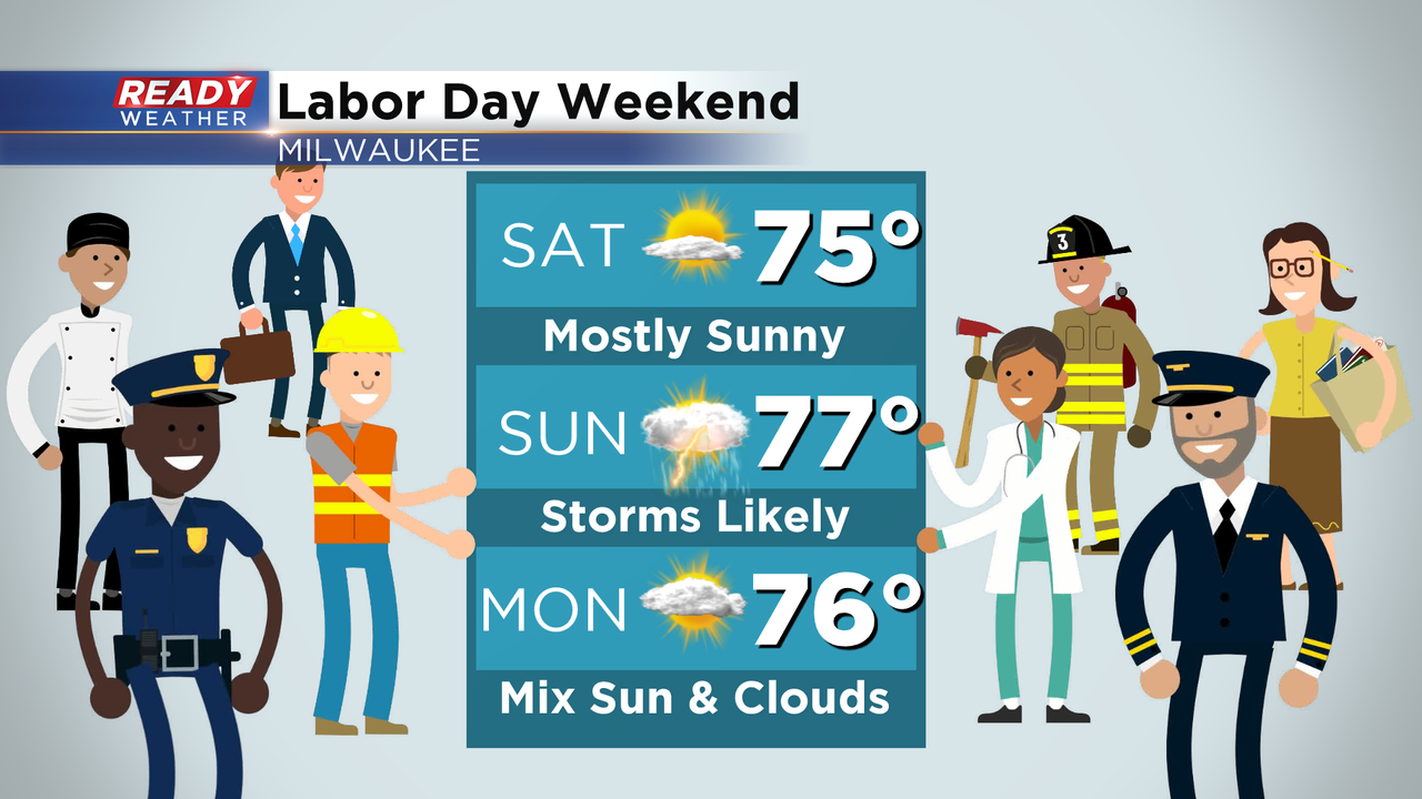
Tonight, a weak disturbance aloft could trigger an overnight shower. It should remain isolated and mainly after midnight through the predawn hours only. The second and more substantial chance comes from a potential complex of showers and storms that, as of now, would be a Sunday morning event. There is a chance for a few stronger storms so we'll be watching that carefully. At this time NOAA's Storm Prediction Center has the area under a low level or marginal risk for strong to severe storms. It's possible a few additional storms pop later in the day or night as well. Be prepared to take outdoor plans inside as any storms brew overhead. Storms may come with hail and gusty wind, as well as lightning and downpours.
Beyond that rain chances will continue and linger through much of next week. The opportunity for 1-3"+ of rainfall is there during this period. High rainfall events aren't totally uncommon during September, we generally get a couple.
Check it out:
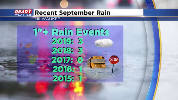
The last two Septembers were both wet recording around seven inches of rain, a good 3 1/2" above the norm. As you can see both years tallying three 1"+ rain events.
Here's what the reliable European model shows for potential rainfall through this upcoming stretch Sunday-Thursday.
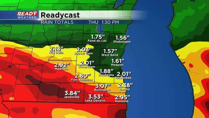
This model focuses higher amounts closer to a slow moving low pressure system setting up shop over central IL through midweek. This location also puts us in the cool sector so brace for what will feel like typical cool fall rain with highs in the 60s.
Grab the umbrella before heading out next week!
I'm meteorologist Rebecca Schuld
