


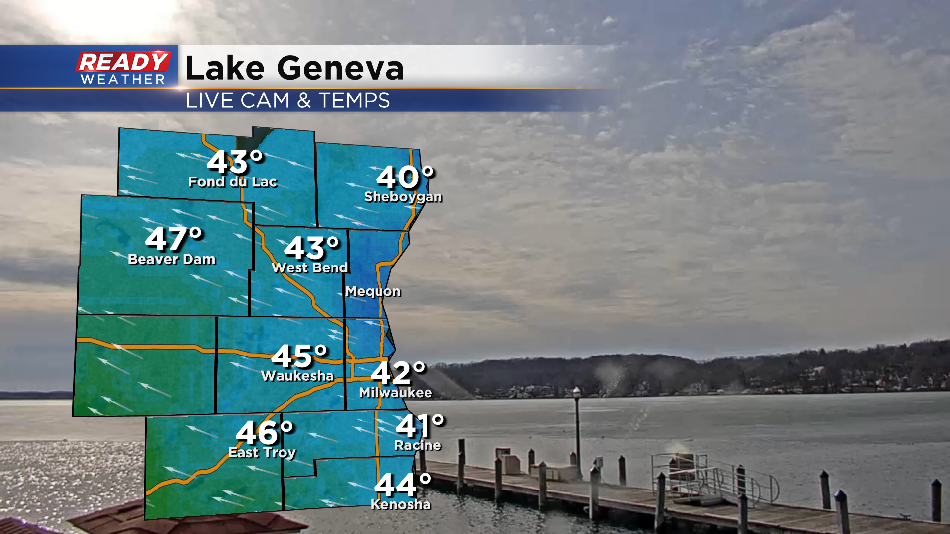
It's been a rather nice day across southeast Wisconsin with mostly sunny skies and temps in the low to mid 40s.
Clouds will continue to increase as we move into this evening ahead of an approaching low pressure system. This system will bring a batch of rain and wet snow into southeast Wisconsin by late evening.
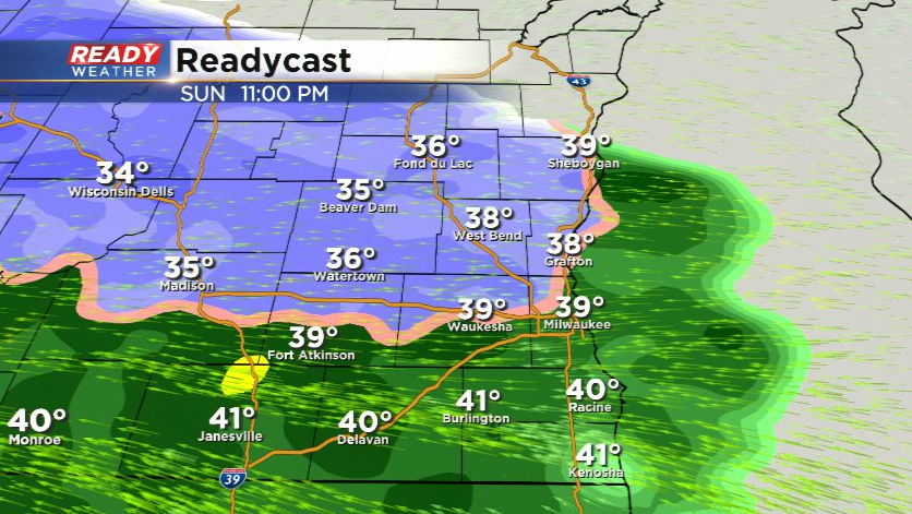
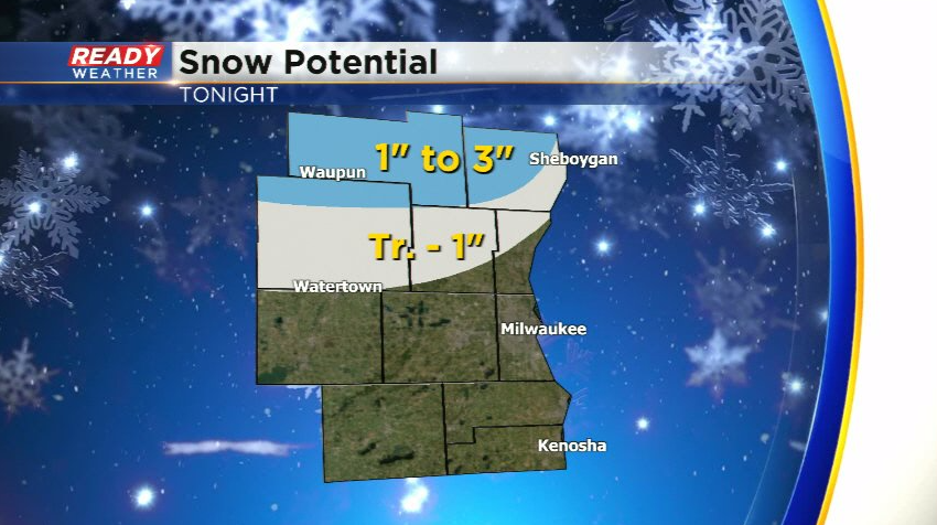
While areas near and south of I-94 will mainly see rain, some wet snow is possible as the precipitation initially moves in. Folks to the north will have a few hours of wet snow overnight.
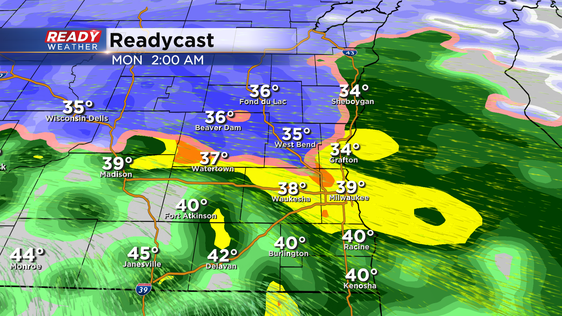
The snow could fall at a heavy rate between 10pm and 3am Monday, especially in Sheboygan and Fond du Lac counties where a Winter Weather Advisory has been issued from 9pm-6am Monday. Snow will change to rain area-wide before sunrise Monday morning.
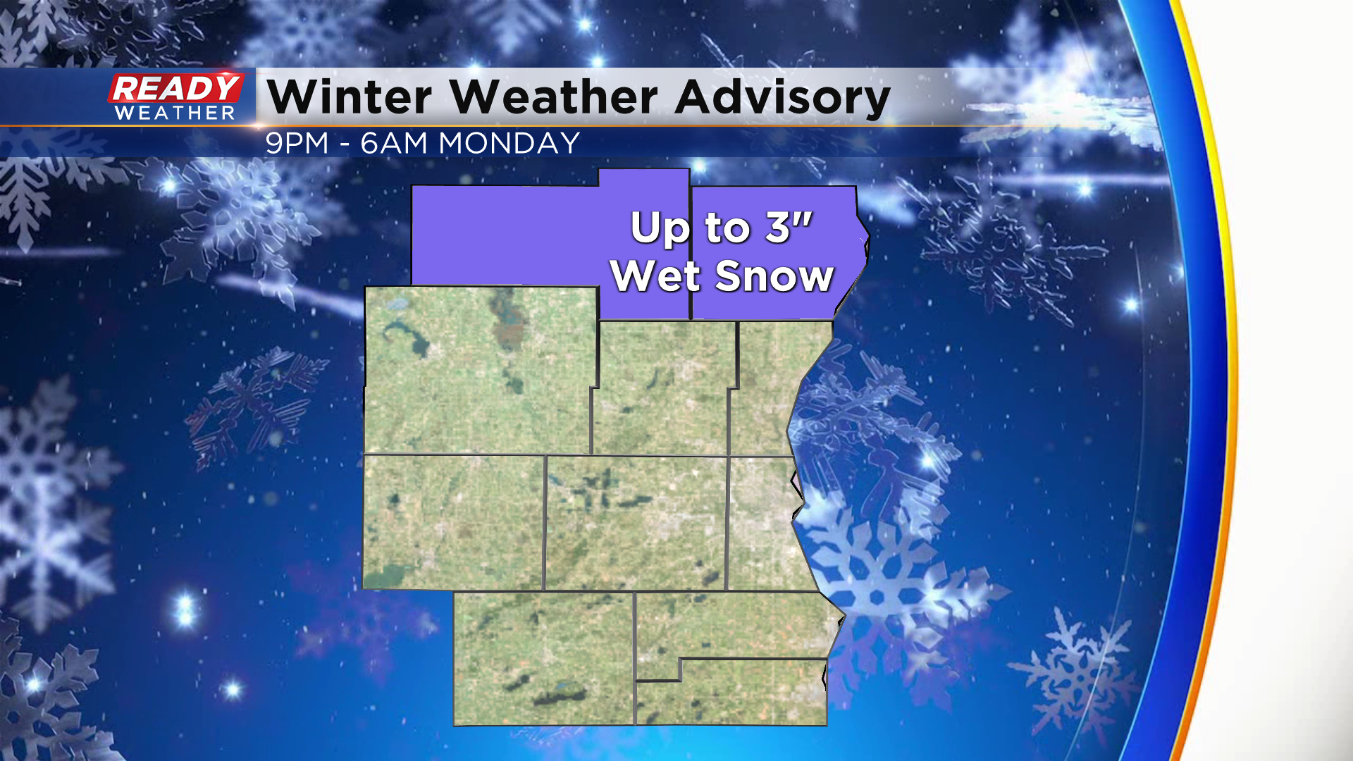
Up to 3" of wet cement-like snow is expected in Fond du Lac and Sheboygan counties before changing to rain. A coating to an inch is expected from Dodge to Ozaukee counties, mainly on the grass.
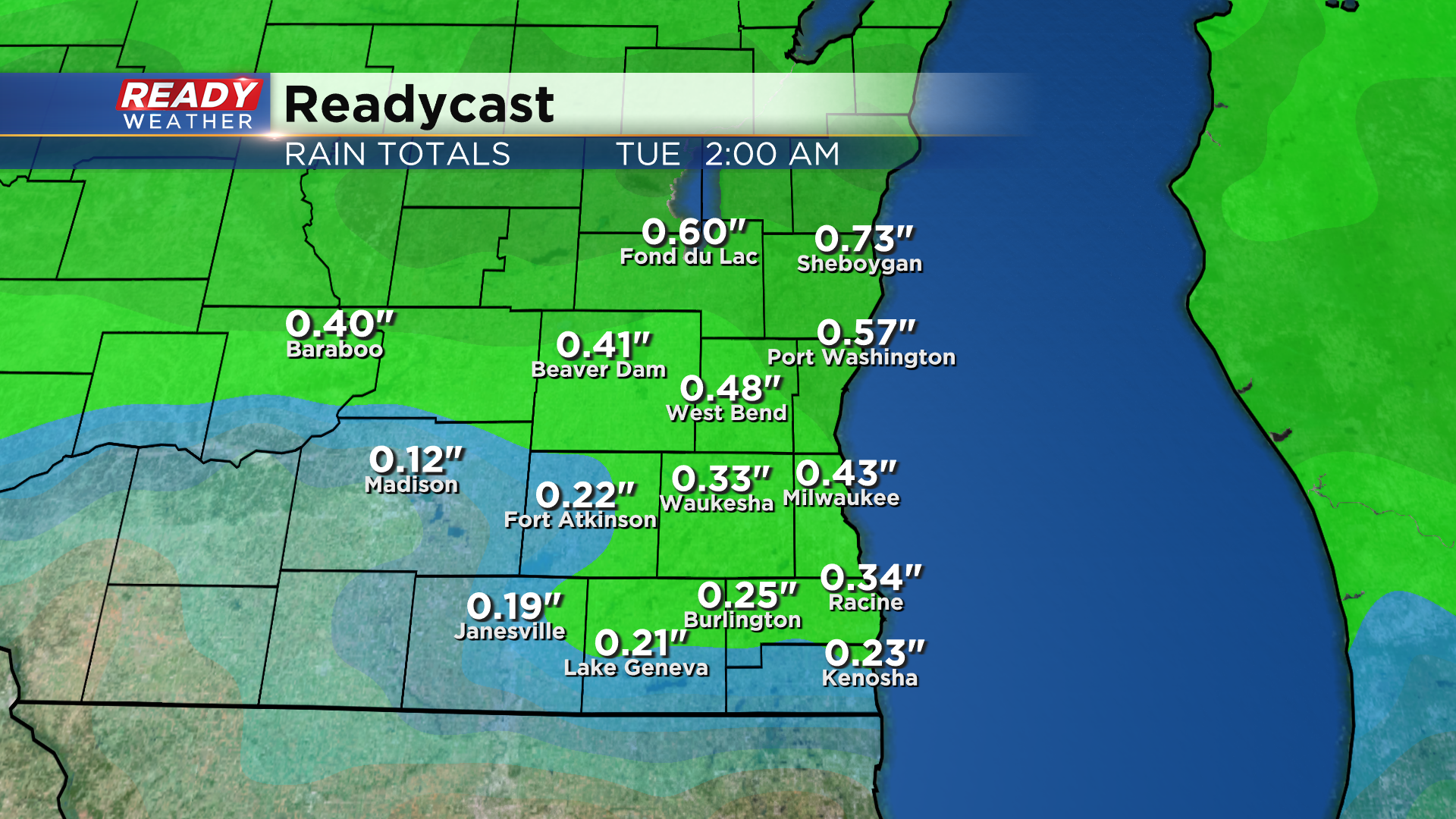
While folks to the north see wet snow, areas along and south of I-94 may hear some thunder early Monday morning. Between .25-.75" of rain/liquid is expected as this moves through.
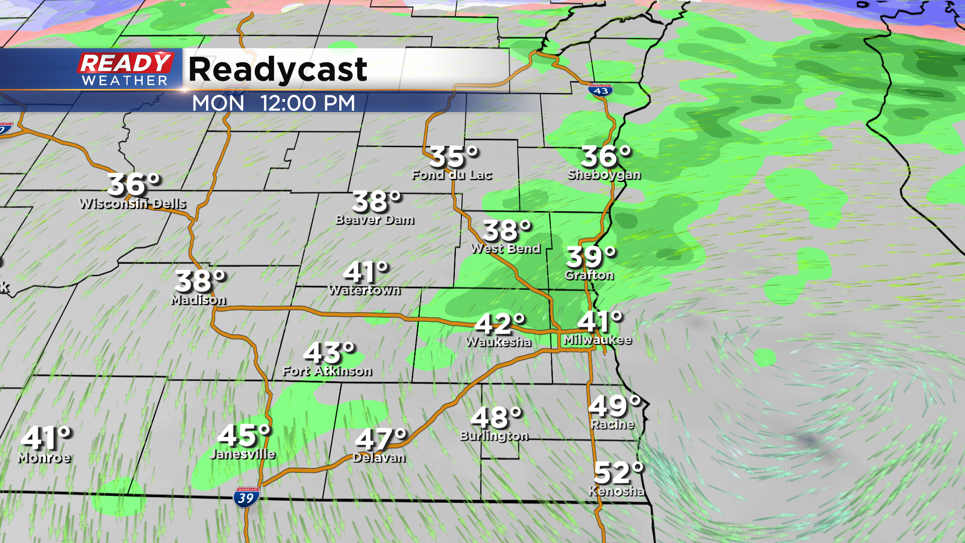
The low will track across the region during the day Monday, keeping the chance for isolated showers around, but the day will be dry more than wet.
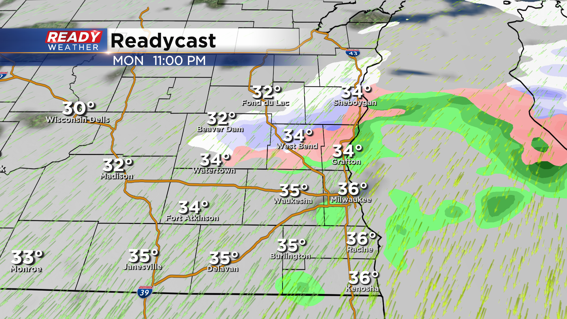
A few snow showers may mix in during the evening on the backside of this system as cooler air moves in.
Download the CBS 58 Ready Weather App to see if there is more wet weather on the way this week.