Rain chances keep coming with an isolated strong storm possible


Tuesday saw a few scattered showers and rumbles of thunder around southeast Wisconsin and Wednesday could feature more of the same. So far Wednesday morning the rain has stayed away to our west and south. The activity in northern Illinois looks to stay just to our south but some moisture moving in from Iowa will bring us a better chance for rain through the morning and into the afternoon.
Here's a look at the local radar image that will update with time:

The chance for showers and storms will continue through the afternoon but most of Wednesday evening and Wednesday night look pretty dry. We can't completely rule out an isolated shower or storm, but a lot of areas should be dry.

A few isolated stronger storms are not completely out of the question on Wednesday especially as temperatures warm into the 60s increasing the level of energy available in the atmosphere. A Level 1 Marginal Risk is in place for most of southern Wisconsin including nearly all of southeast Wisconsin. Some hail would be the primary threat for any strong or borderline severe storms we get Wednesday.

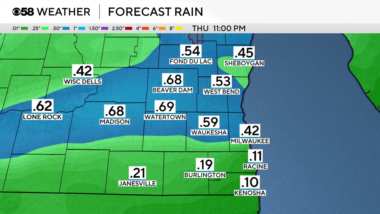
Rain totals for Wednesday and some of the isolated showers on Thursday should see at least a tenth of an inch in most areas but those that see storms or downpours could get over a half inch.
Download the CBS 58 Weather app to track the rain and storms with the interactive radar.