Rain chances return as we get closer to the July 4th weekend


Tuesday was completely dry but a few random rain chances will return the next few days as we head toward the July 4th weekend. After a dry morning on Wednesday we could see a few isolated showers and storms in the afternoon and evening. Not everyone will see the rain Wednesday but others could get downpours or a few rumbles of thunder.

Any storms that do form on Wednesday could be on the stronger side with some gusty wind and small hail. All of Wisconsin is under the Level 1 Marginal risk for strong storms.
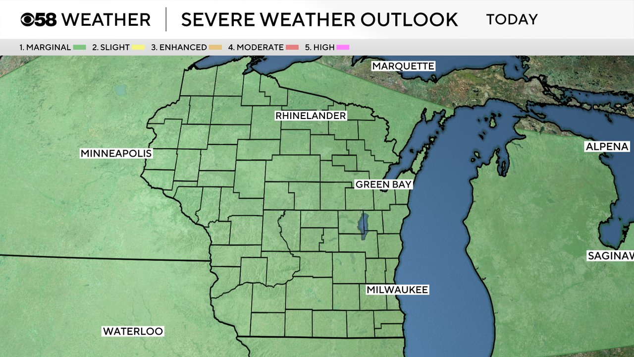
Thursday we are also under the Level 1 Marginal risk for strong storms in the southern half of the state. The timing for storms on Thursday is a bit uncertain, but does look best in the afternoon and evening. Some of the rain on Thursday could linger a bit into Friday morning for July 4th. If you are setting out some chairs or a blanket to stake your spot out early they might get a little wet but by the mid-morning hours the rain chance goes down and everything looks dry for afternoon cookouts and evening fireworks!

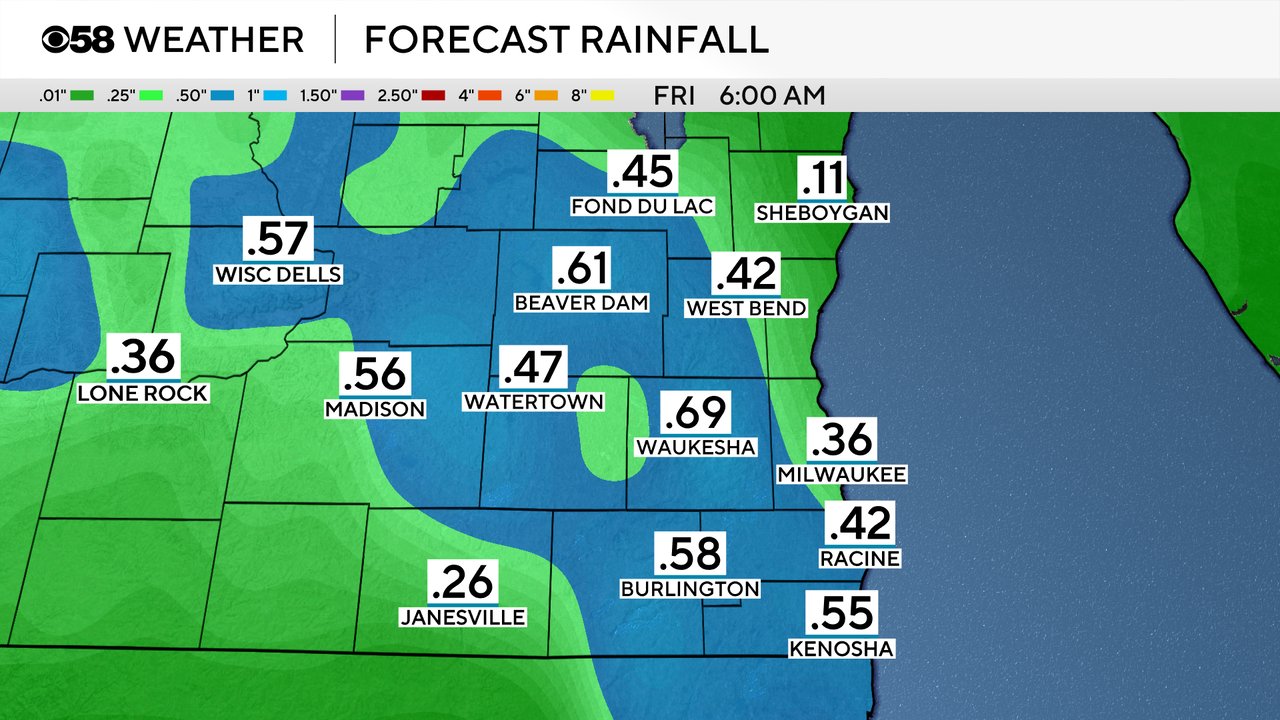
Don't expect a ton of rain the next few days. Some areas that see storms or downpours could get 0.25-0.50" of rain but others that just see a passing shower might only get a tenth of an inch.
Download the CBS 58 Weather app to track the showers and storms the next few days with the interactive radar.