


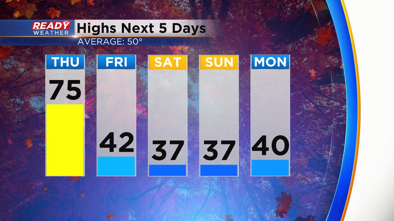
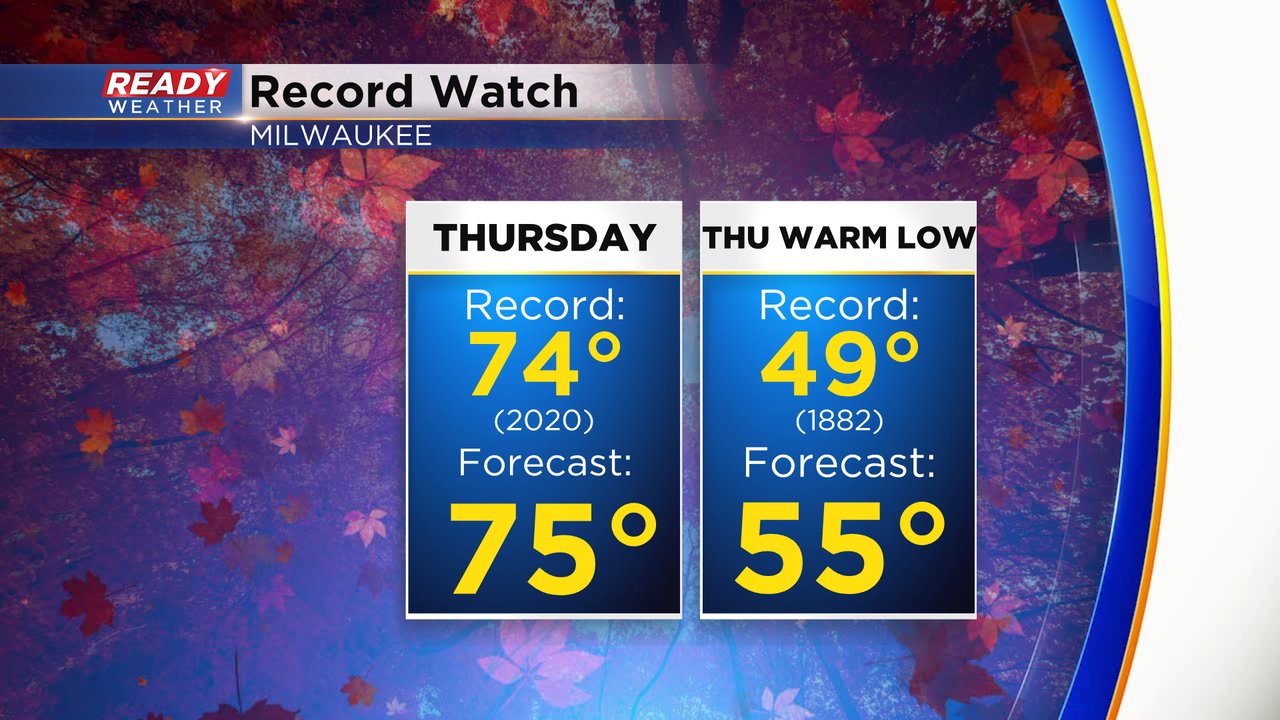
Just a week after we were on record watch, we are doing it again! High temperatures on Thursday will likely warm into the low to middle 70s thanks to sunshine and a gusty southwest wind to 30 mph. A forecast high of 75* in Milwaukee would break the current record of 74* set just two years ago in 2020. Enjoy the warmth because a big drop is coming. Highs for the weekend stay in the 30s!
We're not just watching the record high today but also the record warmest low. The warmest the low temp has been on November 11 from midnight to midnight is 49* set back a long time ago in the 1880s. I don't think we even reach the low 50s on Thursday so that record should be smashed!
Then the monster cold front hits. Look at that cold air off to our west Thursday morning. Teens for temps out in the Dakotas and we could see some teens away from the lakefront over the weekend.

The cold front will also bring a decent chance for rain. Showers are likely after 6 PM Thursday evening with showers likely Thursday night wrapping up during the morning commute Friday. An isolated thunderstorm will be possible, especially in western counties, Thursday evening, otherwise a few snowflakes could mix in as showers wrap up Friday morning. Rain totals for Thursday evening into Friday morning won't be overly impressive but stay in the 0.25" range for most.

Download the CBS 58 Ready Weather app to track the temps and the rain.