Record-smashing warmth is long gone with a winter chill briefly returning
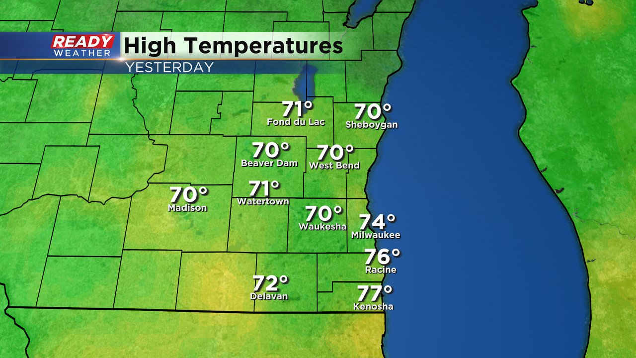
The warmth on Tuesday was insanely impressive, especially for the end of February. All of southeast Wisconsin at least hit 70 degrees and some locations reached the middle 70s. These highs are more typical of early June than the end of February.
The 74* high in Milwaukee shattered the old record high of 65* set back in 1976. We also broke a record warm low since the low only dropped to 49* from midnight to midnight Tuesday smashing the old record of 38* by over 10 degrees!
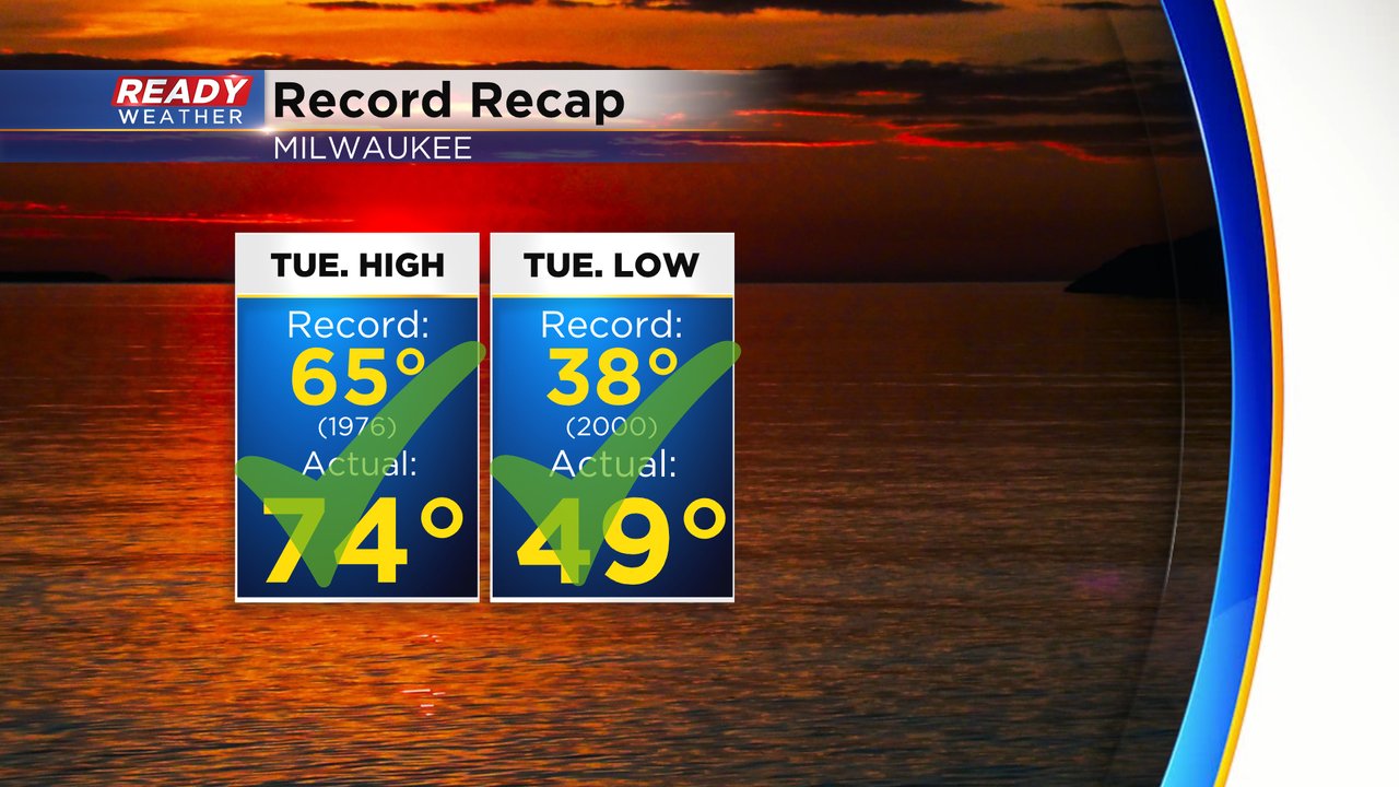
The 74 degree high in Milwaukee not only broke the daily record high but also is the warmest February temperature ever recorded in Milwaukee! And the 77* high in Kenosha is the warmest temperature ever recorded in February across the entire state!

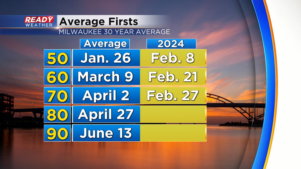
Getting our first 70 degree day this early in the season is pretty rare and comes over a month earlier than average. Based on our 30-year averages Milwaukee doesn't hit the 70s until the beginning of April. Time will tell when we get to our first 80* which on average doesn't happen until the end of April.
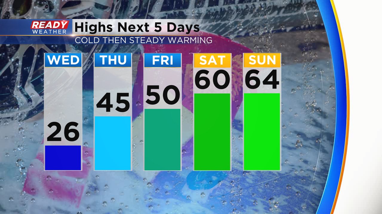
But all of that warmth is well in the past. A very strong cold front has rolled through the state dropping air temps into the teens and 20s locally with wind chills hovering around 0 in some locations Wednesday morning. Temperatures during the afternoon will stay in the 20s with wind chills down in the teens throughout the day. But the cold is short lived. We warm back above average into the 40s tomorrow then 50 on Friday and 60s for the weekend!
The wind will stay persistent the next few days. Very strong wind on Wednesday out of the northwest will gust to 40 mph and strongest in the morning. The wind lightens up a bit Wednesday night but still breezy then it shifts to the southwest Thursday with gusts to 30 mph and on Friday the breeze lingers.
Download the CBS 58 Ready Weather app to track the temps for the end of February and start to March.
