Early Afternoon Update: Spotty rain showers continue through the afternoon


Updated Thursday, April 4th 1:30pm:
The widespread wet snow/rain from this morning has exited southeast Wisconsin, but spotty rain showers will continue to pivot across eastern Wisconsin through the remainder of the afternoon.

Only a few hundredths of an inch of rain is expected, and we really don't need any more. Check out the rain totals since Monday.

Spotty showers taper off this evening with mainly dry weather the next two days besides a stray sprinkle on Friday.
-------------------------------------------------------
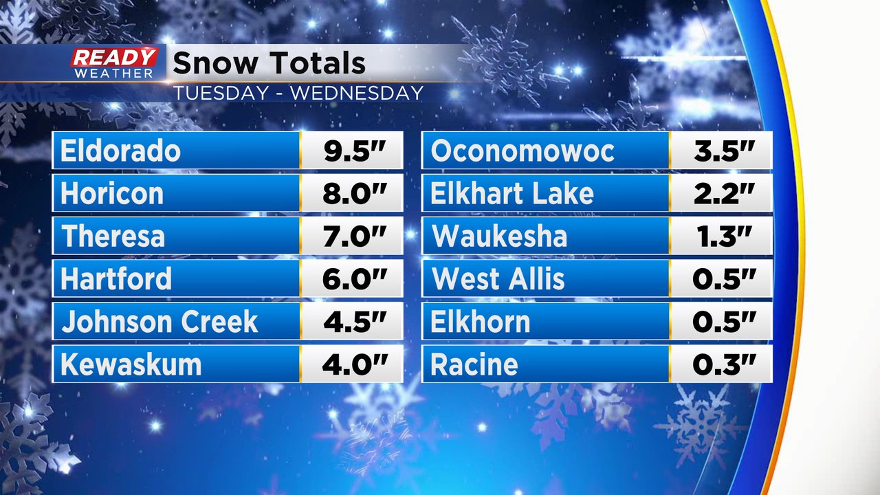
We are not quite done with this storm system that has brought us both rain and snow this week. So far snow totals range anywhere from just a few tenths of an inch in lakeside communities all the way up to nearly 10" of snow in Fond du Lac County.
After the accumulating snow Tuesday into Wednesday we only saw light mix showers the rest of Wednesday with little additional snow accumulation. Most locations have been dry since Wednesday evening but that's about to change with a burst of snow rolling in from the north for the Thursday morning commute. The commute could be a bit slow but roads should just stay wet or slushy. However some snow could accumulate on grassy surfaces anywhere from a dusting to a full inch.

The burst of morning snow should end by noon at the latest but lingering mix showers will continue through the afternoon and evening with little to no additional snow or rain accumulation. Then we dry out Thursday night and sunshine returns on Friday.

Download the CBS 58 Ready Weather app to track the morning snow.