Round of rain and snow possible Monday night into Tuesday


Over the weekend we went from mid fall temperatures to end of November temperatures as a cold front rolled in Saturday dropping the temperature from a record tying 69 degrees all the way down to highs in the 40s on Sunday. Both days were fairly sunny after some early morning showers Saturday then Sunday was quite breezy.

The 40s for highs will stay with us most of this week. Thursday could be a briefly warmer day around 50 then next week could be a touch warmer with highs in the low 50s.
A round of rain, mix and snow will be possible Monday night going into Tuesday morning. Chances for precipitation start after 7 PM with better chances close to midnight. The best chance for any snow accumulation will be from midnight to 7 AM Tuesday.

Northern counties have the best chance to see slushy snow with more of a rain/snow mix in the Milwaukee/Waukesha metro and more rain than snow in southern counties. Pavement temps are still pretty warm after the record tying warmth over the weekend so most of the accumulating snow will happen on grass and cars but if snow comes down heavy at night then roads could become slippery and slushy.
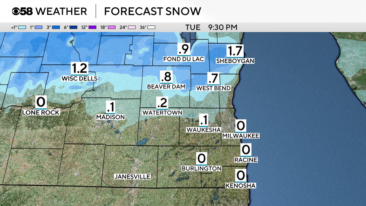
Northern counties have the best chance for a slushy inch or two of snow. The metro area could see a dusting but southern counties should mostly stay way from any accumulating snow.
Download the CBS 58 Weather app to track the mix and snow with the interactive radar.