Scattered showers and rumbles of thunder expected tonight into Saturday
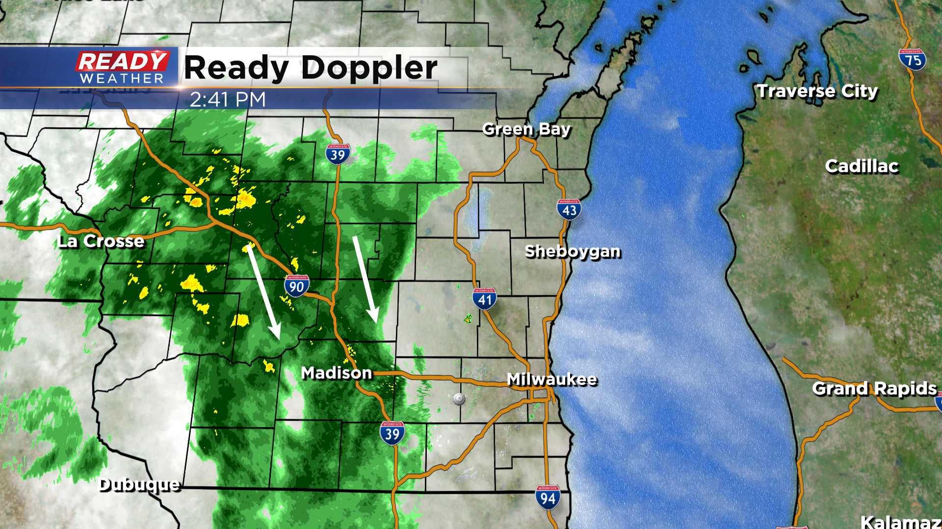
Lingering dry air from a nearby high pressure system has been keeping the steady light rain to our west so far today. A few of these showers may sneak into western counties as we progress through the afternoon, but overall the area of rain is expected to fizzled out by sunset.
Additional scattered showers and storms redevelop overnight tonight and linger into Saturday morning as a low pressure system slowly tracks through the southern part of the state.
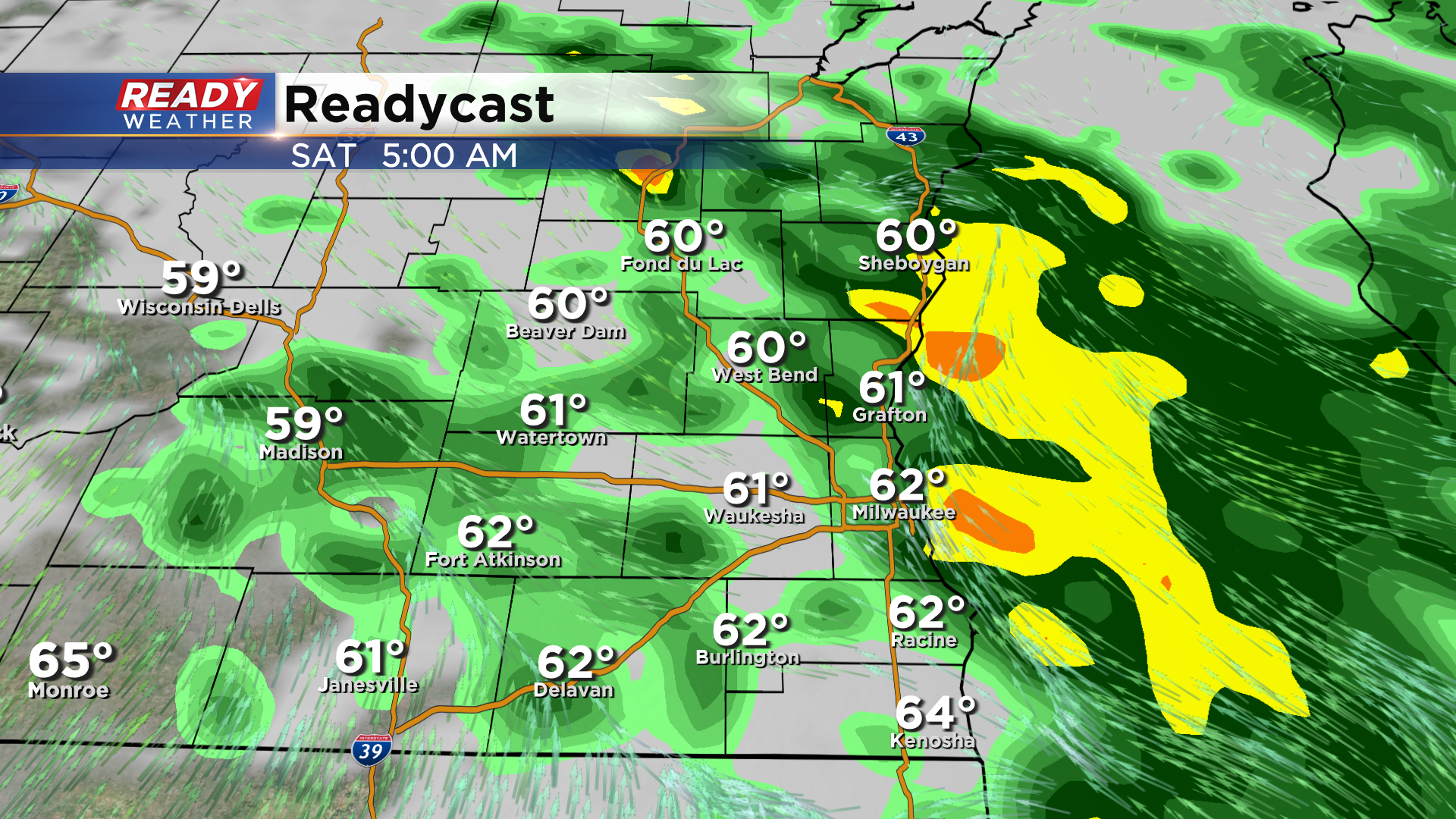
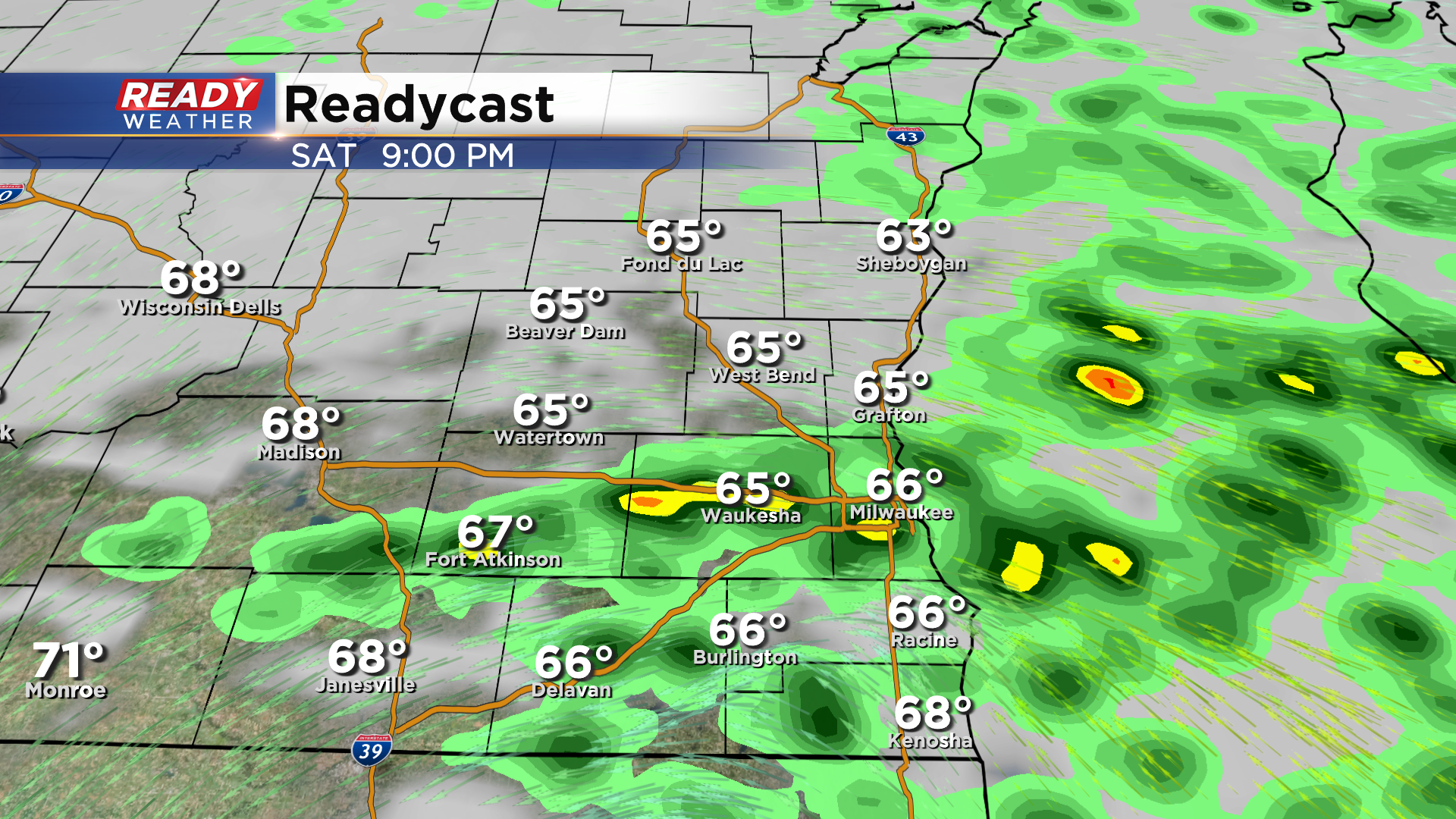
There will be some dry time on Saturday, but spotty showers or storms will be possible until the cold front passes through mid to late evening.
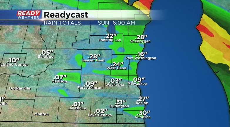
Most of the area will pick up between .10-.30" of rain, but locally higher amounts are possible in any storms that are able to develop. Trends are for the heaviest rain to fall north of Milwaukee.
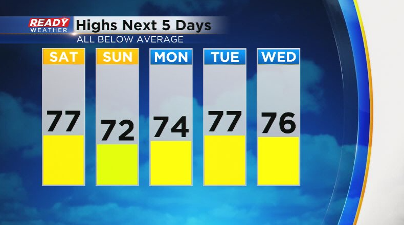
Wind flips back to the northeast on Sunday, which may bring a few sprinkles onshore early in the morning. Otherwise it'll stay from the northeast for the first half of next week, holding highs in the 70s.
Fairly quiet and dry overall next week with chances for showers and storms returning by Friday. Download the CBS 58 Ready Weather App to track the weekend storm chances.
