


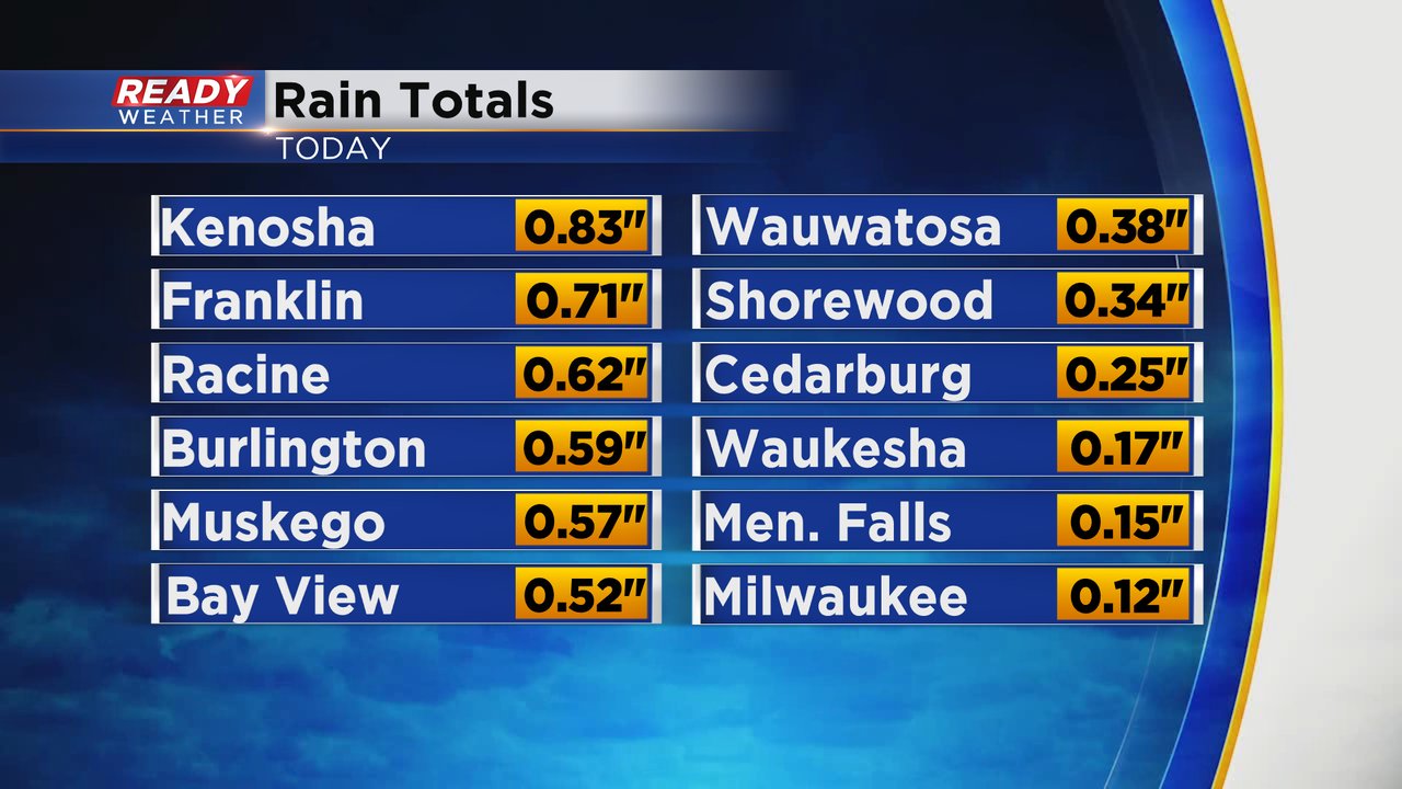
The well anticipated soaking rain started Monday night in many spots. Southern communities picked up the most rain with rain totals through 8 a.m. Tuesday showing nearly an inch to the south but less than a tenth in our northern counties like Fond du Lac, Sheboygan and Dodge. Southern counties are the ones that do need some rain so the heaviest rain fell in the spots that needed in the most.
A first round of steady rain is done, but expect more showers to move through southeast Wisconsin off and on throughout Tuesday. As of Tuesday morning, there's a little rain to our west and south moving our way.

A better chance for some heavier pockets of rain will happen Tuesday night into Wednesday morning. Wednesday's rain doesn't look heavy but persistent light scattered showers will possible all day long and into early Thursday morning.

In addition to the 0.10" to 1.00" of rain that fell Monday night, some spots could get an additional half inch of rain the rest of Tuesday and another half inch on Wednesday. Here's a look at additional rainfall expected Tuesday and Wednesday which when added on to what's already fallen means some areas could get close to 2-3" by Thursday morning.

Even though it won't be raining all day Tuesday, it will be gloomy, raw and windy with wind gusts over 30 mph at times. It will also be cool with afternoon highs on Tuesday struggling to get out of the 50s.

Download the CBS 58 Ready Weather app to track the rain the next few days.