Severe storms with strong wind end our historic warmth


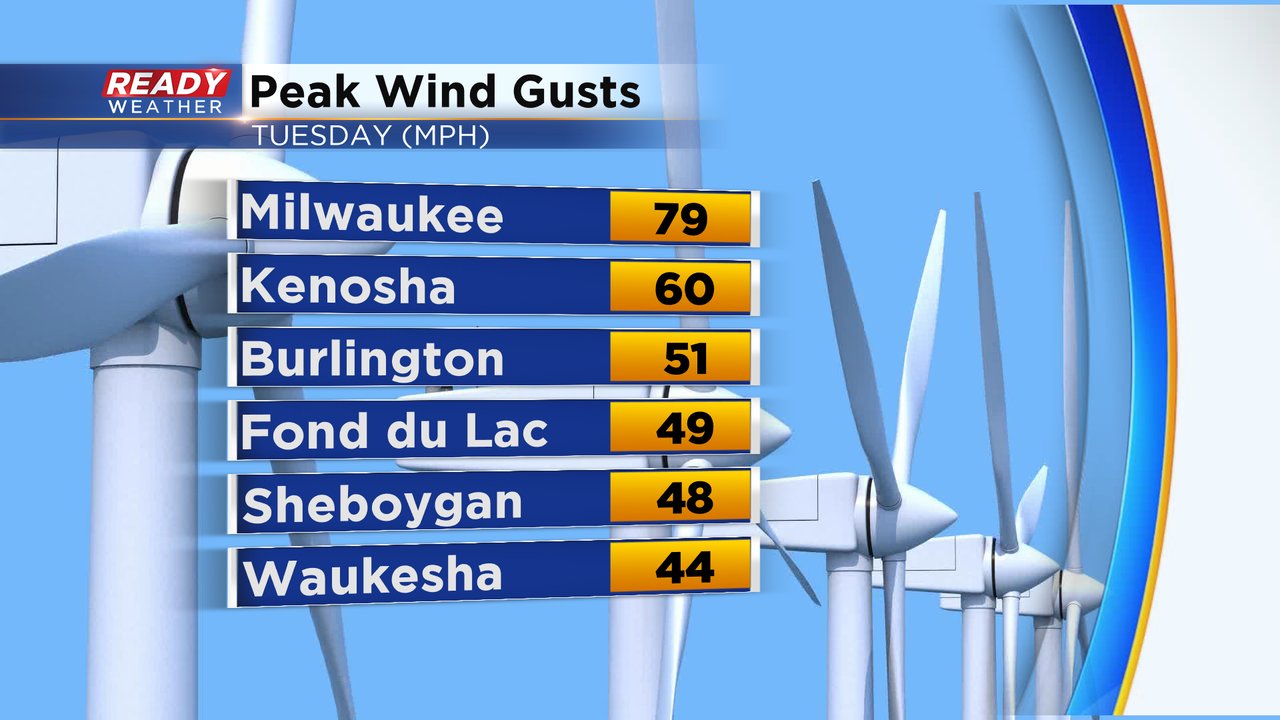
As expected a cold front raced across southeast Wisconsin Tuesday afternoon and evening with some strong to severe storms. Most of the severe weather was confined to our southern counties: Waukesha, Milwaukee, Walworth, Racine and Kenosha. Wind gusts there caused tree damage and widespread power outages. The wind gusted to almost 80 mph in Milwaukee at the airport and 60 mph in Kenosha.
Even though southern counties saw the most wind it was northern areas that saw the most rain. Over 1" of rain fell in Fond du Lac and Mayville with still a good soaking 0.25-0.75" of rain in the rest of southeast Wisconsin.

The rain and storms were a result of a strong cold front that brought our historic warmth to a close. It was over a week ago that our days in the 70s started and that ended Tuesday with highs still in the middle 70s for some. Northern counties didn't get as warm with the cold front there arriving earlier.

The historic warmth lasted eight days and resulted in five broken record high temps: Wednesday tied at 73*, Friday and Saturday at 74*, Monday at 76* and Tuesday at 74*. In addition to the record highs we also broke a record warmest low temperature on Monday when the low only dropped to 63*. We also saw five straight days in the 70s which breaks the previous November record and had seven total days in the 70s which is another record for the month of November.

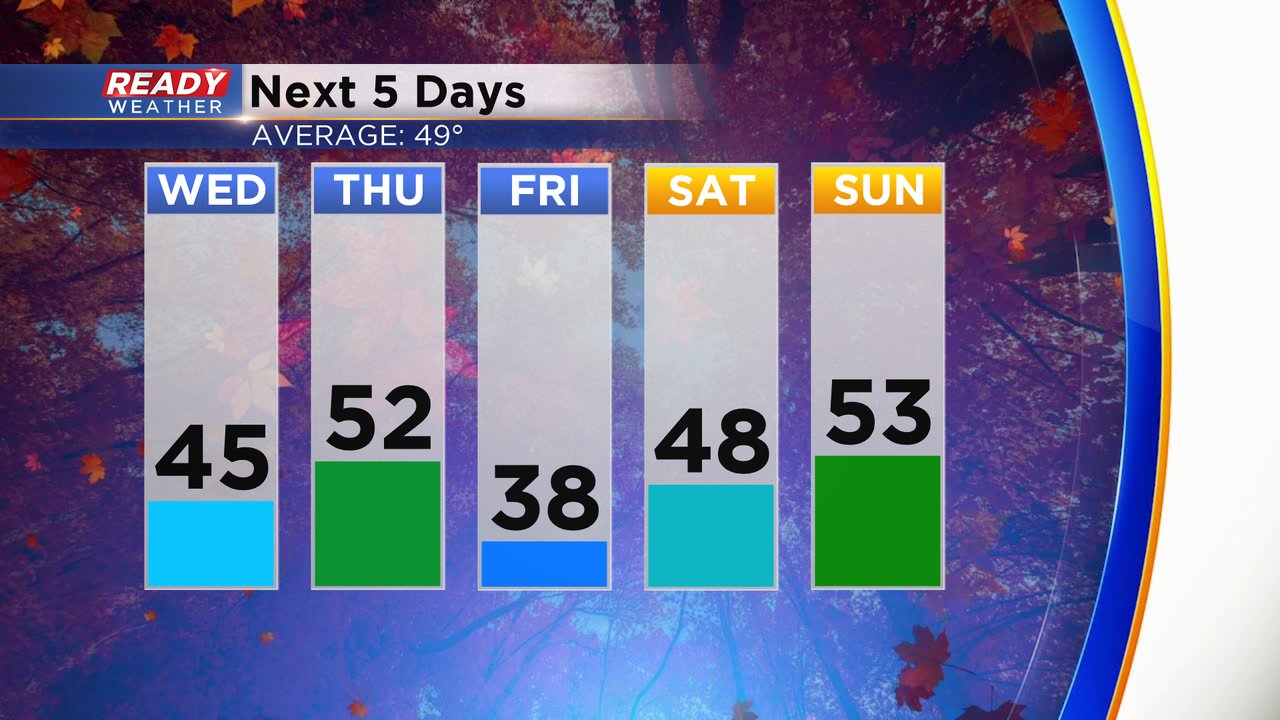
By the end of this week the record warmth will seem like forever with highs staying in the 30s, 40s and 50s through the weekend.
Download the CBS 58 Ready Weather app to track the temps.