Severe weather looking more likely Wednesday night into Thursday


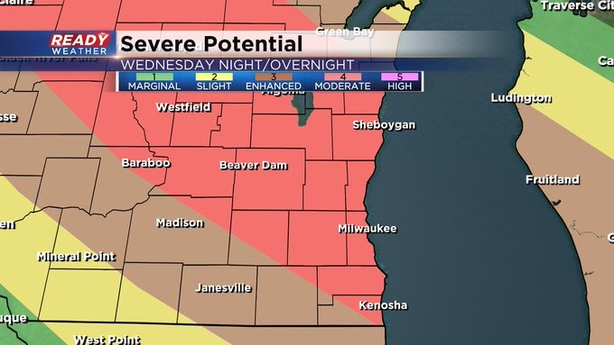
We are in a rare level 4 moderate risk for severe weather tonight. 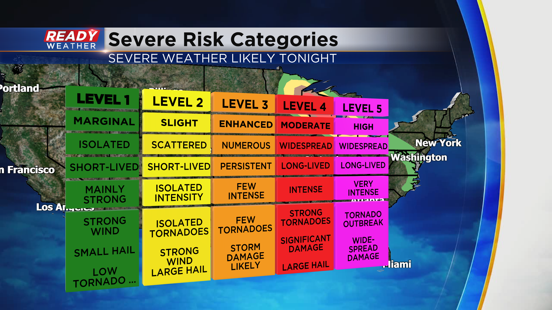 This heightened level of severe weather is generally only issued once every couple of years in our area. It denotes the potential for widespread, long-lived and intense storms. This is being issued with plenty of severe weather components all coming together across the upper Midwest and Great Lakes. Additionally, we have low pressure at the surface approaching from the west, with a stationary to warm front boundary expected to cross over our area late today. This along with very buoyant, humid and unstable air will set the stage for widespread severe weather. The main severe threat will be staged as supercells develop this afternoon over parts of northern Minnesota and track southeast. Now is the perfect time to download the CBS58 Ready Weather App. You can begin to watch the storms take shape upstream and get a good head's up for when they track our way. A great feature on the app is "future radar". When you select this it will show the future progression of the current storms on the map giving you a solid idea of placement and timing of storms moving in. The app is free for Apple and Android users. Not to mention it's a terrific way to get your severe weather alerts no matter where you are! The reason this is so critical is that the storm arrival time will be at night, making storms hard to spot with the eye or the reliance on any type of siren when indoors a bad idea.
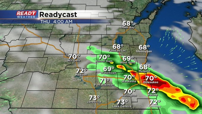
The expected activity could lead to the formation of what we call a derecho. This will pose a threat for significant, potentially destructive hail, a few tornadoes, and severe gusts to hurricane strength. Here's a look at wind comparison for reference: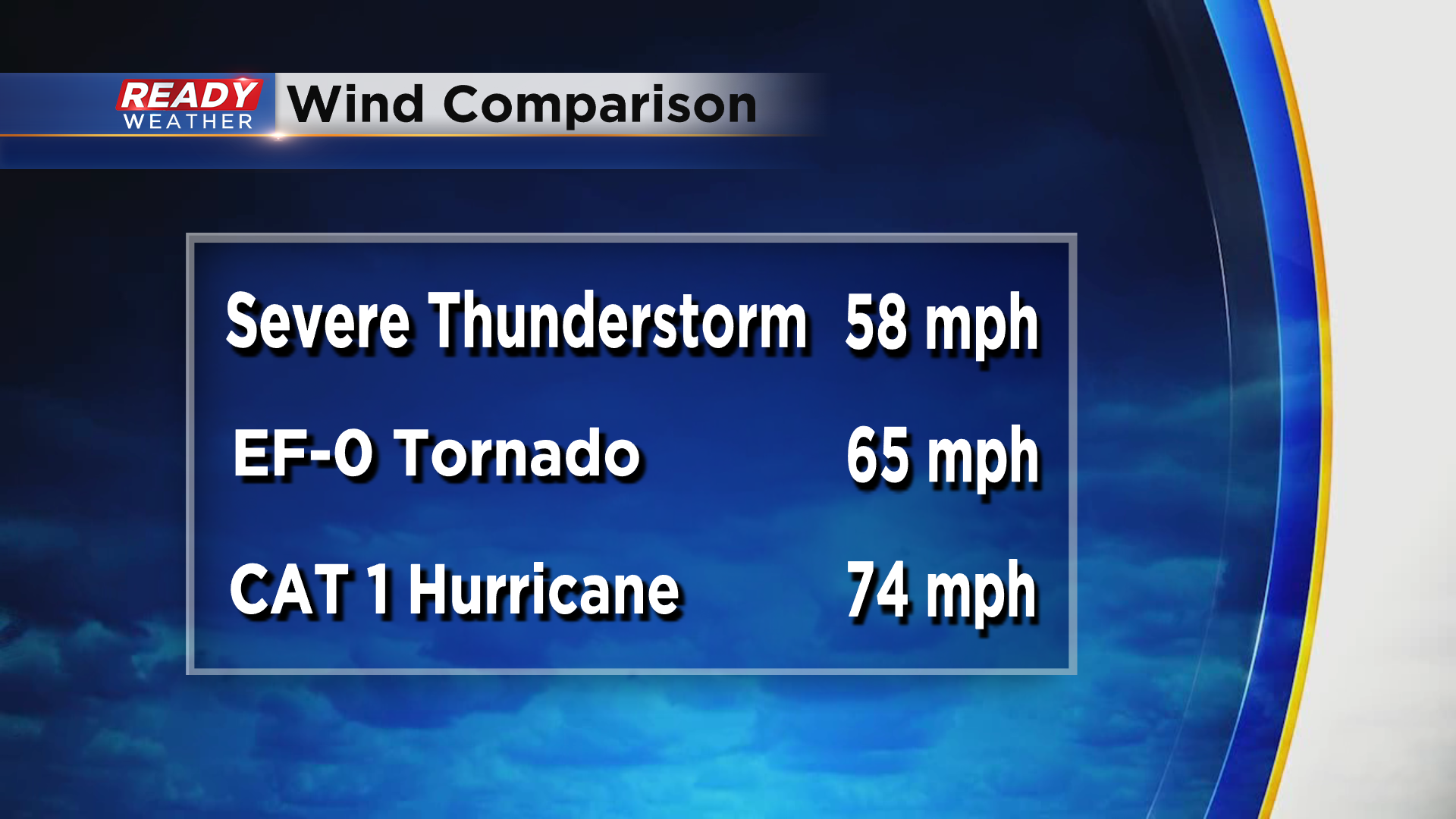 You'll likely hear the term derecho today in the news. This system has the potential to be widespread and long-lived so the entire viewing area is at risk. Take a look at the graphics below to see the best timing for when the storms move into your backyard. They may start as early as 8pm for our northern counties like Fond du Lac, with best chances in and around the metro from 9-10pm. The stormy weather may last into the predawn hours. Have a plan now to stay safe as this activity barrels through tonight.
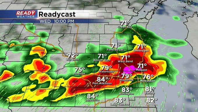
Update as of 8:30 am Wednesday, July 28
The Storm Prediction Center has put most of our area into a "Moderate" risk of severe weather this evening into the overnight. This is a Level 4 of 5. A good chunk of Walworth and western Kenosha Counties is under an "Enhanced" risk. This is a Level 3 of 5. Regardless, you should be weather aware anytime after 8 or 9 pm right into the nighttime hours. Gusty wind, large hail, heavy rain and even tornadoes are all possible. Stay tuned to CBS 58 and cbs58.com for all the details.
_____________________________________________________________________________________________________________
MILWAUKEE (CBS 58)--It's not often we see a moderate risk (level 4) of severe weather, but we will tonight, especially north and west of the Milwaukee metro area.
Damaging wind, large hail, heavy rain and frequent lightning are all possible.
The window of opportunity for these storms will be between 10 p.m. and 4 a.m.
Make sure you have two ways of getting weather information. A NOAA weather radio is a very useful tool to have and so is our CBS 58 Ready Weather App.
There's still another chance of storms Saturday afternoon into the evening with another storm system.
Otherwise, expect our heat to break.
We still have one more run at 90 degrees today away from the lake. But it'll get cooler and drier starting Thursday, July 29.
The weather looks quiet into and lasting much of next week.