Showers ending overnight with more sun to end the weekend


A trough of low pressure moving through the Great Lakes has been generating spotty light showers and drizzle throughout the day today.
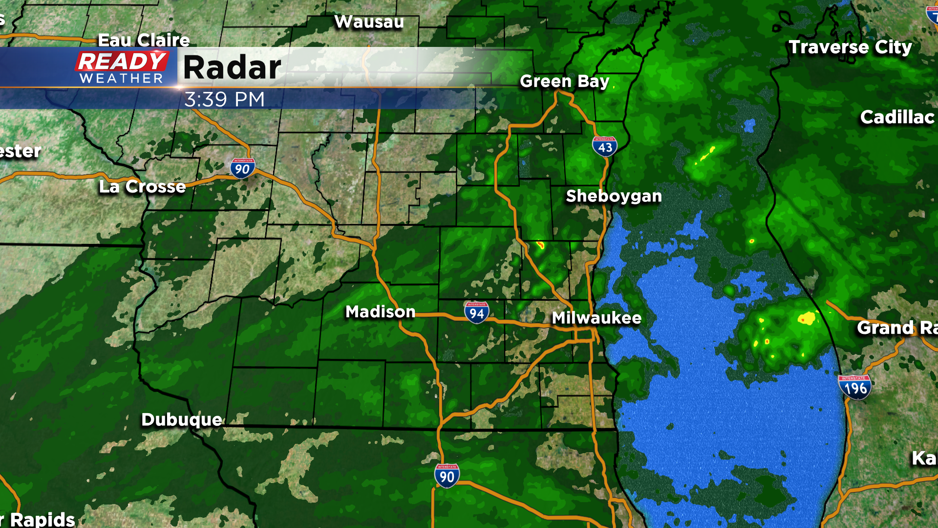
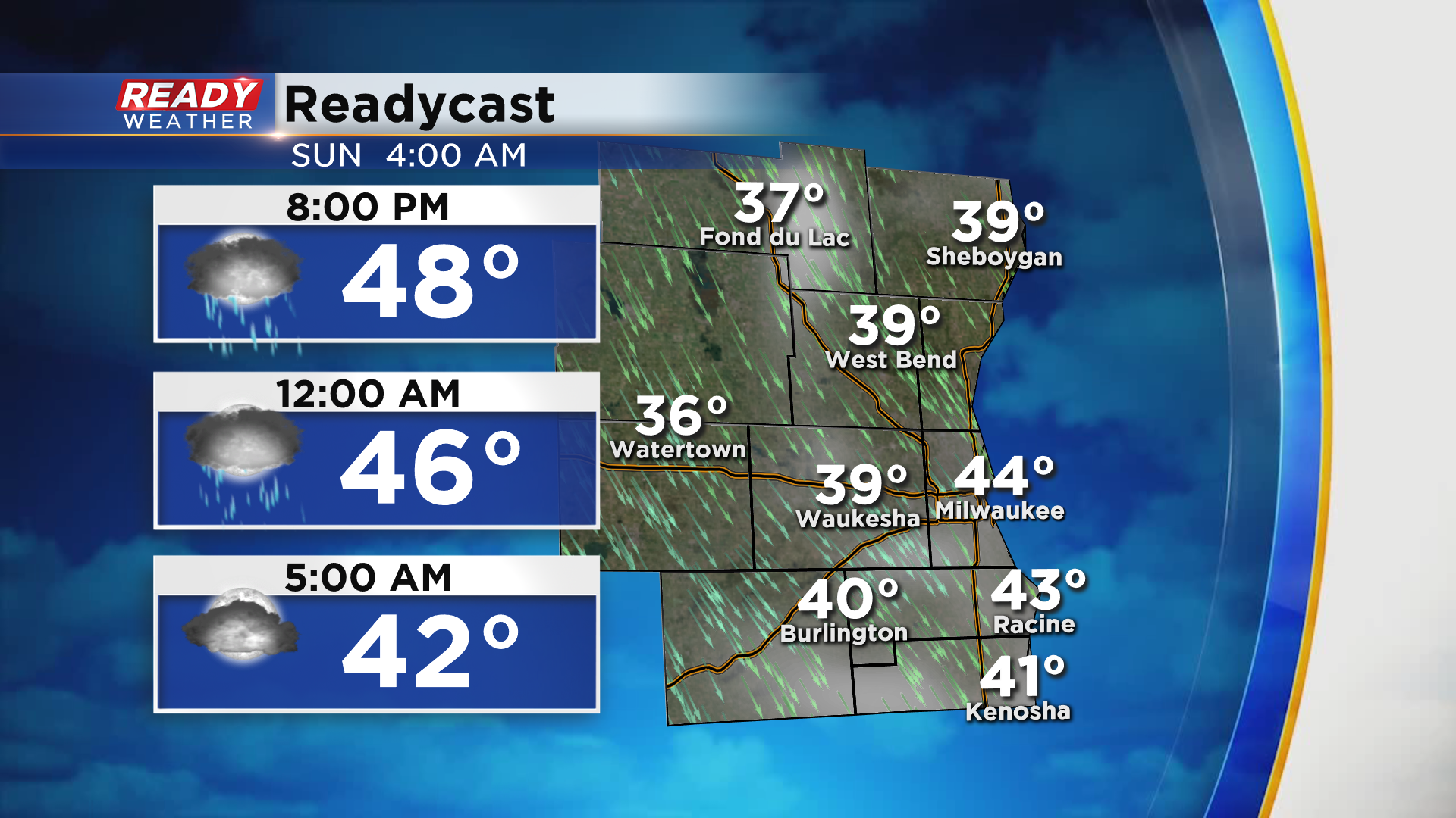
The showers will continue into this evening, coming to an end from northwest to southeast overnight. The lingering clouds and northwest breeze should prevent temperatures from falling into frost territory overnight, but inland spots will likely drop into the 30s.
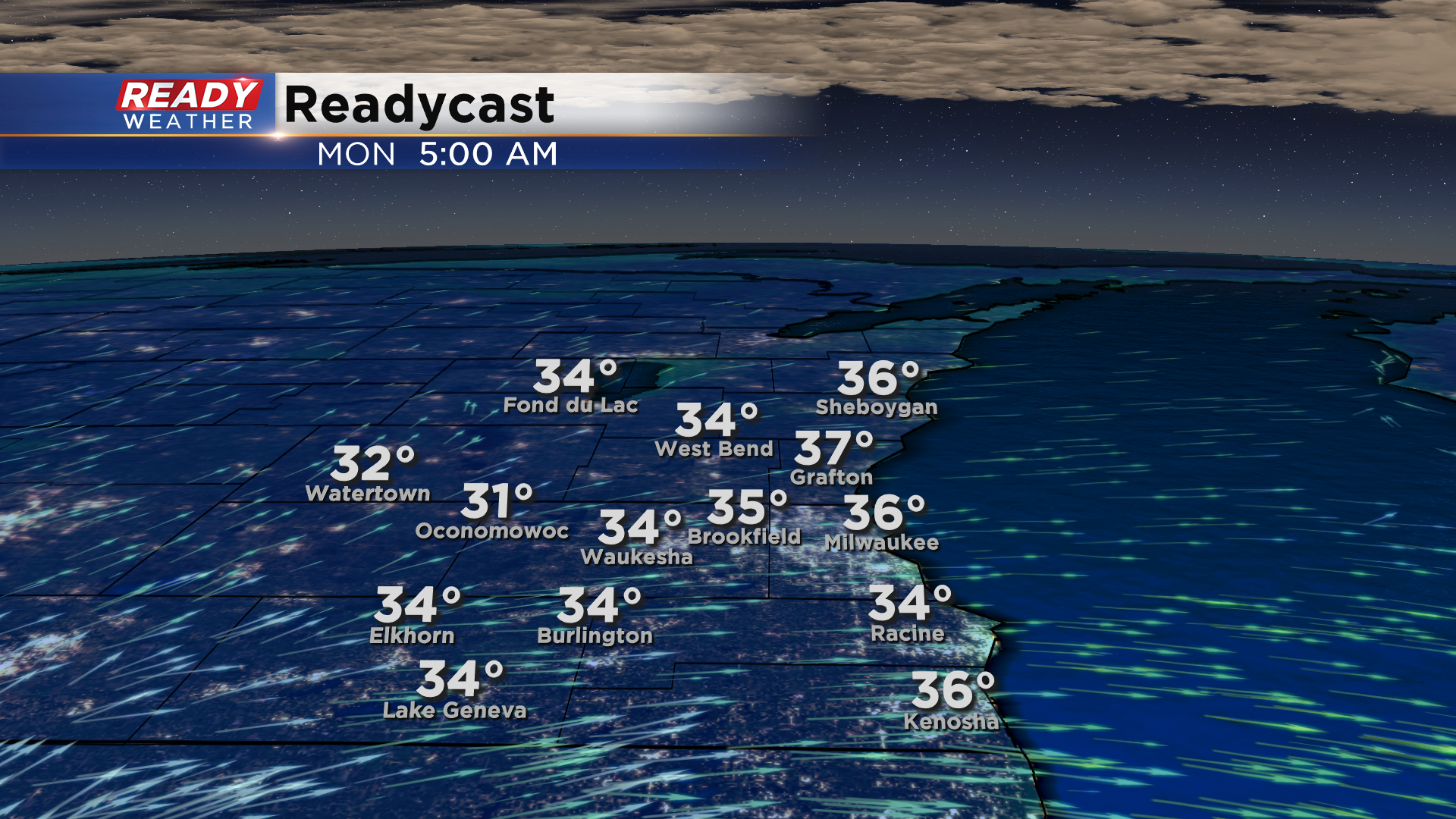
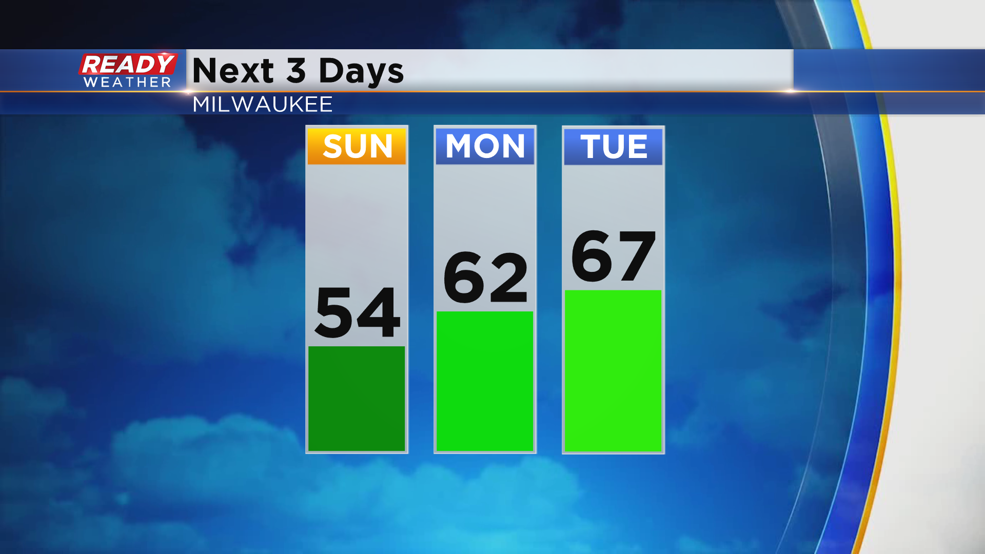
High pressure builds in on Sunday, which will keep us dry and allow for more sunshine to mix with the clouds. Temps will still be on the cool side with highs in the low to mid 50s. With high pressure directly overhead Sunday night, clear skies and light winds will allow temps to plummet into the low to mid 30s with widespread frost expected.
Afternoon another cool day on Sunday, winds will turn to the southwest Monday and Tuesday and help temps warm back into the 60s.
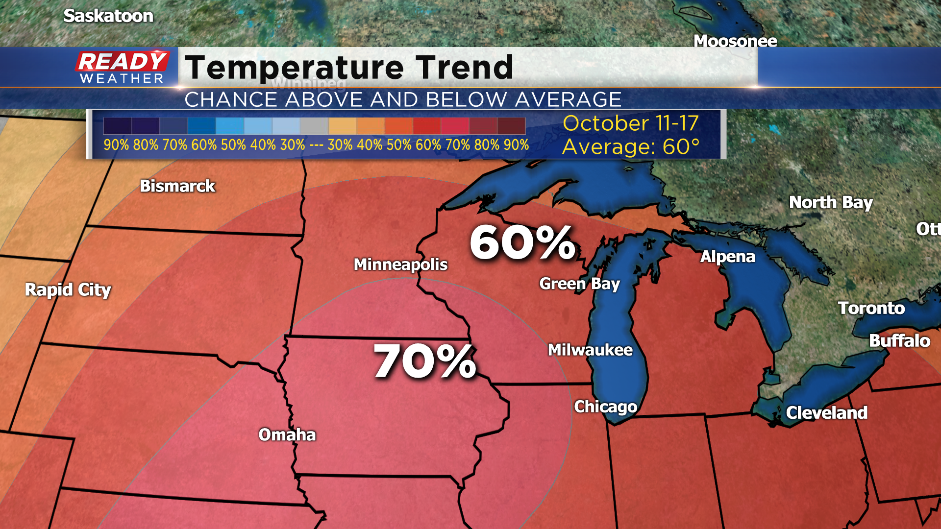
A couple of cold fronts will knock temps down a few degrees for the middle of the week, but the cooler weather won't last for long. Models are indicating a good chance for above normal temperatures next weekend into the middle of October. Normal highs for Milwaukee during that time of year are around 60 degrees.
Download the CBS 58 Ready Weather App to track the evening showers and to see how warm temps could be next weekend.