We're starting off cool and comfortable across southeast Wisconsin this morning with temperatures in the upper 50s to low 60s under partly to mostly cloudy skies.
We'll continue to see clouds stream into the region today ahead of a disturbance and warm front that'll be tracking through later today into tonight.
While we can't rule out an isolated sprinkle this morning, most of the isolated showers and storms should hold off until after the Bucks championship parade.
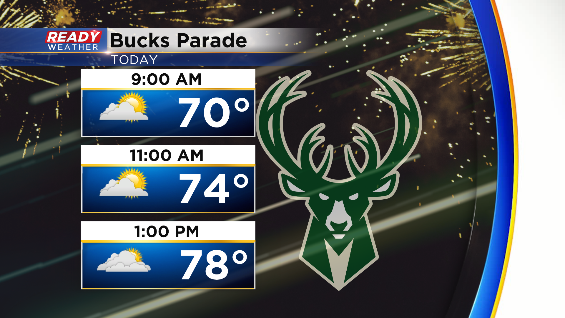
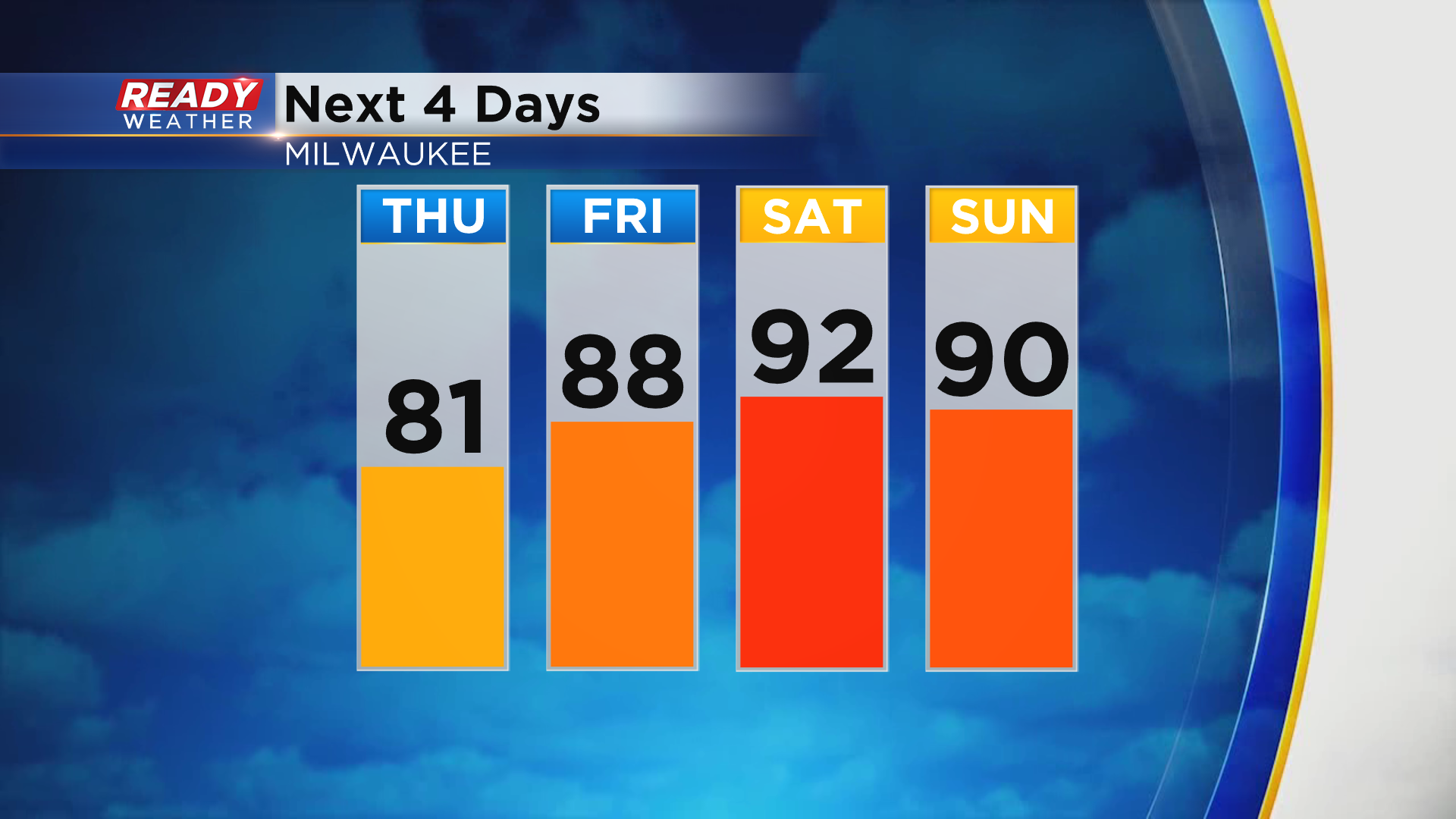
Temperatures will climb through the 70s this morning into the low 80s this afternoon, but the heat will build in for the end of the week and this weekend with highs in the upper 80s to low 90s likely.
Not only will we have to deal with the heat, but the humidity will build back in as well.
Dew points are comfortable this morning in the 50s, but they'll climb into the mid 60s by later this evening and be close to 70° Friday and Saturday.
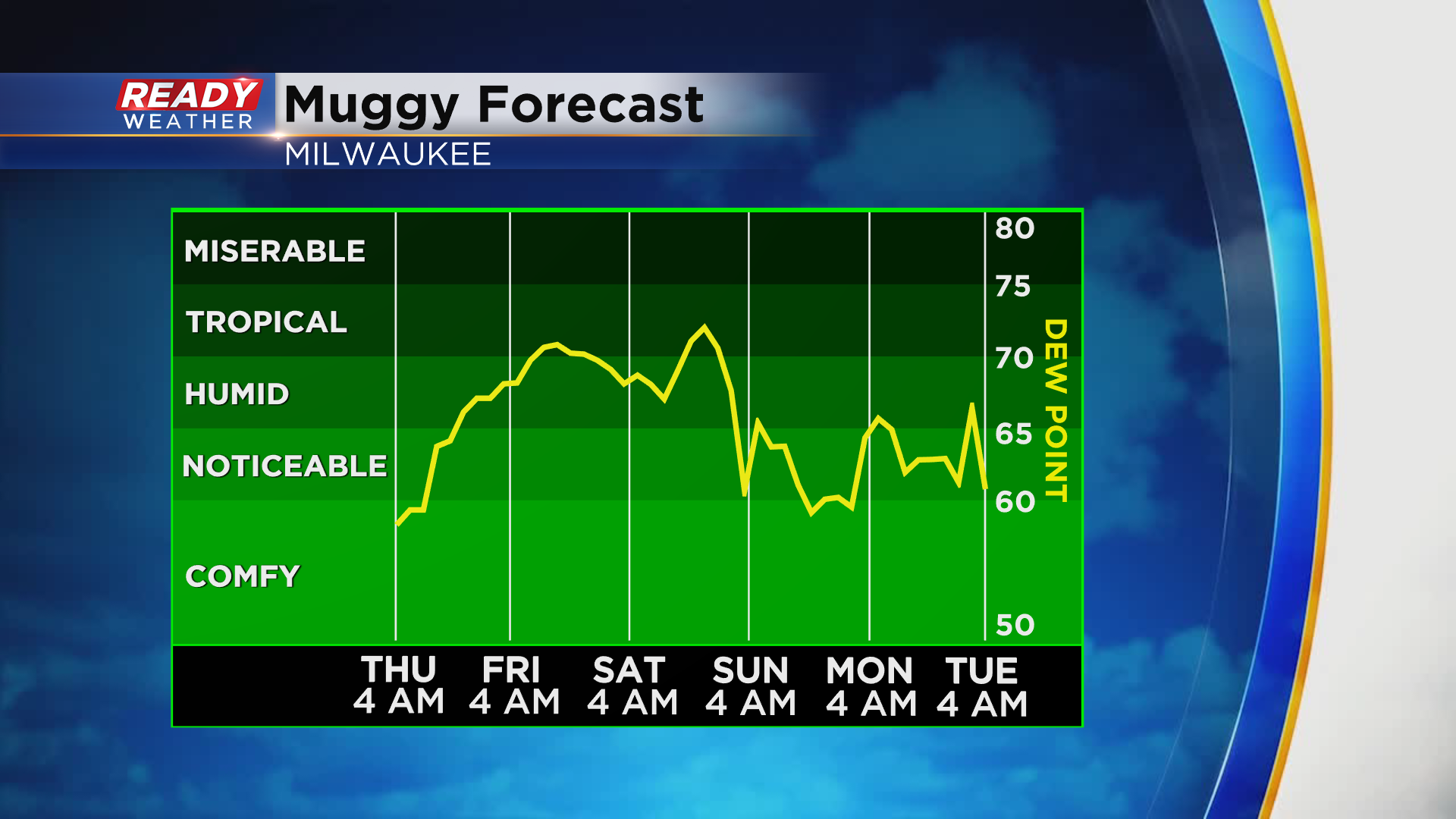
A cold front will bring us a brief break from the humidity on Sunday before it builds back in early next week.
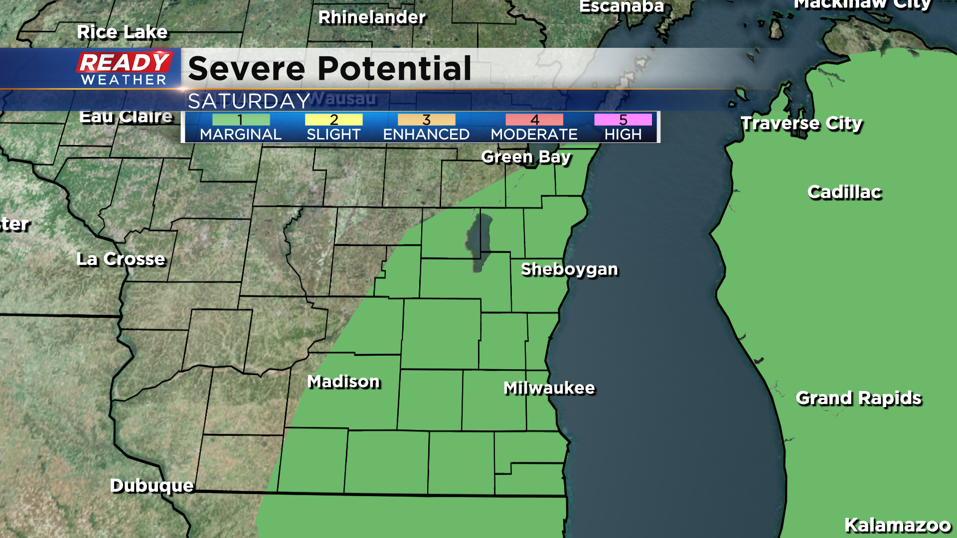
As the cold front moves through on Saturday, we could see a few thunderstorms.
Depending on the exact timing of the front, a few storms could be on the stronger side with gusty winds and hail being the main threats.
Right now all of southeast Wisconsin is under a level 1 of 5, Marginal Risk, for severe storms on Saturday.
Download the CBS 58 Ready Weather App to track any showers if you're heading to the parade!
