Small shower chance to end the weekend before the heat arrives
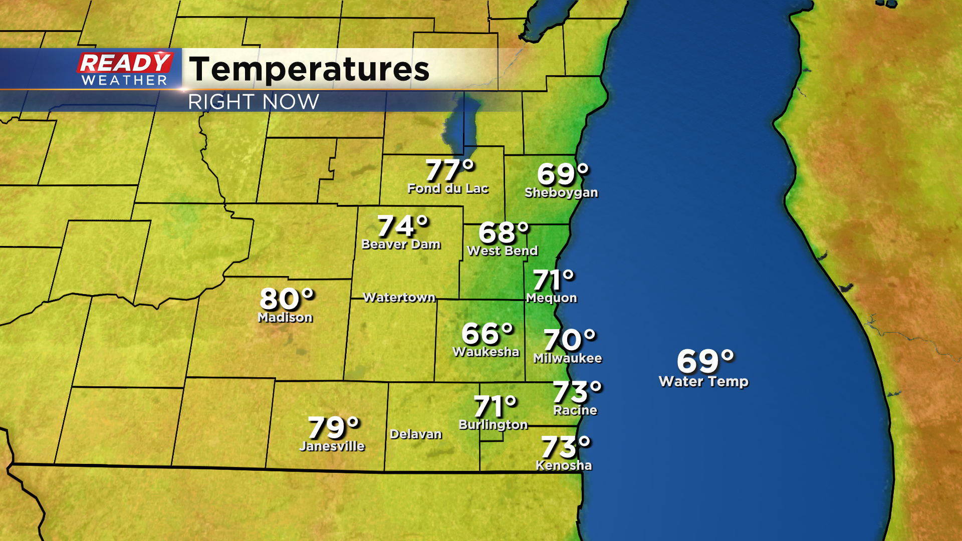
Cloud cover has kept temperatures in check near the lake today with temps only in the 60s to low 70s. Where there's been sunshine today, temps have risen into the upper 70s to low 80s.
Cloud cover will hang around tonight into Sunday with a few isolated showers possible, primarily in the morning along and south of I-94.
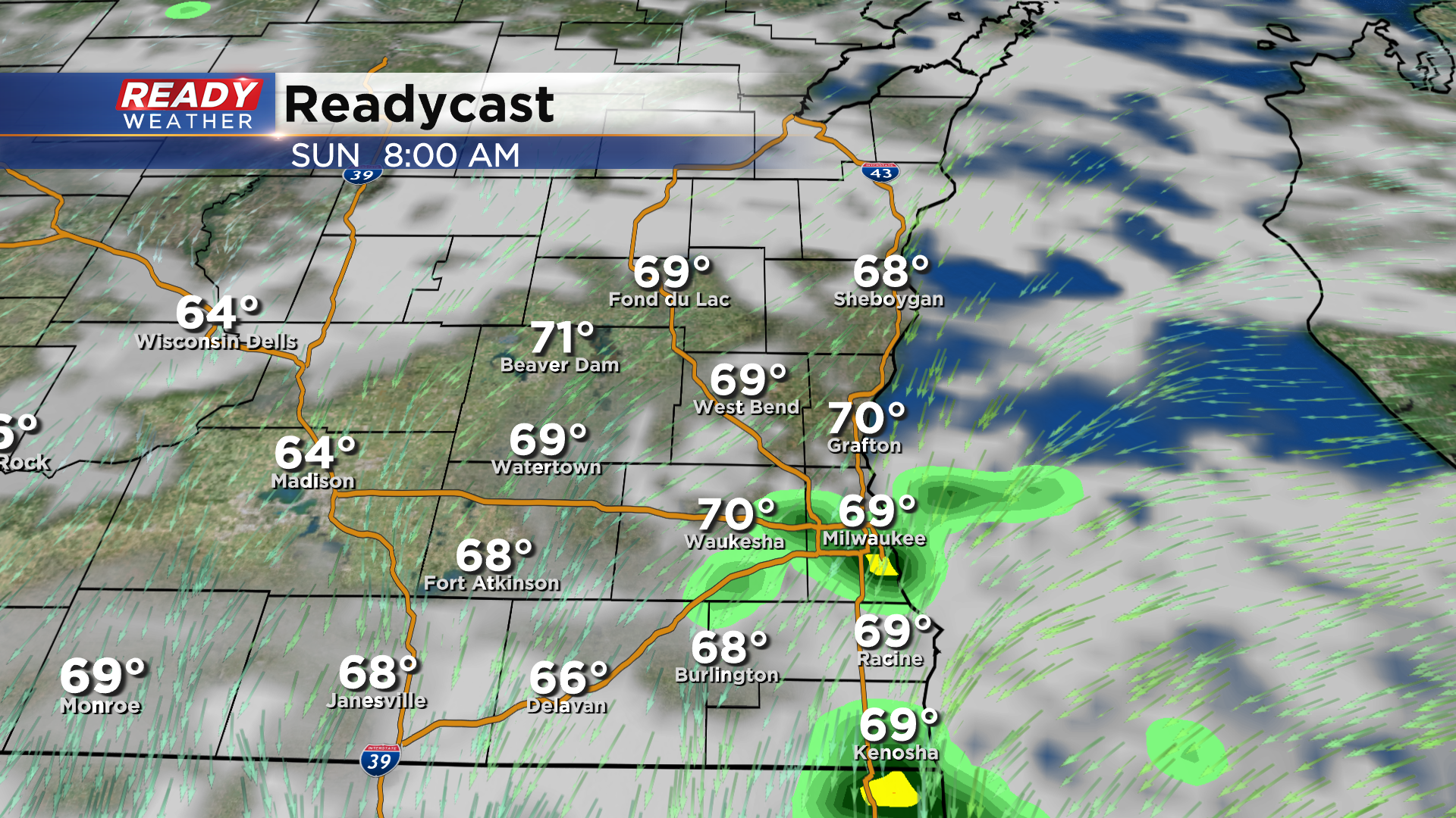
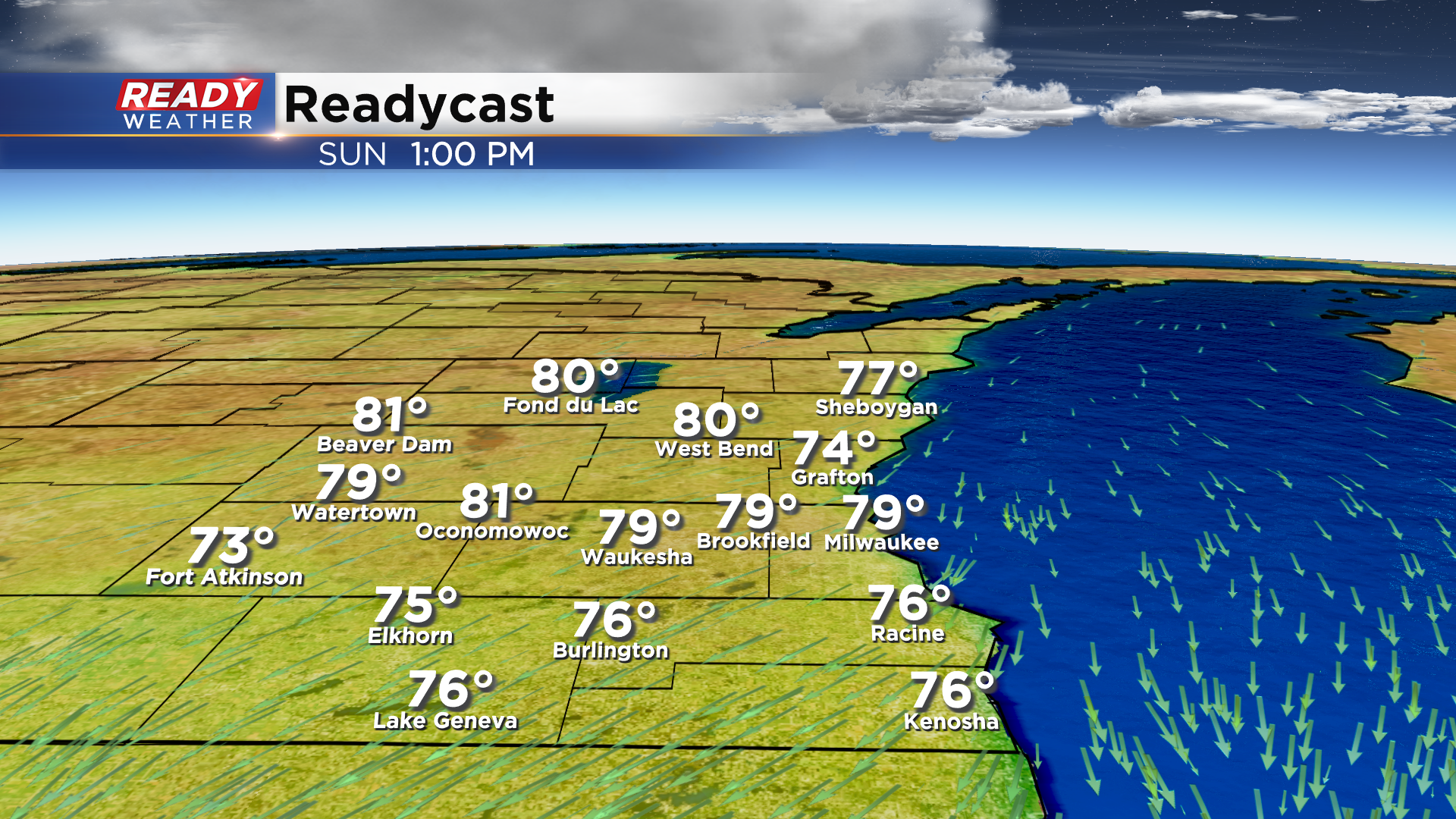
Areas to the north will stay dry and experience more sunshine, helping temps rise into the low 80s while the rest of us top out in the mid to upper 70s.
Clouds clear out Sunday night, and then the heat is on the for rest of the week! Highs rise into the upper 80s to low 90s Monday and Tuesday with a minor drop in temps Wednesday and Thursday behind a cold front.

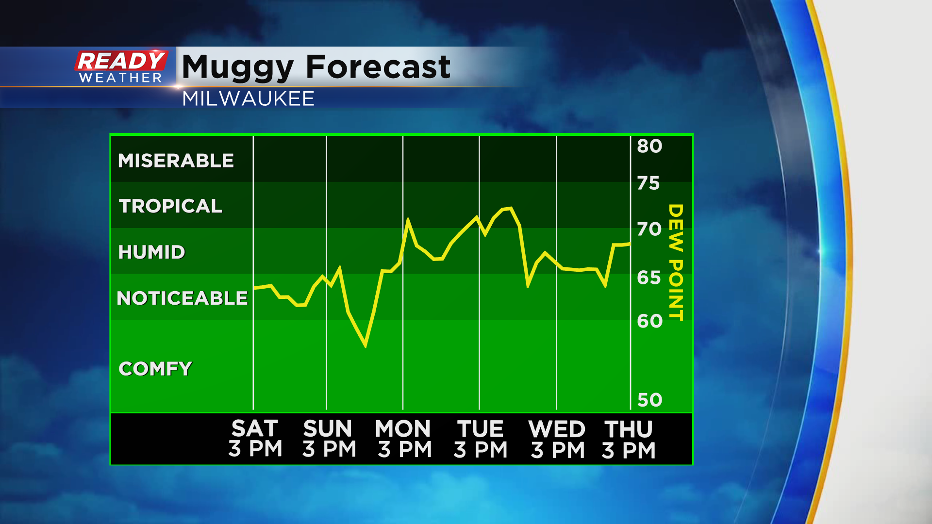
You'll notice the humidity most of the week as well with Tuesday being the more uncomfortable. Dew points in the 70s and highs around 90° will make it feel like the low to mid 90s area-wide.
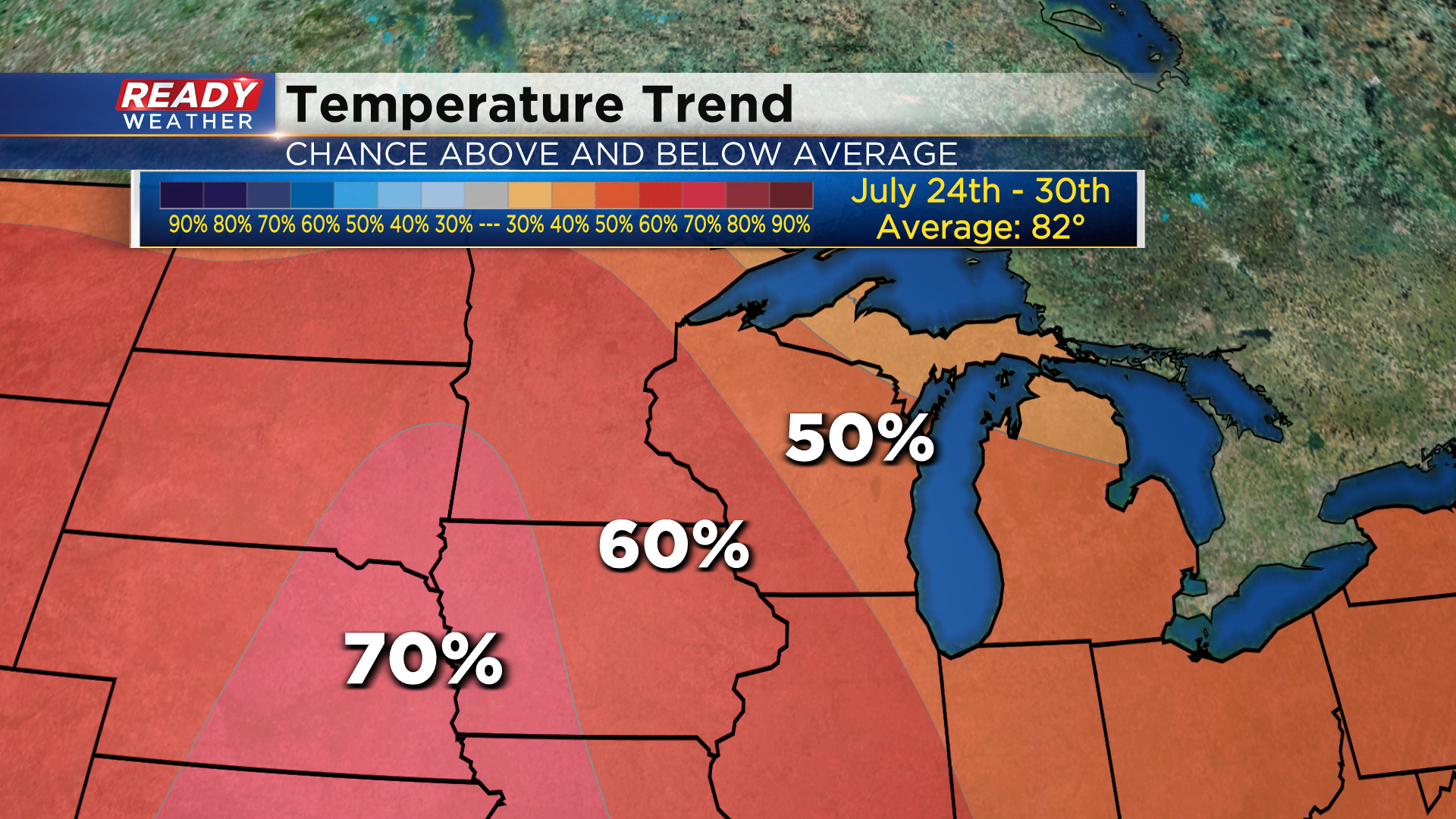
After falling back into the mid 80s during the middle of the week, upper 80s to low 90s return to end the week. There's also a decent chance we experience warmer than normal (82°) temperatures through the end of the month. The 8 to 14 day outlook gives Wisconsin a 50-60% chance of above normal temps through July 30th.
Download the CBS 58 Ready Weather App to see when there may be a few storms this week.
