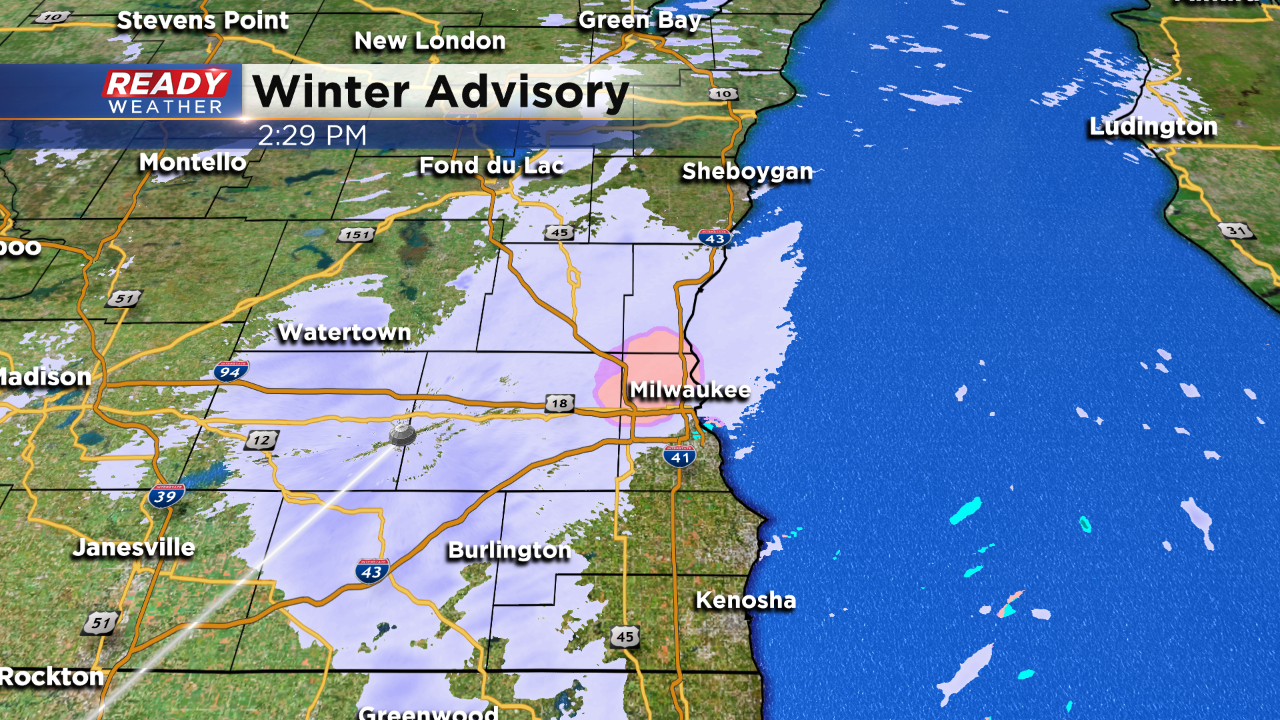
3 PM UPDATE: Some of the advisories have dropped off.


3 PM Update:
Good news Milwaukee, Racine, and Kenosha counties have been dropped from the advisory. Surface temperatures in those areas are above freezing limiting road issues.
All of the other counties remain under the advisory until 6 pm. Light icing on secondary roads and elevated surfaces will continue,. Plan on a mix of snow and freezing drizzle early this evening.
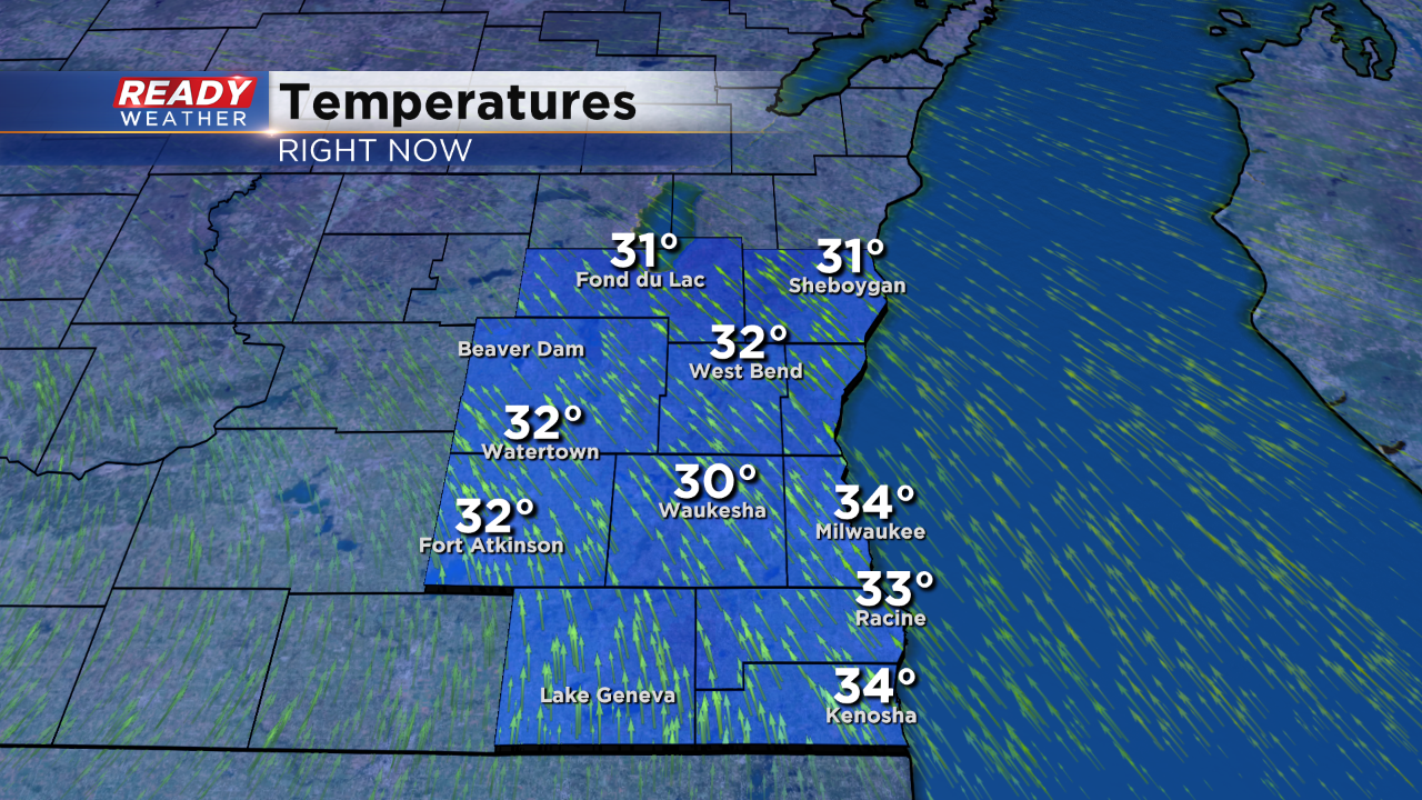
2 PM Update:
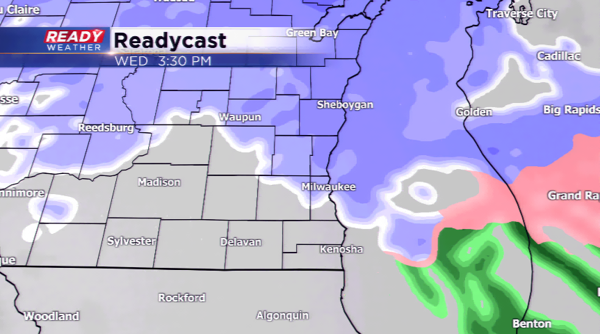
As dry air starts to work within the mid levels of the storm, some of the snow has transitioned over to rain and freezing rain. Take a look at the temperatures above. Areas west of the lake are struggling to make it above 32, so pockets of freezing drizzle and freezing rain are occurring.Light icing below 0.10" is expected.
That will cause elevated surfaces like ramps and bridges and overpasses to become slick.
The drizzle will move out later this evening. The advisories will end by 6 pm across southeastern Wisconsin.
Plan on a mix of snow and drizzle through 6 pm.
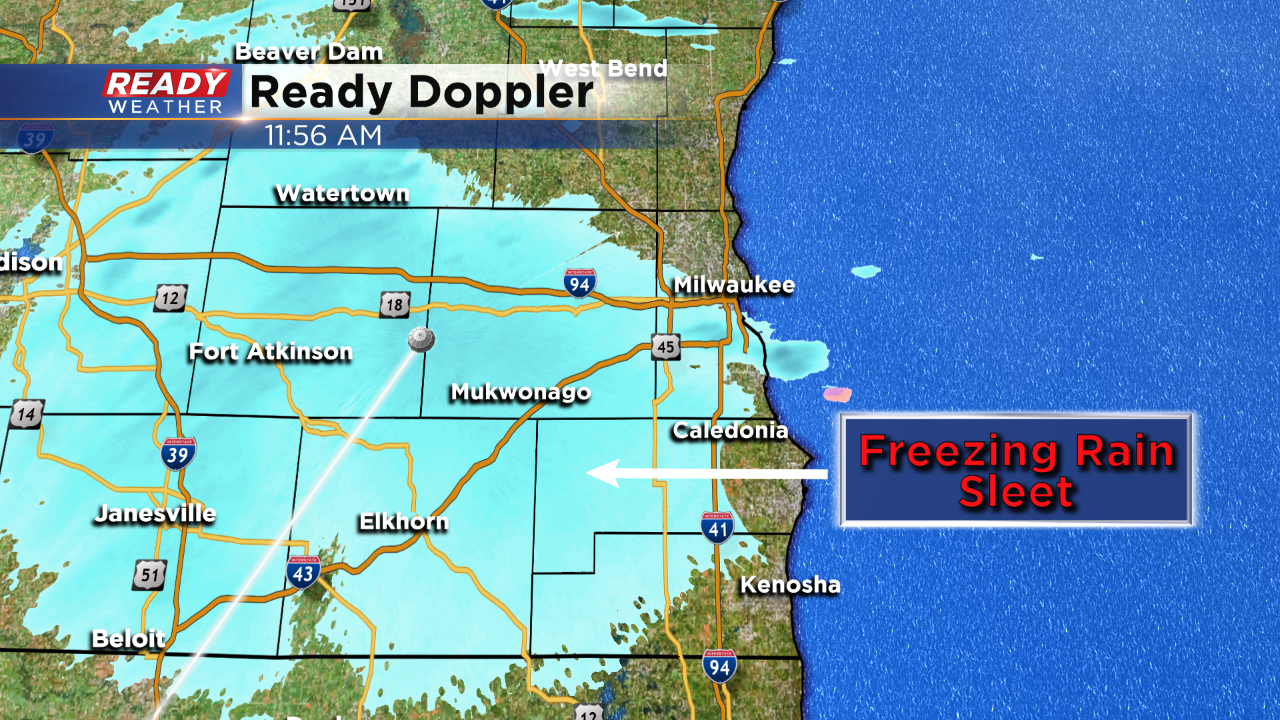
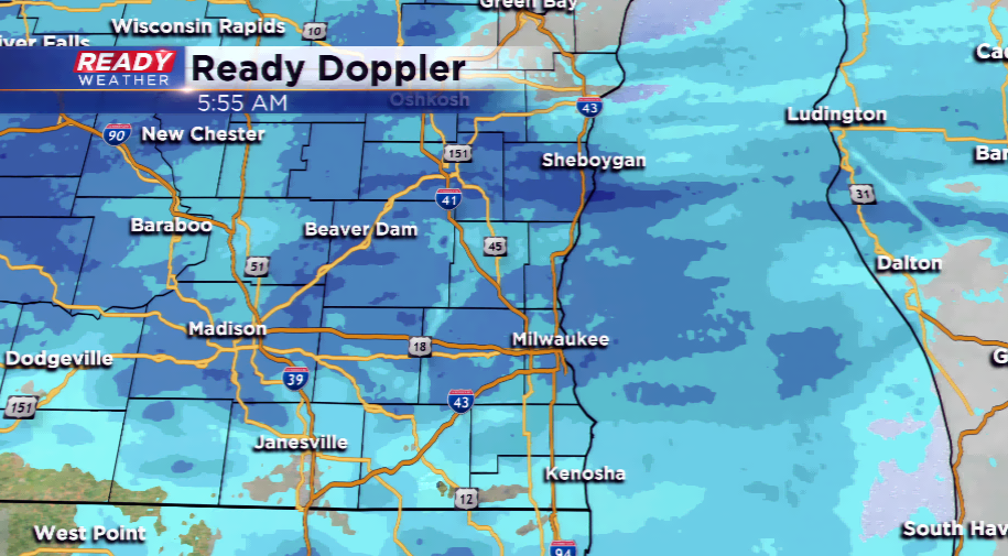
NOON UPDATE:
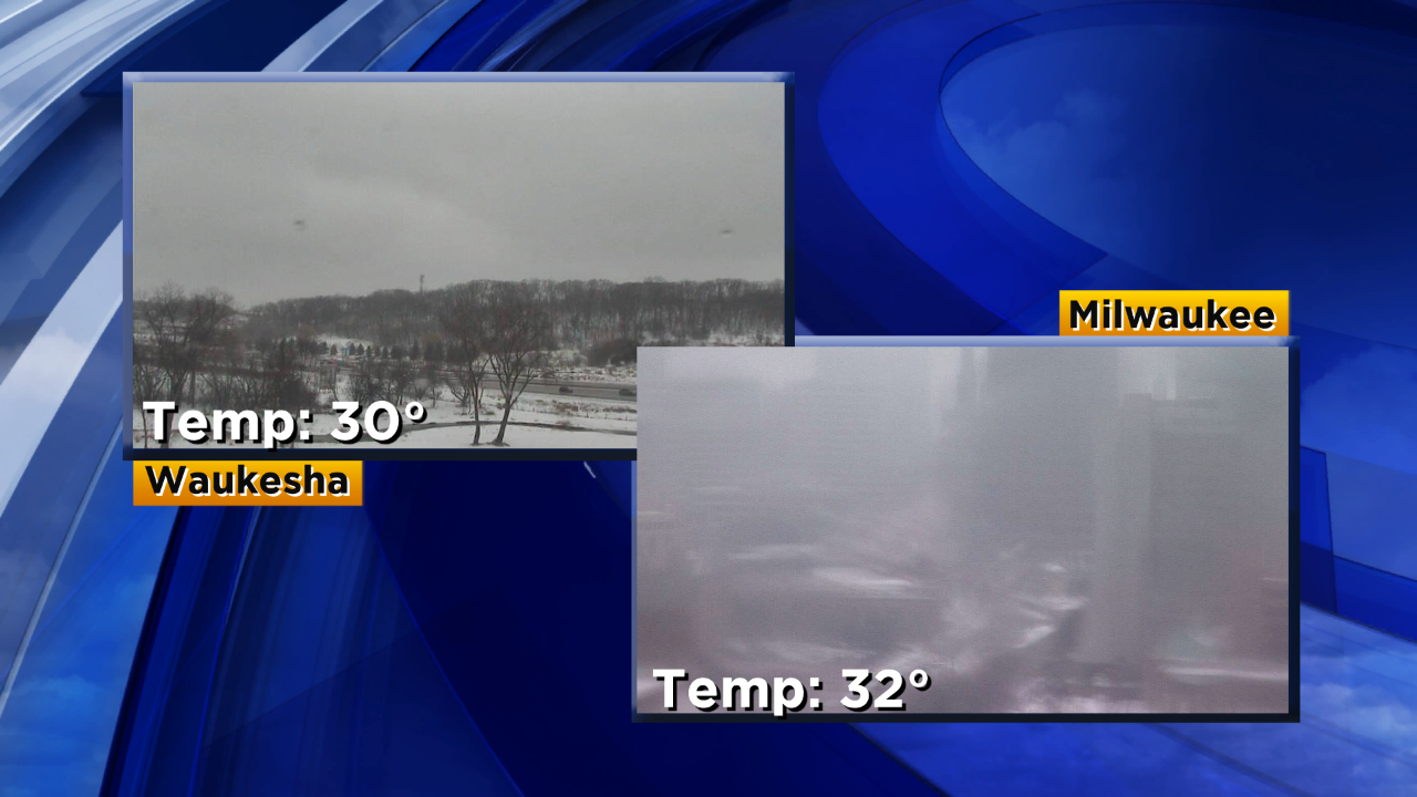
Freezing rain and fine sleet has taken over this afternoon. Many area municipalities are reporting icy roads.
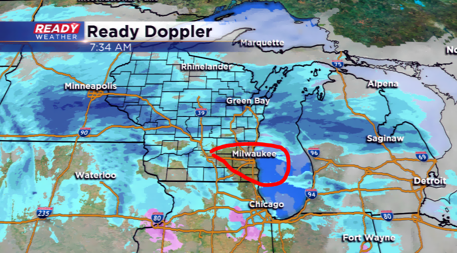
10 AM UPDATE: The main band of snowfall has shifted northward dropping and an inch or so of fresh powder. Keep an eye on the forecast the rest of the day with the winds turning out of the west-southwest and a mix developing. This could cause slippery conditions and even for ice to develop. More updates to follow!
--------------------------------------------------------------------------------------------------------------------------------------------------------------------------------------
8 AM UPDATE: Snow has tapered off a bit in the southern sections of the region. This break will last only temporarily with another batch of snowfall rolling in along with a wintry mix. With winds coming in from the south, the temps warm and could force ice, freezing rain, or sleet to occur. A few tenths of an inch of ice is possible. All of the activity will end by this evening.
----------------------------------------------------------------------------------------------------------------------------------------------------------------------------------
6 AM UPDATE: Snow has taken over around the viewing area. We will see snow-covered roads and gusty winds. This could lower visibility and cause problems on the roads. Updates will continue this morning!
----------------------------------------------------------------------------------------------------------------------------------------------------------------------------------
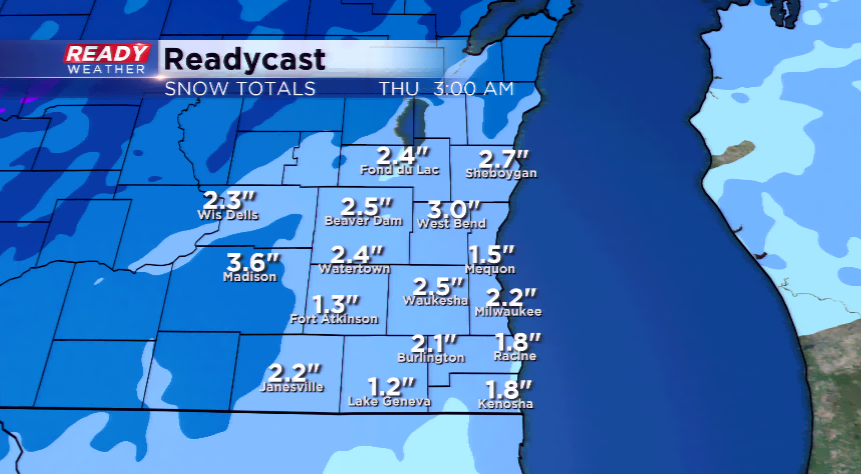
Another batch of snowfall will impact the morning and afternoon commute for everyone in southeastern Wisconsin. Snow is expected to overspread the region, then potentially switching over to a mix later on today. The heaviest snowfall will likely take place in our western areas and over parts of central and south central Wisconsin. Most spots in our neck of the woods will see 1”-3”, with an isolated 4”.
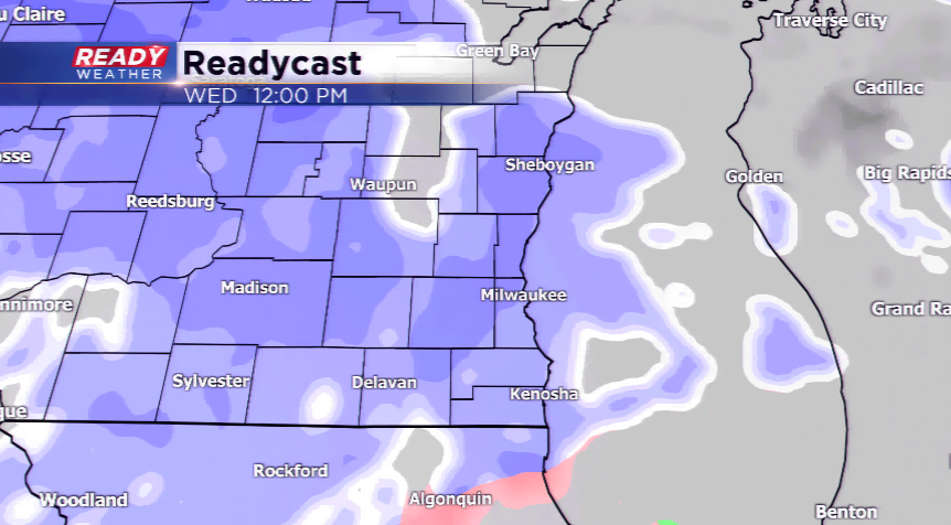
What makes this forecast challenging will be the temperatures. If we see temps holding, we could see a touch more snow; however, if we warm a degree or two, it could get very slick with a glazing of ice. The timing will take the precipitation through this morning before ending by 6 pm this evening. The snow that falls will blow around with gusty easterly winds, eventually turning out of the south and west.

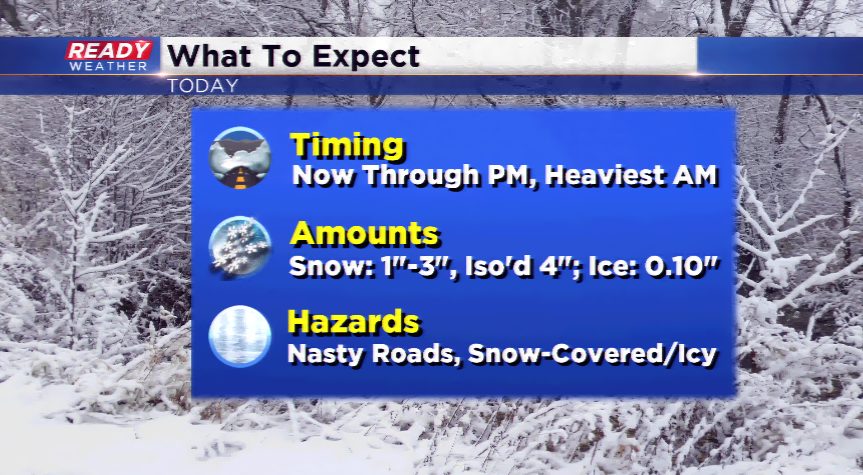
The main impact will be the roads and slippery conditions. On top of dealing with snow, the mix bag of precipitation that is expected to fall this afternoon could make the commute home even trickier. Give yourself plenty of extra time and anticipate delays on area highways and interstates. We’ll have more updates throughout the day. A Winter Weather Advisory will run until this evening for all of the viewing area!