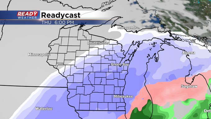
Sorting out wind, rain and snow timing the next several days
Posted: Feb 13, 2023 1:16 PM CDT


It's a lovely start to the week. But we have big time changes ahead. The rest of Monday features a noticeable northwest wind, but not overly gusty. Temperatures will top out in the upper 40s this afternoon as full sunshine continues.
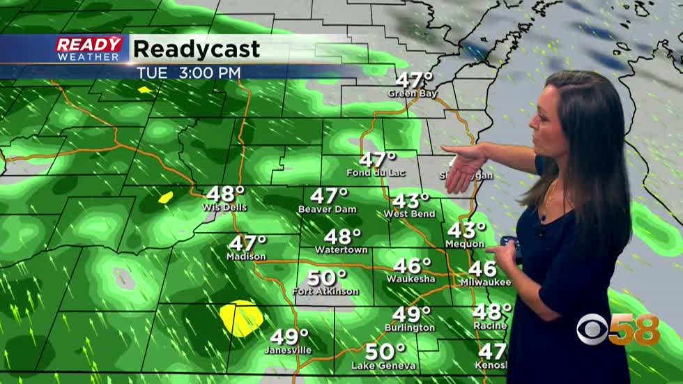
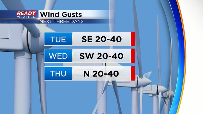
We will continue the mild trend on temps most of the week, but it will come at a price. Winds back southerly starting tomorrow presenting an opportunity to hit fifty degrees, but at the cost of wind gusts to near 40mph. Rain chances will also be on the increase by the mid afternoon becoming likely by dinner time. Head's up if you plan to head out with your honey for Valentine's Day, you'll want the umbrella handy.
I'm meteorologist Rebecca Schuld