Sprinkles and flurries Monday evening, then a major winter storm starts with light snow Tuesday evening


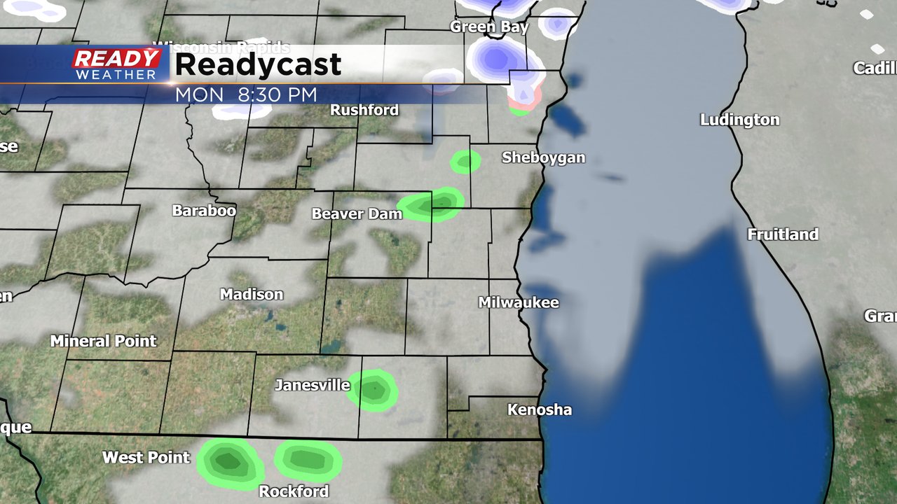
The weekend was nice with some good sunshine and mild temps. That trend will continue on Monday with waves of clouds and mild temps with highs in the low 40s. Monday evening could see a few very isolated light rain or snow showers. No accumulation expected.
Some sunshine is possible during the day on Tuesday with another partly cloudy sky but temperatures are much closer to average with highs in the middle 30s. Tuesday night our large winter storm arrives. The first wave of precipitation will bring a chance of light snow Tuesday evening through Wednesday morning.
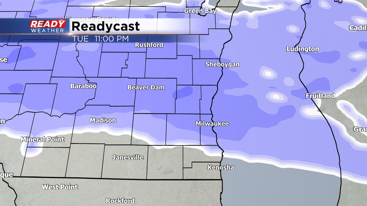
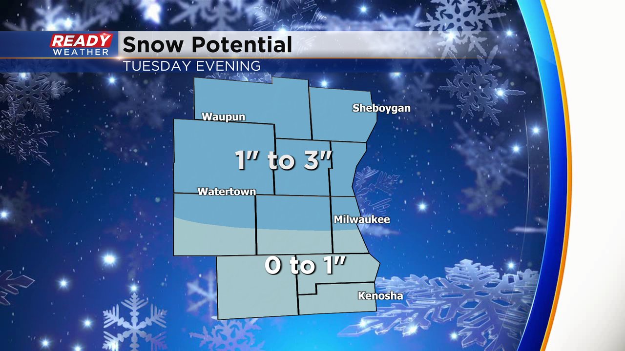
Snow will likely accumulate Tuesday night with some moderate impacts. The Tuesday evening commute is mostly dry with snow arriving after the commute then end during the Wednesday morning commute with improving road conditions. Around an inch of snow looks possible in the Waukesha/Milwaukee metro area with 1-3" north of there and under an inch as you go closer to the IL border.
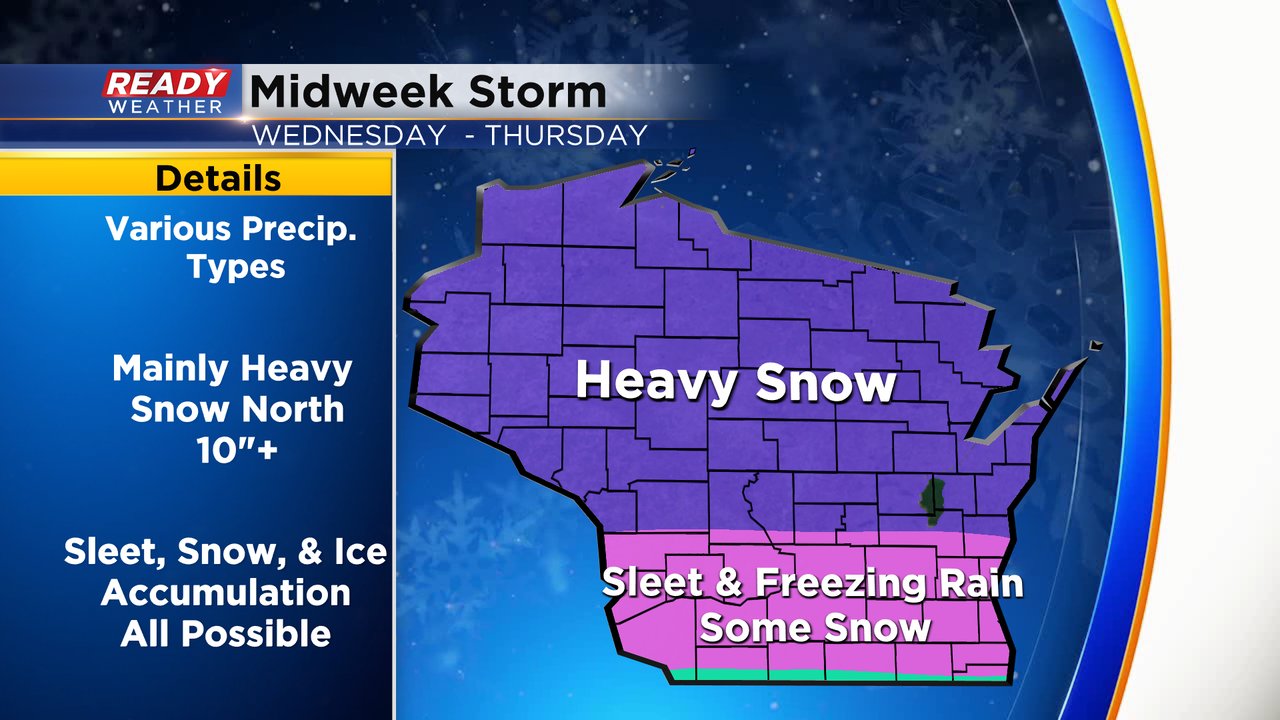
We may get a brief break in precipitation the rest of Wednesday morning but Wednesday afternoon a round of wintry mix is likely. Southern Wisconsin looks to stay right in the mix area with freezing rain, sleet, snow and rain all possible for the second half of Wednesday through Thursday morning before switching to snow Thursday afternoon and evening.
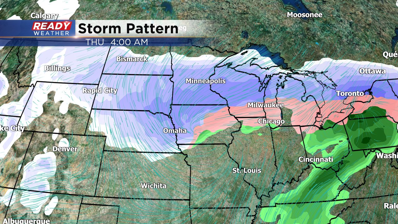
Major snowfall is currently expected in northern part of the state with easily over 10" of snow expected. Northern parts of our local area could see some of the significant snow. Sleet and freezing rain with accumulating ice is a real threat for areas along I-94 and south. Expect major impacts Wednesday afternoon through Thursday morning.
Download the CBS 58 Ready Weather app to see alerts as watches and warnings roll in and check the interactive radar.