


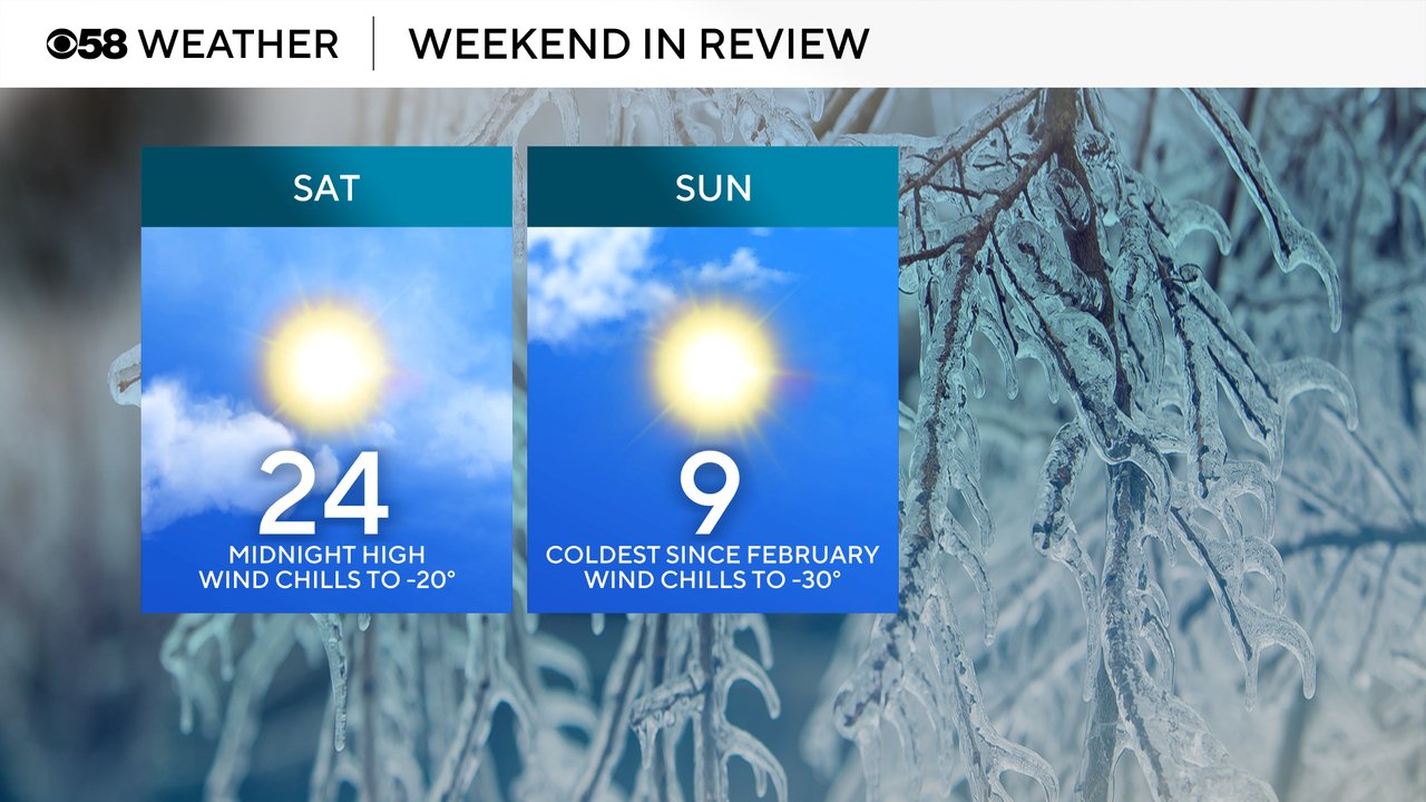
This weekend saw the coldest temps and wind chills since the middle of February last winter. The official high for Saturday goes down at 24 degrees, but that was the temp at midnight, most of the day was in the single digits with wind chills as cold as -20. Lows Sunday morning dropped into the single digits below-zero for everyone. The high Sunday stayed in the single digits at 9.
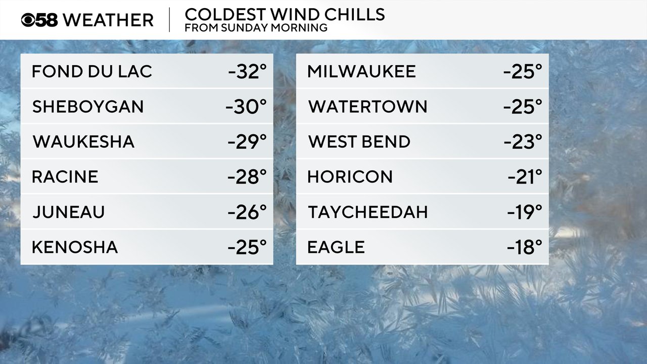
Wind chills Sunday morning dropped between -30 to -20 for most of southeast Wisconsin thanks to the cold and a stiff breeze at times. Frost bite develops in just 30 minutes with temps and wind chills this cold.
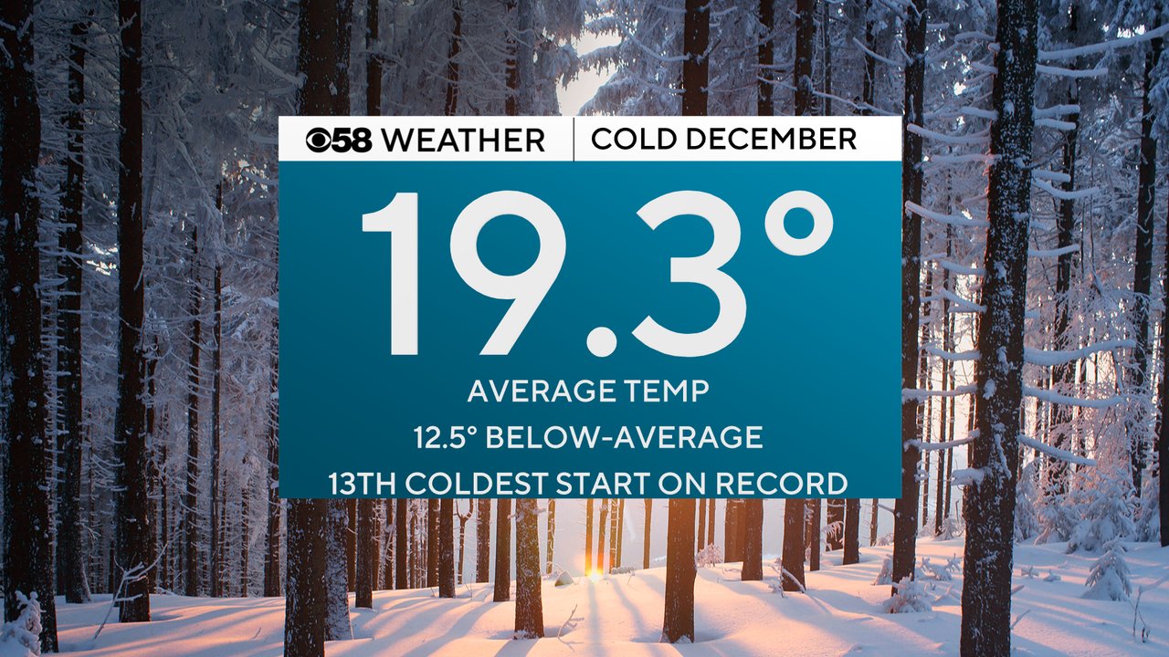
Overall this December has been very cold with an average temperature for the month through the 14th of 19.3 degrees which is over 12 degrees below average and the 13th coldest start to December on record. It's also the coldest start to the month in 20 years since 2005.
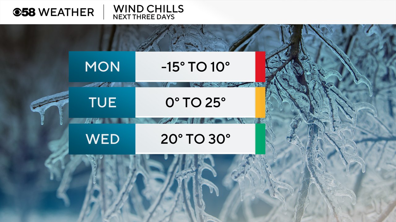
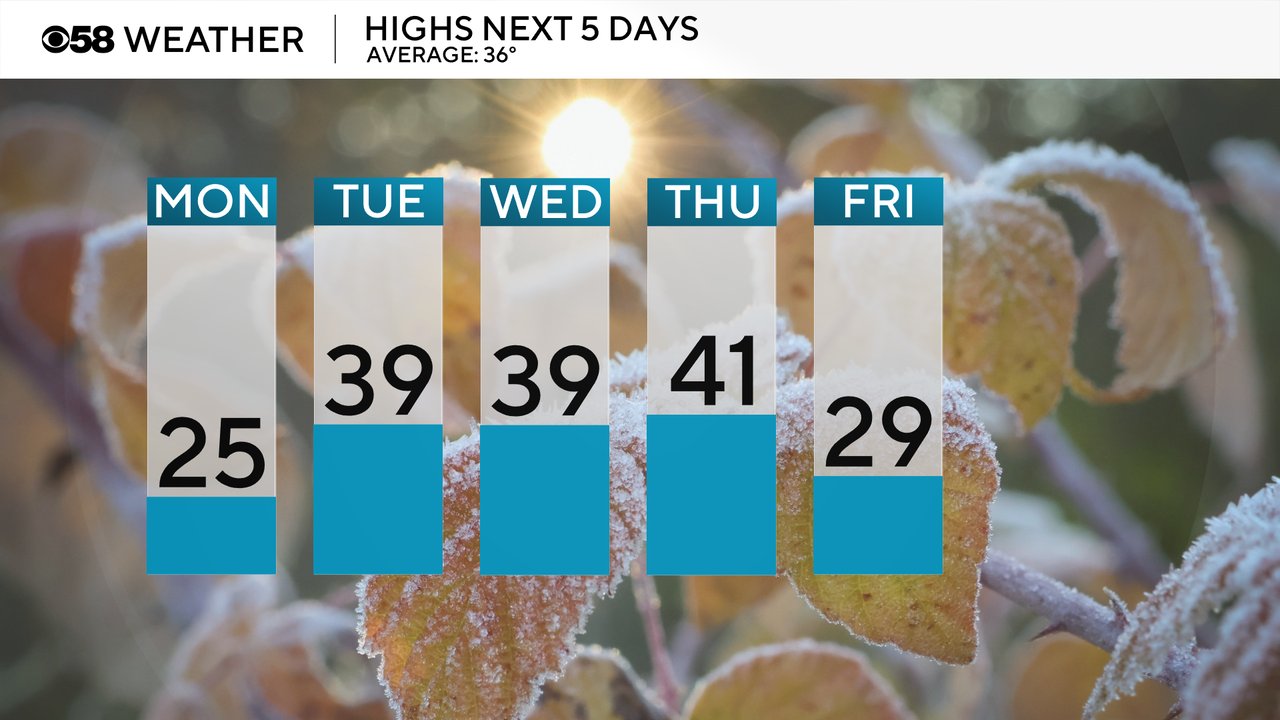
Temperatures will stay chilly on Monday waking up to wind chills below-zero. By the late morning or midday hours we will finally see those wind chills get above-zero with afternoon wind chills around 10 above. Tuesday morning could still be cold with lows in the teens and wind chills as cold as 0 but gets much better in the afternoon with wind chills in the 20s. Wednesday is just fine with wind chills in the 20s most of the day.
Actual highs will rise into the 20s on Monday then finally above average for the first time since the end of November hovering around 40 for Tuesday through Thursday. A cold front that rushes in Thursday afternoon will drop the temp into the 20s for the end of the work week.
Download the CBS 58 Weather app to track the return of the warm air.