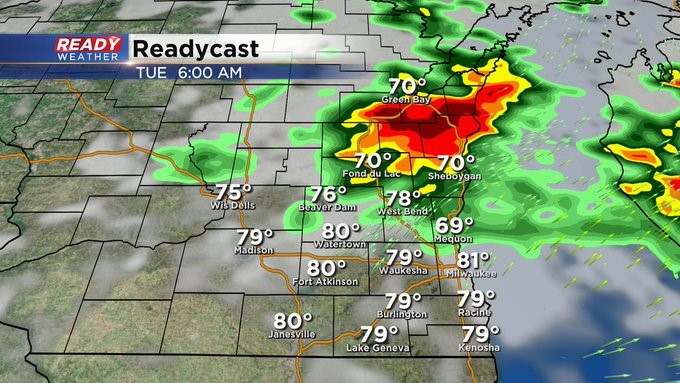
10:40pm Rain Still Possible Next Few Hours


Update as of 10:40 pm Monday, July 4th.
Severe storms have weakened. We continue to see clusters of heavy rain makers but signs show a diminishing trend there too. And most of the activity is sinking south toward the IL border. Conditions should quiet down after midnight.
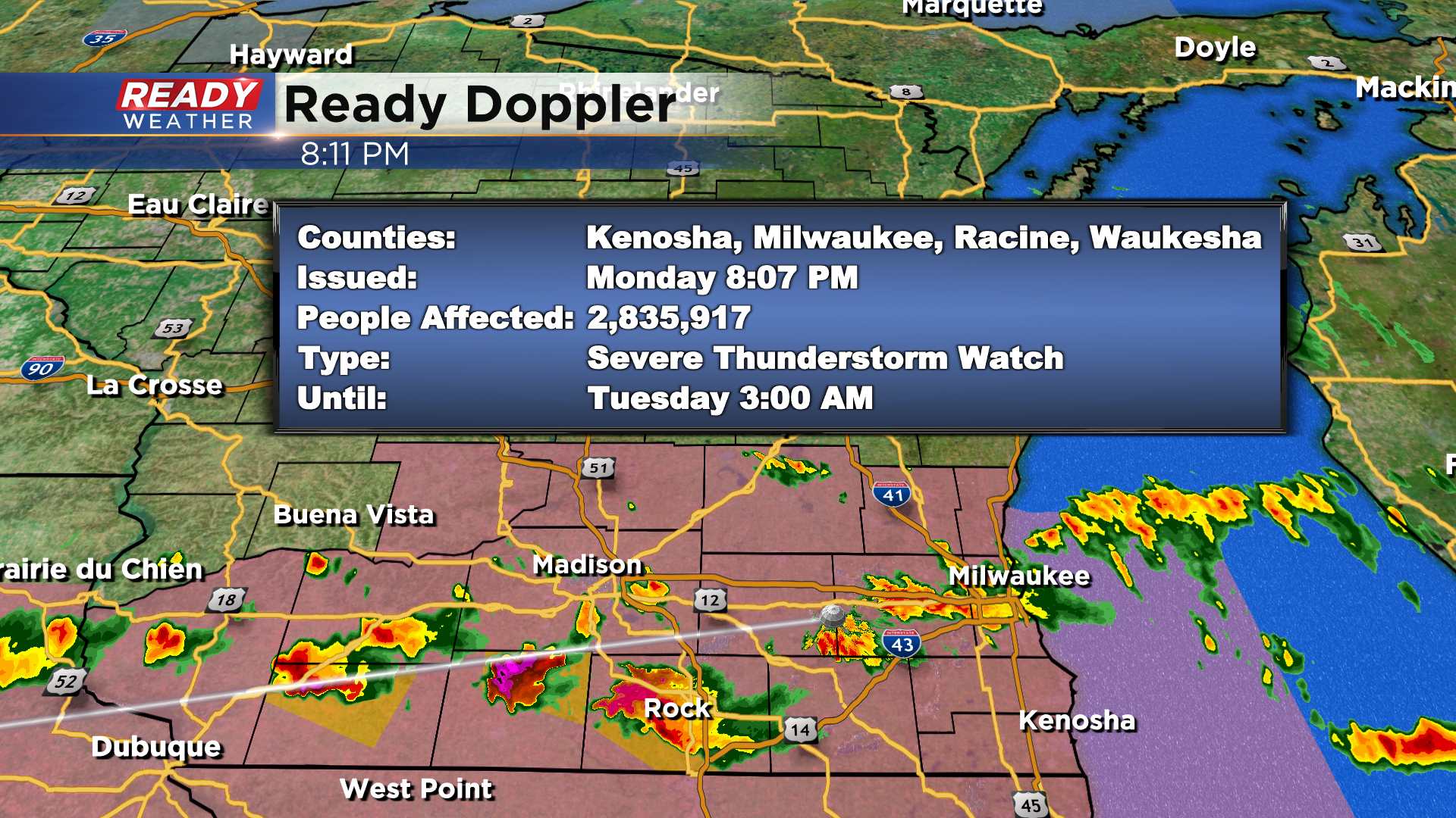
Update as of 8:15 pm Monday, July 4th.
Storms continue to fire in a west to east fashion. A few storms just west of our area have gone under warning. The environment remains primed for storms to become severe. For that reason the National Weather Service has issued a Severe Thunderstorm Watch until 3am.
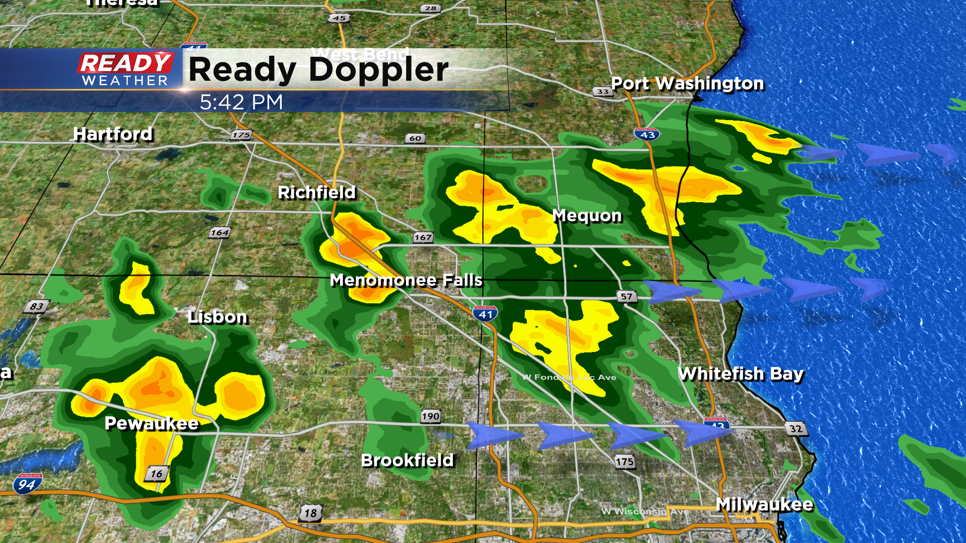
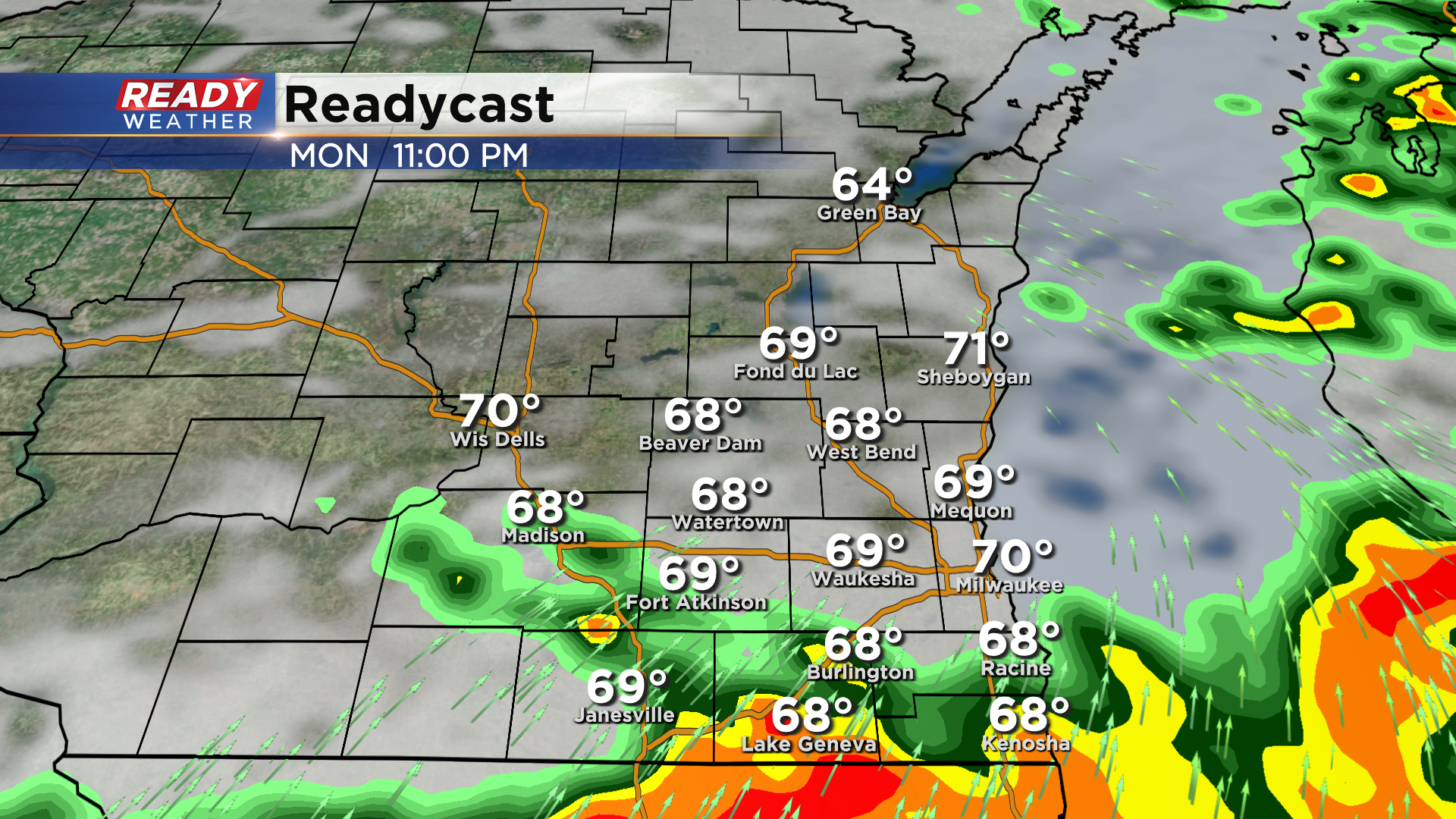
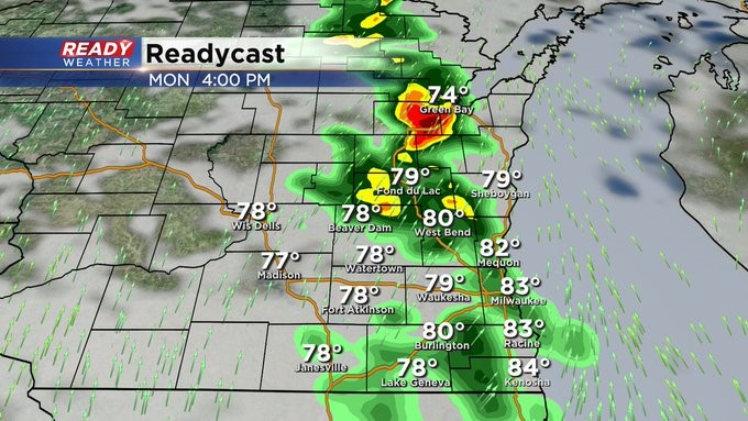
Update as of 5:30 pm Monday, July 4th.
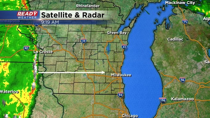
We continue to track a few isolated pockets of rain and embedded storms across southeast WI. So far, we have not had any severe storms. However, that potential still exists with plenty of instability aloft. And an approaching warm front. Here's the latest radar imagery on Ready Doppler
Update as of 11:45 am Monday, July 4th...
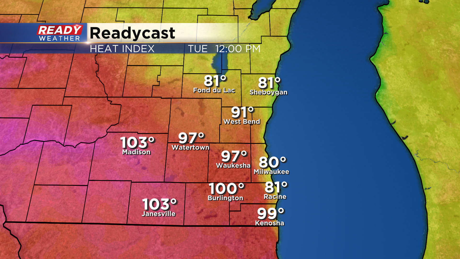
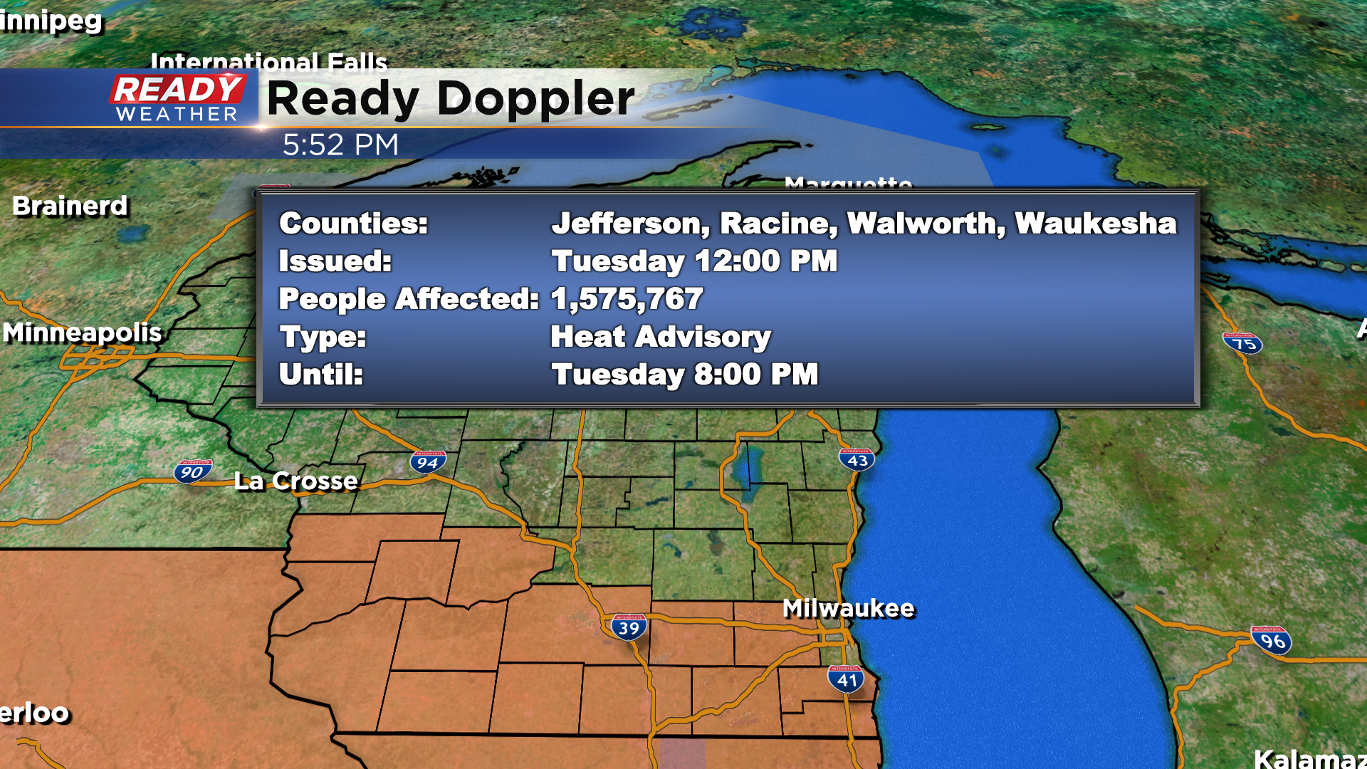
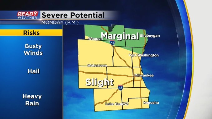
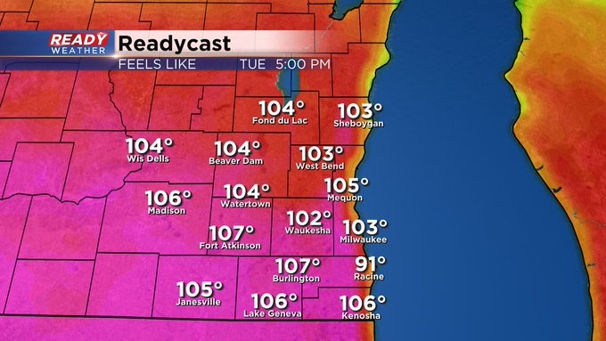
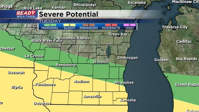
An update to pass along. Fond du Lac and Sheboygan Counties are now in a "marginal" risk for severe weather instead of a "slight." This means the area has been downgraded. But still keep an eye to the sky for potential storms and be ready to move inside if they form. Meantime, we're still on track for scattered storms, especially after 3 pm today. They'll be on and off for much of the week. Some could be strong. So bear that in mind. Also, the heat indices look bad for Tuesday afternoon with numbers above 100 degrees for many of us. Please limit your time outside, including your pets.
Update as of 9:20 am Monday, July 4th...
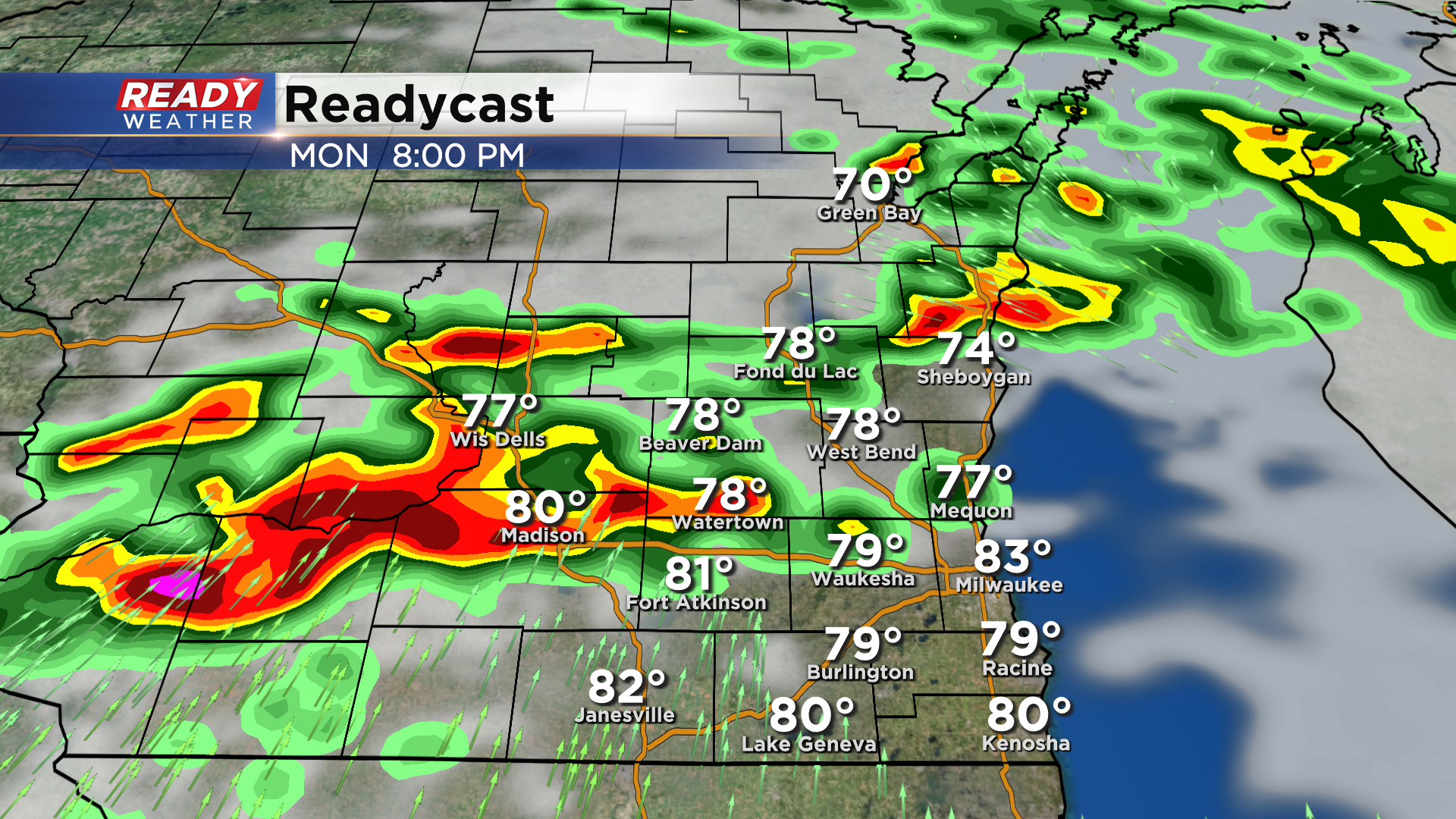
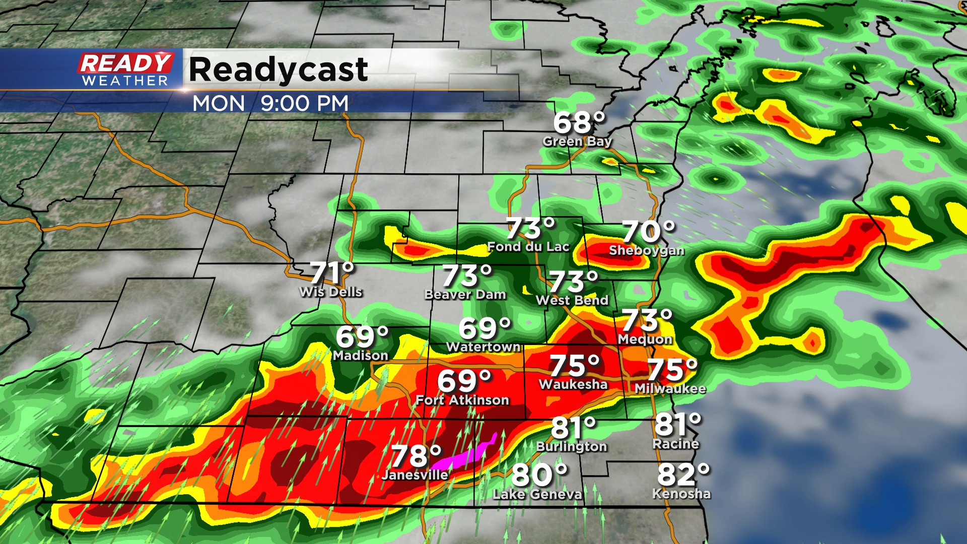
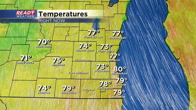
Right on cue. Storms are firing just to the west of Wisconsin. They'll be moving across the Badger State this morning and will overspread the area after 2 or 3 pm. Some could be strong to severe. This is just one batch of at least two or three we'll see over the next day or so. The heat and humidity are building too. By 9 am on Monday, it was already at 80 degrees in Milwaukee. Tomorrow, with the humidity, it'll feel like 100 degrees plus! Please stay hydrated and weather aware the next few days.
___________________________________________________________________________________________________________
MILWAUKEE (CBS 58)--I sure hope you enjoyed the gorgeous weather we had because it's turning stormier just in time for the holiday itself. Look for showers and storms, some strong to severe, to develop in the afternoon and linger into the night. Heavy rain, large hail, and damaging wind all possible. Then we could see a repeat performance into Tuesday evening. Everyone has a slight risk for severe weather on Monday and then a good chunk of the area does into Tuesday night as well. By the way, heat indices will be above 100 degrees on Tuesday.

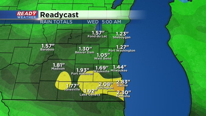

We take a bit of a break on Wednesday and then the chance goes up again for more showers and storms for Thursday and Friday but not the upcoming weekend. So at least the last day of Summerfest should be seasonable and dry.