Strong cold front to bring windy and much cooler conditions for the second half of the week
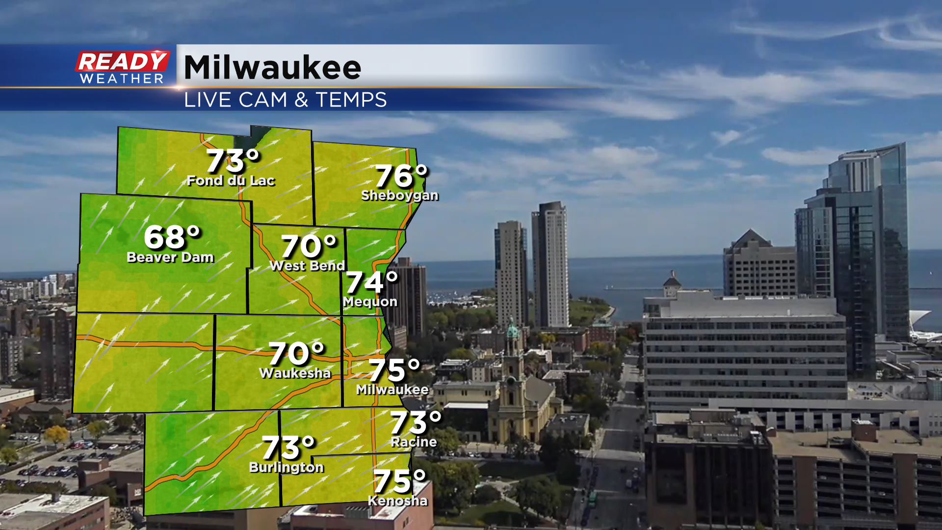
Today's been another glorious fall day across southeast Wisconsin with temps in the low 70s as of midday.
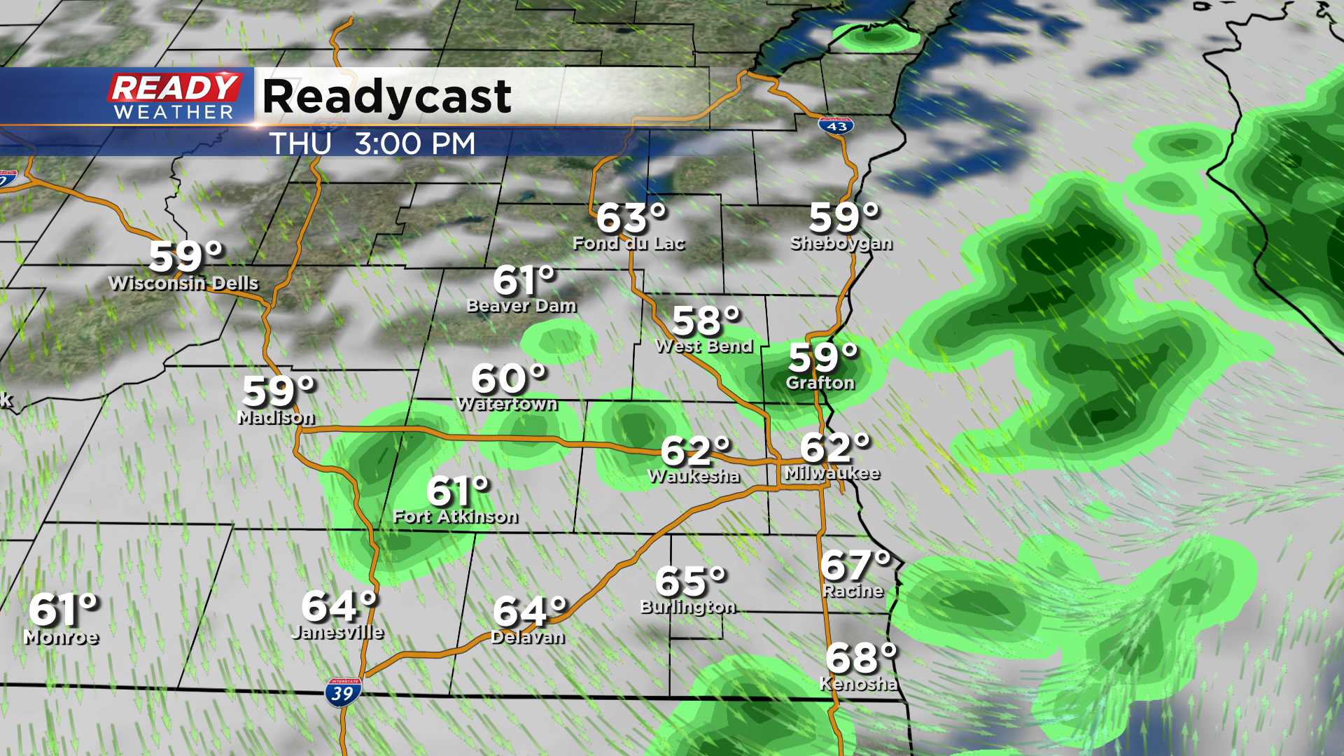
It'll be our last warm day for a while as a strong cold front rolls through Thursday afternoon. Highs top out in the 60s before the front arrives around midday, with temps then falling through the afternoon as the wind shifts to NW.
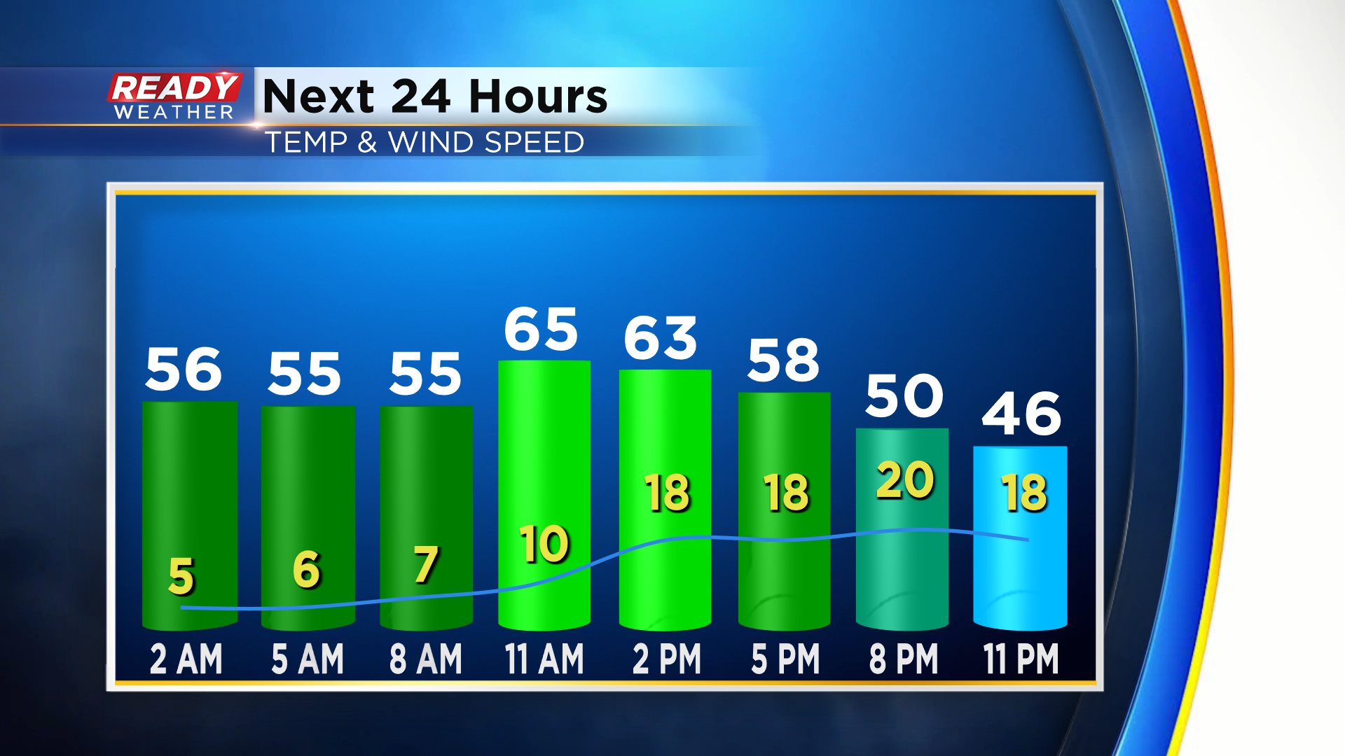
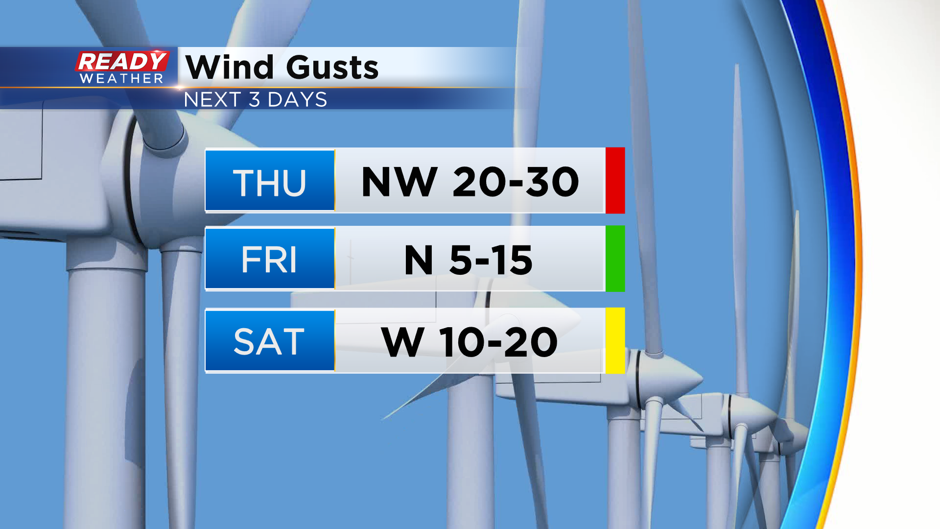
The wind will be quite strong behind the front with gusts between 20-30 mph expected. A few gusts to 35 mph can't be ruled out late Thursday afternoon and evening. Wind gusts subside by Friday afternoon as high pressure rolls in, but more gusts of 20-25 mph are expected Saturday afternoon.
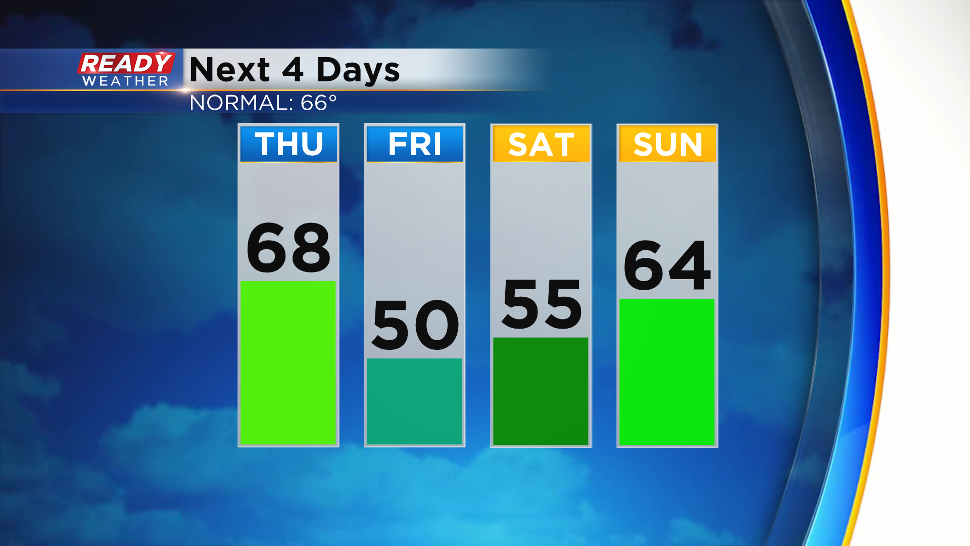
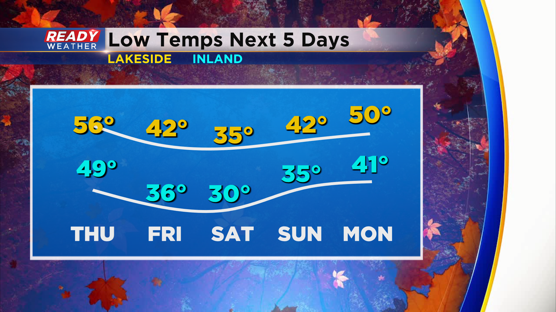
Temps overall will be much cooler behind the front with highs struggling to reach 50 degrees in many spots on Friday. We'll warm back into the mid 50s Saturday then return closer to normal by the end of the weekend.
With cooler temps during the day, you bet it'll be cold at night. Wind should prevent frost for most of us Thursday night, but inland spots will still drop into the 30s. The first true widespread frost and freeze looks likely Friday night into Saturday with a hard freeze possible for some inland spots. Temps drop into the low to mid 30s thanks to clear skies and calm winds.
Thursday's cold front will also bring our first rain chance in a weekend and a half. Besides a few isolated showers tonight, a better chance of showers arrives Thursday afternoon.
A few additional lake effect showers may clip the lakeshore on Friday, but most of the area will be dry. Download the CBS 58 Ready Weather App to see if the cooler temps are here to stay.
