Evening Update: Storms continue to weaken
5:00 PM, July 5th
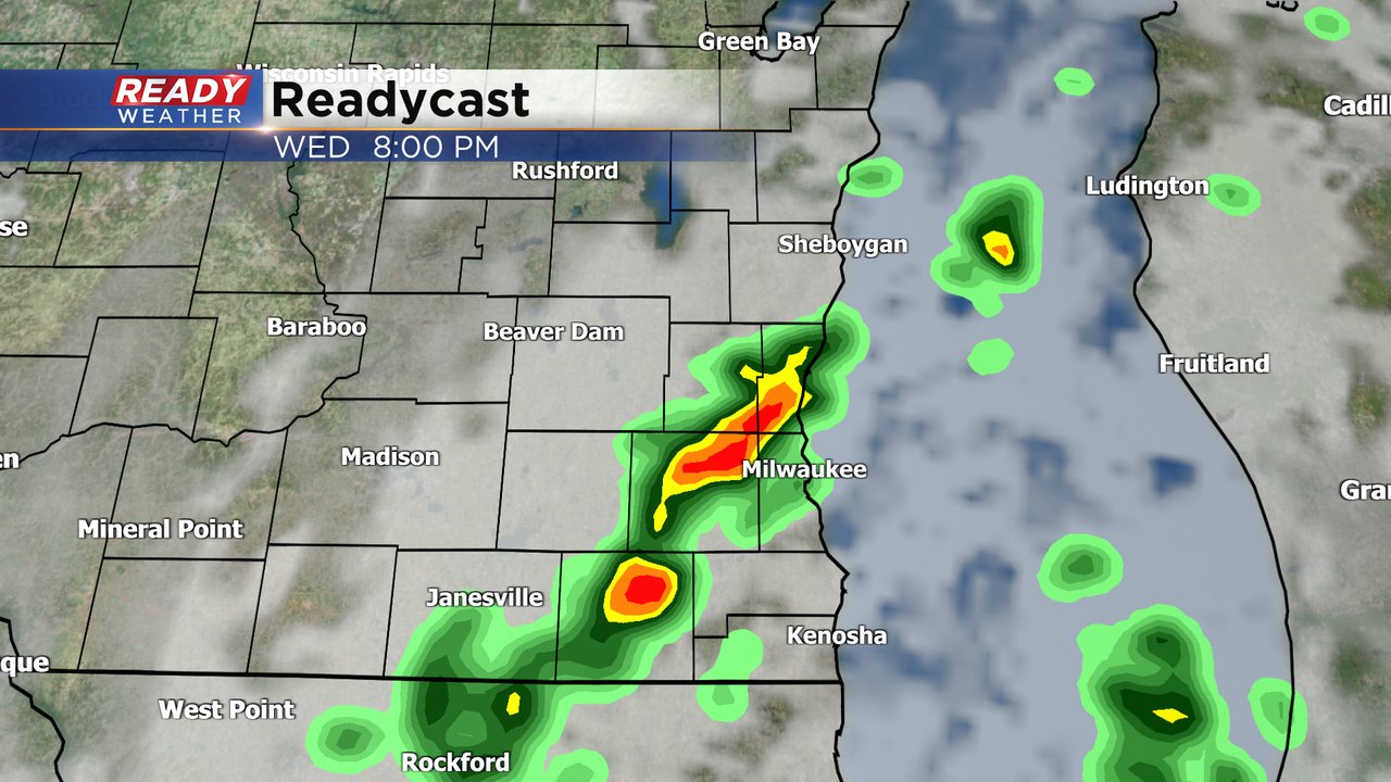
The earlier round of showers and storms packed quite a punch. Locally heavy rainfall and strong gusty winds accompanied the strongest storms. Localized flooding was also reported with storms producing 1" to 2" of rainfall. Thankfully, the atmosphere has been worked over, so we don't expect severe weather.
A few storms could be strong with gusty winds and small hail. This activity will move out after 9 pm.
_____________________________________________________________________________________________________________
2:30 PM, July 5th
Isolated strong to severe storms have developed ahead of a cold front this afternoon. High heat and humidity have contributed to the storms blowing up today. Storms are capable of quick damaging winds between 50 and 60 mph and some small hail.
Expect the storms to continue through the early evening before moving out.
______________________________________________________________________________________________________________
Updated 12:30pm July 5th
We are cooking today!
Feels like temp this hour in Milwaukee is 96 degrees! Air temps are floating around 90 with dew point on either side of 70 making for a very sultry day across the area. With an approaching cold front we are primed for storms to fire. After a quiet morning we are starting to see activity on Ready Doppler: As of 12:45pm we now have one severe cell in our area that has triggered a Severe Thunderstorm Warning in Dodge County. It runs until 1:30pm. There's been a report of quarter size hail closer to the storm in Madison and trees down too. This is what can be expected in any storm that forms today.Updated: 9:31 a.m. July 5, 2023
A cold front will be the focus of our storms today. It's what gives them the spark to form and possibly become strong to severe. Right now that cold front is right across the middle of the state from NE to SW. You can see it pretty clearly on the map below where Wausau and La Crosse have seen the front but Green Bay, Oshkosh and Platteville haven't.
The front will also bring big time relief to our heat and humidity. Check out the rest of the blog below to see what the threats are with any severe storms that do develop Wednesday.
------
Posted: 7:07 a.m. July 5, 2023
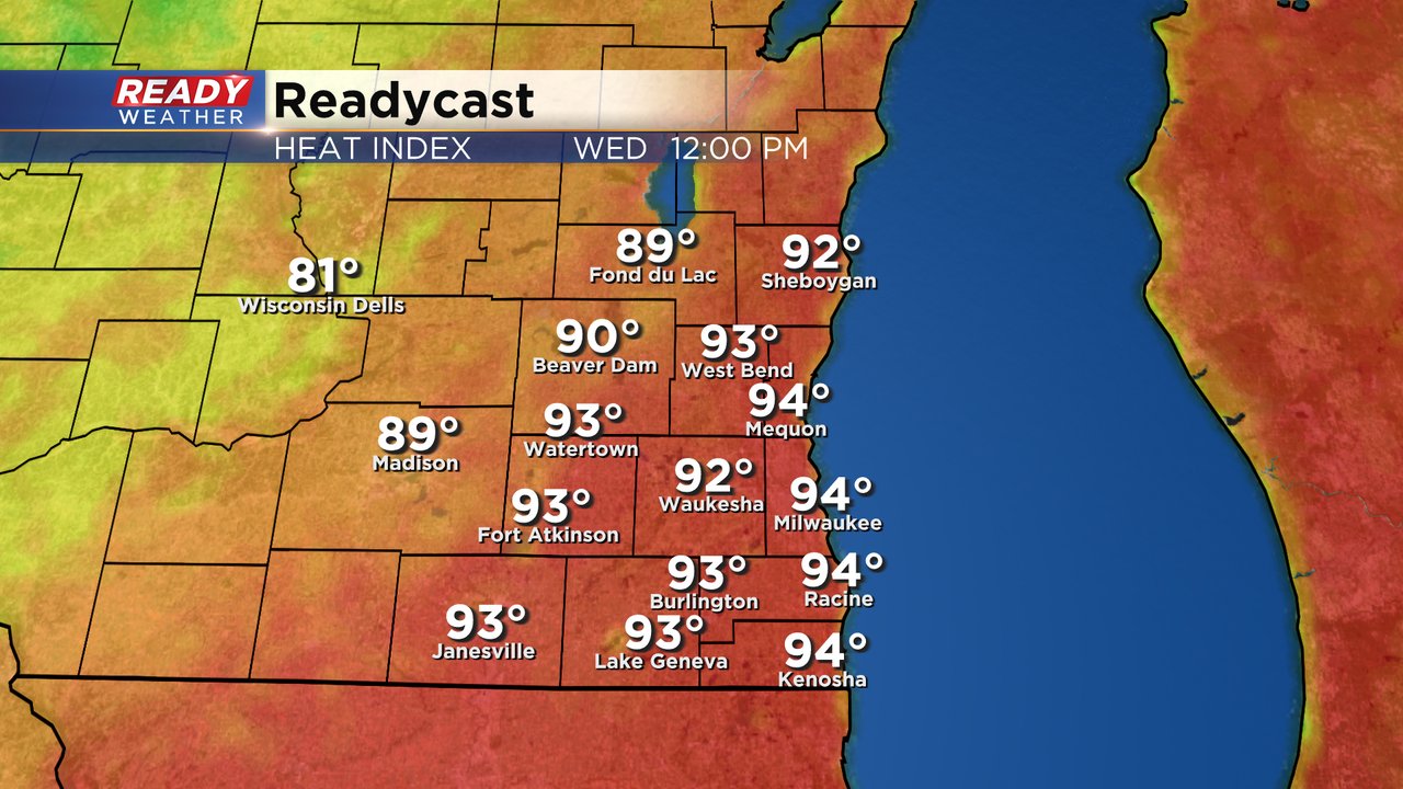
After a hot and humid July 4th that sticky weather pattern isn't going anywhere. High temperatures on Wednesday will once again reach the upper 80s or even 90. Even more humid air is expected too with dew points around 70* putting it into the tropical category. The good news is that the high temps and peak feels like temps will happen around noon Wednesday then temps should drop a bit the afternoon with some rain as a cold front approaches. Expect peak heat index values in the low to middle 90s.
The hottest and most humid air will likely happen in our southern counties. That increase in heat and humidity will add more fuel to any storms that move through on Wednesday and increase the chance for a few stronger or severe storms. Part or all of Jefferson, Waukesha, Walworth, Racine and Kenosha Counties are in the Level 2 Slight Risk for severe weather with damaging wind the main threat.
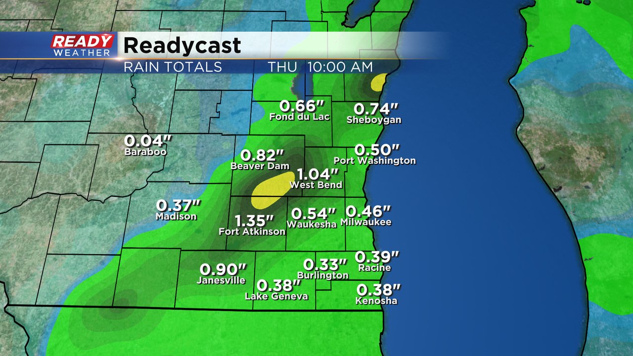
After a fairly dry Wednesday morning rain and storms are expected in the afternoon and evening. Some of those storms could linger into early Thursday before drying out the rest of the day.
Hopefully we can get a good soaking rain with 0.25-0.75" of rain expected in most communities. Those hometowns that see an increase in thunderstorm activity could get over an inch.
Download the CBS 58 Ready Weather app to track any storms that pop up with the interactive radar.


