Mid Afternoon Update: Rain, storms, and a strong cold front closing in on southeast Wisconsin


Updated: April 13th, 2022 3:50 pm:
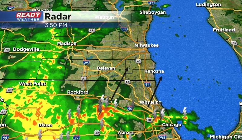
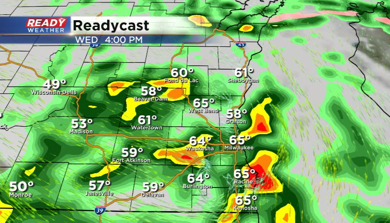
Rain and a few storms continue to close in on southeast Wisconsin and will overspread the area over the next 1-2 hours. Storms lifting out of northern Illinois may produce gusty winds, but the overall severe threat continues to dwindle.
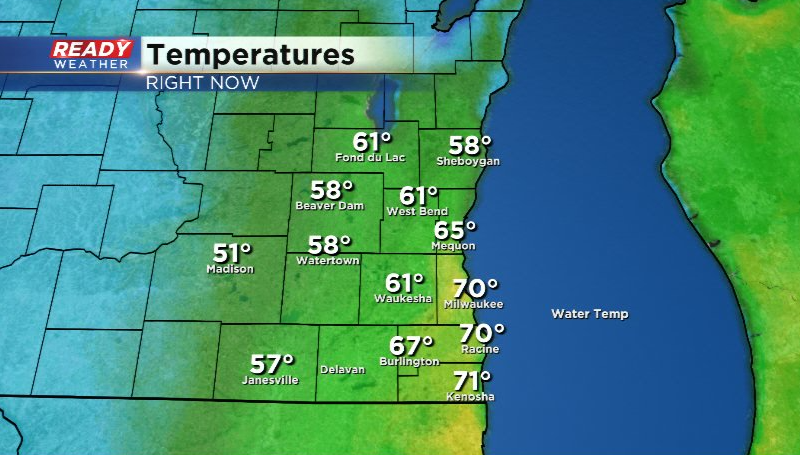
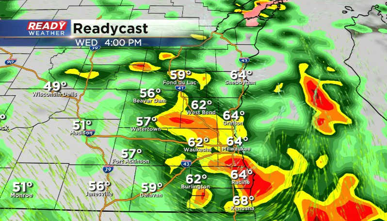
The cold front has knocked temps down to either side of 60 away from the lake and will drop temps into the 30s and 40s by Thursday morning.
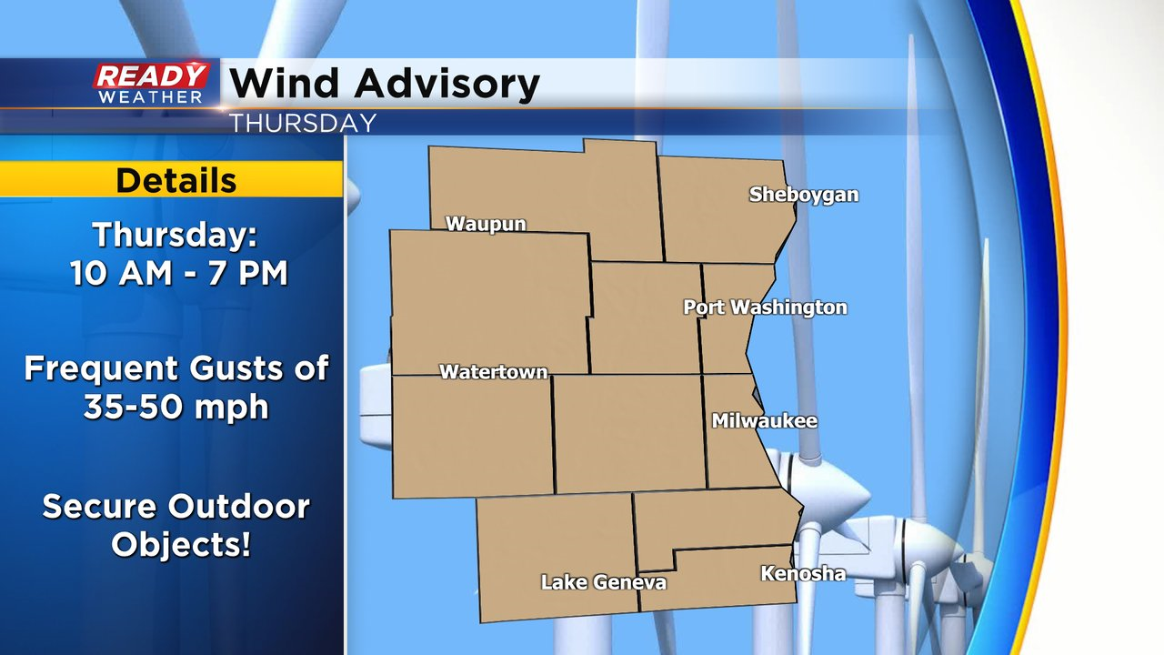
Besides the temperature drop, the bigger story will be the strong winds behind this system. Frequent gusts of 35-50 mph are expected between 10am - 7pm Thursday with the strongest gusts in the afternoon. A Wind Advisory has been issued for all of southeast Wisconsin during this timeframe.
Updated: April 13th, 2022 2:10 pm:
Mostly cloudy and mild conditions continue across southeast Wisconsin with temps for most sitting either side of 70 degrees. However it won't be warm for much longer as the cold front has already reached Madison.
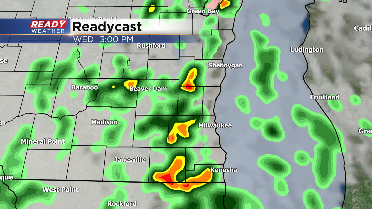
A few isolated showers are trying to pop ahead of the cold front, but the main area of rain and storms is still lifting in from the southwest.
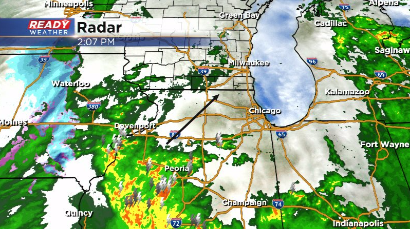
The overall chance for severe storms continues to dwindle, but we can't rule out a strong storm with hail and gusty winds tracking through Milwaukee, Racine, or Kenosha.
Northern Illinois has a slightly higher chance for isolated severe storms this afternoon.
-------------------------------------------------------------------
Updated: April 13th, 2022 12:00 pm:
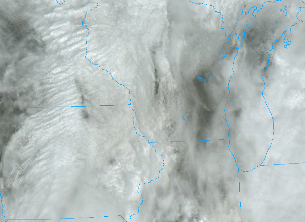
Showers have pushed out of SE WI as of midday, but the lingering clouds have been stubborn. Despite some thinning in the cloud cover, these clouds are limiting instability overall.
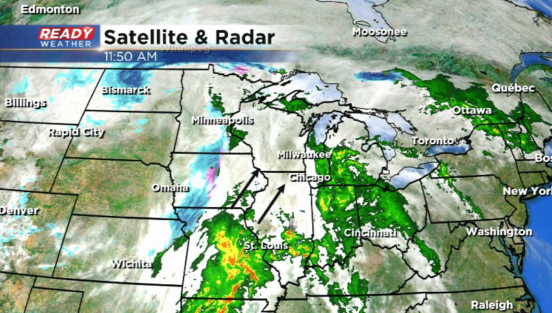
Ongoing strong to severe storms across Missouri will continue to push clouds into the area this afternoon and also limit the coverage and intensity of late afternoon storms.
The combination of these two factors has lead to all of southeast Wisconsin being downgraded to a Marginal Risk (level 1 of 5) for severe storms for the 3pm-7pm timeframe.

While the overall threat is decreasing, it isn't zero. A couple of isolated strong to severe storms are still possible as the cold front pushes through late this afternoon. Damaging winds and hail will be the main threats in any stronger storms.
------------------------------------------------------------------------------------------------
Updated: April 13th, 2022 10:00 am:
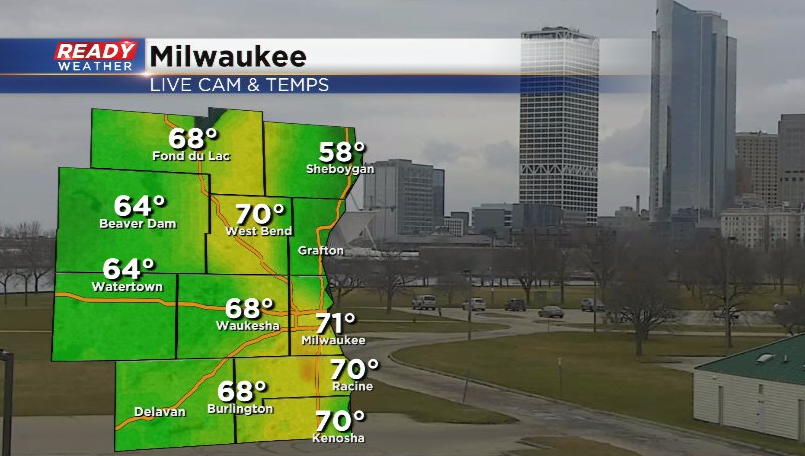
A warm front is currently sitting across central Wisconsin while a strong cold front is approaching the Mississippi River. Warmer and more humid conditions are in place across southern Wisconsin between these two fronts with temps already hitting 70° in Milwaukee!

A few showers and isolated storms having been moving through southern WI this morning, but they've been weakening as they push into southeast WI.
Once these showers exit in the next hour, we'll see dry conditions into early afternoon. Whether or not we see sunshine during this dry time will determine whether or not storms have enough energy to become severe when the cold front arrives late this afternoon. The window for strong to severe storms continues to be between 3pm-7pm.
Most of southeast Wisconsin remains in a Slight Risk (level 2 of 5) for severe storms for late afternoon.
------------------------------------------------------------------------------------------------
Updated: 8:05 a.m. Apr. 13, 2022
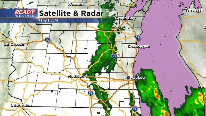
Most of southeast Wisconsin has been dry so far Wednesday morning. An area of rain showers is moving through Madison and a few thunderstorms have popped in northern Illinois. All of this activity is moving ENE. The storms in Illinois will likely move into Walworth, Racine and Kenosha Counties over the next few hours. A stronger storm could be possible but the better threat for severe weather is this afternoon and evening.
Here's a radar image that will update with time:

In addition to the storm chance today, we will naturally have some breezy conditions. Wind gusts out of the SW Wednesday will reach 20 mph. Thursday is the windiest day of the week with gusts going over 40 mph. A wind advisory could be issued for Thursday. The wind stays blustery on Friday out of the west gusting to 30 mph.

------
Updated: 6:13 a.m. Apr. 13, 2022
Severe storms on Tuesday stayed away from our local area in central and northern Wisconsin. A decent severe storm rolled through the Green Bay area Tuesday evening. Any stronger storms that moved across the state Tuesday night weakened before they reached southeast Wisconsin. A few scattered showers are rolling through the local area right now,
After scattered showers and a few isolated storms Wednesday morning through the early afternoon we see the chance for heavier storms in the mid afternoon to evening. The best timing for any severe storms will be from 3 to 8 PM.
The severe risk for Wednesday afternoon and evening has shifted east a bit. Slightly better chances to see the big storms the closer you live to Lake Michigan. The strongest storms will form in front of a cold front that sweeps through our area from 3-8 PM. Wind and hail will be the primary threats with any severe storms that develop. The isolated tornado threat has decreased.

We could definitely see some moderate to heavy rain with any storms that develop. Rain totals for most of southeast Wisconsin will range from 0.50-1.00". If you happen to stay away from the storms your rain totals will probably stay under a half inch closer to 0.25".
Download the CBS 58 Ready Weather app to track the storms and get alerts if warnings are issued.