Strong wind Thursday then a look ahead to snow this weekend


The wintry mix from Wednesday night made roads pretty icy early Thursday morning, but as soon as salt trucks were out the road conditions improved quickly. Sunshine should quickly emerge by Thursday afternoon and the wind will pick up. Wind gusts by Thursday afternoon will be out of the west from 20-45 mph. The wind stays strong Thursday night with gusts to 40 mph then on Friday the wind lightens up pretty quickly from 5-15 mph.

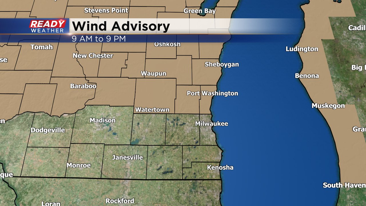
A wind advisory has been issued for our northern counties including Fond du Lac, Sheboygan, Dodge, Washington and Ozaukee Counties until 9 PM Thursday evening. The rest of southeast Wisconsin will still see strong wind but northern counties likely get the strongest gusts.
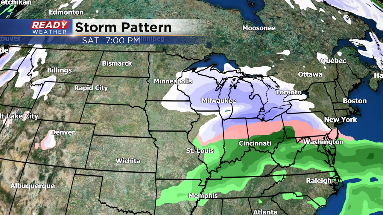
The next chance for precipitation will be over the weekend. Snow is on track for Saturday with the bulk of the accumulation happening in the afternoon and evening. The overall storm track for Saturday has shifted north a bit which could mean less snow in southeast Wisconsin but at least some accumulation is still expected for most of the local area.
Download the CBS 58 Ready Weather app to track the wind gusts for your location Thursday and the snow chance for Saturday.