Summer weather pattern arrives: Warm and humid with daily storm chances


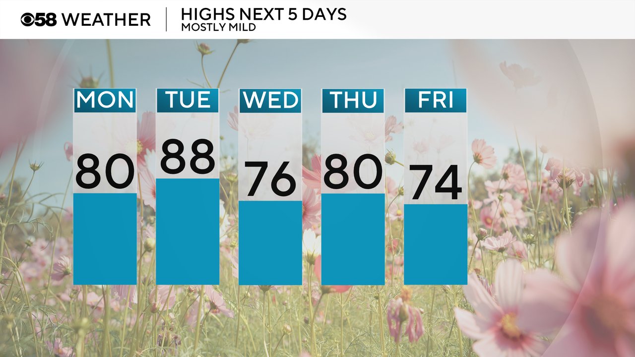
Summer has arrived! The season officially starts at the end of the week, but the weather pattern looks very summery all week long. Temperatures will climb out of the 60s and 70s with highs reaching 80 Monday then upper 80s on Tuesday. A cold front will drop us a bit for the middle and end of the work week with highs in the 70s to around 80.
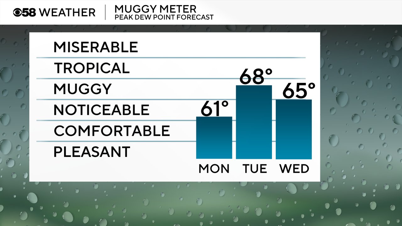
In addition to the mild temperatures, humidity really returns for the first time this season. At least some noticeable humidity arrives for Monday with lots of humidity on Tuesday. Wednesday and most of the week sees at least some mugginess as well.
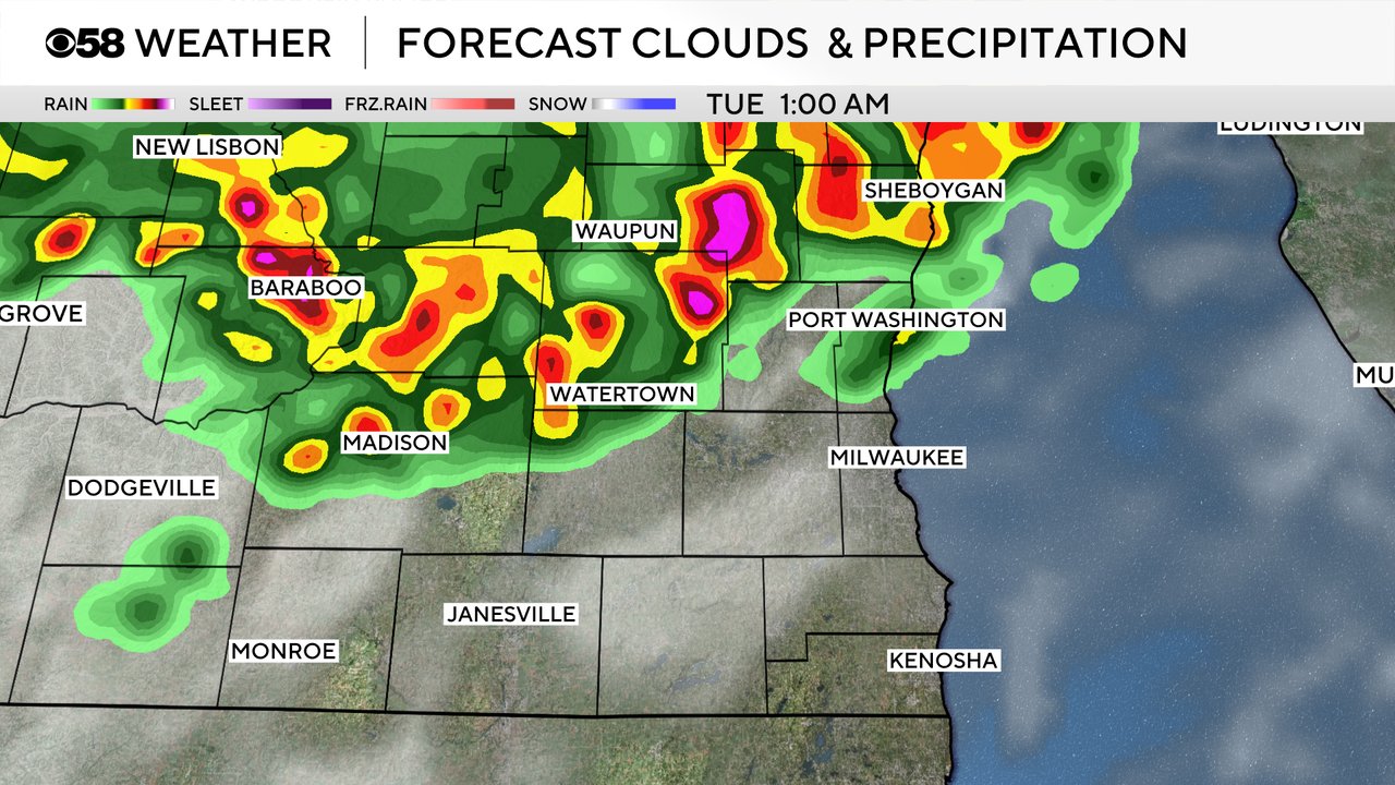
Almost every day this week has a chance for some showers or storms. On Monday the chance for rain looks fairly isolated with some possible in the morning, especially in our western and northern counties. Then we may or may not see a round of storms Monday night into Tuesday morning. Some weather models bring us strong storms, others have those storms weakening before they reach us, and others don't have the storms at all.
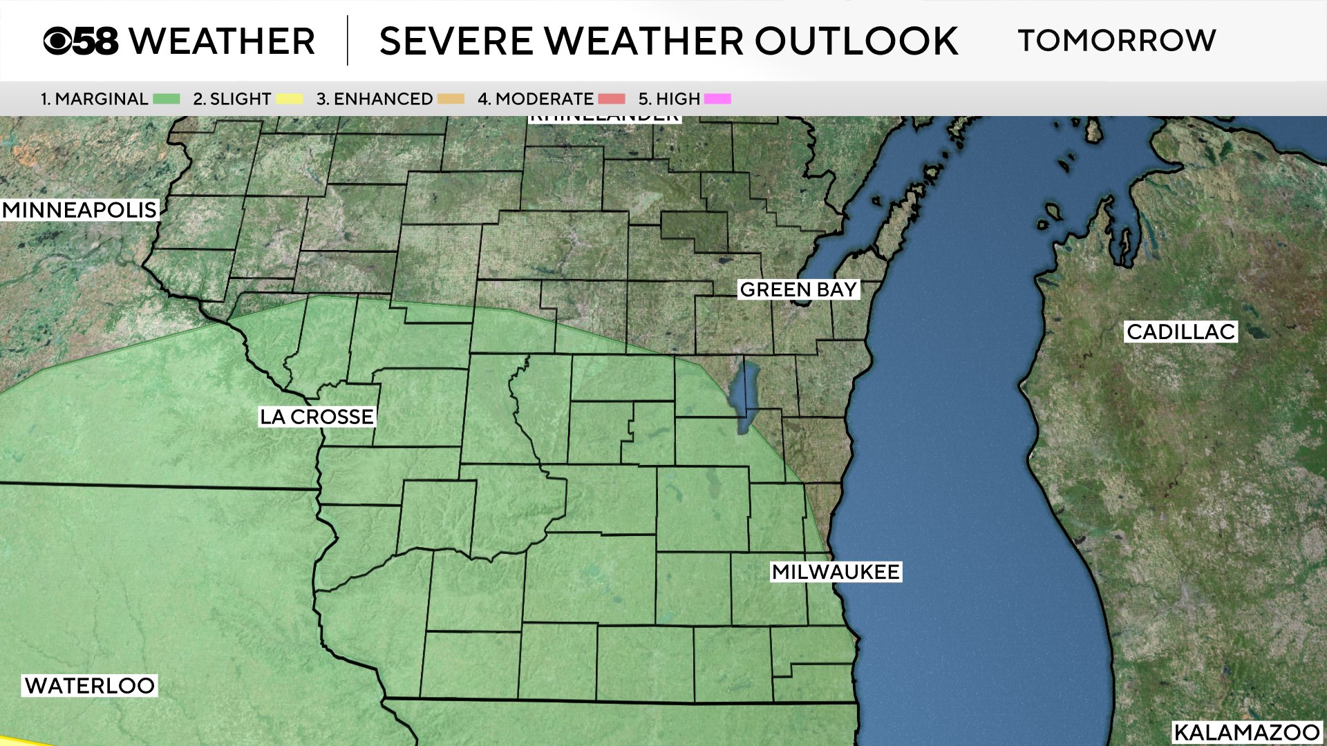
Each day also has at least a marginal threat for some stronger storms. On Monday/Monday night that threat is best well to our west in Minnesota but any overnight storms that do survive into our local area could be strong.
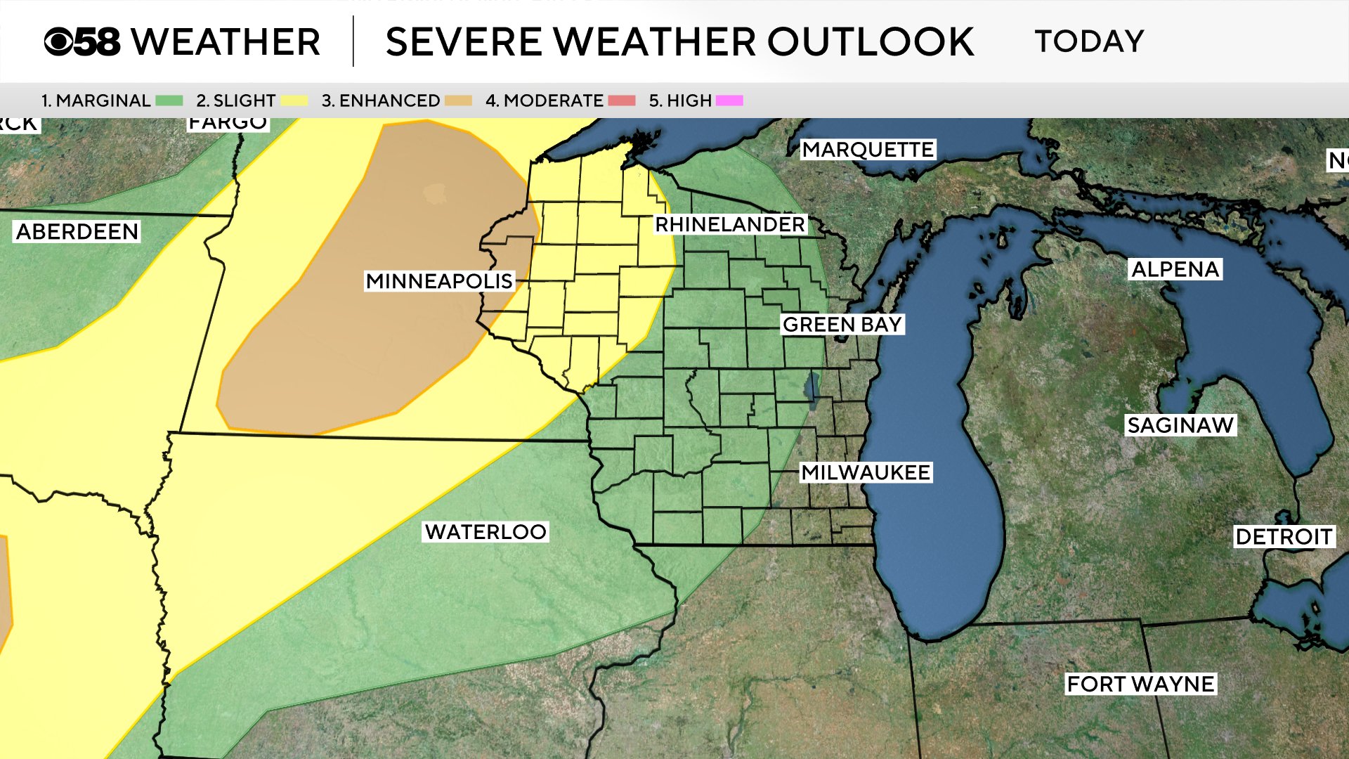
For Tuesday, there's a pretty good chance for storms in the afternoon and evening. Once again, some of those storms could be on the stronger to borderline severe side but no widespread severe weather is expected.
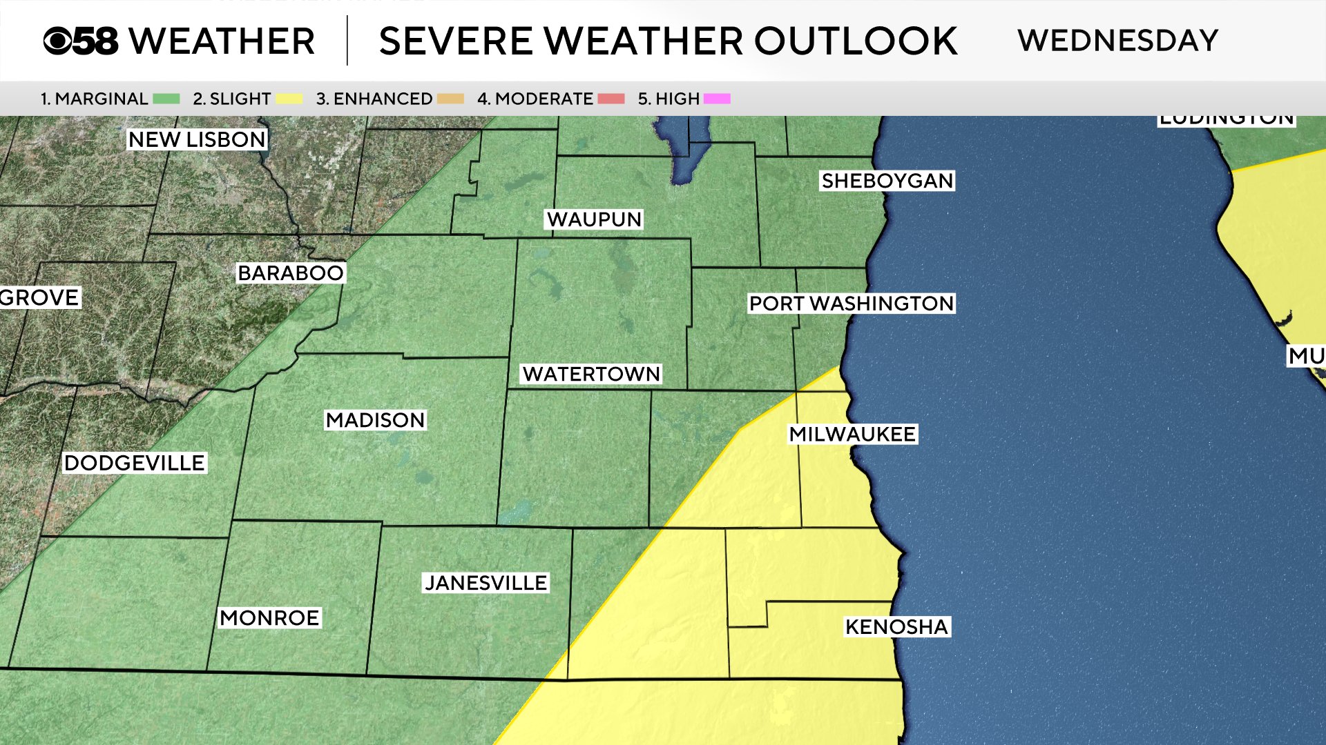
Wednesday right now has the best chance for storms with scattered showers and storms likely off and on throughout most of Wednesday with best chances in the afternoon and evening. Most of these storms form along and around a cold front which will be the focus for some strong to severe storms with a Level 1 (green) and Level 2 (yellow) risks for severe weather.
Monday's showers and storms aren't expected to be heavy but any storms we see on Tuesday afternoon/evening and especially with the rain and storms Wednesday could drop some serious rainfall. Rain totals from Monday all the way through Thursday morning could reach 1-2.50" for most of southeast Wisconsin.

Download the CBS 58 Weather app to track all of the rain and storm chances with the interactive radar.