
-
0:56

People gather at the Bear Moon Pow Wow in celebration of culture...
-
1:07

Milwaukee County Zoo hosts pre-Easter celebration filled with...
-
2:30

Kewaskum police chief, lieutenant could face discipline after...
-
2:04

Big races in Wisconsin’s upcoming spring election Tuesday
-
1:10

Schlesinger’s Saturday Showcase (4/4)...Lots of Easter fun...
-
2:57

Easter holiday weekend starts on a wet note but major improvements...
-
1:12

Wisconsin AG Kaul, Gov. Evers join lawsuit challenging Trump...
-
2:44

Bodycam video shows chaos ensue at Bayshore Mall during ‘teen...
-
1:21

Neighbors helping neighbors: Cleanup underway after severe storm...
-
1:04

Third Ward coffee shop reopens after truck crashed through storefront
-
3:35

Mayor of West Allis joins CBS 58 to discuss ’Strongest Town’...
-
2:20

Kenosha mother killed; boyfriend speaks out about estranged husband’s...

Just when you think we have turned the corner for Spring, winter weather remains possible across the area. Late tonight a disturbance will create a mix of rain and snow across southeastern Wisconsin.
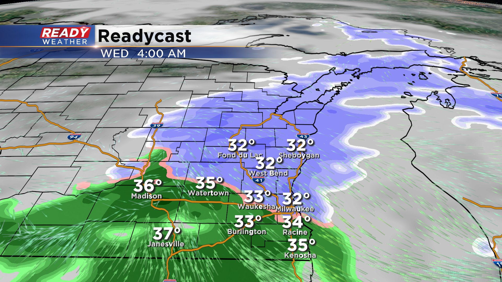
The winter weather should hold off until after midnight. Expect more of a mix of rain and snow along and south of I-94. The further north you are from Milwaukee the better chances for that mix being more snow.
Thankfully road temperatures and ground temperatures are relatively mild, so accumulation will be mostly confined to grassy areas. This will be a wet slushy snow that should melt by Wednesday afternoon. Plan on the mix to be wrapping up by 10 am.
Accumulation should be an inch or less, with the highest totals across Sheboygan and Fond du Lac counties.