Shocking & jarring. Good ways to describe Saturday's weather.


Updated as of Saturday, December 3rd
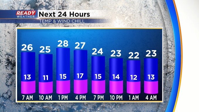
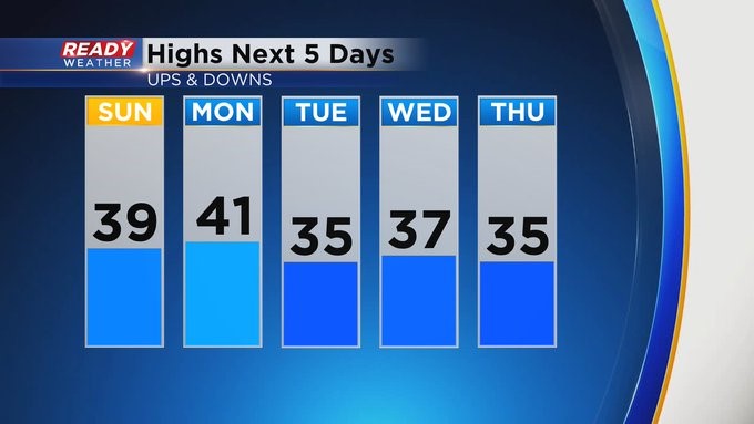
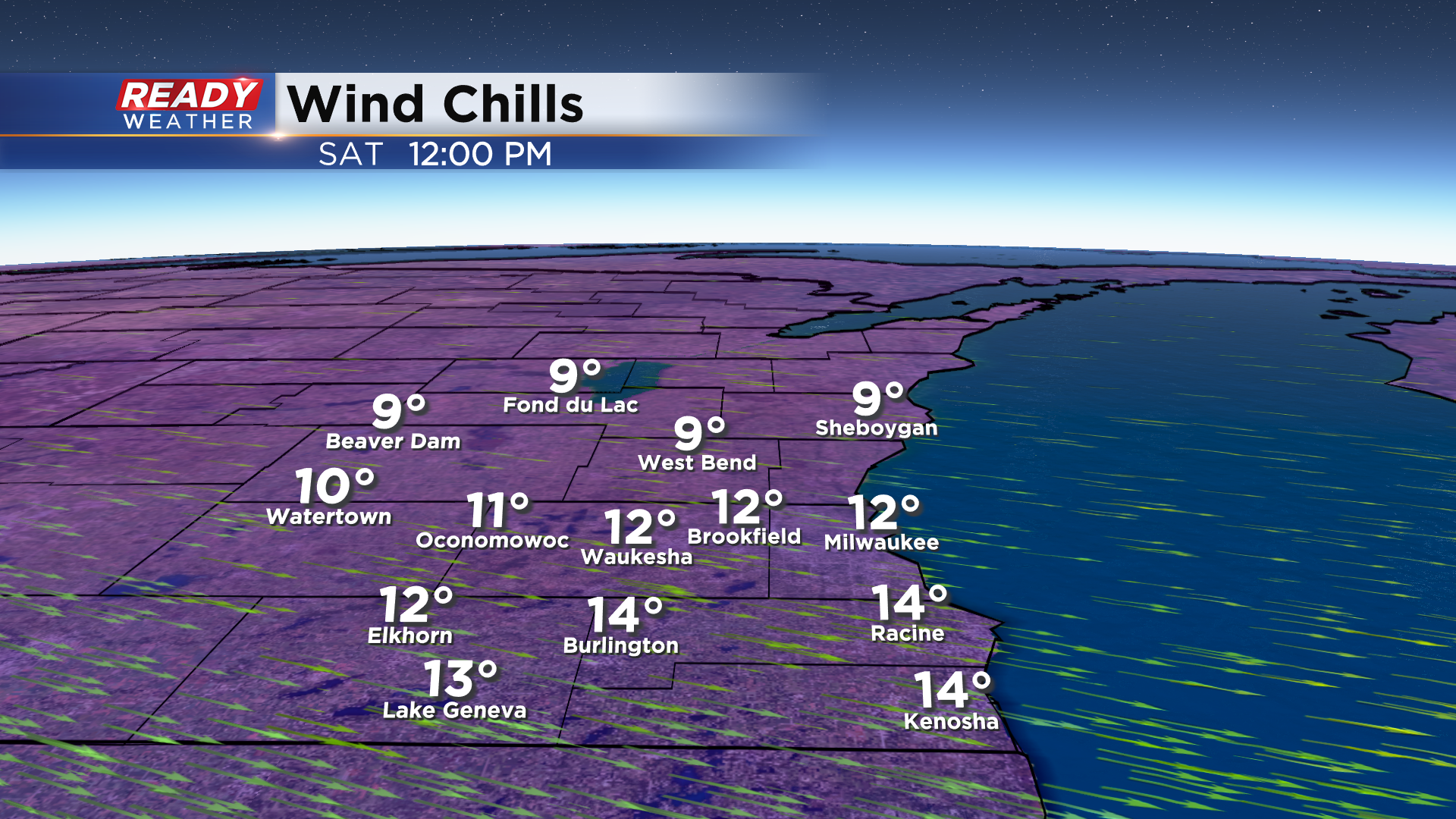
The cold front has left the building! As of 7:30 Saturday morning, we were in the upper 20s across the Milwaukee area. This after a midnight high at 50! The wind will stay brisk into the afternoon. The Wind Advisory goes until mid-morning. It'll feel like 10-15 degrees all day. But don't worry. A nice moderation in the temperature department starts on Sunday. Highs most of this coming week will be 35-40. A slight chance of wintry mix on Monday and perhaps late in the week.
_____________________________________________________________________________________________________________
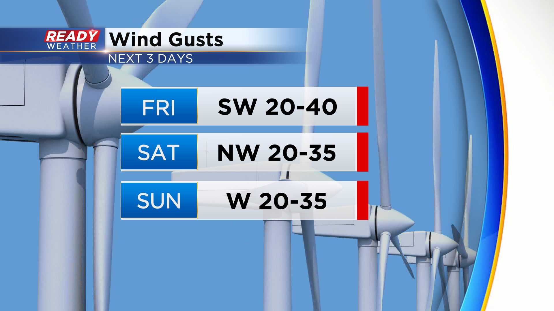
Wind has flipped to the south today ahead of a cold front, which has helped warm our temps back into the 40s!
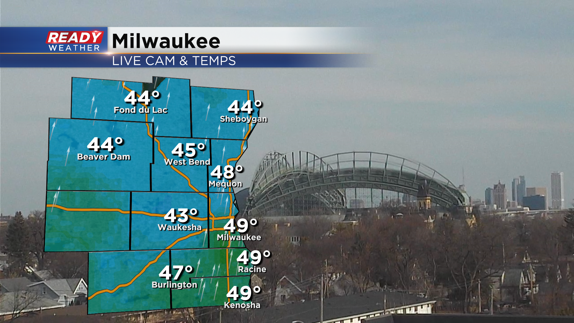
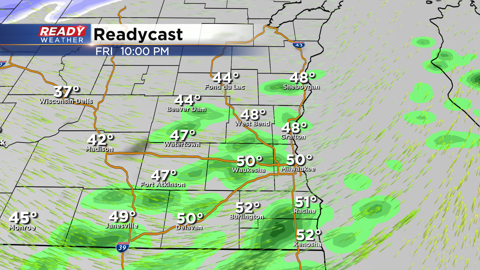
A few spots will likely rise into the low 50s before the cold front arrives this evening. Spotty light showers will develop this evening with the cold front but nothing impactful.
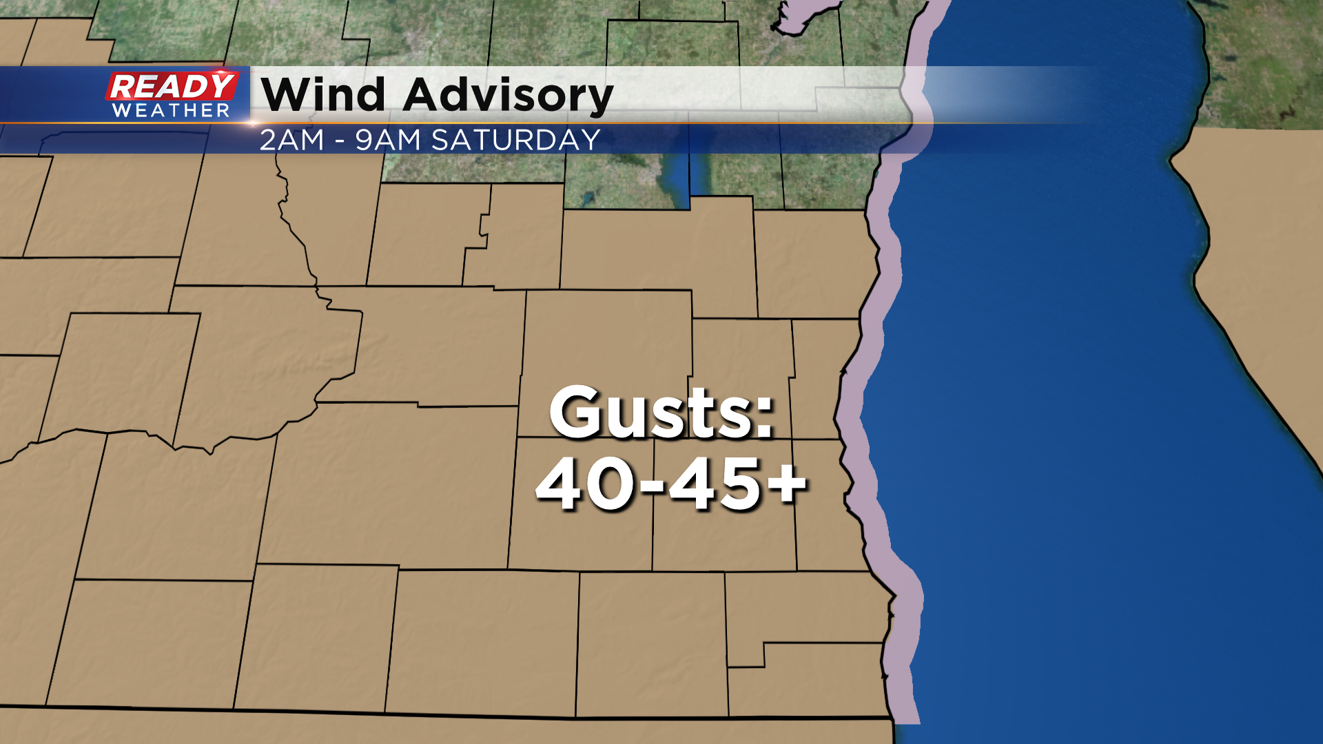
A few spots may see a few snow showers behind the cold front overnight, but the bigger story will be the strong winds. Wind will frequently gust between 40-45 mph overnight into early Saturday morning. Lakeshore areas may see gusts approach 50 mph!
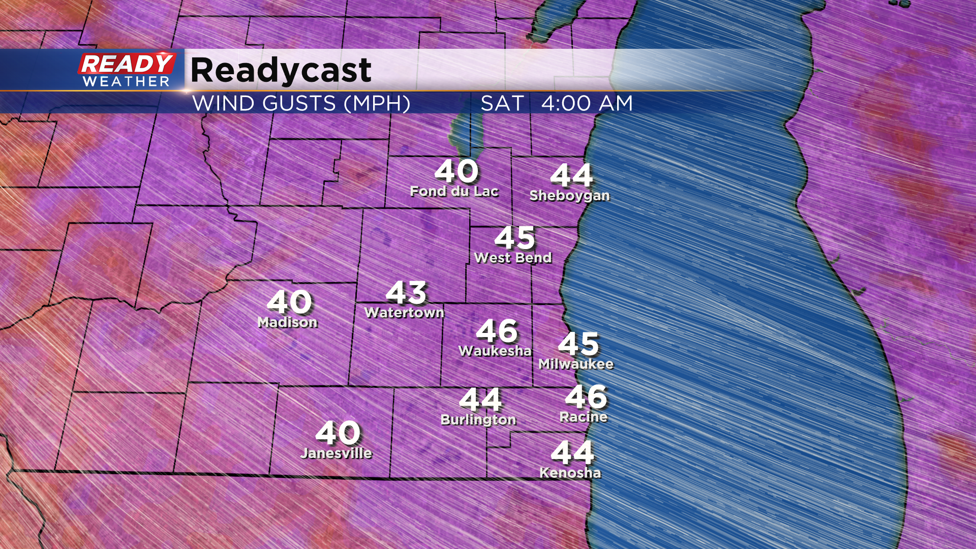
With the sustained strong winds expected, a Wind Advisory has been issued for all of southeast Wisconsin from 2am-9am Saturday.
Wind will gradually lighten up later Saturday, but it'll still be noticeable, making it feel like the single digits and teens all day Saturday.
We'll have light winds Saturday night into Sunday morning, but gusty winds are expected again Sunday afternoon behind another cold front.
Thankfully that front will come through dry, so no concerns for traveling. Download the CBS 58 Ready Weather App to see when wet weather returns next week.