


Updated: 8:12 a.m. October 23, 2020
The steady and heavy at times rain from Thursday night is over and more light and scattered showers have developed across southeast Wisconsin. These showers will likely continue through the rest of the morning into the early evening.

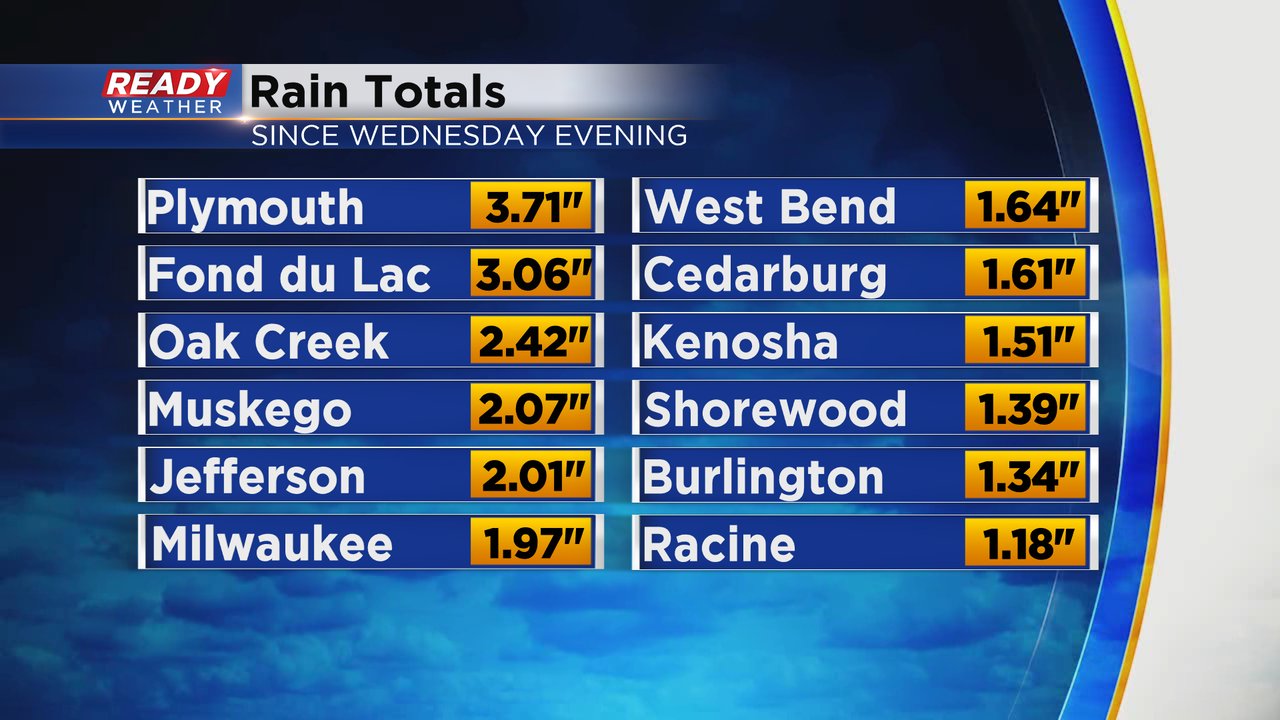
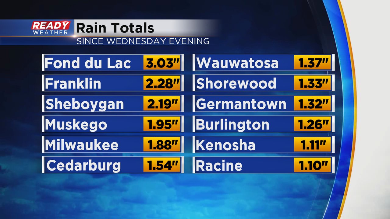
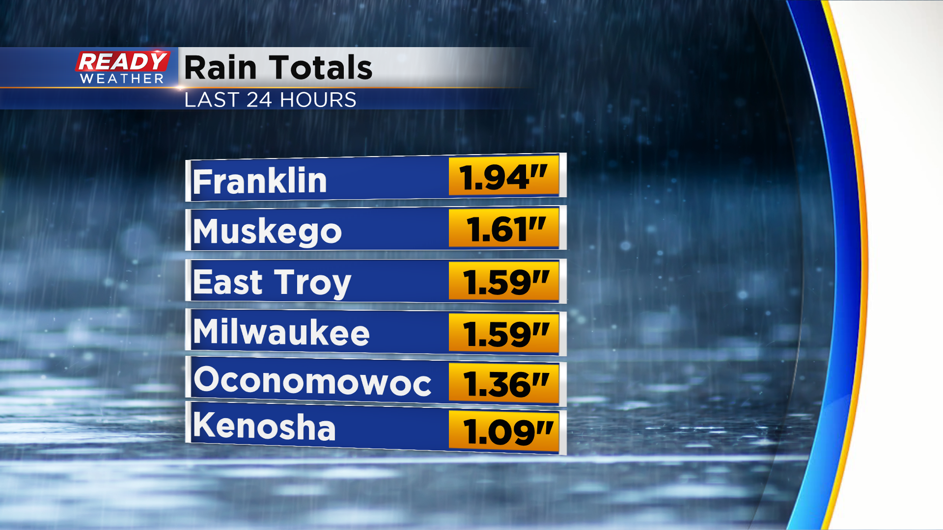
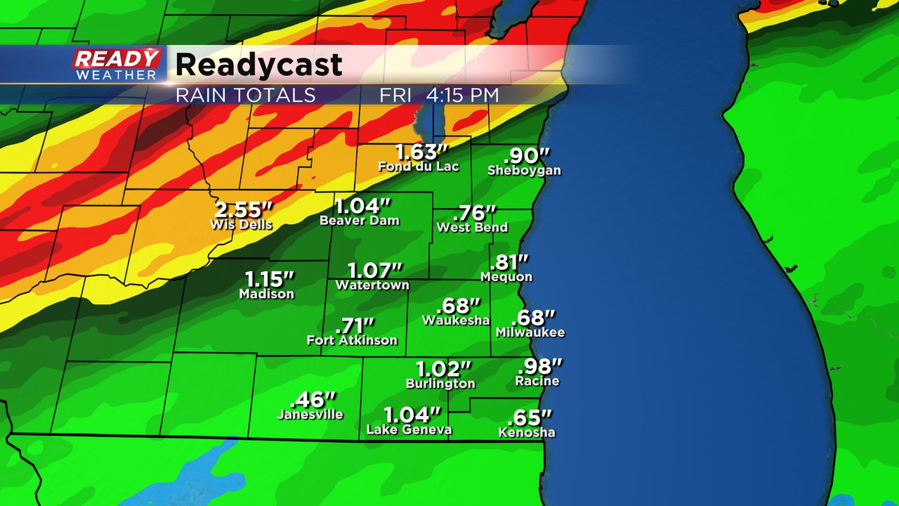
Rain totals are still coming in and a few higher totals are popping up. Plymouth has picked up over 3.50" of rain and Fond du Lac has picked up over 3" of rain. Most of southeast Wisconsin has seen 1-3".
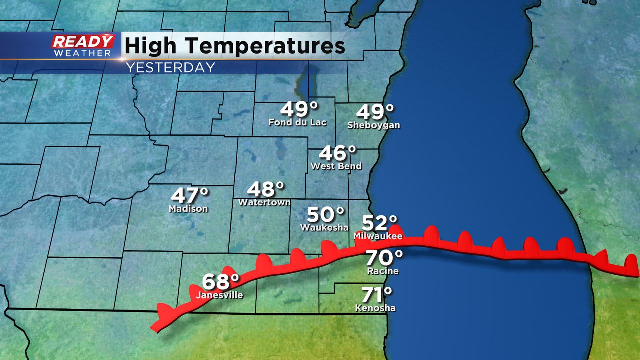
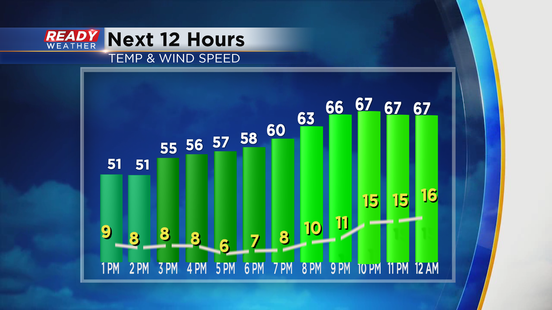
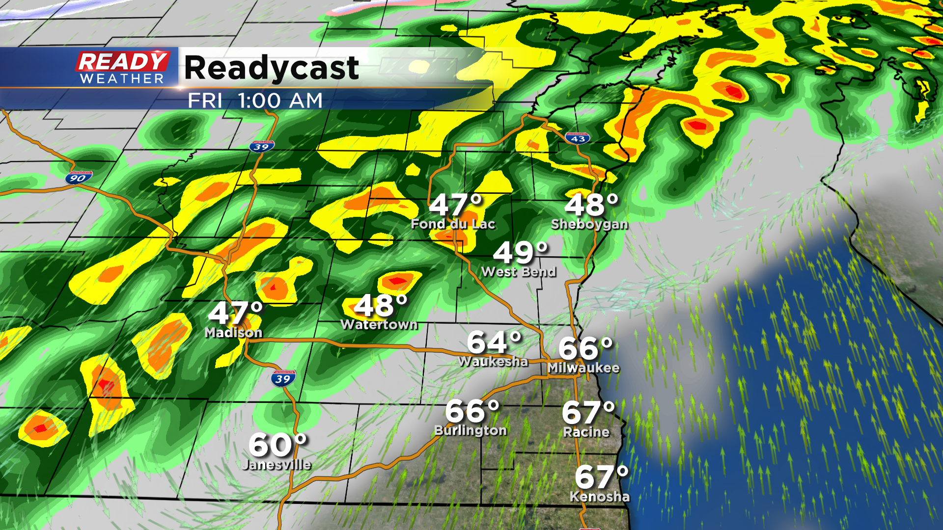
The focus of the rain on Thursday was north of a warm front. That warm front pushed through the southern part of the area where Racine and Kenosha made it to 70* but the rest of southeast Wisconsin stayed in the 40s and 50s for highs.
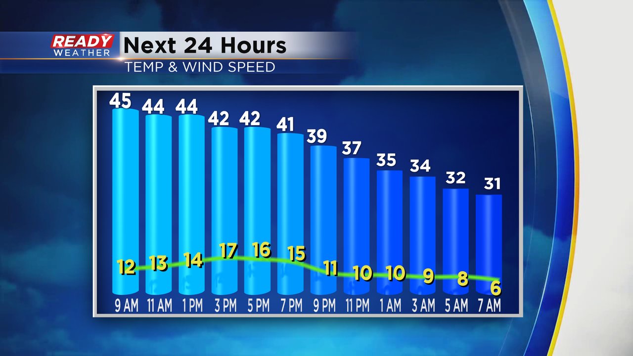
Temperatures dropped into the 40s shortly after midnight for many spots and will stay in the 40s through Friday morning and afternoon. With a good breeze the wind chill will feel more like the 30s. Most locations drop below freezing by Saturday morning.
------
Updated: 5:42 a.m. October 23, 2020
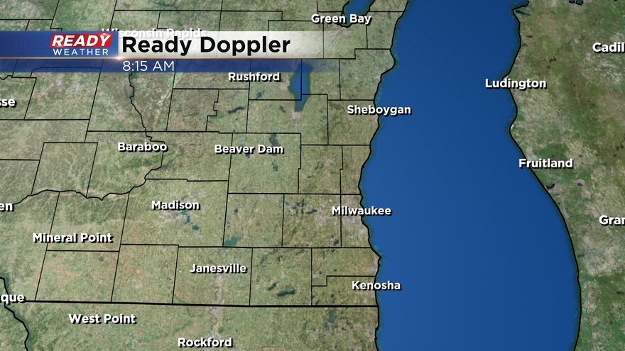
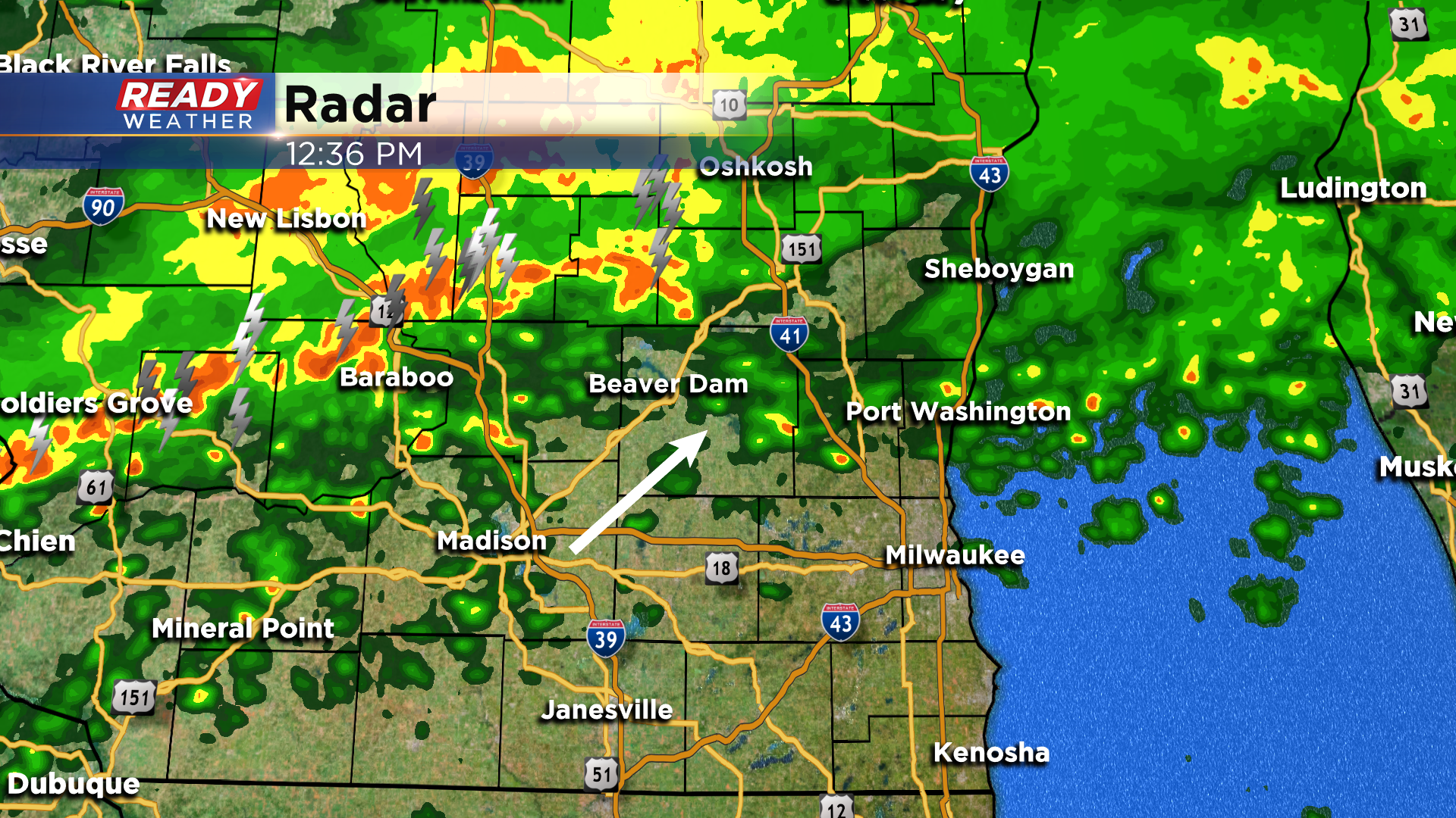
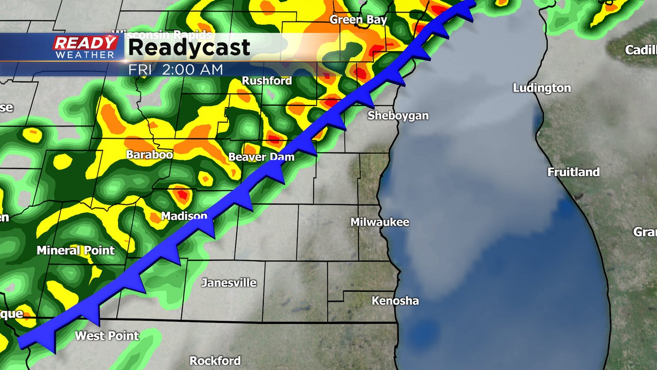
The cold front and a scattered area of showers and storms is currently moving through southeast Wisconsin. Any fog that developed Thursday afternoon and evening is gone. Here's the latest radar which has shown some isolated storms here and there that could bring in some small hail.
Rain totals so far since Wednesday evening have been very impressive. Northern areas like Fond du Lac and Sheboygan got heavy rain Thursday evening into early Friday morning. Most of southeast Wisconsin has picked up 1-3" of rain over the past 36 hours.
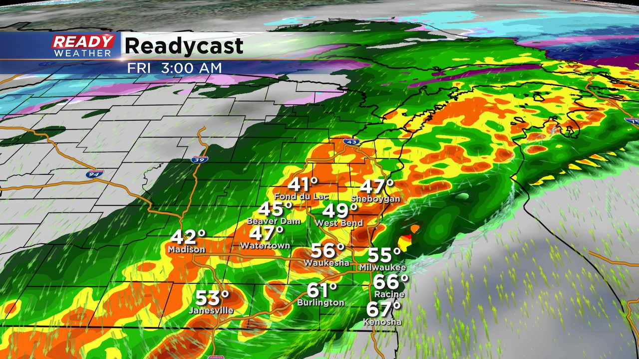
Scattered showers that will begin to weaken will stay with us through all of Friday morning. A little rain may linger through lunchtime with 2 p.m. the time we are eyeing for the rain to come to an end. Additional rain through the early afternoon is up to one inch.

Download the CBS 58 Ready Weather app to track the end of the rain Friday morning.
------
Updated: 9 pm Thursday, October 22nd:

Dense Fog Advisory Until Midnight:
The warm front has been very slow to move north across our area. It's sitting along the WI/IL border now. Fog and drizzle remain pretty thick. Visibility below a mile is possible. Use caution on the roads.
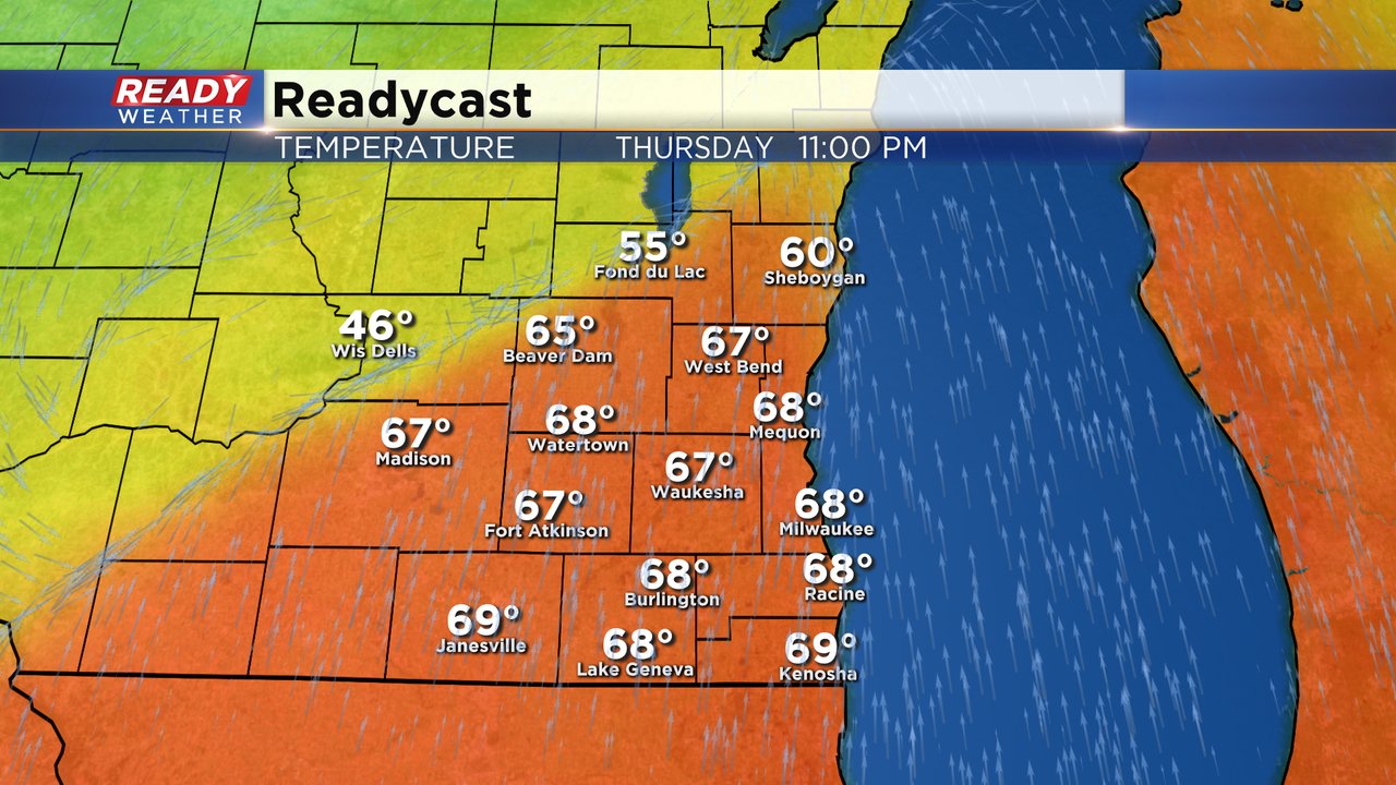
Models will continue to move the warmer air north to around I-94 before the front swings through after midnight. Still looking at some 60 degree temps from Milwaukee, Waukesha, Walworth, Racine, and Kenosha counties between 11 pm and 1 am.
The cold front will move across the area between 11 pm and 4 am. That will push another round of showers and storms across our area with some locally heavy rainfall.
An additional 1" to 2" of rain is possible.
Warmer temperatures are still expected to move across southeastern Wisconsin later this evening between 8 pm and 11 pm. Temperatures across Milwaukee will likely climb into the upper 60s before a cold front arrives by midnight.
Fond du Lac, Dodge, and Sheboygan counties will probably remain in the upper 40s and lower 50s with scattered showers this evening. The cold front will move across the area between 11 pm and 4 am. That will push another round of showers and storms across our area with some locally heavy rainfall.
An additional 1" to 2" of rain is possible.
____________________________________________________________________________________________________________
Fog has become locally dense in Milwaukee, Racine, and Kenosha counties this afternoon with visibilities currently under a half mile.
Fog will stick around for a few more hours but will clear out this evening after the warm front moves through, especially along and south of I-94. A majority of the area is seeing a break from the rain this afternoon, but a few storms are lingering in Fond du Lac county and produced pea sized hail near Ripon.
Most of us will have a break from the rain over the next few hours, but another round of scattered rain and storms moves back into the area tonight. This next round of rain is expected to move into Dodge, Fond du Lac, and Jefferson counties between 9-11pm, overspreading the rest of the area overnight. Showers will gradually end from west to east Friday morning, lingering in lakeshore areas until late morning.
-----------------------------------------------------------------------------------------------------------------------------------------------
Updated: 1 pm Thursday, October 22nd:
The steady rain that's been impacting the area all morning has lifted to the north, leaving with just a few spotty showers heading into this afternoon.
Areas along and south of I-94 picked up 1-2" of rain from this first round of showers and storms. Areas north of Milwaukee have picked up .30-.50" since the rain didn't make it there until this morning. These are the highest 24 hour rain totals through 12 pm:
Locally dense fog has filled in where the steady rain has ended, with visibilities currently under a mile in Kenosha and Racine.
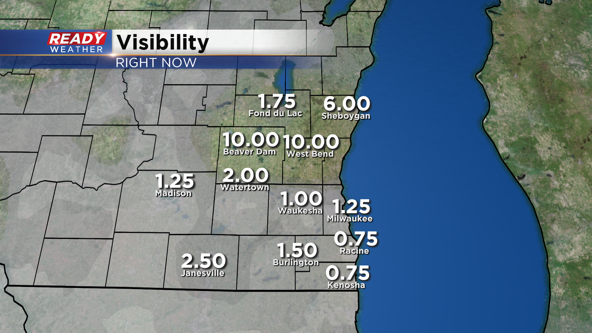
The fog will continue to spread northward and will likely be in place for the afternoon commute. It's imperative that you turn on your headlights so your taillights are activated and others can see you if you'll be driving around this afternoon.
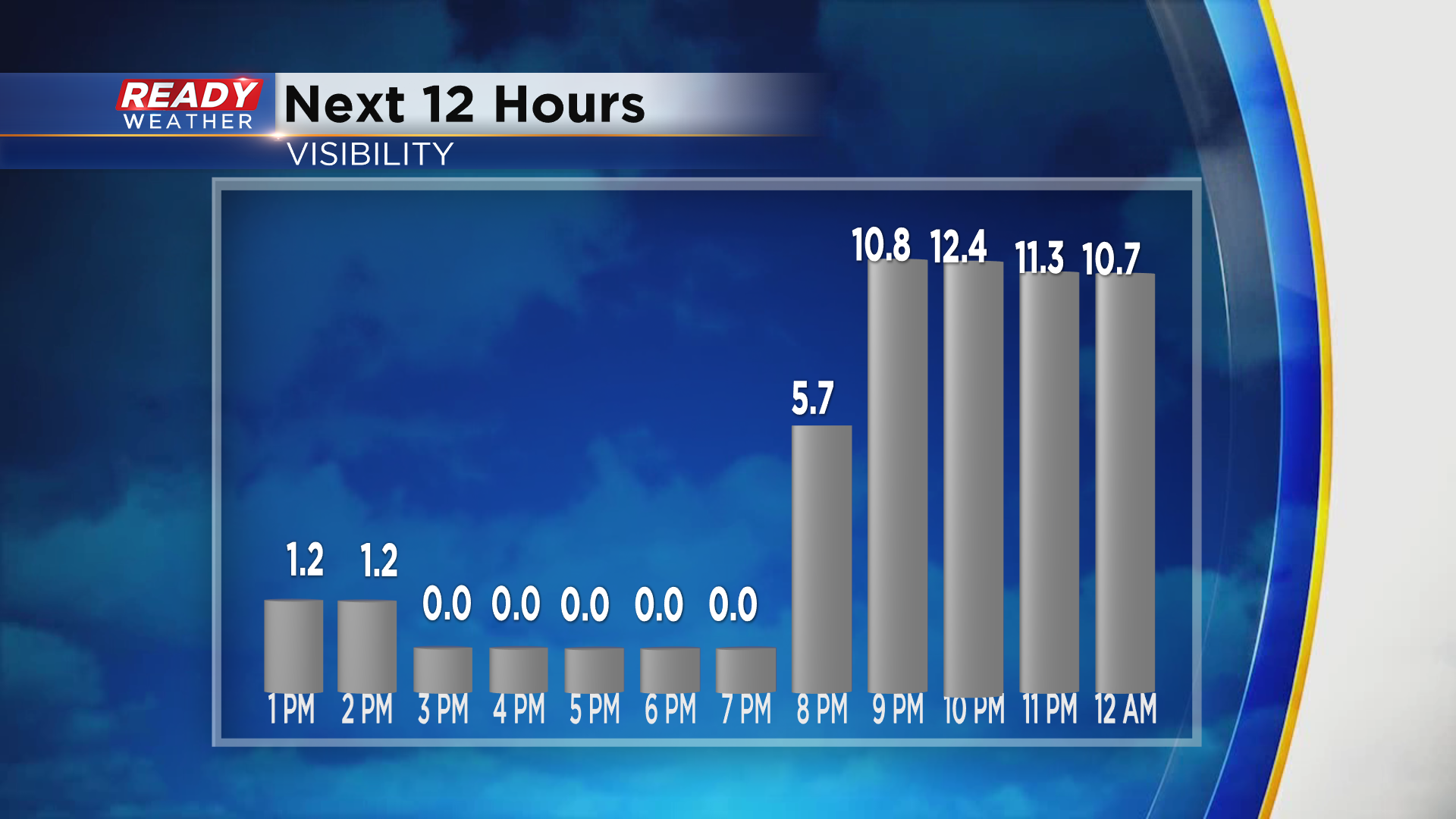
This fog is ahead of a warm front that will lift into parts of southeast Wisconsin this evening. Not only will it clear out the clouds and fog, it will boost temperatures into the mid to upper 60s! This warm up is likely for areas along and south of I-94, but places NW of Milwaukee, like Fond du Lac and Beaver Dam, likely will not experience the temperature jump.
Besides a few spotty showers early this afternoon, most of the area should get a break from the rain into this evening. The cold front will slowly work its way across southeast Wisconsin overnight, bringing rain and isolated storms back into the region around midnight, continuing into Friday morning.
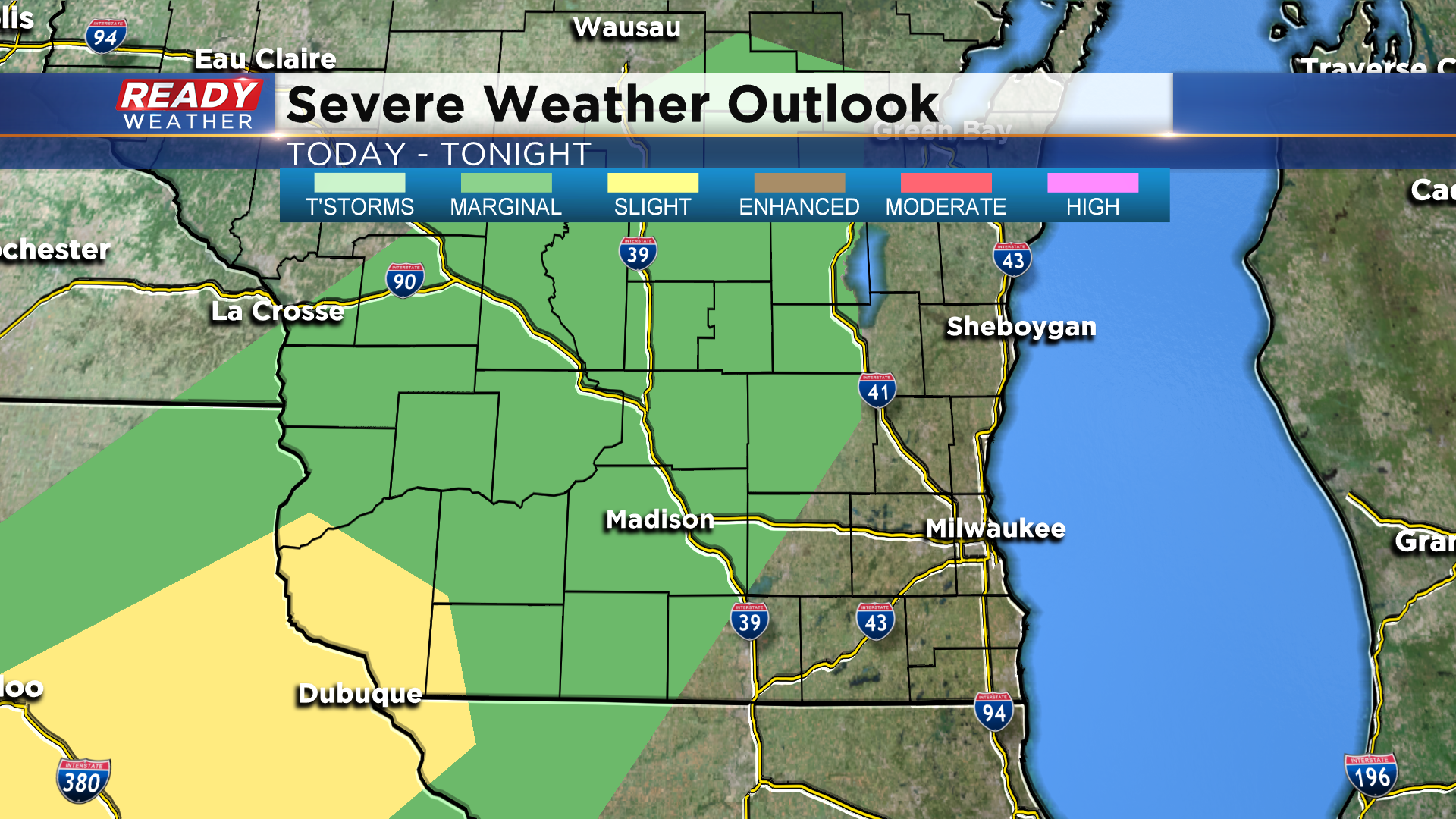
A few storms may produce gusty winds or hail in our far western counties, but the better chance for severe weather will remain in Iowa and far SW Wisconsin.
--------------------------------------------------
Scattered showers Wednesday evening turned to steady rain, especially in areas south of I-94, Thursday morning. The steady rain has slowly lifted north and will continue to do so through the morning as a warm front lifts north. Rain totals as of 7 a.m. show most between a 0.50-1.00" of rain.

The warm front will be the focus of rain during the day on Thursday. That front will slowly lift north bringing the rain with it. By early afternoon most of southeast Wisconsin will be under a dry break that will last through the evening. That front could stall out over some of our northern counties leading to persistent rain showers there for most of the day.

A cold front moving through Thursday night into Friday morning will be the source of our second round of rain and storms. An isolated stronger storm is possible during this period along with heavy downpours.
Rain will last through Friday morning before wrapping up around noon with decreasing clouds throughout the rest of Friday. By the end of Friday morning many of us will have picked up an additional half to inch and a half of rain. Those are totals on top of the rain already picked up through Thursday morning meaning some may be over 2" by the time this is all done.
Temperatures will be a little wonky for Thursday through Friday. As the warm front pushes north across the area during the day Thursday temperatures will warm. Most of Thursday afternoon will be in the 40s and 50s before spiking into the upper 60s for highs by the late evening.
The warmth will be very short lived as temperature drop fast with the cold front. By the time many of us are waking up Friday morning temperatures will have dropped into the upper 40s and stay there for much of the afternoon. Expect low 30s for Saturday morning.

Download the CBS 58 Ready Weather app to track the rain and storms with the interactive radar and see how fast temperatures drop where you live in the hour-by-hour forecast.