Winter Weather Advisory cancelled...3:45 pm Update
3:45 pm Update: The NWS has cancelled the winter weather advisory has been cancelled across the entire area. Some lingering snow showers are possible south of 94; however, major traffic issues aren't expected.
2:30 PM Update: The NWS has reduced the size of the winter weather advisory. The overall snow band continues to move south, so the accumulating snow chances look to be confined closer to the border of Wisconsin and Illinois. A swath of 1" to 2: still looks realistic for our southern counties.
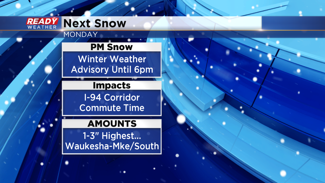
Early Afternoon Update: Snow showers are intensifying across southwest Wisconsin and that trend is expected to continue this afternoon. This fairly narrow band of snow will move west to east and the I-94 corridor looks to be the target track for this event. The timing of this snow is for the mid afternoon and commute time. Due to the higher volume of traffic expected and with light accumulations likely, the National Weather Service has the Winter Weather Advisory in place until 6pm for hazardous travel conditions.
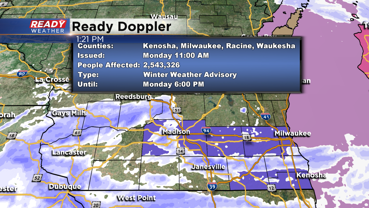
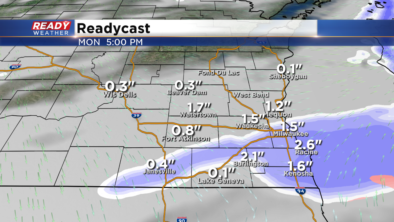
Within the advisory another 1" to 3" of snow is expected, with most spots around 1.5-2". As you can see from this image, the snow is likely still in progress during the commute for the greater Milwaukee area and places along and south of I-94.
Be prepared for falling snow and slippery roads as you are out and about this afternoon and early evening. The snow should wind down by 7pm. Then the focus turns to the increasing wind behind this system dragging wind chills to around zero by daybreak.
------
Download the CBS58 Ready Weather App to stay ahead of the storm and get updates when they come in.
