Up and down temps with increasing wind and rain chances this week


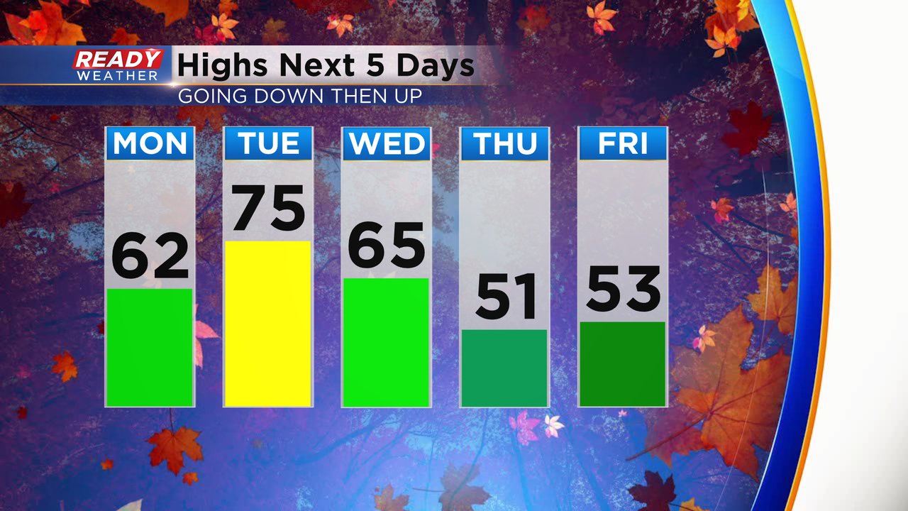
It was another great fall weekend in southeast Wisconsin. The up and down temperature trends we've seen the last few weeks will continue into a new week. Highs on Monday are just slightly below-average in the low 60s. Tuesday will be a nice warm day with highs in the mid 70s then we drop steadily into the 60s for highs Wednesday and end the week on a chilly note in the low 50s.
Expect lots of sun Monday with no rain chance but the rain chance will increase Tuesday evening. And even with the warm temps we could have an isolated storm. Wednesday will be our best rain chance that we've had in about a month in southeast Wisconsin with a soaking rain possible.

The rain will really pick up as well this week. A light lake breeze on Monday will give way to a gusty wind on Tuesday to 25 mph. A cold front rolling in on Wednesday will keep that wind strong with gusts to 30 mph. Expect some of the gustiness to last through the end of the work week.

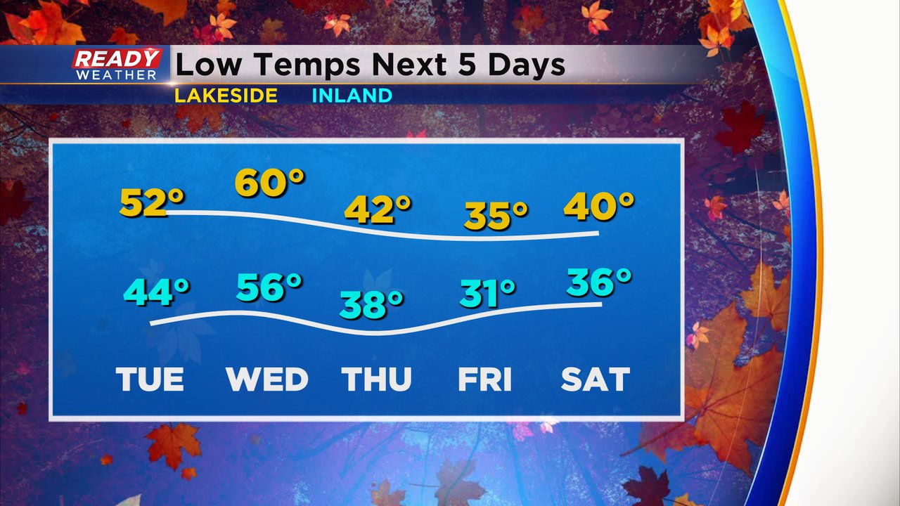
There will be no chance for frost or freeze Tuesday or Wednesday mornings but Wednesday night we will need to watch the chance for some inland frost and Thursday night/ Friday morning will be another chance for a widespread frost and possible killing freeze.
Download the CBS 58 Ready Weather app to track the up and down temps, increasing wind and rain chances.