Upper Midwest sees temp swings from wind chill to heat index over 160°


The hottest part of the summer is starting to wind down. We still have some warm days ahead of us, but on average the high starts going down on August 5 to 79°. Now is a good time to recap the extreme temperatures swings we've seen during the year.
North America is known for it's extreme weather and extreme temperature swings. This map was created with data from an Alaska climatologist, Brian Brettschneider. It takes the warmest heat index in 2019 minus the lowest wind chill. As expected, there are fewer temperatures swings near the Gulf of Mexico and Pacific Northwest where water temperatures prevent too much warming or cooling.

The bullseye is where we in Wisconsin expect it to be - the Upper Midwest. Places like Rochester, MN, Davenport, IA, Rockford, IL and Madison, WI see a temperature swing from wind chill to heat index over 160°.

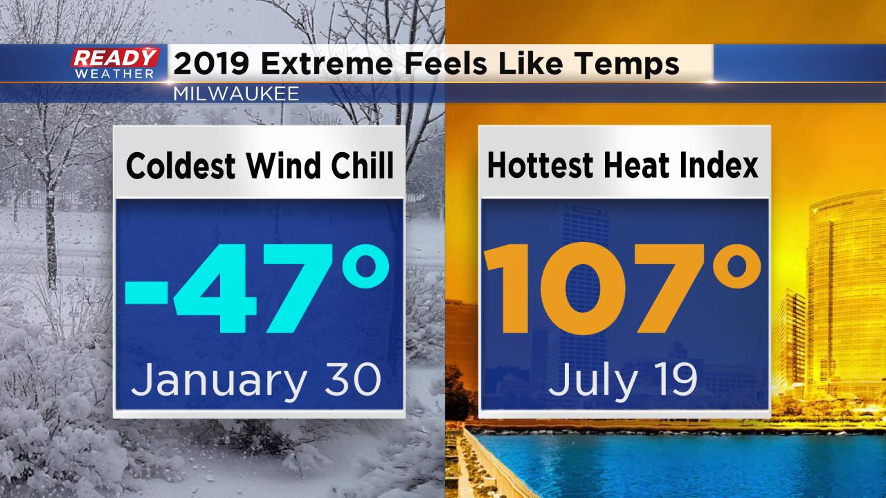
In Milwaukee the coldest wind chill happened January 30 when we hit -47°. The hottest heat index happened July 19 when it felt like 107°. Our temperature swing was 154°. Still very impressive.
When you compare that impressive temperature swing to our records, it's not in the top 5. 1985 saw the biggest feels like temp swing when the wind chill hit -54° and the heat index reached 110° for a 164° temp swing. The 90s also had a couple years with big temp swings. 1994 had a temp swing of 160° and 1996 had a temp swing of 155°. Data from the 1970s is included but wind chill and heat index values weren't as reliable back then.

Temperatures will warm back into the 80s this August but there's not any big heat on the horizon. Download the CBS 58 Ready Weather App to see the 10-day forecast.