


Update as of 8:30 am Sunday, November 20th
I'm happy to say we've bottomed out with the temps. We're on the rebound now. Overnight, we had a low temp of 13 degrees. It wasn't a record in Milwaukee but felt like it. Actual air readings were below zero in the Northwoods. It felt like -10 in some spots with the wind factored into the equation. The wind will still be brisk the next few days but at least a more southwesterly wind component will start to modify the numbers. Some computer models are hinting at close to 50 by the end of the week with rain showers for Thanksgiving!
_
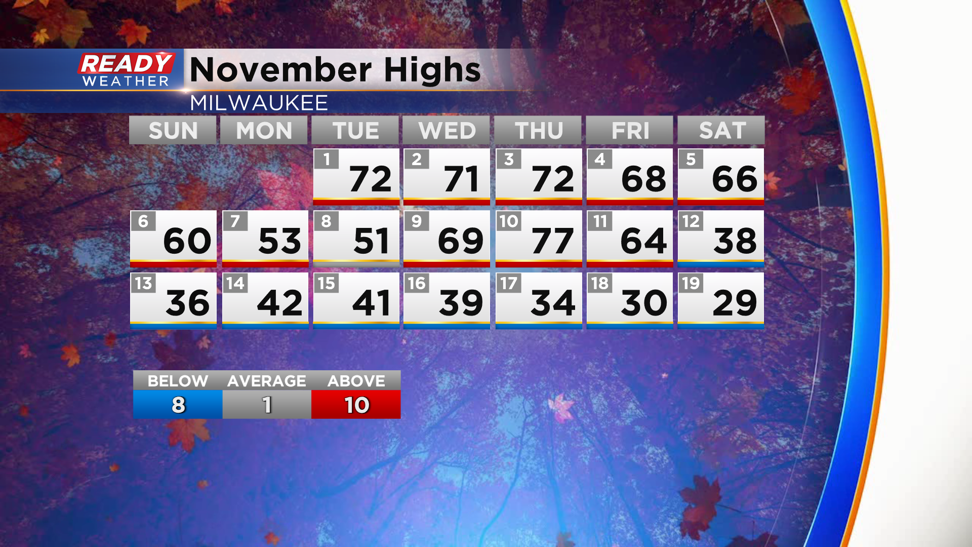
Remember 9 days ago when it was 77 degrees? We've been stuck in a chilly and snowy weather pattern ever since with highs primarily in the 30s to low 40s. Today was the coldest day with highs only in the upper 20s.
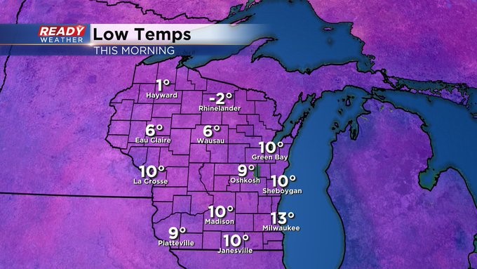
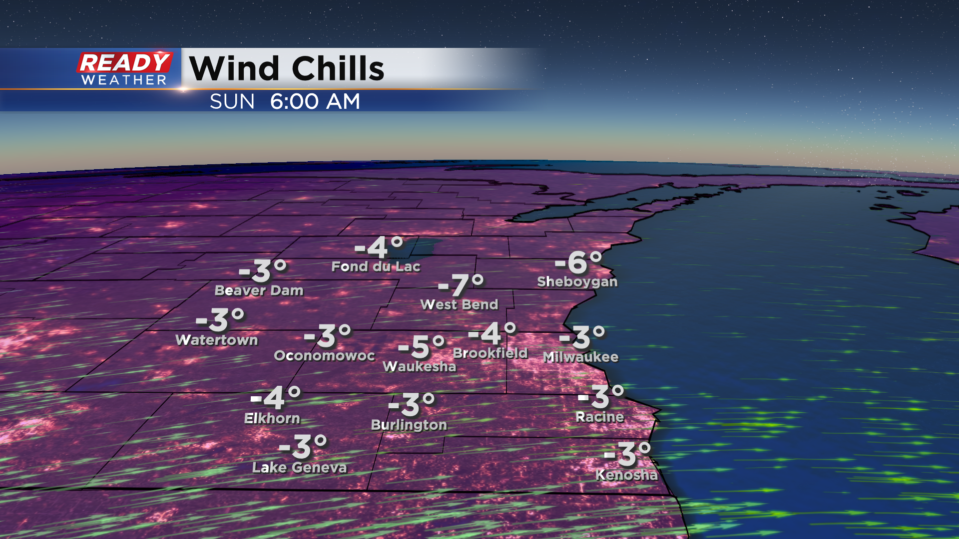
Our chilliest day so far this month will lead into our coldest night as temperatures drop into the upper single digits to low teens by sunrise Sunday morning. The record low for Sunday is 8 degrees, so we'll come close in Milwaukee!
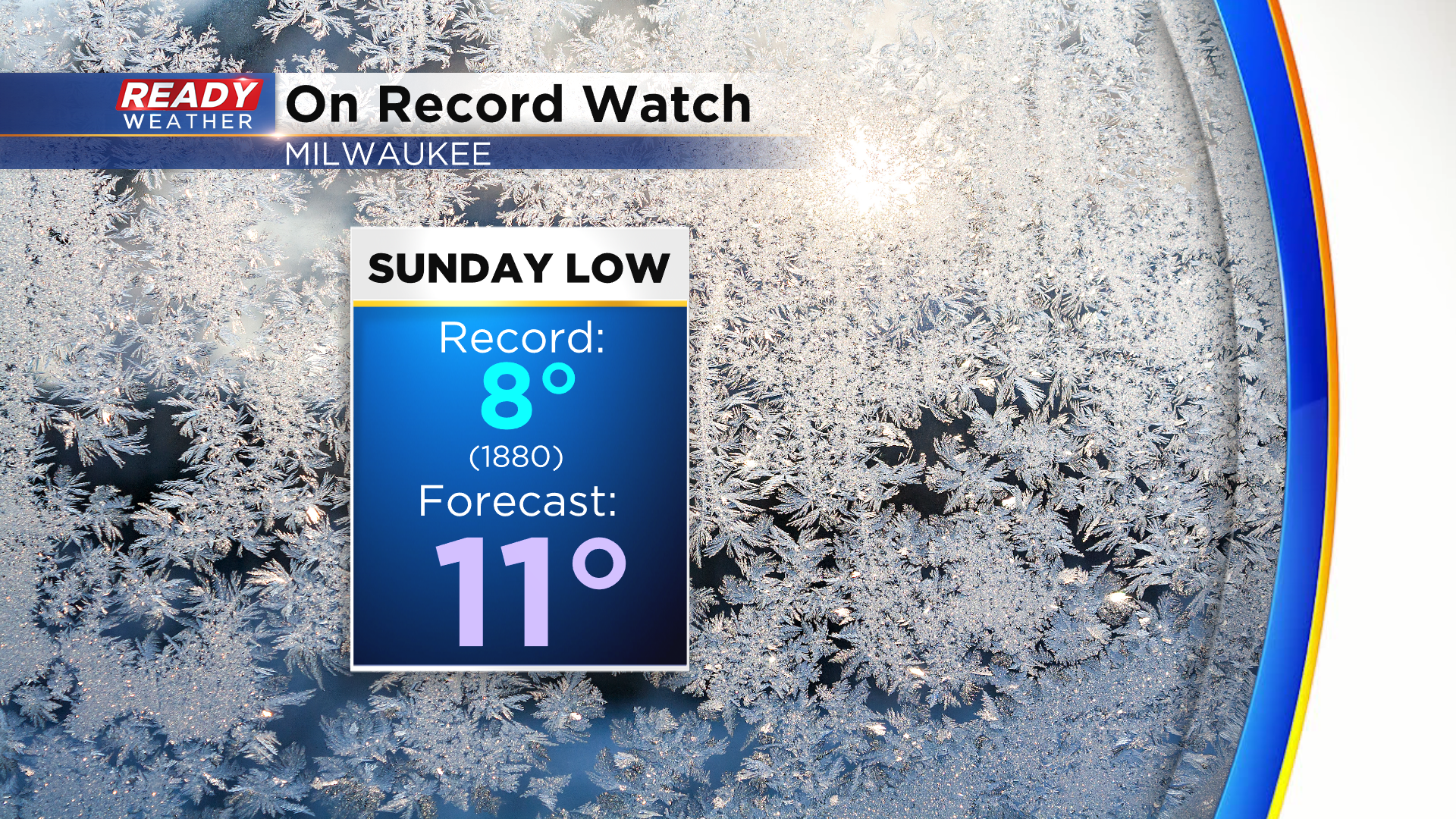
What may prevent us from reaching a record low is the wind will stay between 10-20 mph tonight. However, that'll make it feel like it's at or below zero area-wide early Sunday morning.
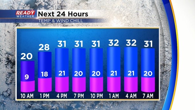
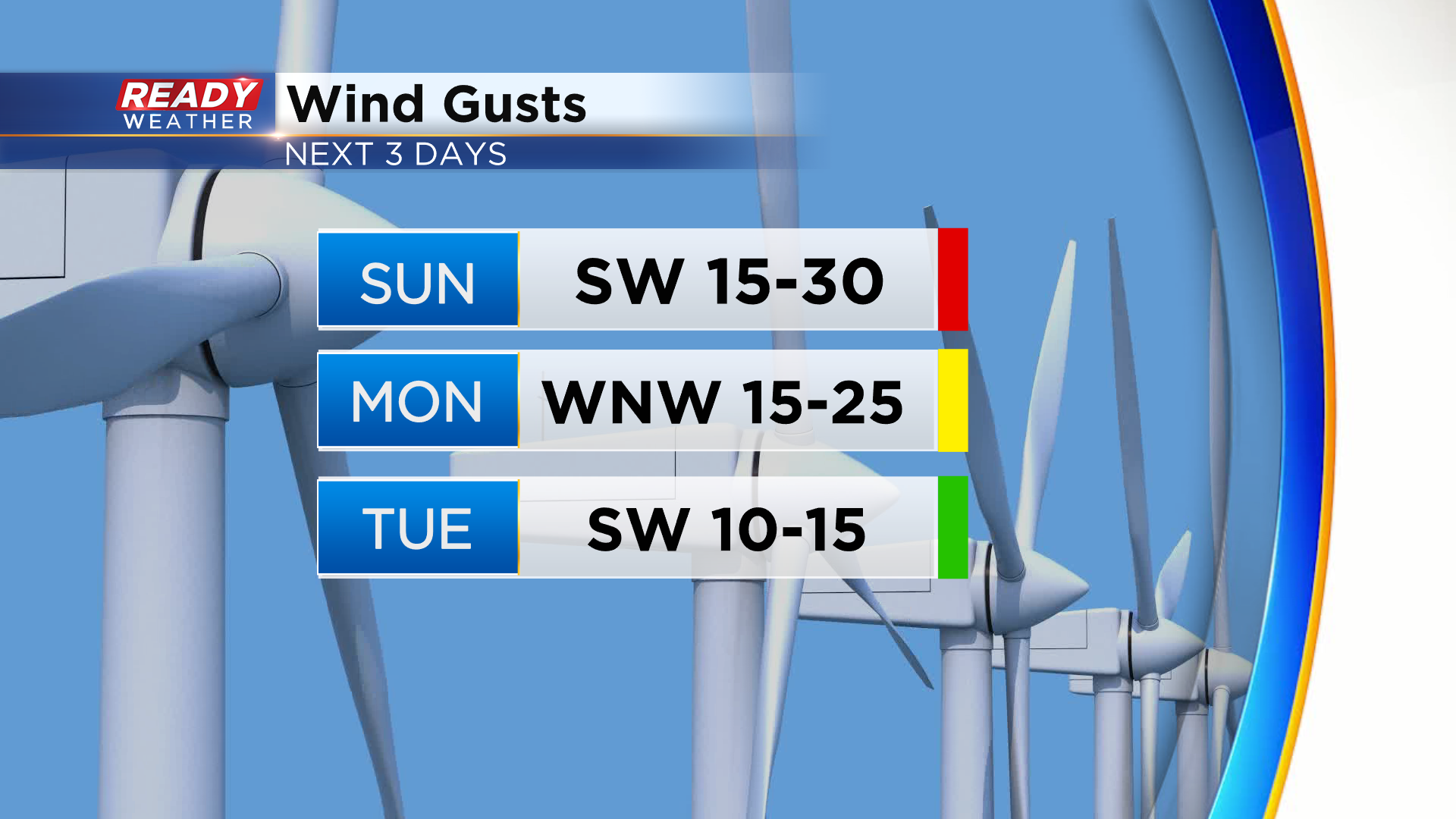
The wind will stay blustery on Sunday with gusts around 30 mph with gusts only to 25 mph expected Monday before high pressure moves on top of us and causes winds to calm down a bit on Tuesday.
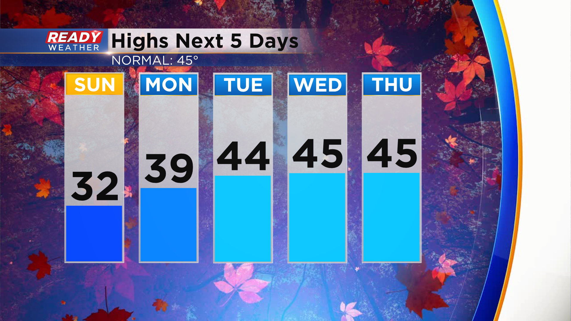
The wind tuning to the southwest will help temps warm into the low 30s Sunday then back to normal in the mid 40s by Tuesday.
Mainly dry weather is expected throughout the stretch. Our next chance for precipitation arrives in the form of light rain showers later in the day on Thanksgiving. Download the CBS 58 Ready Weather App to see the full forecast.