


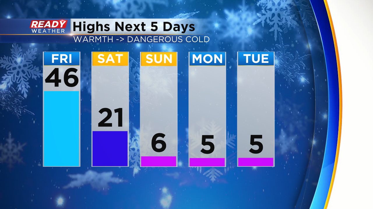
Enjoy the warmth Friday!! It's going to be the warmest day of 2025 so far with highs reaching into the middle 40s for most of southeast Wisconsin!! The wind will stay blustery throughout the day but even still, wind chills will stay in the 30s during the afternoon.

A cold front will role through Friday evening. We can't rule out a few sprinkles or flurries as the front moves through but the chance is very low and most should stay dry. The front will shift the wind to the NW for the weekend but not before a 40 mph gust on Friday brings in the warm air. A stiff breeze will stay with us through at least Sunday.

After hitting the 40s on Friday the cold front will drop temps most of Saturday with midday highs hovering around 20. Then the dangerous cold arrives starting Sunday with highs only in the single digits through Tuesday.
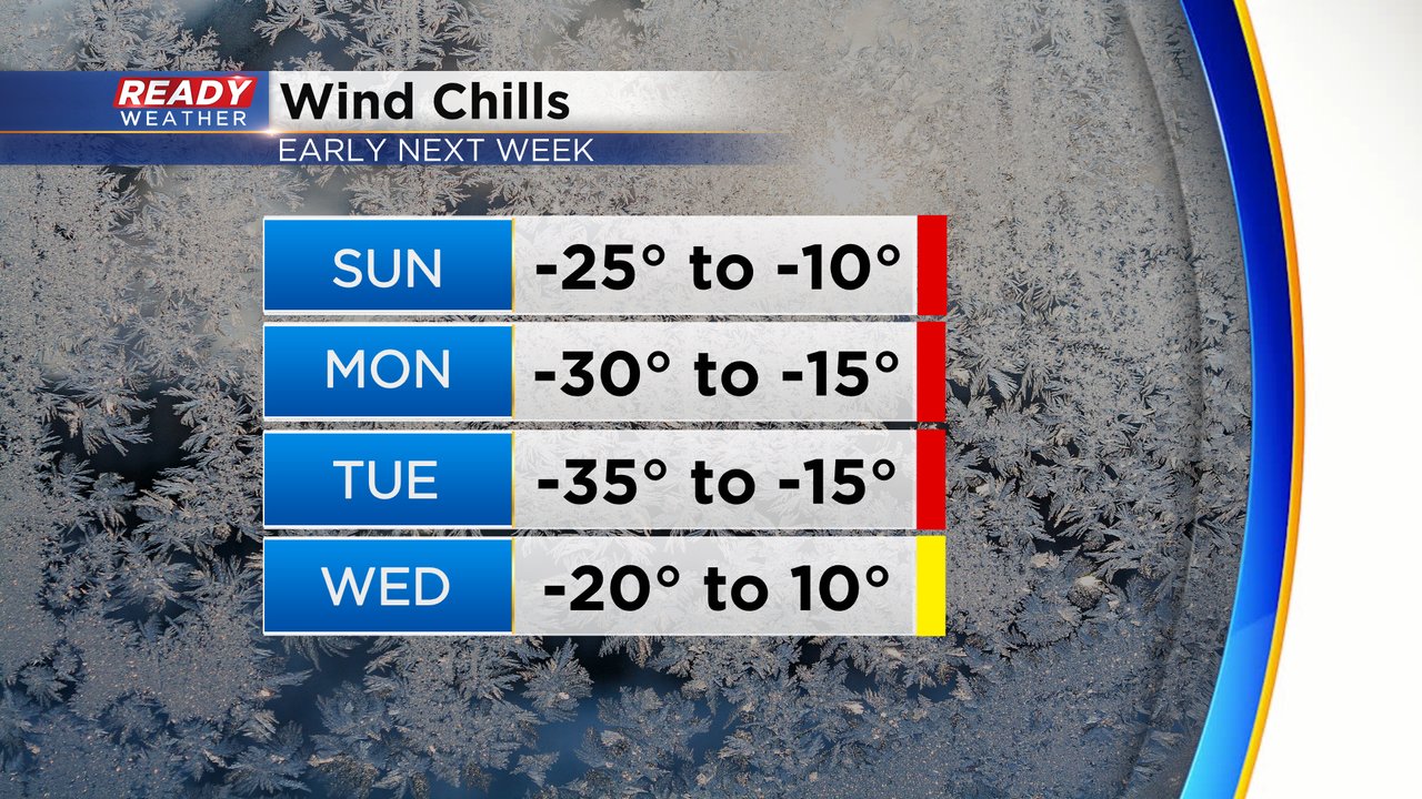
The wind chills are what you want to dress for. Cold weather advisories are likely Sunday through at least Tuesday and an extreme cold warning is also possible, especially Tuesday morning. Wind chills during the morning will stay in the 20s or 30s below-zero with afternoon wind chills in the teens below-zero. Tuesday morning looks like the coldest morning with wind chills to -35. Wednesday morning is still cold with wind chills to -20 then finally go above-zero by Wednesday afternoon.
Download the CBS 58 Ready Weather app to track the wind chills for your location.