


Gross. That's what the start of May this year is. Rain, snow and mix showers have been falling since the weekend but as colder air filters in the rain is switching over to mostly snow Monday morning. Snow has already been observed accumulating in the grass and the side of the roads in some northern counties; mainly Fond du Lac, Sheboygan, Washington and Ozaukee Counties.
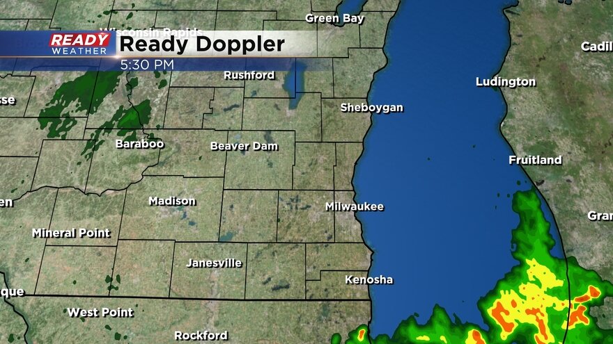
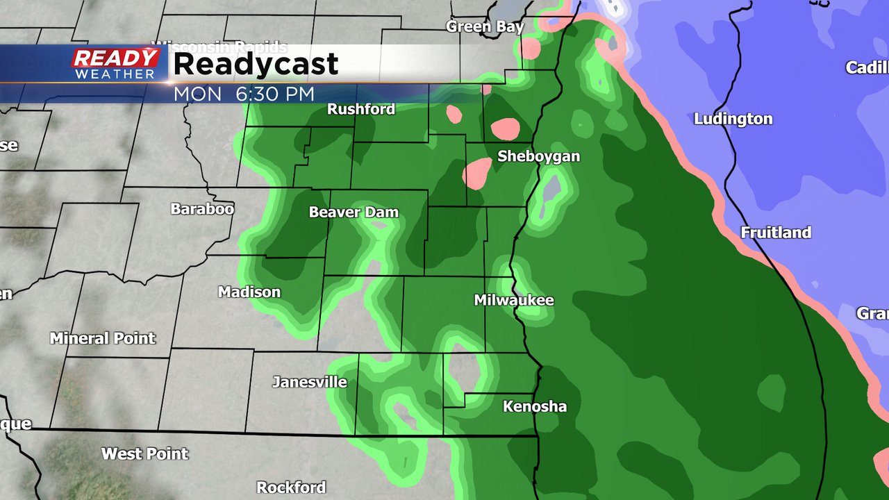
Here's a radar image that will update with time during the day:
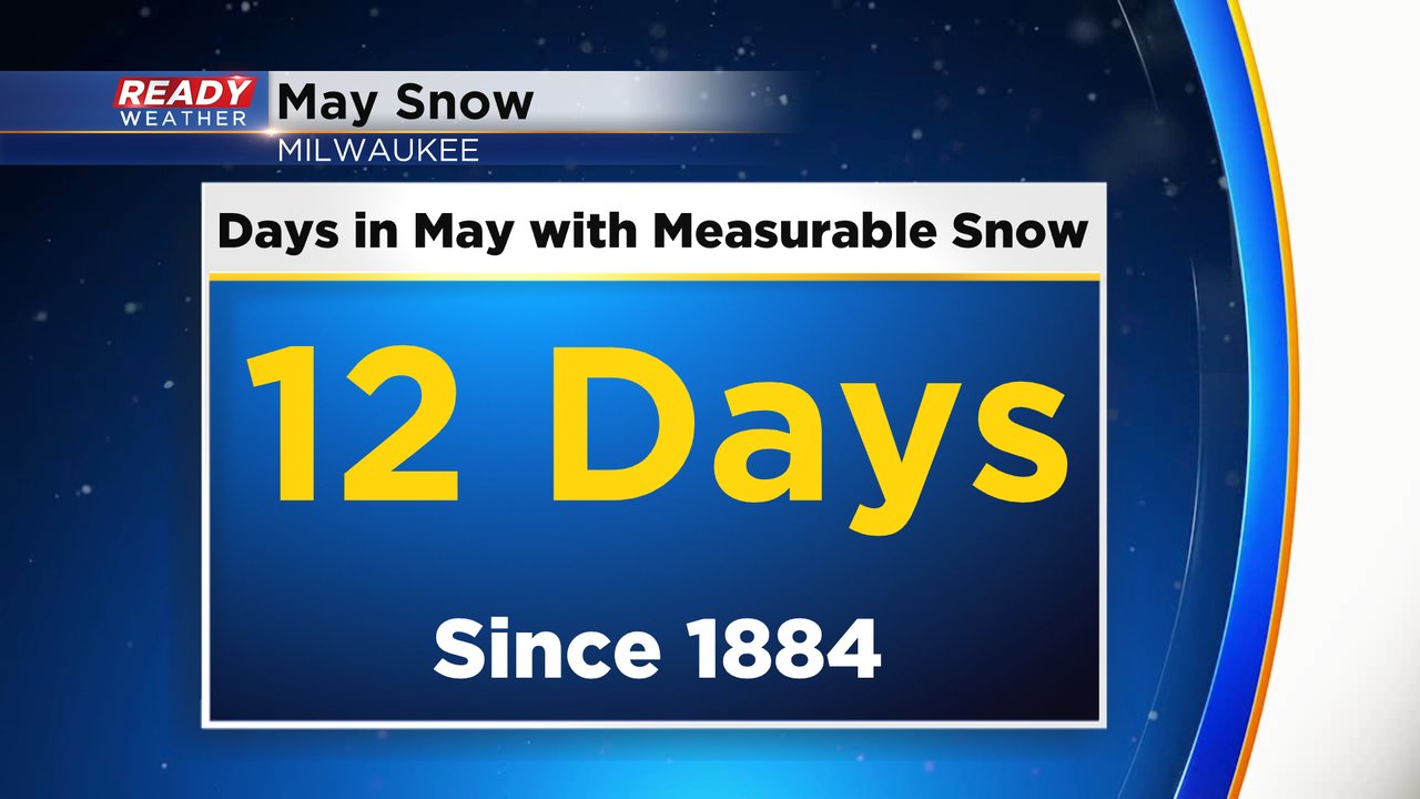
There have only been 12 times in recorded history (since 1884) that Milwaukee has picked up accumulating snow during the month of May.
Most of those were pretty light with only a few tenths reported but other areas saw a couple inches. The latest accumulating snow on record was May 11, 1966 when we saw a tenth of an inch.
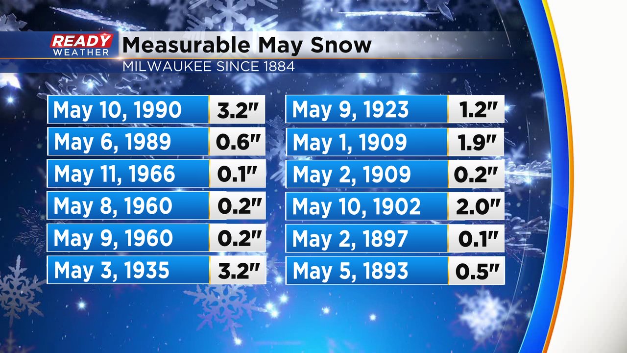
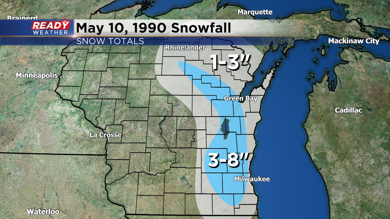
One of the biggest snows ever during the month of May was not long ago when a swath of 3-8" of snow fell in some inland counties on May 10, 1990. That is also the most recent year that we had accumulating snow in May.
The rain and wet snow from Monday morning will switch over to all rain by Monday afternoon. A sprinkle or flurry can't be ruled out on Tuesday but accumulation there does not look likely.
As if the snow/rain/mix wasn't bad enough Monday and Tuesday are also going to be very blustery days. Wind gusts on Monday could reach 40 mph and stay strong to 30 mph on Tuesday. By Wednesday the wind will lighten up. Prepare for some raw days!

Download the CBS 58 Ready Weather app to track the snow switching to rain and see if we get any accumulation.