Warming up to start the weekend with a chance of strong storms late Saturday


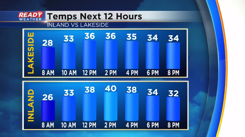
After a chilly Thursday with highs only around freezing, temps will rise into the upper 30s to low 40s today with warmest temps inland thanks to a southeast wind.
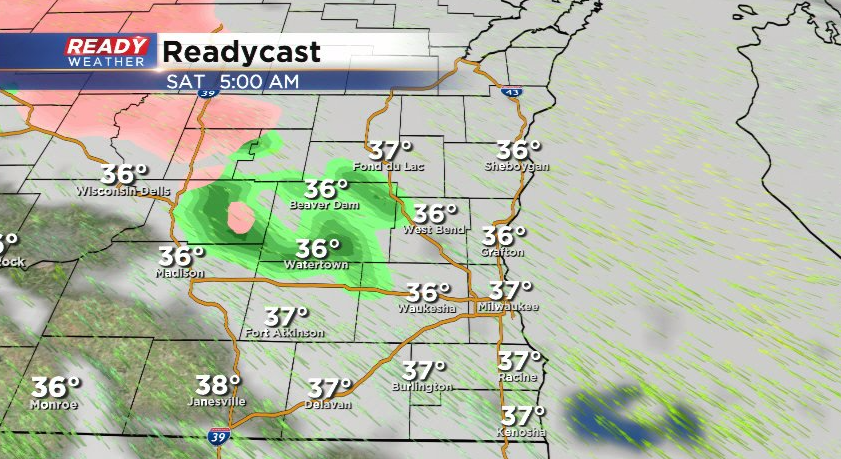
Temps won't fall much overnight tonight as clouds increase ahead of a warm front. A few isolated showers will be possible before sunrise with the best chance closer to central Wisconsin. Temps will be several degrees above freezing so there are no icing concerns.
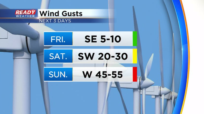
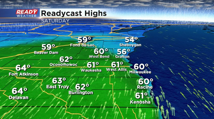
Winds will shift to the South/SSW by midday Saturday as a warm front lifts through the area. This will boost temps into the upper 50s to low 60s area-wide with peeks of sun during the afternoon.
The warmer temps could fuel some strong to severe storms Saturday evening as a cold front moves into the area.
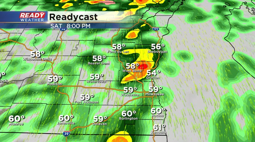
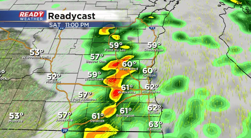
Scattered showers and storm look to move through around 7pm with most of the shower activity tapering off after midnight.
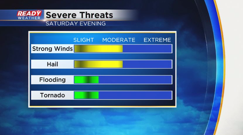
The main threats with these storms will be strong winds and hail. The tornado threat is low, along with the flooding threat. However, there could be some ponding on roads and low lying areas as the ground is still frozen.
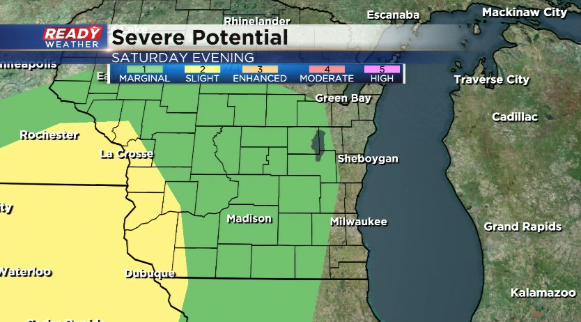
The best chance for severe storms in southeast WI will be from Fond du Lac to Walworth county where a level 1, Marginal Risk, is in place.
After the storms move over the lake around midnight, winds will turn to the west and become very strong. Wind gusts of 45-55 mph are possible through mid morning Sunday, which will cause temps to drop back into the 40s.