Wind chills improving to near zero this afternoon


Updated: 9:15 a.m. February 14th, 2020
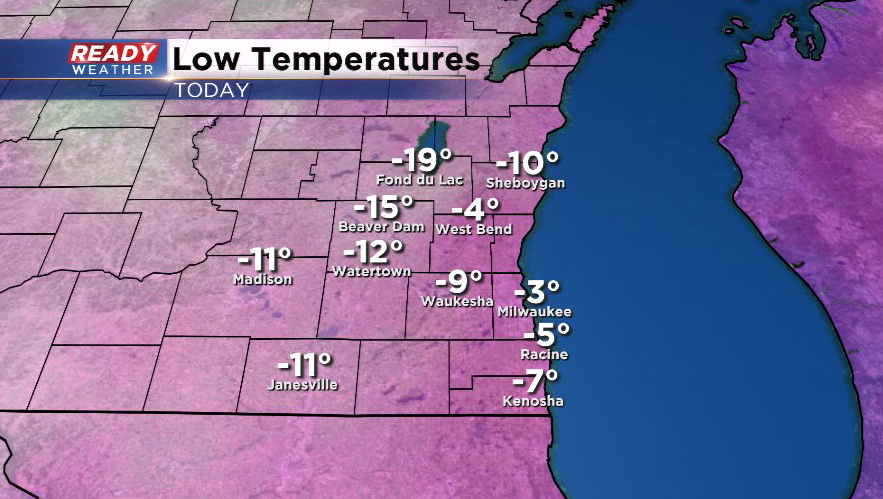
This morning was officially the coldest morning so far this winter in the Milwaukee area as temperatures dropped below zero for the first time since March 4th, 2019.
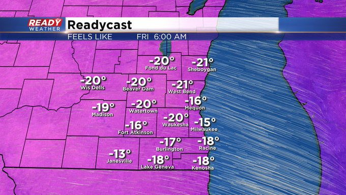
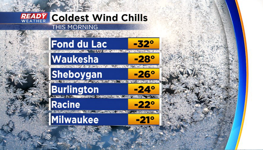
Most of the area experienced wind chills between -15° and -25° last night and early this morning, but Fond du Lac was the "winner" as it felt like -32°!
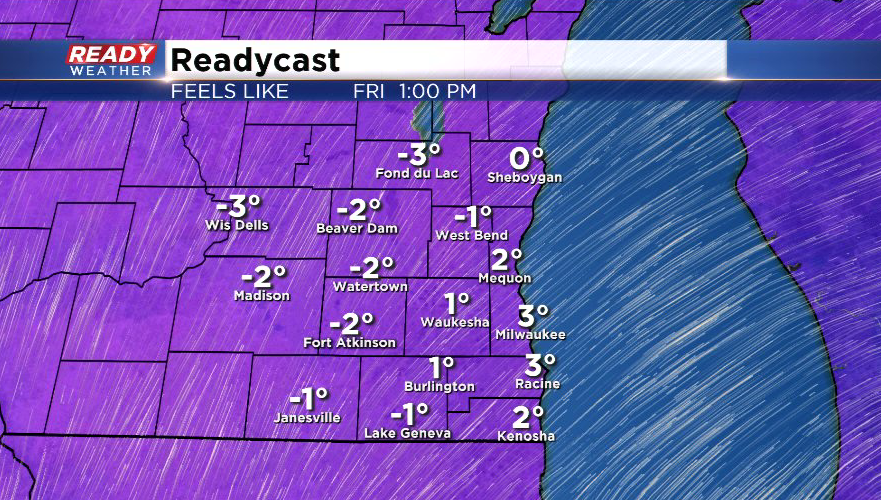
The dangerous cold will end by late morning with wind chills hovering either side of zero through the afternoon. Wind chills will drop into the single digits below zero tonight, but temps will be on a warming trend heading into Saturday so the brutal cold will be gone.
----------------------------------------------------------------------------------
Arctic high pressure settling into the region has cleared our skies after the early morning snow. Skies will remain clear tonight with temperatures plummeting to around 0° lakeside and potentially as cold as -10° to -15° inland.
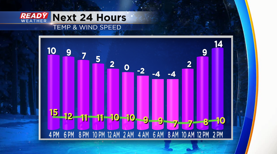
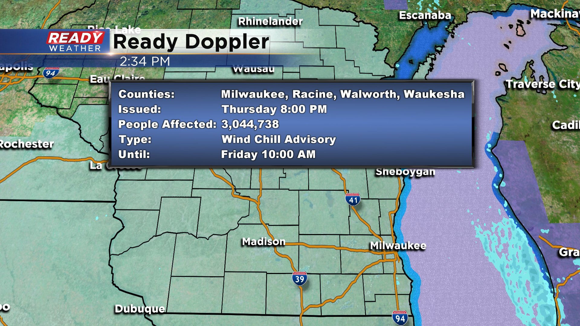
While the wind won’t be terribly strong (5-10 mph), it’ll be enough to push wind chills down to -25° well inland and as cold as -15° to -20° near the lake, so the National Weather Service has issued a Wind Chill Advisory for all of southeast Wisconsin from 8 p.m. tonight through 10 a.m. Friday.
Frostbite can occur in as little as 30 minutes with wind chills this cold, so make sure you layer up before you head out this evening or to work and school Friday morning!