Wind Chill Warning starts at 6 p.m., the coldest air since 1996 arrives tonight

-
2:45

Closing arguments begin in trial of Harry Wait
-
2:15

New Marquette Law School Poll reveals voters undecided about...
-
2:12

Milwaukee city attorney ’changes mind’ on piece of ’ICE...
-
3:51

Aurora Health Care doctor discusses colorectal cancer
-
1:01

Potawatomi Casino Hotel CEO calls on Evers to sign bill legalizing...
-
2:01

Common Council delays confirmation of Karin Tyler as new director...
-
0:47

Evers’ administration celebrates Women’s History Month with...
-
0:59

’Not about protecting democracy’: Community leaders express...
-
1:18

Milwaukee Film Festival preview includes look at ’The Big Cheese,’...
-
3:13

WisDOT joins CBS 58 to talk I-94 traffic as road work continues...
-
1:46

The North Shore Library starts a new chapter in Bayside
-
6:03

Milwaukee magicians celebrate Houdini’s birthday, preview upcoming...

Arctic air will quickly move across southeastern Wisconsin this evening. Temperatures by 10 pm will drop between -10 to -20! The winds tonight through Wednesday will remain up between 15 to 25 mph.
A low near -20 is possible for Wednesday morning; moreover, wind chills for Wednesday morning will drop to -50 below. This arctic air is extremely dangerous. Please check on elderly and bring in outdoor pets and animals!
The record low for tonight is -24!
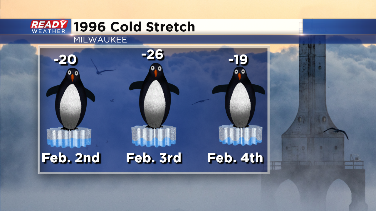
While 2014 had some very cold temperatures, this outbreak of cold is closer to the outbreak of February 1996. The all-time record low was set on February 3, 1996 at -26. It doesn't look like Milwaukee will get that cold but we will make a run at it.
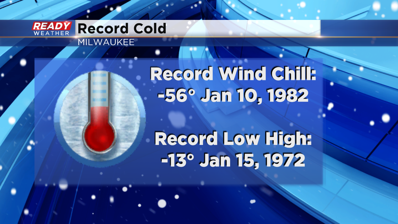
The coldest low maximum is -13! Wednesday afternoon we are expecting a high of -10, so we will monitor that record as well.