Wind, snow and rain reports from Wednesday with another round of snow possible for some Friday


Wednesday saw a bit of everything in southeast Wisconsin as a huge and very dynamic storm system moved across the Midwest. While we didn't see any of the blizzard or high winds they did to our west or the heavy accumulating snow like they did in northern Wisconsin, we did get a lot of rain and some wind and snow.
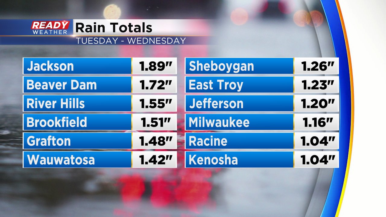
Rain totals from Tuesday through Wednesday reached 1-2" for most of southeast Wisconsin. A really good soaking rain that helps our precipitation deficit that we've been in since January.
The rain started to switch over to snow during the late morning hours of Wednesday through the afternoon and evening. Not much accumulated but Milwaukee got about a half inch and some other areas got closer to an inch or two.

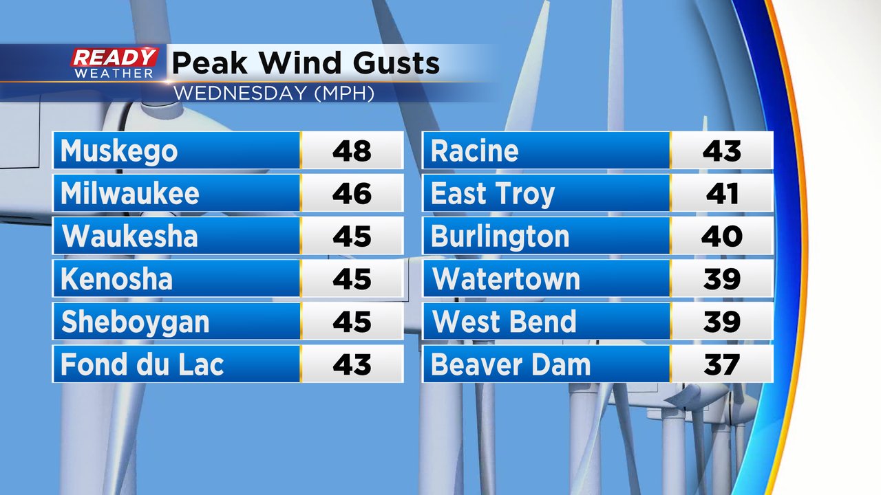
In addition to the rain and snow, the wind also picked up Wednesday afternoon and evening. Wind gusts ranged from 40-50 mph for most of southeast Wisconsin. The wind will stay breezy most of Thursday with gusts at times to 30 mph, especially in the morning, then lighten up heading into the weekend.
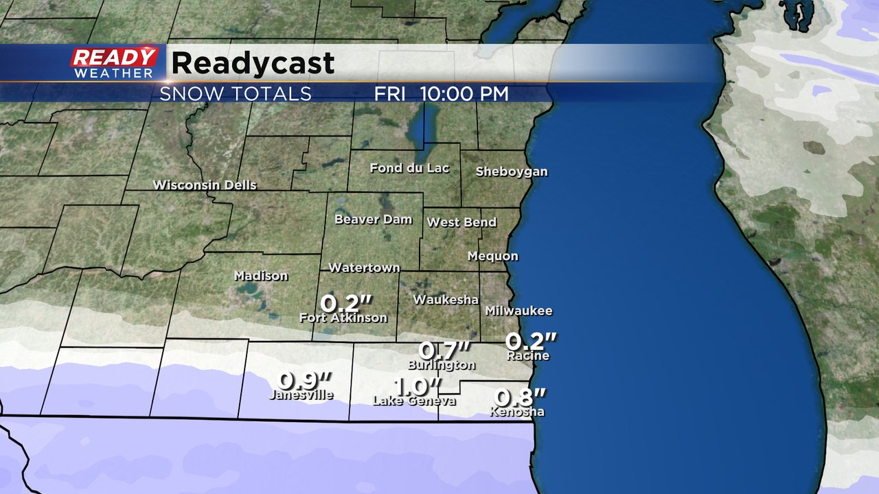
We aren't completely done with our precipitation chances for the week. A round of snow is possible in southern counties Friday starting in the morning and lasting through the afternoon.
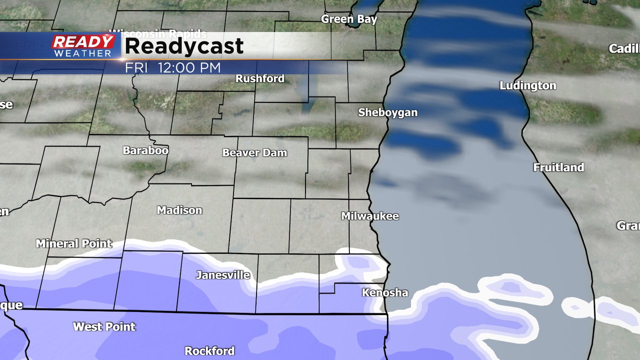
Walworth, Racine and Kenosha Counties have the best chance at accumulating snow with only a few flurries along the I-94 corridor. Anyone living north of I-94 should stay snow free.
Download the CBS 58 Ready Weather app to track the next snow chance.