Winds lighten up overnight with a rather quiet week ahead


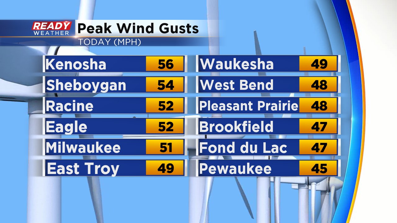
It's been quite the windy and raw day across southeast Wisconsin today. Peak winds gusts from around midday were between 45-55 mph, with Kenosha having the strongest gust at 56 mph!
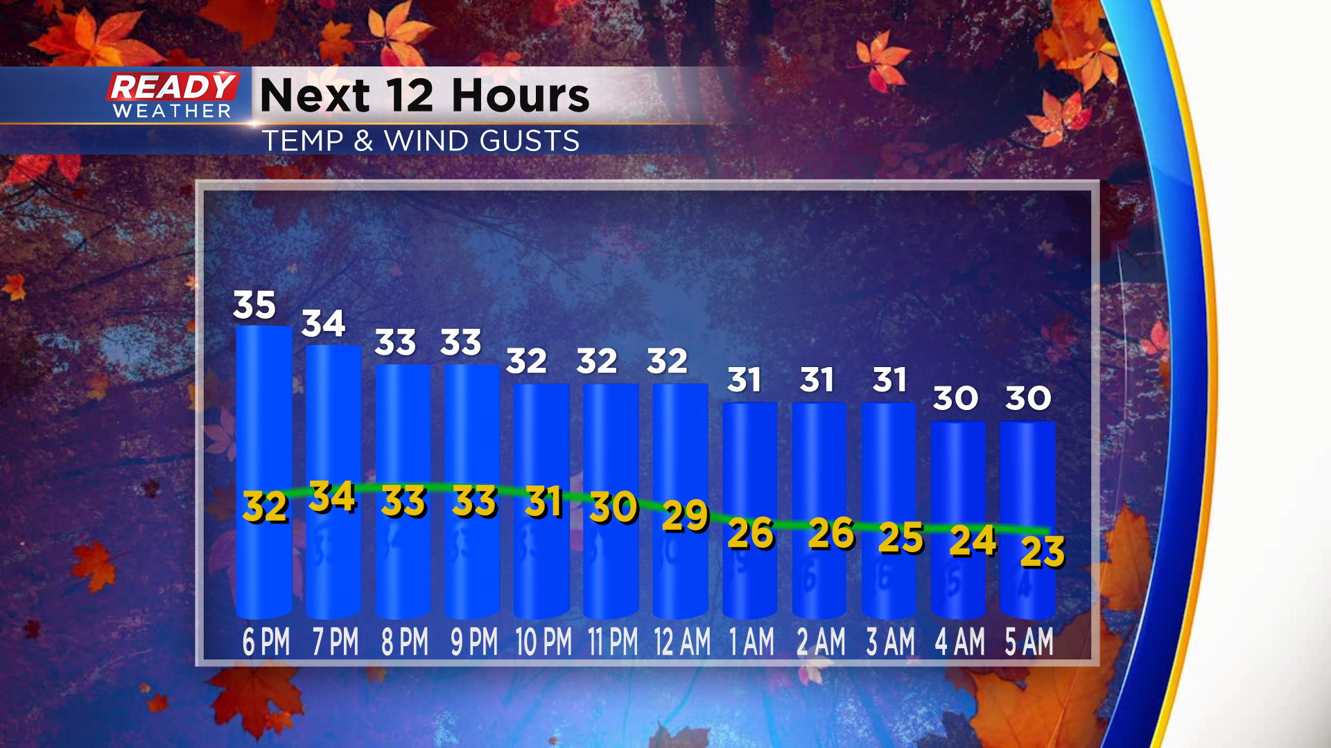
As of sunset, winds are still gusting between 35-45 mph. Gusts between 25-35 mph will be common throughout the evening and gradually taper off by daybreak Monday.
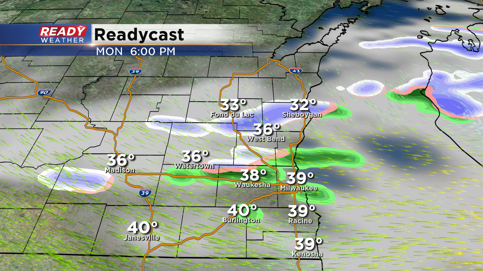
The rain was able to outrace the colder temperatures this morning, so we lucked out and didn't have any wet snow. However we could see a few flakes mix in with some very light showers late Monday afternoon and evening as a weak system moves through the state. Any rain or snow showers will be isolated and not everyone will see them.
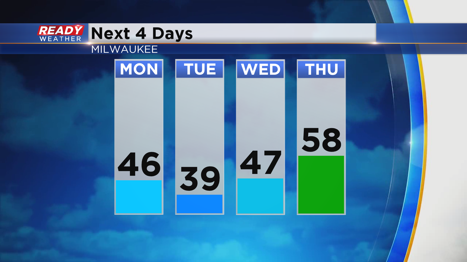
Temperatures will warm into the mid 40s ahead of this system Monday afternoon, but we'll cool back into the upper 30s for highs on Tuesday with wind chills remaining at or below freezing. Winds turn back to the south late Wednesday and Thursday which will warm temps up nicely into the 40s and 50s. There's a chance we may even hit 60 on Thursday!
After Monday's isolated rain/snow showers we'll remain dry for the rest of the work week, but rain looks to return by next weekend. Download to the CBS 58 Ready Weather app to see how long the 50s stick around.