7 PM Update: Accumulating snow has ended, but roads remain slick and snow covered


Updated: 8:30 p.m. February 9th, 2020
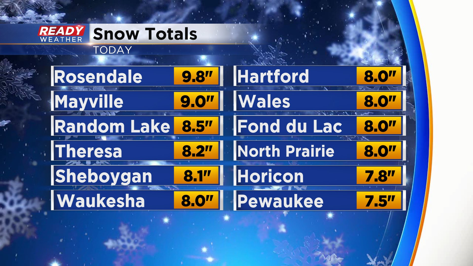
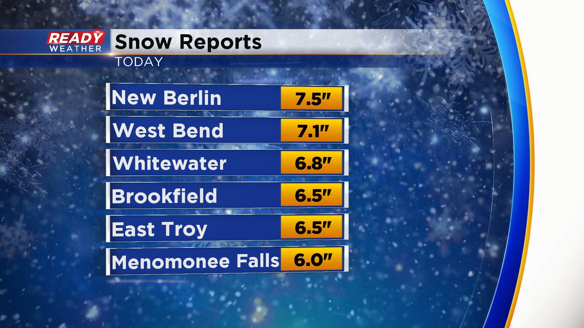
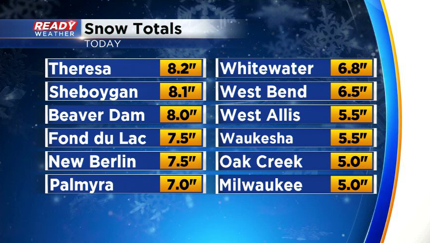
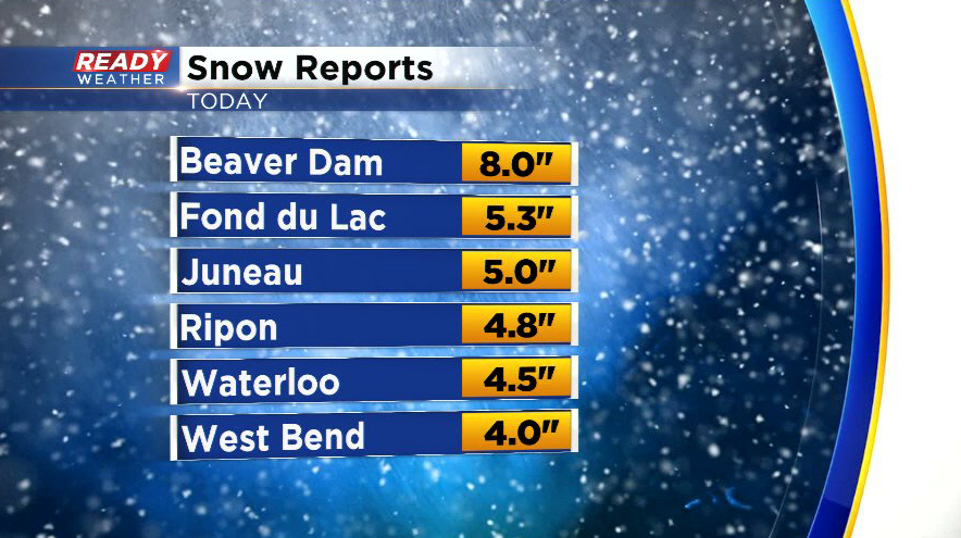
Here are the largest snow totals across southeast Wisconsin:
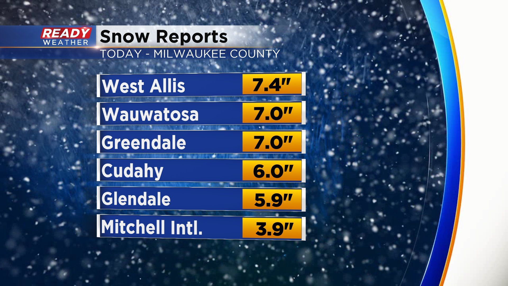
Snow totals across Milwaukee county ranged from 4" near the lake to 7.5" inland.
----------------------------------------------------
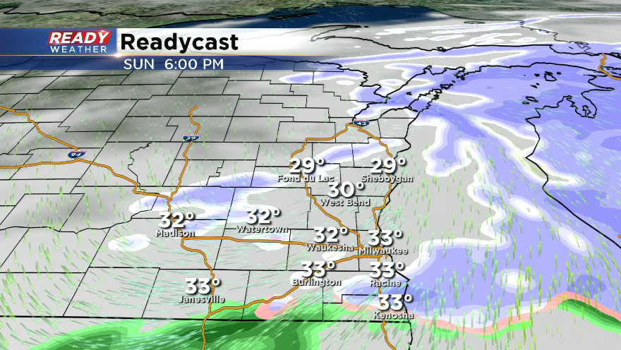
Updated: 6:45 p.m. February 9th, 2020
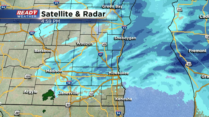
Accumulating snow has ended around southeast Wisconsin. A few flurries could linger over the next few hours, but nothing you'd need to shovel.
While the official Milwaukee snow total from the airport was 3.9", most of Milwaukee county picked up 5-7" of snow. The warm waters of Lake Michigan kept totals a tad lower right along the lake.
Road conditions will slowly but surely improve this evening, but slippery spots are expected area wide for the morning commute as temps drop into the teens to around 20 degrees tonight. Be careful traveling!
--------------------------------------------------
Updated: 5:00 p.m. February 9th, 2020
More light snow developed on the backside of the main area of snow, so expect light snow to continue for an additional 1-2 hours.
Snow totals continue to pour in, with a majority of the area picking up between 5-8" of snow. 3-5" was common around Racine and Kenosha counties.
--------------------------------------------------------------------
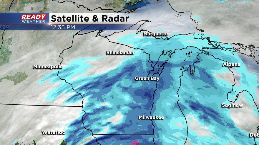
Updated: 3:00 p.m. February 9th, 2020
A band of heavy snow is tracking through the Milwaukee metro and extends back through Janesville.
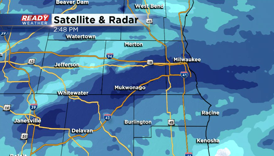
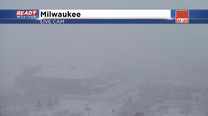
Near whiteout conditions are occurring under this band of snow that is producing snowfall rates of 1-2" per hour.
This entire swath of snow is moving at 50 mph, so the back edge of the steady snow should move through around 5 p.m. A few patchy snow showers may linger until 7 p.m., but as of right now we aren't seeing any freezing drizzle on the backside of the snow.
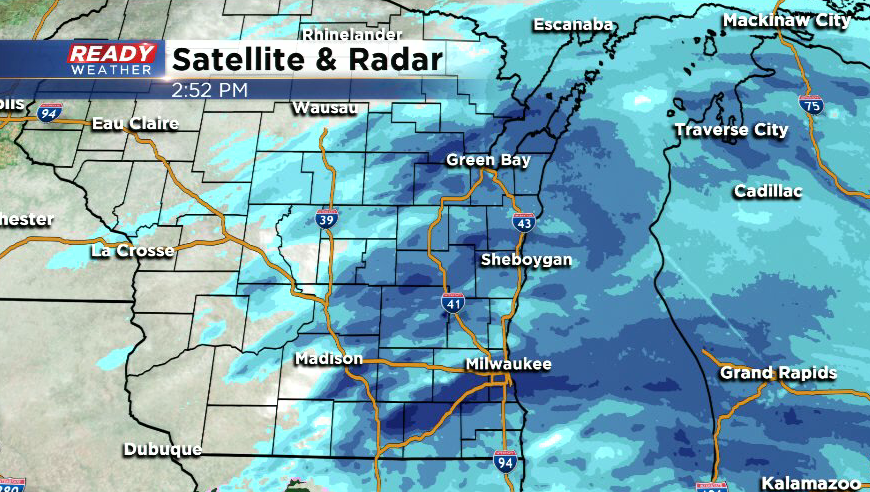
Places north of Milwaukee have picked up 4-8" of snow and counting. We will provide updated snow totals for the rest of the area as they come in and as the snow winds down. A list of totals through midday can be found with the 1 p.m. blog update below.
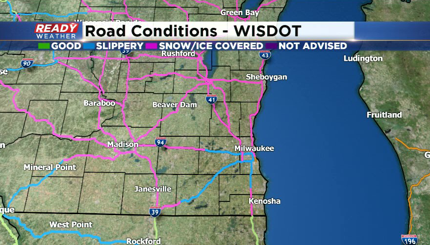
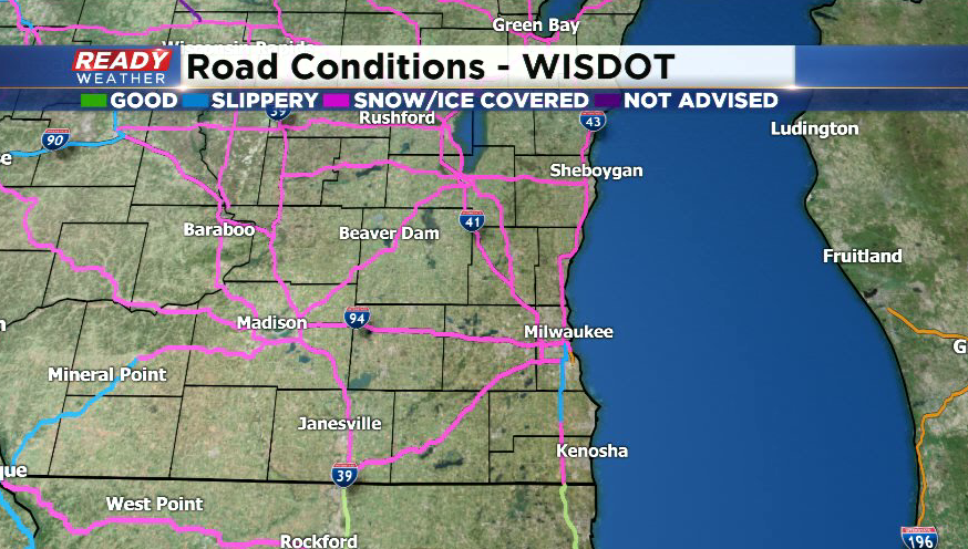
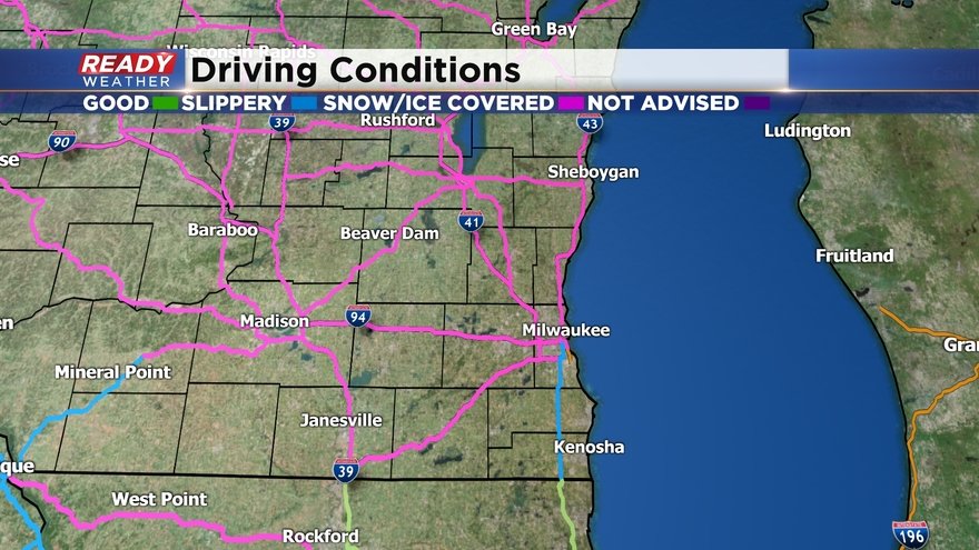
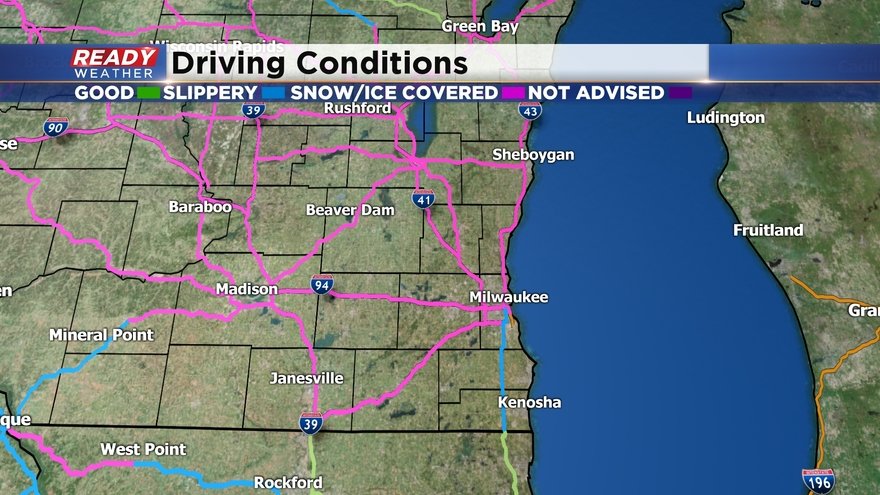
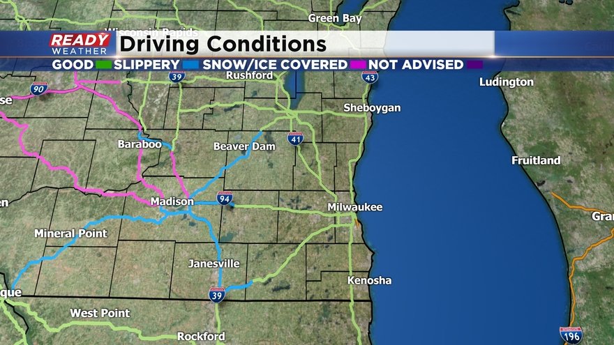
Roads are snow covered around the area and numerous accidents have been reported on I-94 West between Milwaukee and Waukesha. Roads will gradually improve this evening as the snow ends.
------------------------------------------------------
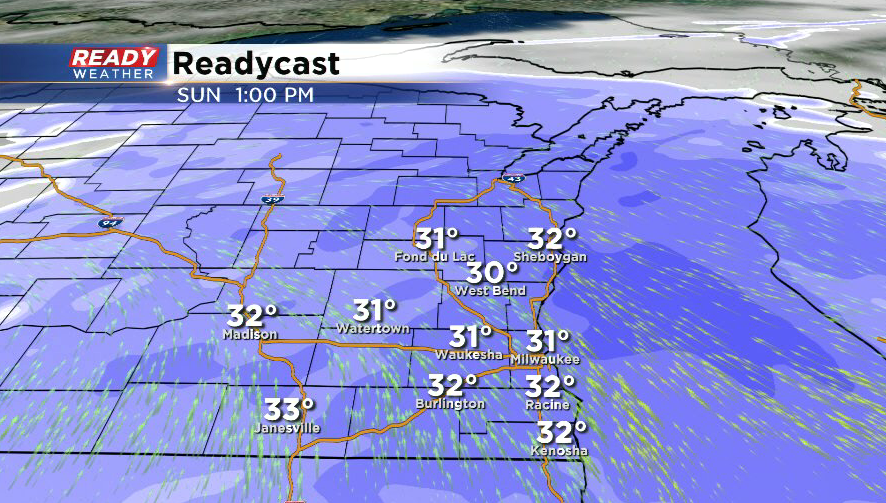
Updated: 1:00 p.m. February 9th, 2020
Light to moderate snow has filled back into the area and will be with us through the remainder of the afternoon, becoming lighter around sunset. Snow should taper off completely between 6-8 p.m. from west to east. Some freezing drizzle/drizzle will be possible around sunset as well with the best chance near the WI/IL border.
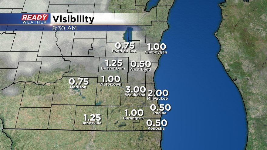
With the moderate snow moving through, visibility in most places is under a mile. Expect this to continue under the snow tapers off.
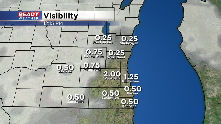
Roads remain snow covered or slippery across southeast Wisconsin.
Snow totals so far:
Beaver Dam: 7.0"
Juneau: 5.0"
Waupun: 4.5"
West Bend: 4.0"
Plymouth: 4.0"
Fox Lake: 4.0"
Fond du Lac: 3.8"
Port Washington: 3.5"
Theresa: 3.5"
Slinger: 3.0"
Hartford: 3.0"
Germantown: 2.8"
Mequon: 2.0"
Watertown: 2.0"
Milwaukee: 0.7" (through noon)
-------------------------------------------------
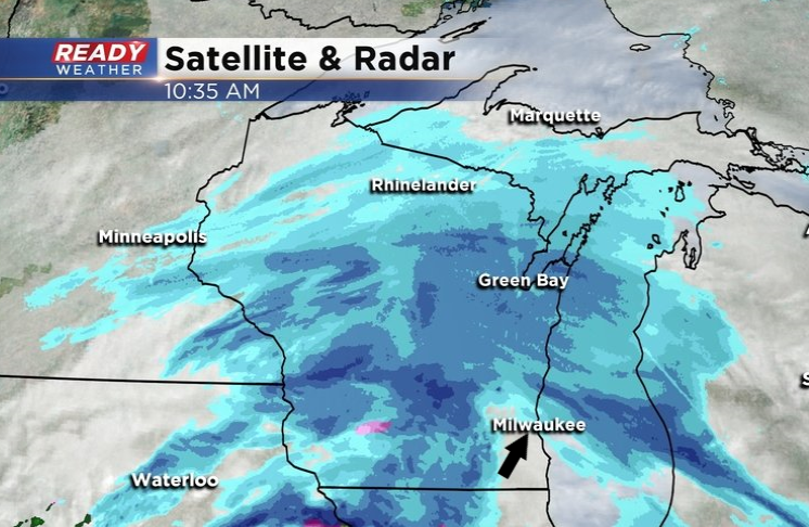
Updated: 10:45 a.m. February 9th, 2020
Some parts of southeast Wisconsin have seen a lull in the snow for a period of time, but the main push of moderate to heavy snow is moving in from the west and southwest. This is still on track to impact the area throughout the afternoon. Snowfall rates of an 1 per hour or higher will be possible NW of Milwaukee as it pushes through.
Most major highways are reporting snow covered roads, and that won't change until the snow comes to an end this evening.
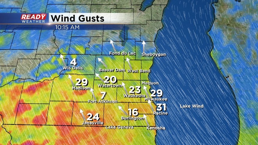
Winds are picking up with gusts currently between 20-30 mph. This will continue through the afternoon, creating blowing and drifting and reducing visibilities even further.
There could be some freezing drizzle/freezing rain/rain that mixes in near the WI/IL after 3 p.m.
--------------------------------------------------------------
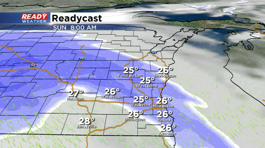
Updated: 9:00 a.m. February 9th, 2020
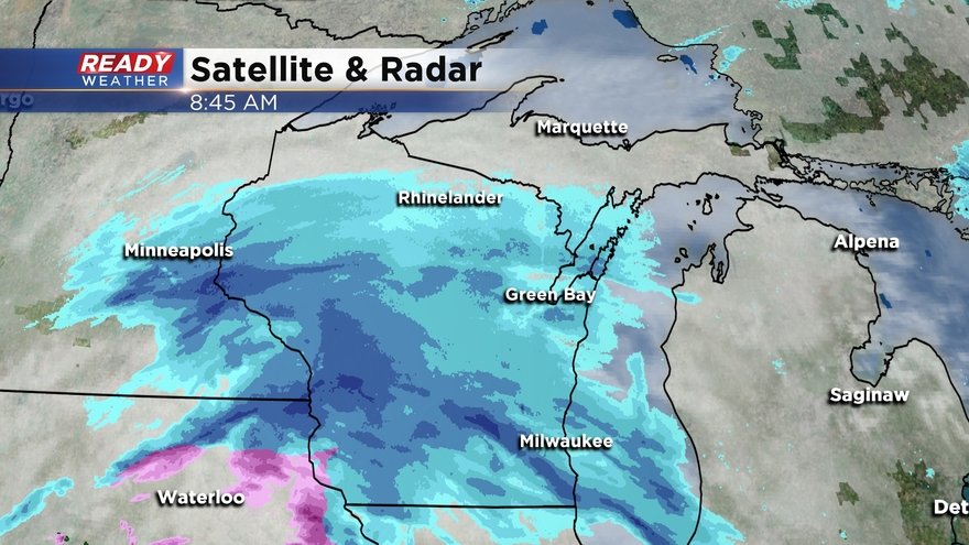
The forecast remains on track this morning. Snow has moved into all of southeast Wisconsin, with periods of moderate to heavy snow occurring at times. A more moderate band of snow will push into the Milwaukee metro around 9 a.m. More widespread moderate to heavy snow currently falling across western Wisconsin is expected to impact the area late this morning through the afternoon.
Road conditions will continue to deteriorate throughout the afternoon, along with visibility. Current visibilities have dropped to under a mile under the moderate snow band closing in on the Milwaukee metro and with another moderate burst of snow from West Bend to Fond du Lac. Widespread low visibility and snow covered roads are expected midday throughout the afternoon.
Snow reports so far:
2.5" Beaver Dam as of 8:30 a.m.
1.3" in Merton as of 8:15 a.m.
1.3" Waukesha as of 7:30 a.m.
1.0" Allenton as of 7:40 a.m.
--------------------------------------------------------------
Updated: 7:00 a.m. February 9th, 2020
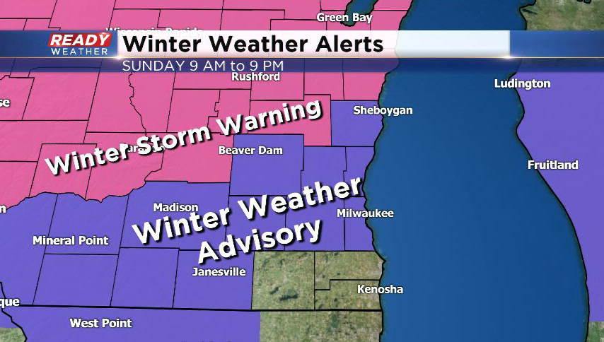
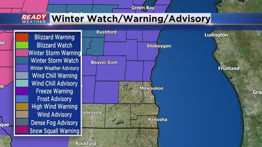
Overnight model trends continued bringing slightly heavier snow into Fond du Lac, Sheboygan, and Dodge counties, so the Winter Storm Warning has been expanded into these areas.
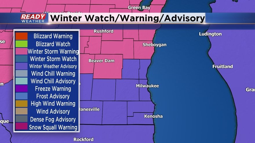
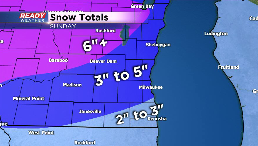
6-8" of accumulation is expected under the Winter Storm Warning, with isolated totals over 8" possible in western Fond du Lac county. 2-5" is expected across the rest of the area with lowest totals (2-3") near the WI/IL border, 3-4" around Milwaukee and Waukesha, and up to 5" across Washington, Ozaukee, and Jefferson counties.
Light to moderate snow has been moving into the area over the last hour and is still on track to be heaviest from mid to late morning through mid afternoon. Snowfall rates could approach an inch an hour or higher during this time, leading to visibilities under a half mile.
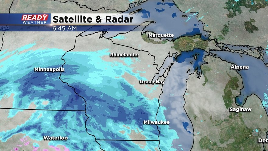
The heaviest band of snow is currently located in Dodge county back through SE Minnesota, where thundersnow has been reported this morning. Road conditions are deteriorating quickly under this band of heavy snow and won't improve much until the snow moves east around sunset.
---------------------------------------------------------------
Update: 9:35 p.m. February 8th, 2020
The impending low pressure system is already producing a band of heavy snow in parts of South Dakota, where snow is falling at over an inch per hour. This band will move into Dodge, Jefferson, and Walworth around 6 a.m., overspreading the rest of southeast Wisconsin after sunrise.
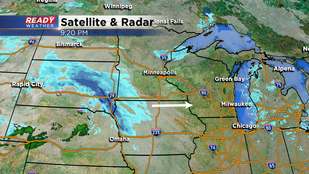
Heaviest snow is still expected to fall between 10 a.m. and 4 p.m. This is when visibility will be the worst and when wind gusts will be strongest, peaking between 20-25 mph. Snowfall rates could reach 1” per hour in parts of Dodge and Fond du Lac counties during this time, so road crews will have trouble keeping up.
Recent model runs have come in a little bit heavier with precipitation totals across portions of Dodge and Fond du Lac counties, so slight adjustments have been made, but overall the snow forecast remains on track for the rest of the area.
----------
Updated: 2:45 p.m. February 8th, 2020
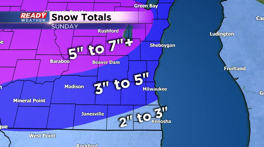
The Winter Weather Advisory has been expanded to include Milwaukee and Waukesha counties. The advisory has been upgraded to a Winter Storm Warning for Fond du Lac county.
Western Fond du Lac county has the best chance of picking up 6 inches or so of snow from Sunday's system. A good 3-4" looks likely around the Milwaukee metro with up to 5 inches NW of the city. Snow totals will be a bit lower near Racine and Kenosha as temperatures will be a tad warmer.
Snow is still on track to move in after sunrise Sunday morning.
The heaviest snow looks to fall from midday into mid afternoon.
Snow will taper off in the evening and may even mix with rain briefly near the WI/IL border. Some patchy freezing drizzle is possible once the snow ends as well.
-----------------------------------------------------------------------------------
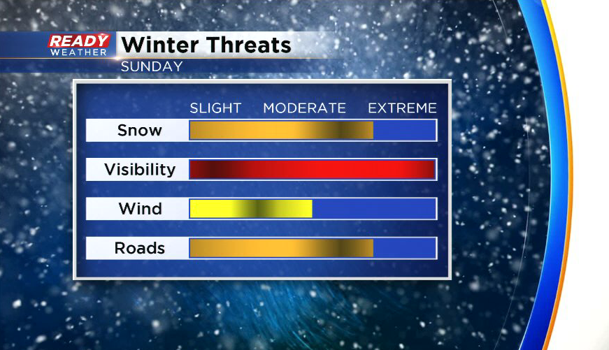
While a few scattered flurries will be possible today, we’re still expecting accumulating snow on Sunday. This system is expected to track across southern Wisconsin, with the heaviest snow falling on the northern edge of the system across central Wisconsin where Winter Storm Watches and Warnings are in place. Closer to home, a Winter Weather Advisory will be in effect from 9 a.m. to 9 p.m. Sunday for all counties north and west of Milwaukee, besides Waukesha county.
Snow looks to move into the area from west to east between 7-9 a.m. Sunday morning and continue throughout the day, tapering off between 7-10 p.m. In general, 2-5” of snow is expected across southeast Wisconsin with the best chance of 4-5" in the Winter Weather Advisory. Folks in western Fond du Lac and Dodge counties could see up to 6 inches.
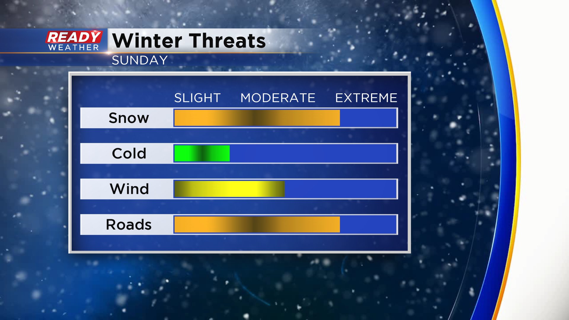
Expect snow covered roads and reduced visibility throughout Sunday, so give yourself plenty of extra time and space to reach your destination. The track of this system is not set in stone and could shift north or south, which could shift the placement of heaviest snow north or south, so check back for updates over the next 36 hours.