A few showers and storms possible on this Independence Day


Happy 4th of July! This Independence Day features slightly mild temps with highs reaching the low 80s, just a bit above the average high of 81 degrees. But it may actually be one of the coolest July 4ths in recent memory since we've had a lot of upper 80s and low 90s the last 10 years. Humidity levels will be noticeable and muggy at times but not too bad.
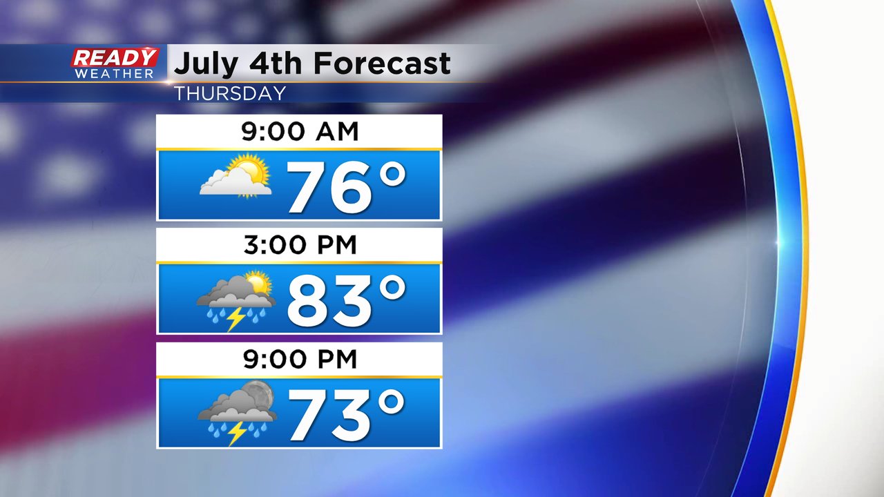
The morning for the holiday starts dry through the early afternoon but by the mid afternoon hours a few showers and storms start to pop up.

We may get a bit of a dry break for most of the area, besides an isolated shower/storm, during the later evening hours. So, the fireworks forecast looks ok, but there's another chance for a line of storms to roll through shortly after fireworks.

A few of the storms in our western counties could be on the stronger side with some gusty wind and small hail. Fond du Lac, Dodge and Jefferson Counties are in the Level 1 Marginal Risk with a Level 2 Slight Risk far to our west.

Rain totals for most of the area look manageable with 0.25-0.50" of new rainfall but some areas that see thunderstorms could get up to an inch.

Download the CBS 58 Ready Weather app to track the showers and storms for the holiday.