Late Afternoon Update: Warnings are over, snow is done and reports are in


Updated: 4:04 p.m. Mar. 25, 2023
Besides a few lingering snow showers in Sheboygan County the snow is over. Roads are in good shape with good winter driving reported for the vast majority of our local area. The winter storm warning has expired for all of southeast Wisconsin. Clouds will quickly clear this evening with a chance for some sunshine before sunset.
Snowfall came down hard in many communities, especially Saturday morning. Most of southeast Wisconsin reported 6-10" of snowfall but a few hometowns saw as much as a foot.

The 8.7" of snowfall in Milwaukee shatters the old record for March 25 of 5.2". That total could still go up.

This will be the last update for this round of winter weather in spring. Another smattering of snow is not out of the question Sunday afternoon and evening for some locations. Download the CBS 58 Ready Weather app to keep an eye on that one.
------
Updated: 2:02 p.m. Mar. 25, 2023
What a winter/spring storm this has been! But the good news is it is starting to wind down. The back edge of the snow has now moved into our local western counties and will continue to move east the rest of the afternoon. Not much more accumulating snow is expected but some isolated communities could pick up another inch. Most will be done with the snowfall by 5 PM then quickly clearing this evening. A decent sunrise could be in store for western counties.
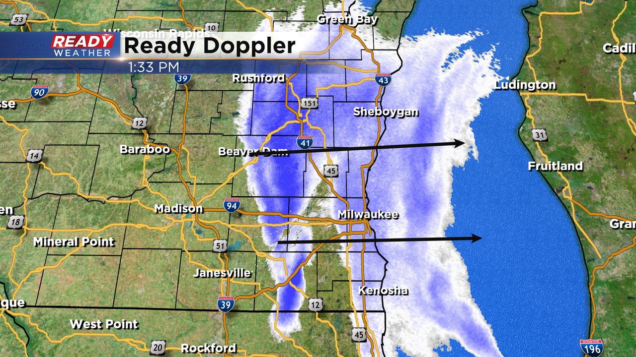
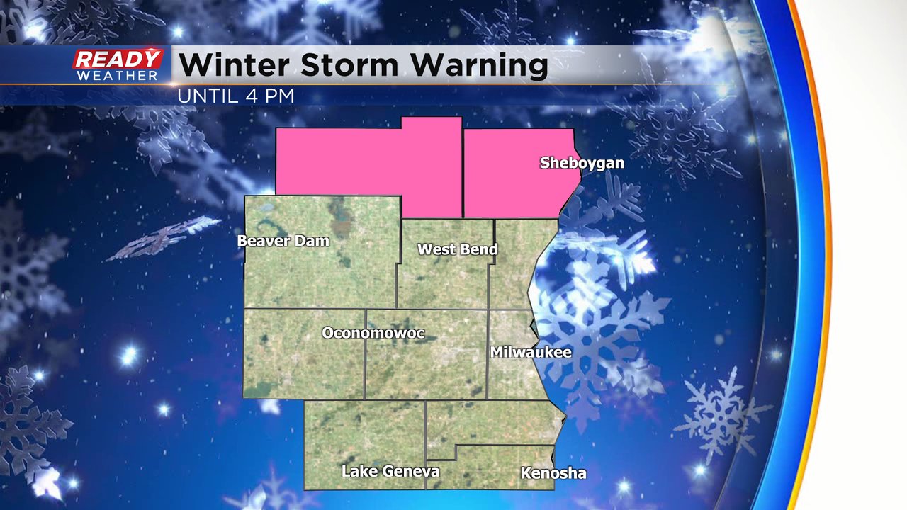
The winter storm warning has been canceled for everyone except Fond du Lac and Sheboygan Counties where it remains in effect until 4 PM.
Once plows rolled through this morning the roads have been in decent shape. Air temperatures in most hometowns are hovering around the freezing mark making roads just wet and touch slushy. There are still slippery roads in some areas.
Here's the latest DOT map that will update with time:

Milwaukee did officially see record snowfall with 8.7" of new snow falling at the airport. Some local communities got more with some reporting over 10".
Download the CBS 58 Ready Weather app to track the end of the snow.
------
Update as of Noon, Saturday, March 25th...
The snow has returned to the metro after a brief break this morning. We'll be seeing more snow, on and off, through the middle of the afternoon perhaps adding up to several more inches. So far, many of us have had 4 to 6 inches of snowfall. The highest total I've seen in our area is Ripon with a foot!! Roads remain treacherous right through the afternoon before improvements come for the evening. The Winter Storm Warning holds until 4 pm for everyone except Kenosha County. Meantime, we've gotten some great photos. If you have some you'd like to share, just email them to [email protected] or send them via our free weather mobile app.


___________________________________________________________________________________________________________
Update As of 10 a.m. Saturday, March 25th...
The snow has stopped for the most part across the metro for the time being. But expect it to pick up again late this morning into the afternoon as low pressure pulls off to the east, and we get behind the storm system. We'll see wrap around moisture. It's amazing to see some of the high totals, especially north and west of the metro. Many spots in Dane County have received more than a foot of snowfall this morning alone. Please watch the roads if you have to head out today. They're snow covered and rather slick.


_____________________________________________________________________________________________________________UUpdate As of 7:45 am, Saturday, March 25th...
The Winter Storm Warning covers the entire area through mid afternoon. Look for 4-6"+ of snow to the north of I-94, 6-9"+ to the south. We've already gotten widespread reports of 2 to 4" across the area with more than 5" already in Madison and Elkhorn. Travel has become hazardous. It won't really improve until this evening. Please use extra caution if you have to venture out today.


____________________________________________________________________________________________________________
MILWAUKEE (CBS 58)--Hard to find any spring in this forecast at least on Saturday. The Winter Storm Warning has been extended until 4 p.m. for most of the viewing area expect Sheboygan and Fond du Lac Counties where it's a Winter Weather Advisory. We could see snowfall rates between 1 and 2 inches an hour. Total amounts for many will be 6 to 9" with lesser amounts well to the north. Watch out for power outages and downed tree limbs with gusty winds from the northwest at 30 to 40 mph. Improvements will come tonight, but there will be lots of slick spots and digging out to do.
Sunday features the possibility of some wintry mix later in the afternoon but don't expect anything much. Also, look for rain at the end of the upcoming week.


